Related Research Articles

The First Intifada, also known as the First Palestinian Intifada or the Stone Intifada, was a sustained series of protests, acts of civil disobedience and riots carried out by Palestinians in the Israeli-occupied Palestinian territories and Israel. It was motivated by collective Palestinian frustration over Israel's military occupation of the West Bank and the Gaza Strip, as it approached a twenty-year mark, having begun in the wake of the 1967 Arab–Israeli War. The uprising lasted from December 1987 until the Madrid Conference of 1991, though some date its conclusion to 1993, with the signing of the Oslo Accords.
Palestinian refugees are citizens of Mandatory Palestine, and their descendants, who fled or were expelled from their country over the course of the 1947–1949 Palestine war and the Six-Day War. Most Palestinian refugees live in or near 68 Palestinian refugee camps across Jordan, Lebanon, Syria, the West Bank and the Gaza Strip. In 2019 more than 5.6 million Palestinian refugees were registered with the United Nations.
Rafah is a Palestinian city in the southern Gaza Strip. It is the capital of the Rafah Governorate of the State of Palestine, located 30 kilometers (19 mi) south-west of Gaza City. In 2017, Rafah had a population of 171,889. As a result of massive bombardment and ground assaults in Gaza City and Khan Yunis by Israel during the Israel–Hamas war, about 1.4 million Palestinians are believed to be sheltering in Rafah as of February 2024.

Uzi Narkiss was an Israeli general. Narkiss was commander of the Israel Defense Forces (IDF) units in the Central Region during the 1967 Six-Day War. Narkiss appears in the famous photograph of Defense Minister Moshe Dayan flanked by Chief of Staff Yitzhak Rabin taken in the Old City of Jerusalem shortly after its capture from Jordanian forces.

Canada Park is an Israeli national park stretching over 7,000 dunams (7km2), and extending from No man's land into the West Bank. The park is located north of Highway 1, and is situated near the Ayalon Valley, between the Latrun Interchange and Sha'ar HaGai.

1948 and After: Israel and the Palestinians is a collection of essays by the Israeli historian Benny Morris. The book was first published in hardcover in 1990. It was revised/expanded and published by Clarendon Press, Oxford, in 1994, ISBN 0-19-827929-9.
The Palestinian right of return is the political position or principle that Palestinian refugees, both first-generation refugees and their descendants, have a right to return and a right to the property they themselves or their forebears left behind or were forced to leave in what is now Israel and the Palestinian territories during the 1948 Palestinian expulsion and flight and the 1967 Six-Day War.

Imwas or Emmaus, known in classical times as Nicopolis, was a Palestinian village located 12 kilometres (7.5 mi) southeast of the city of Ramla and 26 kilometres (16 mi) from Jerusalem in the Latrun salient of the West Bank. It is traditionally identified with the biblical Emmaus. Its population was expelled and its buildings razed by Israeli forces in 1967.
Issues relating to the State of Palestine and aspects of the Israeli–Palestinian conflict occupy continuous debates, resolutions, and resources at the United Nations. Since its founding in 1948, the United Nations Security Council, as of January 2010, has adopted 79 resolutions directly related to the Arab–Israeli conflict.

The following outline is provided as an overview of and topical guide to the State of Palestine:
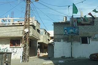
Al-Shati, also known as Shati or Beach camp, is a Palestinian refugee camp located in the northern Gaza Strip along the Mediterranean Sea coastline in the Gaza Governorate, and more specifically Gaza City.
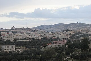
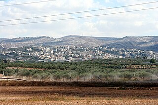
Beit Awwa is a Palestinian town in the southern West Bank, in the Hebron Governorate of the State of Palestine, located 22 kilometers west of Hebron and 4 kilometers west of Dura. According to the Palestinian Central Bureau of Statistics, Beit Awwa had a population of 10,436 inhabitants in 2017.
Beit Liqya is a Palestinian town located in the Ramallah and al-Bireh Governorate in the northern West Bank. According to the Palestinian Central Bureau of Statistics, it had a population of approximately 9,304 in 2017.
The 1949–1956 Palestinian expulsions were a continuation of the 1948 expulsion and flight of Palestinian Arabs from Israeli-controlled territory that occurred after the signing of the 1949 ceasefire agreements. This period of the exodus was characterised predominantly by forced expulsion during the consolidation of the state of Israel and the growing tension along ceasefire lines that ultimately lead to the 1956 Suez Crisis.

Yalo was a Palestinian Arab village located 13 kilometres southeast of Ramla. Identified by Edward Robinson as the ancient Canaanite and Israelite city of Aijalon. During the Middle Ages, it was the site of a Crusader castle, Castrum Arnaldi.
In the 1948 Palestine war more than 700000 Palestinian Arabs – about half of Mandatory Palestine's Arab population – were expelled or fled from their homes, at first by Zionist paramilitaries, and after the establishment of Israel, by its military. The expulsion and flight was a central component of the fracturing, dispossession, and displacement of Palestinian society, known as the Nakba. Dozens of massacres targeting Arabs were conducted by Israeli military forces and between 400 and 600 Palestinian villages were destroyed. Village wells were poisoned in a biological warfare programme and properties were looted to prevent Palestinian refugees from returning. Other sites were subject to Hebraization of Palestinian place names.
Nakba Day is the day of commemoration for the Nakba, also known as the Palestinian Catastrophe, which comprised the destruction of Palestinian society and homeland in 1948, and the permanent displacement of a majority of the Palestinian people. It is generally commemorated on 15 May, the Gregorian calendar date of the Israeli Declaration of Independence in 1948. For Palestinians, it is an annual day of commemoration of the displacement that preceded and followed Israel's establishment.

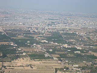
The Latrun salient is an area of the West Bank that protrudes into Israeli territory. It is surrounded by a strip of territory covering 46.4 square kilometres (17.9 sq mi), that has the formal status of a no man's land (NML) between Israel and Palestine. Israel considers the NML a part of its state, while Palestinians regard it as part of the West Bank.
References
Notes
- ↑ Para 57: appearing in the Sunday Times (London) on 11 October 1970, where reference is made not only to the villages of Jalou, Beit Nuba, and Imwas, also referred to by the Special Committee in its first report, but in addition to villages like Surit, Beit Awwa, Beit Mirsem and El-Shuyoukh in the Hebron area and Jiflik, Agarith and Huseirat, in the Jordan Valley. The Special Committee has ascertained that all these villages have been completely destroyed. Para 58: the village of Nebi Samwil was in fact destroyed by Israeli armed forces on March 22, 1971. [5]
Citations
- ↑ Shaked 2022, p. 7.
- ↑ Bowker 2003, p. 81.
- ↑ Gerson 1978, p. 162.
- 1 2 3 McDowall 1989 , p. 84
- 1 2 Thant 1971.
- ↑ Segev 2007, p. 405.
- ↑ Mohammed Zaatari (31 May 2011). "Army may prevent June 5 protesters reaching border fence". The Daily Star. Archived from the original on 7 October 2012. Retrieved 1 June 2011.
Sources
- Bowker, Robert P. G. (2003). Palestinian Refugees: Mythology, Identity, and the Search for Peace. Lynne Rienner Publishers. ISBN 1-58826-202-2.
- Gerson, Allan (1978). Israel, the West Bank and International Law (PDF). Psychology Press. ISBN 0-7146-3091-8.
- McDowall, David (1989). Palestine and Israel: The Uprising and Beyond. University of California Press. ISBN 1-85043-289-9.
- Segev, Tom (2007). 1967 Israel, The War and the Year that Transformed the Middle East (PDF). Little, Brown. ISBN 978-0-316-72478-4.
- Shaked, R. (2022). The Naksa in the Shadow of the Nakba (PDF). Göttingen University Press.
- Thant, U (5 October 1971). "Report Of The Special Committee To Investigate Israeli Practices Affecting The Human Rights Of The Population Of The Occupied Territories, A/8389". United Nations. Archived from the original on 12 February 2007.