
Beverly Hills is a southern suburb of Sydney, in the state of New South Wales, Australia. Beverly Hills is located 15 kilometres southwest of the Sydney central business district and is part of the St George area and is split between the local government areas of the Georges River Council and the City of Canterbury-Bankstown. The postcode is 2209, which it shares with neighbouring Narwee.
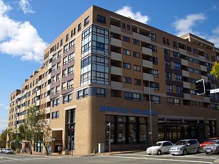
Hurstville is a suburb in Southern Sydney, New South Wales, Australia. It is 16 kilometres south of the Sydney CBD and is part of the St George area. Hurstville is the administrative centre of the local government area of the Georges River Council.

Arncliffe is a suburb in southern Sydney, in the state of New South Wales, Australia. Arncliffe is located 11 kilometres south of the Sydney central business district, in the local government area of the Bayside Council.
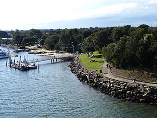
Oatley is a suburb in Southern Sydney in the state of New South Wales, Australia. It is located 18 kilometres south of the Sydney central business district and is part of the St George area. Oatley lies in the local government area of Georges River Council. It lies on the northern side of the tidal estuary of the Georges River and its foreshore includes part of Oatley Bay and Lime Kiln Bay, and all of Neverfail Bay, Gungah Bay and Jewfish Bay.

Kogarah is a suburb of Southern Sydney, in the state of New South Wales, Australia. Kogarah is located 14 kilometres south-west of the Sydney central business district and is considered to be the centre of the St George area.

The Division of Banks is an Australian electoral division in the state of New South Wales.

The St George region of Sydney is part of the southern suburbs of Sydney, in the state of New South Wales, Australia. The area includes all the suburbs in the local government area of Georges River Council and the part of Bayside Council which was Rockdale City prior to 2016. The eastern boundary of the district is Lady Robinson Beach on Botany Bay. The name "St George" derives from the cadastral Parish of St George, and the area was later covered by the St George County Council, the electricity supplier for the councils in this region. While generally being considered part of Southern Sydney the area is occasionally included as part of the Inner South-West.

2RPH is an Australian radio reading service that reads newspapers and magazines for the benefit of those who have difficulties reading for themselves. It is the Sydney station of the RPH Network.

Allawah is a suburb in southern Sydney, in the state of New South Wales, Australia. Allawah is 16 kilometres south of the Sydney central business district and is part of the St George area. Allawah lies in the local government area of the Georges River Council. The postcode is 2218, which is shared by the neighbouring suburb of Carlton.
Sans Souci is a Southern Sydney suburb in the state of New South Wales, Australia. Sans Souci is 17 kilometres south of the Sydney central business district and lies across the local government areas of the Bayside Council and the Georges River Council. It is part of the St George area.

Peakhurst is a suburb in Southern Sydney, or the St George Area, in the state of New South Wales, Australia 21 kilometres south-west of the Sydney central business district. Peakhurst is in the local government area of the Georges River Council.

The Division of Watson is an Australian electoral division in the state of New South Wales.
South Hurstville is a suburb in the St George area of Southern Sydney, 18 kilometres south of the Sydney central business district. South Hurstville is in the local government area of the Georges River Council. Hurstville and Hurstville Grove are separate neighbouring suburbs.

Narwee is a suburb in southern Sydney, in the state of New South Wales, Australia. Narwee is located 18 kilometres south of the Sydney central business district and is part of the St George area. Narwee is in local government areas of City of Canterbury-Bankstown and Georges River Council. The postcode is 2209, which it shares with neighbouring Beverly Hills.

Banksia is a suburb in southern Sydney, in the state of New South Wales, Australia. Banksia is located 12 kilometres south of the Sydney central business district, in the local government area of the Bayside Council and is part of the St George area.

Bexley is a suburb in southern Sydney, in the state of New South Wales, Australia. Bexley is located 14 kilometres (8.7 mi) south-west of the Sydney central business district, in the local government area of the Bayside Council and is part of the St George area.

Carlton is a suburb in southern Sydney, in the state of New South Wales, Australia. Carlton is located 15 kilometres south of the Sydney central business district and is part of the St George area. Carlton lies across the boundary of two local government areas, the Georges River Council and the Bayside Council.

2RRR is a community radio station based in Ryde in Sydney. It is licensed to cover part of the Lower North Shore suburbs including Ryde, Hunters Hill, Gladesville and Eastwood.

Oatley is an electoral district of the Legislative Assembly in the Australian state of New South Wales in Sydney's St George district. It is currently held by Mark Coure of the Liberal Party.

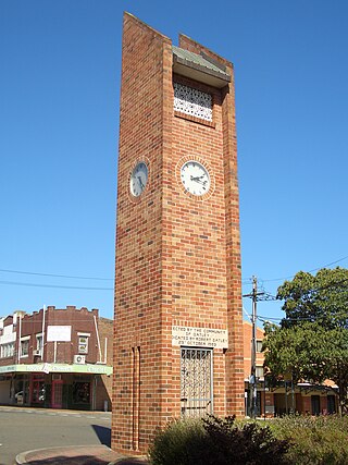
Georges River Council is a local government area located in the St George region of Sydney located south of the CBD, in New South Wales, Australia. The Council was formed on 12 May 2016 from the merger of the Hurstville City Council and Kogarah City Council.