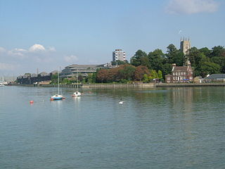
The River Medway is a river in South East England. It rises in the High Weald, West Sussex and flows through Tonbridge, Maidstone and the Medway conurbation in Kent, before emptying into the Thames Estuary near Sheerness, a total distance of 70 miles (113 km). About 13 miles (21 km) of the river lies in East Sussex, with the remainder being in Kent.

The Jubilee River is a hydraulic channel in southern England. It is 11.6 km (7.2 mi) long and is on average 45 metres wide. It was constructed in the late 1990s and early 2000s to take overflow from the River Thames and so alleviate flooding to areas in and around the towns of Maidenhead, Windsor, and Eton in the counties of Berkshire and Buckinghamshire. It achieves this by taking water from the left bank of the Thames upstream of Boulter's Lock near Maidenhead and returning it via the north bank downstream of Eton. Although successful in its stated aims, residents of villages downstream, such as Wraysbury, claim it has increased flooding in those locations.

Albert Bridge is a road bridge over the River Thames connecting Chelsea in Central London on the north bank to Battersea on the south. Designed and built by Rowland Mason Ordish in 1873 as an Ordish–Lefeuvre system modified cable-stayed bridge, it proved to be structurally unsound, so between 1884 and 1887 Sir Joseph Bazalgette incorporated some of the design elements of a suspension bridge. In 1973 the Greater London Council added two concrete piers, which transformed the central span into a simple beam bridge. As a result, today the bridge is an unusual hybrid of three different design styles. It is an English Heritage Grade II* listed building.

The Cotswold Line is an 86+1⁄2-mile (139.2 km) railway line between Oxford and Hereford in England.

Wolvercote is a village that is part of the City of Oxford, England. It is about 3 miles (5 km) northwest of the city centre, on the northern edge of Wolvercote Common, which is itself north of Port Meadow and adjoins the River Thames.

Kingston Railway Bridge in Kingston upon Thames, London, crosses the River Thames on the reach above Teddington Lock. It carries the Kingston Loop Line train service from London Waterloo station, where the majority of services begin and end and which line includes a maintenance depot. The loop diverges from main lines at New Malden and Richmond. East and west of the bridge along the line are Kingston and Hampton Wick stations. The loop returns to the south bank of its terminus via Richmond Railway Bridge. The loop feeds a branch line, a further incentive for the 1863 construction of the bridge, Shepperton Branch Line.

Gatehampton Railway Bridge, otherwise referred to as Gatehampton Viaduct, is a railway bridge carrying the Great Western Main Line over the River Thames in Lower Basildon, Berkshire, England. It takes the line between the stations at Goring and Streatley and Pangbourne, and crosses the Thames on the reach between Whitchurch Lock and Goring Lock.

Godstow Bridge is a road bridge across the River Thames in England at Godstow near Oxford. The bridge is just upstream of Godstow Lock on the reach to King's Lock and carries a minor road between Wolvercote and Wytham.
The Oxford Ring Road circles the city of Oxford, England. It is a dual carriageway ring road for most of its length apart from a short section between Woodstock Road and Banbury Road in the north of the city. The severe restrictions on traffic in Oxford city centre mean that it is the only practical way for long-distance traffic to get past Oxford, especially as there are few road bridges over the rivers Isis and Cherwell. Five Park and Rides are close to the ring road.

Osney Bridge is a road bridge across the River Thames in Oxford, England, built in 1888 to replace a stone bridge which collapsed in 1885. It carries the Botley Road (A420) from Botley into Oxford. The Thames Path crosses the river on this bridge, just above Osney Lock.

Osney Lock is a lock on the River Thames in Oxford, England, where the village or island of Osney is next to the river.

Godstow Lock is a lock on the River Thames in Oxfordshire, England. It is between the villages of Wolvercote and Wytham on the outskirts of Oxford. The first lock was built of stone by Daniel Harris for the Thames Navigation Commission in 1790. It is the lock furthest upstream on the river which has mechanical (electro-hydraulic) operation - every lock upstream of Godstow utilises manual beam operation instead.

King's Lock is a lock on the River Thames in England. It is in open country to the north of Oxford, Oxfordshire, on the southern bank of the river. The lock was one of the last pound locks built on the Thames, built by the Thames Conservancy in 1928 to replace the former flash lock. It has the smallest fall of any lock on the river, 0.77 m.

The River Don Navigation was the result of early efforts to make the River Don in South Yorkshire, England, navigable between Fishlake and Sheffield. The Dutch engineer Cornelius Vermuyden had re-routed the mouth of the river in 1626, to improve drainage, and the new works included provision for navigation, but the scheme did not solve the problem of flooding, and the Dutch River was cut in 1635 to link the new channel to Goole. The first Act of Parliament to improve navigation on the river was obtained in 1726, by a group of Cutlers based in Sheffield; the Corporation of Doncaster obtained an Act in the following year for improvements to the lower river. Locks and lock cuts were built and by 1751 the river was navigable to Tinsley.

Black Potts Railway Bridge carries the railway from London (Waterloo) to Windsor, Berkshire across the River Thames. The Staines to Windsor & Eton Line terminates immediately after the bridge at Windsor and Eton Riverside railway station. The bridge crosses the Thames on the reach above Old Windsor Lock, shortly before Romney Lock.

Nuneham Viaduct, also known as Nuneham Railway Bridge and the Black Bridge. is near the town of Abingdon-on-Thames in Oxfordshire, England. It is a two-span, bowstring truss bridge that carries the Didcot to Oxford section of the Cherwell Valley Line across the River Thames between Abingdon Lock and Sandford Lock. Its name is derived from the neighbouring Nuneham House. The total length is 99 yards (91 m); the southern and northern ends are respectively 57 miles 24 chains (92.22 km) and 57 miles 29 chains (92.32 km) from Paddington.

Kennington Railway Bridge is a railway bridge over the River Thames near Kennington, Oxfordshire between Sandford Lock and Iffley Lock. It carries the freight railway branch line that serves the BMW Mini factory at Cowley. The freight railway is part of the former Wycombe Railway that linked Maidenhead and Oxford via High Wycombe and Princes Risborough.

Isis Bridge is a modern road bridge across the River Thames just south of Oxford, England. It carries the Oxford Ring Road, part of the A423 road, across the Thames on the reach between Sandford Lock and Iffley Lock.
Duke's Cut is a short waterway in Oxfordshire, England, which connects the Oxford Canal with the River Thames via the Wolvercote Mill Stream. It is named after George Spencer, 4th Duke of Marlborough, across whose land the waterway was cut. It is seen as a branch of the Oxford Canal.

