Abohar

Last updated

Abohar
City
India Punjab location map.svg
Red pog.svg
Abohar
Location in Punjab, India
India location map.svg
Red pog.svg
Abohar
Abohar (India)
Coordinates: 30°08′00″N74°12′00″E / 30.1334°N 74.2001°E / 30.1334; 74.2001
CountryFlag of India.svg  India
State Punjab
District Fazilka
Government
  TypeMunicipal Corporation
  BodyAbohar Municipal Corporation
Area
  Total188.24 km2 (72.68 sq mi)
Elevation
180 m (590 ft)
Population
 (2011) [1]
  Total145,302
  Density770/km2 (2,000/sq mi)
Demonym Aboharias
Languages
  Official Punjabi [2]
  Others Bagri, Hindi [3]
Time zone UTC+5:30 (IST)
PIN
152116
STD code01634
Vehicle registration PB-15

Abohar is a city and municipal corporation in the Fazilka district of the Indian state of Punjab, [4] southeast of Fazilka city and northeast of Sri Ganganagar. [5] It is near the India-Pakistan border. Abohar's population is 145,302 as of 2011. [6] The city is known for kinnow production and accounts for 60% of the country's produce. [7]

Contents

Demographics

Population

According to the 2011 Indian census, Abohar city had a population of 145,302, of which 76,984 were males and 68,318 were females. [1]

Religion

Religion in Abohar City (2011 census) [1]
ReligionPercent
Hinduism
83.27%
Sikhism
15.60%
Others
1.13%

Majority of the people living in Abohar follows Hinduism, with a significant Sikh minority. [1]

Languages

Language in Abohar (2011 census) [3]
LanguagePercent
Punjabi
42.66%
Hindi
36.67%
Bagri
5.20%
Others
15.47%

Punjabi is the official language of the city and is spoken by the majority. [2] [3] Other major languages spoken are Bagri and Hindi. [3]

Wildlife sanctuary

Abohar is home to the Abohar Wildlife Sanctuary, which provides a free-range sanctuary for black bucks. The open sanctuary is spread over an area of 18,650 hectares across farmlands and villages. [8] The Abohar Wildlife Sanctuary is located in the Fazilka District of Punjab. The formation of sanctuary relates to a unique success story of wildlife conservation in which people of Bishnoi community united themselves for protecting the Black Buck which is regarded as a sacred animal by them. It is also the State Animal of Punjab. It is home to several varieties of flora and fauna viz. Albizia lebbeck, Acacia nilotica, Azadirachta indica, A. tortilis, Nilgai, porcupine, hare, jackal, etc.

Related Research Articles

<span class="mw-page-title-main">Kangra district</span> District in Himachal Pradesh, India

Kangra district is the most populous district of the Indian state of Himachal Pradesh. Dharamshala is the administrative headquarters of the district.

<span class="mw-page-title-main">West Tripura district</span> District in India India, Tripura

West Tripura is an administrative district in the state of Tripura in India. The district headquarters are located at Agartala. As of 2012 it is the most populous district of Tripura.

<span class="mw-page-title-main">Darjeeling district</span> District of West Bengal, India

Darjeeling District is the northernmost district of the state of West Bengal in eastern India in the foothills of the Himalayas. The district is famous for its hill station and Darjeeling tea. Darjeeling is the district headquarters.

<span class="mw-page-title-main">Amritsar district</span> District in Charda Punjab, India

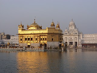
Amritsar district is one of the twenty three districts that make up the Indian state of Punjab. Located in the Majha region of Punjab, the city of Amritsar is the headquarters of this district.

<span class="mw-page-title-main">Sri Ganganagar</span> City in Rajasthan, India

Sri Ganganagar is the northernmost city of the Indian state of Rajasthan, near the international border of India and Pakistan. It is the administrative headquarters of Sri Ganganagar district. It is named after Maharaja Shri Ganga Singh Bahadur, Maharaja of Bikaner. The city is also known as the "Food Basket of Rajasthan".

<span class="mw-page-title-main">Firozpur</span> City in Punjab, India

Firozpur, also known as Ferozepur, is a city on the banks of the Sutlej River in Firozpur District, Punjab, India. After the partition of India in 1947, it became a border town on the India–Pakistan border with memorials to soldiers who died fighting for India.

<span class="mw-page-title-main">Bathinda district</span> District of Punjab in India

Bathinda district is in Malwa region of Punjab, India. The district encompasses an area of 3,385 square kilometers. By area, Bathinda district is the second-largest in Punjab, after Ludhiana district. It is bounded by Faridkot district and Moga district on the north, Muktsar district on the west, Barnala and Mansa districts on the east, and the state of Haryana on the south. Bathinda is cotton producing belt of Punjab.

<span class="mw-page-title-main">Sirsa</span> City in Haryana, India

Sirsa is a city and a municipal council in Sirsa district in the westernmost region of the Indian state of Haryana, bordering Punjab and Rajasthan. It is located near to Thar desert or we can say a small portion of Sirsa is under Thar Desert. It is located 250 kilometres north-west of New Delhi and 260 kilometers south-west of state capital Chandigarh. Sirsa Nearest city Hisar, Fatehabad, Bhadra, Nohar, Mandi Dabwali, Hanumangarh. Its history dates back to the time of the Mahabharata. At one time, the Sarasvati River flowed in this area.

<span class="mw-page-title-main">Firozpur district</span> District in Punjab, India

Firozpur district, also known as Ferozepur district, is one of the twenty-three districts in the state of Punjab, India. Firozpur district comprises an area of 2,190 km2 (850 sq mi).

<span class="mw-page-title-main">Hanumangarh district</span> District in Rajasthan, India

Hanumangarh district is a district in the state of Rajasthan in India. The city of Hanumangarh is the district headquarters and its largest city.

<span class="mw-page-title-main">Fazilka</span> City in Punjab, India

Fazilka, also known as Bangla, is a city and a municipal council in Fazilka district of Punjab, India. In 2011, it was made the headquarter of the newly created Fazilka district. The Trans-Afghanistan Pipeline (TAPI) project originating in Turkmenistan will have its last station in Fazilka.

Maharajganj is a town and municipal board in Maharajganj district in the Indian state of Uttar Pradesh.

<span class="mw-page-title-main">Shopian</span> Town in Jammu and Kashmir, India

Shopian or Shupiyan ,, known as Shupyan in Kashmiri, is an administrative division of the Shopian district, located in southern part of Kashmir Valley, of Jammu and Kashmir, India. Shopian is called the ''Apple town of Kashmir'' as majority of the population engages in apple growing practices which also provides employment to more than 60% of the population. It is 2nd richest district in Kashmir region after Srinagar.

Vita, also known as Vite, is a town and a municipal council in Sangli district in the Indian state of Maharashtra. Vita is also taluka headquarters of Khanapur taluka.

Kandhwala or Kandhwala HazarKhan is a village located in the Fazilka district of Punjab, India. The village falls under Tehsil of Fazilka district.

Bishanpura is a village in the notified area of Zirakpur in Mohali district, Punjab, India.

<span class="mw-page-title-main">Fazilka district</span> District of Punjab in India

Fazilka district is one of 23 districts in the state of Punjab in India. The district headquarters of the Fazilka District are at Fazilka.

<span class="mw-page-title-main">Pathankot district</span> District of Punjab in India

Pathankot district is the northernmost district of the Indian state of Punjab. Pathankot is the district headquarters. The district was created on July 27, 2011.

Abohar Wildlife Sanctuary earned the status of a sanctuary in 1975 and again in 2000 under the Wildlife Protection Act 1972. It is located in the Fazilka district of Punjab and is a private nature reserve. It is known for being a preservation hotspot for Black Buck, which is regarded as a sacred animal by the people of Bishnoi community who are native to the place.

References

  1. 1 2 3 4 "C-01: Population by religious community - Abohar city". censusindia.gov.in. Retrieved 15 June 2022.
  2. 1 2 "52nd Report of the Commissioner for Linguistic Minorities in India" (PDF). nclm.nic.in. Ministry of Minority Affairs. Archived from the original (PDF) on 25 May 2017. Retrieved 8 August 2019.
  3. 1 2 3 4 "C-16: Population by mother tongue - Abohar". censusindia.gov.in. Retrieved 15 June 2022.
  4. "Municipal Council - Fazilka". fazilka.nic.in. Retrieved 21 August 2020.
  5. "Archived copy" (PDF). Archived from the original (PDF) on 9 November 2016. Retrieved 19 November 2016.{{cite web}}: CS1 maint: archived copy as title (link)
  6. "Census India 2011". Office of the Registrar General and Census Commissioner; India. Retrieved 1 January 2017.
  7. Kamal, Neel (2 March 2019). "Punjab: Good kinnow crop this year, but salinity poses a challenge". The Times of India. Retrieved 14 February 2020.
  8. "Black Buck Sanctuary Abohar | District Fazilka, Government of Punjab | India". fazilka.nic.in. Retrieved 22 February 2021.

https://www.gktoday.in/question/the-abohar-wildlife-sanctuary-is-located-in-which