
Cape Wrath is a cape in the Durness parish of the county of Sutherland in the Highlands of Scotland. It is the most north-westerly point in mainland Britain.
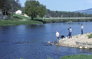
The River Spey is a river in the northeast of Scotland. At 98 mi (158 km) it is the ninth longest river in the United Kingdom, as well as the third longest and fastest-flowing river in Scotland. It is important for salmon fishing and whisky production.

Aberfeldy is a burgh in Perth and Kinross, Scotland, on the River Tay. A small market town, Aberfeldy is located in Highland Perthshire. It was mentioned by Robert Burns in the poem The Birks Of Aberfeldy.
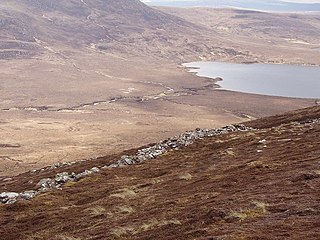
Forsinard is a hamlet in the county of Sutherland in the Highland area of Scotland. It is located on the A897 road in Strath Halladale. It is served by a railway station on the Far North Line. The local hotel closed several years ago, but there is now a B&B just across the level crossing.
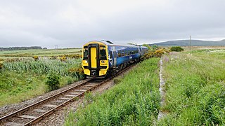
The Far North Line is a rural railway line entirely within the Highland area of Scotland, extending from Inverness to Thurso and Wick. As the name suggests, it is the northernmost railway in the United Kingdom. The line is entirely single-track, with only passing loops at some intermediate stations allowing trains to pass each other. In common with other railway lines in the Highlands and northern Lowlands, it is not electrified and all trains are diesel-powered.

The A897 single track road is entirely within the Highland council area of Scotland. It runs generally north from the A9 at Helmsdale to the A836 near Halladale Bridge, east of Melvich. The road passes through or near Kildonan, Kinbrace and Forsinard, and has a junction with the B871 at Kinbrace. It also passes through Achiemore.

Bettyhill is a village in the parish of Farr, on the north coast of Scotland.
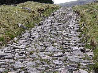
The Corrieyairack Pass is a 770 m (2526 ft) high pass in the Scottish Highlands at grid reference NN417986. It is notable for the presence of one of General Wade's military roads, built at the time of the Jacobite risings in the eighteenth century.
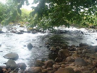
River Sgitheach also known as Skiach or Skiack, is a river in Ross and Cromarty, Scotland. It rises on the southern slopes of Ben Wyvis, passes through Strath Sgitheach, passing Clare plantation, Swordale, the village of Evanton, and after about 13 miles (21 km) empties into the Cromarty Firth near the ruin of the old Kiltearn parish church. About a mile to the northeast, on the other side of Balconie Point, the Allt Graad also empties in the Firth. The ruin that lies on the beach between the two rivers is an old salmon fishing bothy of the Novar Estate.

Melvich is a village in the county of Sutherland on the north coast of Scotland. It is situated on the A836 road, near the mouth of the River Halladale. It has a successful Gaelic choir. The A897 road which runs from Helmsdale, through the Strath of Kildonan and past Kinbrace, terminates at Melvich.

Loch Broom is a sea loch located in northwestern Ross and Cromarty, in the former parish of Lochbroom, on the west coast of Scotland. The small town of Ullapool lies on the eastern shore of the loch.

Borgie is a hamlet in Sutherland, Highland, Scotland. Historically it was part of the 12,600-acre (5,100-hectare) Tongue estate with shooting rights, and it contains the Borgie Lodge, now a bed and breakfast. Borgie is noted for its salmon, which are caught in the River Borgie which flows to the east of the hamlet.
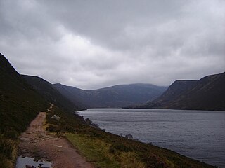
Loch Muick is an upland, freshwater loch lying approximately 5 mi (8.0 km) south of Braemar, Scotland at the head of Glen Muick and within the boundary of the Balmoral estate.

Chno Dearg is a mountain in the Lochaber area of the Scottish Highlands. It overlooks Glen Spean to the north and Loch Treig to the west. With a height of 1,046 metres (3,432 ft), it is classed as a Munro.

Beinn Odhar is a Scottish mountain situated at the northern extremity of the Loch Lomond and the Trossachs National Park. It stands four km (2.5 mi) north of Tyndrum, a location with which it has strong ties, being well seen from the village. The mountain lies on the border between Argyll and Bute and Stirling council areas within the Auch and Invermeran estate.
Strathdevon is the strath of the River Devon in Clackmannanshire, Scotland. Strathdevon is associated with the parish of Muckhart and was up until 1971 the southernmost tip of Perthshire.

Strath of Kildonan, also known as Strath Ullie,, is a strath in Sutherland, in the north of Scotland. It extends in a north-westerly direction from Helmsdale towards Kinbrace.
Strath Halladale is a strath in the traditional county of Sutherland in the north of Scotland down which the Halladale River flows to enter the Atlantic Ocean at Melvich Bay. It is followed by the A897 road between Forsinard and just short of Melvich where it joins the A836 north coast road, just east of Halladale Bridge, the lowest road crossing of the river. The headwaters of the river gather within The Flows National Nature Reserve and head northwest towards Forsinard. The flow is soon joined by the left bank tributaries of the Catsack and Ewe burns. The main tributary is the left-bank River Dyke or Abhainn Bheag which joins just south of the twin settlements of Trantlemore and Trantlebeg on the west and eastern sides of the valley respectively. There are a large number of broch ruins within Strath Halladale.
Loch Hope is a loch in the Durness parish in Sutherland in the Highland Council Area of northern Scotland. It is located on the A838 main road. The settlements of Hope, Lochside, and Muiseal directly on the loch in addition nearby there's Inverhope, Heilam, Moine House, Alltnacaillich, Strathmore, ect.. The Loch is a large tourist destination for the area around it.


