
Adamsville is a settlement in the municipality of Colrain, Massachusetts. [1] [2]
Adamsville is a settlement in the municipality of Colrain, Massachusetts. [1] [2]
Adamsville is bounded by Heath to the west, Shelburne to the south, Halifax to the north, and the Leyden border to the east. It is connected via a bridge over the Connecticut River to Greenfield. Greenfield is famous for Rocky Mountain Park, the Stoneleigh-Burnham School and Greenfield Community College.
Around Colrain visitors can find a diverse landscape of valleys, low hills and slopes, and farms with fertile plain. The various villages have buildings clustered and scattered. The small Adamsville community is the extreme northwest corner of Colrain, not far from the Vermont and Massachusetts border and the Town of Heath. From Adamsville one can hike northeast to H.O. Cook State Forest to an elevation of 722 feet, or west through the Town of Heath to reach Pelham Lake Park in the Town of Rowe, Massachusetts. [3] [4] [5]

Franklin County is a nongovernmental county located in the northwestern part of the U.S. state of Massachusetts. As of the 2020 census, the population was 71,029, which makes it the least-populous county on the Massachusetts mainland, and the third-least populous county in the state. Its traditional county seat and most populous city is Greenfield. Its largest town by area is New Salem. Franklin County comprises the Greenfield Town, MA Micropolitan Statistical Area, which is included in the Springfield-Greenfield Town, MA Combined Statistical Area.

Ashfield is a town in Franklin County, Massachusetts, United States. The population was 1,695 at the 2020 census. It is part of the Springfield, Massachusetts Metropolitan Statistical Area.

Bernardston is a town in Franklin County, Massachusetts, United States. The population was 2,102 at the 2020 census. It is part of the Springfield, Massachusetts Metropolitan Statistical Area.

Buckland is a town in Franklin County, Massachusetts, United States. The population was 1,816 at the 2020 census. The town shares the village of Shelburne Falls with neighboring Shelburne. The town center at Shelburne Falls is the western end of the Bridge of Flowers, a local tourist attraction.

Charlemont is a town in Franklin County, Massachusetts, United States. The population was 1,185 at the 2020 census. It is part of the Springfield, Massachusetts Metropolitan Statistical Area.

Colrain is a town in Franklin County, Massachusetts, United States. The population was 1,606 at the 2020 census. It is part of the Springfield, Massachusetts Metropolitan Statistical Area.

Heath is a town in Franklin County, Massachusetts, United States. The population was 723 at the 2020 census. It is part of the Springfield, Massachusetts Metropolitan Statistical Area.

Leyden is a town in Franklin County, Massachusetts, United States. The population was 734 at the 2020 census. It is part of the Springfield, Massachusetts Metropolitan Statistical Area.

Monroe is a town in Franklin County, Massachusetts, United States. The population was 118 at the 2020 census. By area, population, and population density, it is the smallest town in the county; and is the second-smallest town by population in the Commonwealth, with only Gosnold having fewer residents.

Rowe is a town in Franklin County, Massachusetts, United States. The population was 424 at the 2020 census.

Shelburne is a town in Franklin County, Massachusetts, United States. The population was 1,884 at the 2020 census. It is part of the Springfield, Massachusetts Metropolitan Statistical Area.

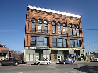
Greenfield is the only city in and the seat of Franklin County, Massachusetts, United States. Greenfield was first settled in 1686. The population was 17,768 at the 2020 census. Greenfield is home to Greenfield Community College, the Pioneer Valley Symphony Orchestra, and the Franklin County Fair. The city has a Main Street Historic District containing fine examples of Federal, Greek Revival, and Victorian architecture.
Orange is a town in Franklin County, Massachusetts, United States. The population was 7,569 at the 2020 census. It is part of the Springfield, Massachusetts Metropolitan Statistical Area.
Adamsville may refer to:


Deerfield River is a river that runs for 76 miles (122 km) from southern Vermont through northwestern Massachusetts to the Connecticut River. The Deerfield River was historically influential in the settlement of western Franklin County, Massachusetts, and its namesake town. It is the Connecticut River's second-longest tributary in Massachusetts, 2.1 miles (3.4 km) shorter than Metropolitan Springfield's Westfield River.

Massachusetts's 1st congressional district is a United States congressional district located in the western and central part of Massachusetts. The state's largest congressional district in area, it covers about one-third of the state and is more rural than the rest. It has the state's highest point, Mount Greylock; the district includes the cities of Springfield, West Springfield, Pittsfield, Holyoke, Agawam, Chicopee and Westfield.

Area code 413 is a telephone area code in the North American Numbering Plan (NANP) for the western third of Massachusetts. It is the largest numbering plan area in the Commonwealth, and extends from the New York state line eastward into Worcester County, while excluding the Franklin County towns of Orange, New Salem, Warwick, and Wendell, which use the overlay of area codes 978 and 351. The most-populous city of area code 413 is Springfield. 413 also includes Great Barrington, Greenfield, North Adams, Northampton and Pittsfield. The 413 numbering plan area constitues local access and transport area (LATA) 126.
Mohawk Trail Regional School is a school located on Route 112 in Buckland, Massachusetts, United States. The public school currently serves grades 7–12 for nine towns: Ashfield, Buckland, Charlemont, Colrain, Hawley, Heath, Plainfield, Rowe and Shelburne.

The Green River is a tributary of the Deerfield River in southern Vermont and northwestern Massachusetts in the United States.
Places adjacent to Adamsville, Colrain, Massachusetts | |
|---|---|