| Ahbach Formation | |
|---|---|
| Stratigraphic range: Eifelian-Givetian ~ | |
| Type | Formation |
| Sub-units | Hallert & Olifant members |
| Lithology | |
| Primary | Limestone |
| Other | Mudstone |
| Location | |
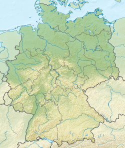
| Coordinates | 50°18′N7°36′E / 50.3°N 7.6°E |
| Approximate paleocoordinates | 23°00′S8°00′E / 23.0°S 8.°E |
| Region | Nordrhein-Westfalen, Rheinland-Pfalz |
| Country | Germany |
| Extent | Eifel, Rhenisch Schiefergebirge |
 Ahbach Formation (Germany) | |
The Ahbach Formation is a geologic formation in Germany. It preserves fossils dating back to the Middle Devonian period.