
The Pensacola Mountains are a large group of mountain ranges and peaks that extend 280 nautical miles in a northeast–southwest direction in the Transantarctic Mountains System, Queen Elizabeth Land region of Antarctica. They comprise the Argentina Range, Forrestal Range, Dufek Massif, Cordiner Peaks, Neptune Range, Patuxent Range, Rambo Nunataks and Pecora Escarpment. These mountain units lie astride the extensive Foundation Ice Stream and Support Force Glacier which drain northward to the Ronne Ice Shelf.

The Flores Sea covers 240,000 square kilometres (93,000 sq mi) of water in Indonesia. The sea is bounded on the north by the island of Celebes and on the south by the Sunda Islands of Flores and Sumbawa.
Bonfire Shelter is an archaeological site located in a southwest Texas rock shelter, near Langtry, Texas. This archaeological site contains evidence of mass American buffalo hunts, a phenomenon that is usually associated with the Great Plains hundreds of miles to the north. This site is the southernmost site that has been located in North America, where mass bison hunts have taken place.
The Iberá Wetlands are a mix of swamps, bogs, stagnant lakes, lagoons, natural slough, and courses of water in the center and center-north of the province of Corrientes, Argentina.

Pétrola is a municipality in Albacete, Castile-La Mancha, Spain, in a fertile valley watered by cascades and small rivers. The town's name comes from the ancient Roman word "petra", meaning 'stone'.
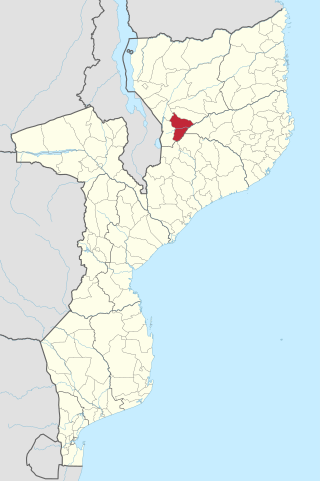
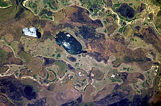
Cuamba District is a district of Niassa Province in north-western Mozambique. The principal town is Cuamba.
Chosmes is a village and municipality in San Luis Province in central Argentina.
Olaroz Chico is a rural municipality and village in Jujuy Province in Argentina.
Machigasta is a municipality and village in La Rioja Province in northwestern Argentina.
Punta de los Llanos is a municipality and village in La Rioja Province in northwestern Argentina.
La Hoyada is a village and municipality in Catamarca Province in northwestern Argentina.
Singuil is a village and municipality in Catamarca Province in northwestern Argentina.
Villa Vil is a village and municipality in Catamarca Province in northwestern Argentina.
Nahuel Niyeu is a village and municipality in Río Negro Province in Argentina.

Antevs Glacier, also known as North Heim Glacier, is a glacier on Arrowsmith Peninsula, Graham Land, flowing north between Seue Peaks and Boyle Mountains into Muller Ice Shelf, Lallemand Fjord. It was named by the United Kingdom Antarctic Place-Names Committee in 1960 after Ernst V. Antevs, American glacial geologist.
Beaglehole Glacier is a glacier between Spur Point and Friederichsen Glacier on the east coast of Graham Land. It was named by the UK Antarctic Place-Names Committee after John Cawte Beaglehole, New Zealand historian of the Antarctic and biographer of Captain James Cook.
Carbutt Glacier is a glacier entering Goodwin Glacier to the east of Maddox Peak, close east of Flandres Bay on the west coast of Graham Land.
Fendorf Glacier is a broad glacier draining from the eastern slopes of the Gifford Peaks and flowing north to merge with Dobbratz Glacier, in the Heritage Range of the Ellsworth Mountains, Antarctica. It was mapped by the United States Geological Survey from ground surveys and U.S. Navy air photos, 1961–66, and was named by the Advisory Committee on Antarctic Names for Lieutenant Commander James E. Fendorf, U.S. Navy, a pilot with Squadron VX-6 during Operation Deep Freeze 1966.

Sohm Glacier is a glacier flowing into Bilgeri Glacier on Velingrad Peninsula, the west coast of Graham Land. Charted by the British Graham Land Expedition (BGLE) under Rymill, 1934–37. Named by the United Kingdom Antarctic Place-Names Committee (UK-APC) in 1959 for Victor Sohm, Austrian skiing exponent who invented a special type of ski skins and ski wax.
