Related Research Articles
Avionics are the electronic systems used on aircraft. Avionic systems include communications, navigation, the display and management of multiple systems, and the hundreds of systems that are fitted to aircraft to perform individual functions. These can be as simple as a searchlight for a police helicopter or as complicated as the tactical system for an airborne early warning platform.

The Federal Aviation Administration (FAA) is a U.S. federal government agency within the U.S. Department of Transportation which regulates civil aviation in the United States and surrounding international waters. Its powers include air traffic control, certification of personnel and aircraft, setting standards for airports, and protection of U.S. assets during the launch or re-entry of commercial space vehicles. Powers over neighboring international waters were delegated to the FAA by authority of the International Civil Aviation Organization.

The Semi-Automatic Ground Environment (SAGE) was a system of large computers and associated networking equipment that coordinated data from many radar sites and processed it to produce a single unified image of the airspace over a wide area. SAGE directed and controlled the NORAD response to a possible Soviet air attack, operating in this role from the late 1950s into the 1980s. Its enormous computers and huge displays remain a part of Cold War lore, and after decommissioning were common props in movies such as Dr. Strangelove and Colossus, and on science fiction TV series such as The Time Tunnel.

Air traffic control (ATC) is a service provided by ground-based air traffic controllers who direct aircraft on the ground and through a given section of controlled airspace, and can provide advisory services to aircraft in non-controlled airspace. The primary purpose of ATC is to prevent collisions, organize and expedite the flow of traffic in the air, and provide information and other support for pilots.
Free flight is a developing air traffic control method that uses no centralized control. Instead, parts of airspace are reserved dynamically and automatically in a distributed way using computer communication to ensure the required separation between aircraft. This new system may be implemented into the U.S. air traffic control system in the next decade. Its potential impact on the operations of the national airspace system is disputed, however.
Aviation is the design, development, production, operation, and use of aircraft, especially heavier-than-air aircraft. Articles related to aviation include:

A traffic alert and collision avoidance system (TCAS, pronounced TEE-kas), also known as an Airborne Collision Avoidance System (ACAS), is an aircraft collision avoidance system designed to reduce the incidence of mid-air collision (MAC) between aircraft. It monitors the airspace around an aircraft for other aircraft equipped with a corresponding active transponder, independent of air traffic control, and warns pilots of the presence of other transponder-equipped aircraft which may present a threat of MAC. It is a type of airborne collision avoidance system mandated by the International Civil Aviation Organization to be fitted to all aircraft with a maximum take-off mass (MTOM) of over 5,700 kg (12,600 lb) or authorized to carry more than 19 passengers. CFR 14, Ch I, part 135 requires that TCAS I be installed for aircraft with 10-30 passengers and TCAS II for aircraft with more than 30 passengers. ACAS/TCAS is based on secondary surveillance radar (SSR) transponder signals, but operates independently of ground-based equipment to provide advice to the pilot on potentially conflicting aircraft.

The IBM 9020 was an IBM System/360 computer adapted into a multiprocessor system for use by the U.S. FAA for Air Traffic Control. Systems were installed in the FAA's 20 en route Air Route Traffic Control Centers (ARTCCs), beginning in the late 1960s. The U.K. CAA also installed a system in its London centre. The IBM 9020A, for example, was based on the S/360-50 and the 9020D used two out of three or four S/360-65 processors for flight and radar data processing with two out of three S/360-50 processors providing input/output capability.
A NOTAM is a notice filed with an aviation authority to alert aircraft pilots of potential hazards along a flight route or at a location that could affect the flight. NOTAMs are notices or advisories that contain information concerning the establishment, conditions or change in any aeronautical facility, service, procedure or hazard, the timely knowledge of which may be essential to personnel and systems concerned with flight operations.
System Wide Information Management (SWIM) is a global Air Traffic Management (ATM) industry initiative to harmonize the exchange of Aeronautical, Weather and Flight information for all Airspace Users and Stakeholders. SWIM is an integral part of the International Civil Aviation Organization (ICAO) Global Air Navigation Plan (GANP). The GANP defines 4 Performance Improvement Areas (PIA), SWIM resides in PIA 2: Globally interoperable systems and data, where its implementation is further defined in Aviation System Block Upgrades (ASBU) B1-SWIM and B2-SWIM. ASBU B1-SWIM defines SWIM as a “a net-centric operation where the air traffic management (ATM) network is considered as a series of nodes, including the aircraft, providing or using information.” it goes on to say “The sharing of information of the required quality and timeliness in a secure environment is an essential enabler to the ATM target concept.”
The En Route Automation Modernization (ERAM) system architecture replaces the En Route Host computer system and its backup. ERAM provides all of today's functionality and:
The Capstone Program was a United States government-funded aviation safety program for the state of Alaska, primarily focusing on rural areas of the state. This joint effort – between the Federal Aviation Administration (FAA), the Alaska Pilot's Association, commercial operators, the University of Alaska, MITRE Corporation, some avionics manufacturers and individual pilots – cut the accident rate in the eastern part of Alaska by around 40%.
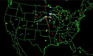
Flight Traffic Mapping uses animation to depict flight traffic. The mapping of flights in real-time is based on a sophisticated air traffic control system that was developed for North America. The air traffic control system is a complex combination of electronics and people that helps guide planes from departure to destination. In 1991, data on the location of aircraft was made available by the Federal Aviation Administration to the airline industry. The National Business Aviation Association (NBAA), the General Aviation Manufacturers Association, the Aircraft Owners and Pilots Association (AOPA), the Helicopter Association International, and the National Air Transportation Association petitioned the FAA to make ASDI information available on a "need-to-know" basis. Subsequently, NBAA advocated the broad-scale dissemination of flight traffic data.
The Next Generation Air Transportation System (NextGen) is an ongoing United States Federal Aviation Administration (FAA) project to modernize the National Airspace System (NAS). The FAA began work on NextGen improvements in 2007 and plans to finish the final implementation segment by 2030. The goals of the modernization include using new technologies and procedures to increase the safety, efficiency, capacity, access, flexibility, predictability, and resilience of the NAS while reducing the environmental impact of aviation.
The Air Traffic Organization (ATO) is an air navigation service provider in the United States of America. The ATO is the operational division of the Federal Aviation Administration (FAA).

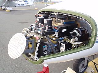
Automatic Dependent Surveillance–Broadcast (ADS-B) is an aviation surveillance technology and form of electronic conspicuity in which an aircraft determines its position via satellite navigation or other sensors and periodically broadcasts its position and other related data, enabling it to be tracked. The information can be received by air traffic control ground-based or satellite-based receivers as a replacement for secondary surveillance radar (SSR). Unlike SSR, ADS-B does not require an interrogation signal from the ground or from other aircraft to activate its transmissions. ADS-B can also receive point-to-point by other nearby equipped ADS-B equipped aircraft to provide traffic situational awareness and support self-separation.
The United States Congress established the Joint Planning and Development Office (JPDO) in 2003 to plan and coordinate the development of the Next Generation Air Transportation System (NextGen). The JPDO is a multi-agency public/private initiative to include: United States Department of Transportation, United States Department of Defense, Department of Commerce, Department of Homeland Security, Federal Aviation Administration, National Aeronautics and Space Administrations, and White House Office of Science and Technology Policy. Congress ended funding for JPDO in 2014.

Anchorage Air Route Traffic Control Center (PAZA/ZAN) is an Area Control Center operated by the Federal Aviation Administration just outside the main gate of Joint Base Elmendorf-Richardson at 700 North Boniface Parkway in Anchorage, Alaska, United States. The Anchorage ARTCC is one of 22 Air Route Traffic Control Centers in the United States.
Airport surveillance and broadcast systems are a set of runway-safety tools that display aircraft on and near an airport.

Airway Transportation Systems Specialists', also known as (ATSSs; FV-2101) are Systems Electronics Technicians assigned to the Technical Operations (TechOps) section of the Federal Aviation Administration's Air Traffic Organization (ATO). Airway Transportation Systems Specialists possess theoretical and practical knowledge in electronic theory and characteristics, functions, operations, and capabilities of a variety of National Airspace System (NAS) systems. Airway Transportation Systems Specialists ensure the safety and efficiency of the NAS by performing preventive maintenance, corrective maintenance, and system modifications of air traffic control systems at ATCTs, TRACONs, and ARTCCs throughout the United States of America and its territories. ATSS generally possesses years of experience in a variety of U.S. National Airspace System (NAS) systems. Airway Transportation Systems Specialists are responsible for the maintenance, operation, fabrication, installation, and management of the technical infrastructure of the National Airspace System. Airway Transportation Systems Specialists work at different Systems Support Centers (SSCs) in the United States. Airway Transportation Systems Specialists install, maintain, repair, operate, and monitor hardware and software to ensure they work as designed. ATSS certifies equipment and services to ensure safe and efficient flight operations throughout NAS. The FAA workforce currently includes 5,200 ATSS nationwide.
References
- ↑ "Access to Aircraft Situation Display to Industry (ASDI) and National Airspace System Status Information (NASSI) Data". August 21, 2013. Retrieved December 12, 2022.
- ↑ Smith, Matthew; Moser, Daniel; Strohmeier, Martin; Lenders, Vincent; Martinovic, Ivan (April 2017). Economy Class Crypto: Exploring Weak Cipher. Financial Cryptography and Data Security (FC 2017). Malta.
- ↑ "Introduction". ed-thelen.org. Retrieved May 8, 2023.
- ↑ "MITRE - About Us - MITRE History - Semi-Automatic Ground Environment (SAGE)". Archived from the original on May 13, 2009. Retrieved April 28, 2009.