Ajjampura

Last updated

Ajjampura
Town
India Karnataka location map.svg
Red pog.svg
Ajjampura
Location in Karnataka, India
Coordinates: 13°43′24″N76°00′17″E / 13.723377°N 76.004791°E / 13.723377; 76.004791
CountryFlag of India.svg  India
State Karnataka
District Chikkamagaluru
Government
  Body Town panchayat
Area
[1]
  Total27.13 km2 (10.47 sq mi)
Elevation
760 m (2,490 ft)
Population
 (2011)
  Total11,372
  Density420/km2 (1,100/sq mi)
Languages
  Official Kannada
Time zone UTC+5:30 (IST)
PIN
577547
Telephone code08261
Vehicle registration KA 66
Website www.ajjampuratown.mrc.gov.in

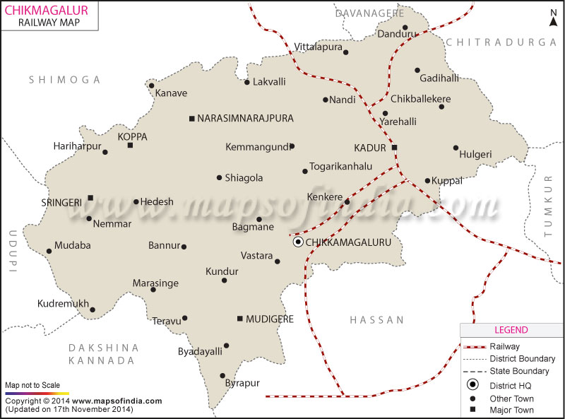
Ajjampura is a town and taluk headquarters in the district of Chikmagalur district in the Indian state of Karnataka.[ citation needed ]

Contents

Ajjampura has a police sub-inspector's office, [2] one movie theatre, a veterinary hospital and the Amrit Mahal cattle breeding station. It has a famous temple called rajarajeshwari temple.

History

Although not much is known about the history of this town, it is believed that the place was originally known as "Keral". An account of this was found in "Mysore: A Gazetteer Compiled for Government by Benjamin Lewis Rice" (First published in London in 1887). The image shows an entry from this Gazetteer.

Education

Ajjampura has a Government Pre-University College for 11th and 12th Standard students. It is located at the Gandhi Circle of Ajjampura. The college is named after the donor of the land, Shetru Siddappa, and is called Govt. Setru Siddappa Pre University College. Ajjampura is affiliated with the Government First Grade College which is a constituent college of Kuvempu University, Shankaraghatta, Karnataka, India.[ citation needed ]

Related Research Articles

<span class="mw-page-title-main">Karnataka</span> State in southern India

Karnataka, formerly Mysore State, is a state in the southwestern region of India. It was formed as the State of Mysore on 9 August 1947, by renaming of the Kingdom of Mysore, and renamed Karnataka in 1973. The state was part of the Carnatic region in British terminology. Its capital and largest city is Bengaluru (Bangalore).

<span class="mw-page-title-main">Hubli</span> City in Karnataka, India

Hubli, officially known as Hubballi, is a city in the Indian state of Karnataka. The twin cities Hubli–Dharwad form the second largest city in the state by area and population and the largest city in North Karnataka. Hubli is in Dharwad district of Karnataka and is the taluk headquarters of Hubli City and Hubli Rural. Although it hosts the HDMC office, the district headquarters is in Dharwad.

<span class="mw-page-title-main">Bijapur</span> City in Karnataka, India

Bijapur, officially known as Vijayapura, is the district headquarters of Bijapur district of the Karnataka state of India. It is also the headquarters for Bijapur Taluk. Bijapur city is well known for its historical monuments of architectural importance built during the rule of the Adil Shahi dynasty. It is also well known for the sports by the popular Karnataka premier league team as Bijapur Bulls. Bijapur is located 530 km (330 mi) northwest of the state capital Bangalore and about 550 km (340 mi) from Mumbai and 211 km (131 mi) east of the city of Belagavi.

<span class="mw-page-title-main">Chikmagalur district</span> District of Karnataka in India

Chikmagalur, officially Chikkamagaluru is an administrative district in the Malnad subregion of Karnataka, India. Coffee was first cultivated in India in Chikmagalur. The hills of Chikmagalur are parts of the Western Ghats and the source of Tunga and Bhadra rivers. Mullayanagiri, the highest peak in Karnataka is located in the district. The area is well known for the Sringeri Mutt that houses the Dakshina Peeta established by Adi Shankaracharya.

<span class="mw-page-title-main">Tiruvallur</span> Town in Tamil Nadu, India

Tiruvallur is a Grade I municipality in the Indian state of Tamil Nadu. It is located on the banks of Coovum river about 46 km (29 mi) from downtown Chennai (Madras) and just 5 km from megacity border, in the western part of the Chennai Metropolitan Area (CMA). It is a satellite town of Chennai and is the administrative headquarters of Tiruvallur district. The city is known for the Veera Raghavar temple, one of the 108 sacred shrines of Vaishnavites. The tank festival is held at a pond near this temple. A Shiva temple near this shrine which is popular among the locals. There is also a 40-foot (12 m) tall Viswaroopa Panchamukha Hanuman temple, where the murti is made of a single green granite stone.

<span class="mw-page-title-main">Belagavi district</span> District of Karnataka in India

Belagavi district, formerly known as also Belgaum district, is a district in the state of Karnataka, India. The district is known as Sugar Bowl of Karnataka with 1.5 lakh (150,000) hectares being used for commercial production and it has displaced Mandya district in sugar cane production over the last decade. The city of Belgaum (Belagavi) is the district headquarters in Belagavi district. It houses the Second legislative building, where the Karnataka Legislature hold session once a year. The district is famous for its native sweet, Kunda. According to the 2011 Census of India, it has a population of 4,779,661, of which 24.03% live in urban areas, making it the second most populous district in Karnataka, after Bangalore Urban. The district has an area of 13,415 km2 (5,180 sq mi) making it the largest district in Karnataka, and is bounded by Kolhapur District and Sangli district of Maharashtra state on the west and north, on the northeast by Bijapur district, on the east by Bagalkot district, on the southeast by Gadag district, on the south by Dharwad and Uttara Kannada districts, and on the southwest by the state of Goa.

<span class="mw-page-title-main">Yelahanka</span> Suburb / satellite town in Bengaluru, Karnataka, India

Yelahanka is a suburb and Taluk of Bangalore Urban district in the Indian state of Karnataka. One of the zones of BBMP. It is the oldest part of present Municipal Bengaluru (Bangalore) city and is in the north of the city. It is Nadaprabhu Kempegowda I, of the Yelahanka Prabhu clans, who laid the foundation of present-day Bengaluru through the creation of a "mud fort town" in 1537 CE

<span class="mw-page-title-main">Bijapur district, Karnataka</span> District of Karnataka in India

Bijapur district, officially known as Vijayapura district, is a district in the state of Karnataka in India. The city of Bijapur is the headquarters of the district, and is located 530 km northwest of Bangalore. Bijapur is well known for the great monuments of historical importance built during the Adil Shahi dynasty.

<span class="mw-page-title-main">Vokkaliga</span> Group of castes in Karnataka

Vokkaliga is a community, or a group of closely-related castes, from the Indian state of Karnataka. They are also present in the neighbouring state of Tamil Nadu.

<span class="mw-page-title-main">Shimoga district</span> District of Karnataka in India

Shimoga district, officially known as Shivamogga district, is a district in the Karnataka state of India. A major part of Shimoga district lies in the Malnad region or the Sahyadri. Shimoga city is its administrative centre. Jog Falls view point is a major tourist attraction. As of 2011 Shimoga district has a population of 17,52,753. There are seven taluks: Soraba, Sagara, Hosanagar, Shimoga, Shikaripura, Thirthahalli, and Bhadravathi. Channagiri and Honnali were part of Shimoga district until 1997 when they became part of the newly formed Davanagere district.

Birur is a town located in Kadur Taluk in Chikkamagaluru district in the state of Karnataka, India. It belongs to Mysuru Division. It is located 41 km east from district headquarters Chikkamagaluru.

Farrukhnagar is a small town and municipality in Farrukhnagar tehsil of Gurugram district in the Indian state of Haryana. It is situated 21 kilometres (13 mi) from Gurgaon and shares its border with Jhajjar district. It is part of the Ahirwal region.

<span class="mw-page-title-main">Hindupur</span> City in Andhra Pradesh, India

Hindupur is a city in Sri Sathya Sai district of the Indian state of Andhra Pradesh. It is located to the edge of the Andhra–Karnataka border and is the headquarters of Hindupur mandal. Hindupur is the biggest Parliamentary Constituency in the newly formed District Sri Sathya Sai. It is located about 67 km from district headquarters Puttaparthi, 100 km from Bengaluru the capital of Karnataka, 95 km From Kadiri.

Sedam or Seram is a town in Kalaburagi district in the Indian state of Karnataka. It is also the headquarters of the Sedam Taluka.

<span class="mw-page-title-main">Hampankatta</span> Place in Karnataka, India

Hampankatta is the centre of Mangalore City, Karnataka. Hampankatta also called as Happananakatte/Hampankatte/Hampananakatte/Hampanakatte. Most of the public utilities are located here and the locality boasts the most buzzing commercial activity in the city. Hampanakkatte was named by the British in 1920. Its original name was 'Appanakatte'. It was named after a person called Appanna Poojary who constructed a 'well' in the region around 1900, hence it was named Appannakatte. He used to feed his bullock cart etc. in those days and used to take rest.

<span class="mw-page-title-main">Khillari cattle</span> Breed of cattle

The Khillari is a cattle breed. It is a member of the Bos indicus sub-species, native to Satara, Sangli and Kolhapur regions in Maharashtra and Bijapur, Dharwad and Belagavi districts of Karnataka in India. The breed is well adapted to the area's tropical and drought-prone conditions. They are favoured by the local farming community due to their ability to handle the hardships of farming. The breed is in decline, mostly due low milk yield, which offers an alternate income stream.

<span class="mw-page-title-main">Hosur</span> Industrial city in Tamil Nadu, India

Hosur is an industrial city located in Krishnagiri district in the Tamil Nadu state of India. Hosur is one of the 21 municipal corporations in Tamil Nadu. It is located on the bank of the river River Ponnaiyar, 40 kilometres (25 mi) southeast of Bengaluru and 306 kilometres (190 mi) west of Chennai, the state capital. Hosur is home to major manufacturing industries including Stellantis, Ashok Leyland, Titan, TVS Motors, Caterpillar, Ather Energy, Schaeffler, and many others.

<span class="mw-page-title-main">Harchandpur</span> Village in Uttar Pradesh, India

Harchandpur is a village and corresponding community development block in Raebareli district, Uttar Pradesh, India. It is located on the Baiti river, which is a tributary of the Sai, and it is northeast from the district headquarters on the road to Lucknow. Particularly since the coming of the railway in the 1800s, Harchandpur serves as one of the main commercial centres for the surrounding region; it is also a major exporter of local goods. As of 2011, its population is 4,348 people, in 833 households.

<span class="mw-page-title-main">Amrit Mahal</span> Breed of cattle

The Amrit Mahal is a breed of cattle that originated from the erstwhile state of Mysore in Karnataka, India. They originated from the Hallikar and closely related breeds, Hagalavadi and Chithradurg. Originally developed for use in war for transporting equipage, the bullocks are notable for their great endurance and speed. Their head is elongated with a ridge in the middle and a bulging forehead. The cows in contrast are poor milk-yielders and hence, are classified to be a draught breed.

<span class="mw-page-title-main">Hallikar</span> Breed of cattle

Hallikar is a breed of cattle native to the state of Karnataka, India. It derives its name from the Hallikar community traditionally known for their cattle rearing. It is commonly found in the traditional Hallikar belt of Mysore, Mandya, Kolar, Hassan, Banglore rural and Tumkur districts of South Karnataka.

References

  1. [www.ajjampuratown.mrc.gov.in/en/city-summaray "Town info"]. Retrieved 31 July 2023.{{cite web}}: Check |url= value (help)
  2. "S.P. Office, Chickmagalur District". Archived from the original on 15 June 2007. Retrieved 7 July 2007.