This article may be expanded with text translated from the corresponding article in Italian. (January 2022)Click [show] for important translation instructions.
|
Albanella | |
|---|---|
| Comune di Albanella | |
 | |
 Coat of arms | |
| Motto(s): La terra degli ulivi | |
 Albanella within the Province of Salerno | |
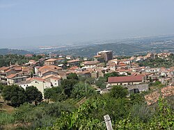
Location of Albanella  | |
File:Map Albanella Location of Albanella in Italy  Albanella Albanella (Campania) | |
| Coordinates: 40°29′N15°7′E / 40.483°N 15.117°E Coordinates: 40°29′N15°7′E / 40.483°N 15.117°E | |
| Country | Italy |
| Region | Campania |
| Province | Salerno |
| Frazioni | Borgo San Cesareo, Bosco, Cerrina, Forestelle, Matinella, San Chirico, San Nicola, Tempa delle Guardie |
| Government | |
| • Mayor | Renato Iosca |
| Area | |
| • Total | 40.24 km2 (15.54 sq mi) |
| Elevation | 205 m (673 ft) |
| Population (28 February 2017) [2] | |
| • Total | 6,437 |
| • Density | 160/km2 (410/sq mi) |
| Demonym(s) | Albanellesi |
| Time zone | UTC+1 (CET) |
| • Summer (DST) | UTC+2 (CEST) |
| Postal code | 84044 |
| Dialing code | 0828 |
| Patron saint | Sophia of Rome and Matthew the Evangelist |
| Saint day | 15 May (Saint Sophia) and 21 September (Saint Matthew) |
| Website | Official website |
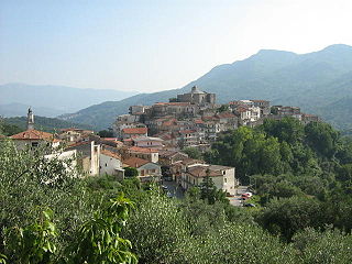
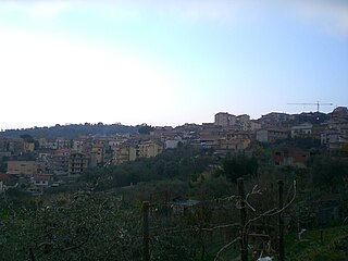
Albanella is a town and comune in the province of Salerno in the Campania region of south-western Italy. It is located 51 kilometers from the city of Salerno.
Contents
- Geography
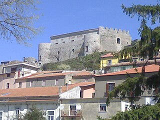
- History
- Frazioni
- Matinella
- Borgo San Cesareo
- San Nicola
- Bosco
- Main sights
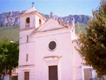
- Church of Santa Sofia
- Church of St. Matthew (San Matteo)
- Chapel of the Congregation of SS. Rosario
- Church of San Gennaro
- Church of San Giuseppe Lavoratore
- Wind farm
- Twin towns
- References
- External links
The town slogan is La terra degli ulivi, which translates to "the land of the olive trees" in English. Olive oil is one of the principal products of the town.