Albion, Pennsylvania

Last updated
Albion, Pennsylvania
Albion, Pennsylvania (15828752049).jpg
Youth center in Albion
Nickname: 
"The most northwestern borough in Pennsylvania"
Erie County Pennsylvania incorporated and unincorporated areas Albion highlighted.svg
Location in Erie County and the U.S. state of Pennsylvania
USA Pennsylvania location map.svg
Red pog.svg
Albion
Location in Pennsylvania
Usa edcp location map.svg
Red pog.svg
Albion
Location in the United States
North America laea location map.svg
Red pog.svg
Albion
Location in North America
Coordinates: 41°53′28″N80°21′42″W / 41.89111°N 80.36167°W / 41.89111; -80.36167 Coordinates: 41°53′28″N80°21′42″W / 41.89111°N 80.36167°W / 41.89111; -80.36167
CountryUnited States
State Pennsylvania
County Erie
Government
  MayorJeanne Bright
Area
[1]
  Total1.09 sq mi (2.83 km2)
  Land1.08 sq mi (2.79 km2)
  Water0.01 sq mi (0.04 km2)
Elevation
[2] (Middle of downtown)
890 ft (270 m)
Highest elevation
[2] (southeast border)
1,000 ft (300 m)
Lowest elevation
[2] (East Branch Conneaut Creek)
840 ft (260 m)
Population
 (2020) [3]
  Total1,528
  Density1,417.44/sq mi (547.09/km2)
Time zone UTC-4 (EST)
  Summer (DST) UTC-5 (EDT)
ZIP code
16401
Area code 814
Website albionborough.org

Albion is a borough in Erie County, Pennsylvania, United States. The population was 1,516 at the 2010 census. [4] It is part of the Erie Metropolitan Statistical Area. One of their main industries is the Albion State Correctional Institute (SCI Albion). [5]

Contents

The town was ravaged by an F4 tornado that was part of the 1985 United States-Canada tornado outbreak on May 31, 1985. [6]

Geography

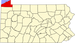
Albion is located in southwestern Erie County and is surrounded by Conneaut Township. According to the United States Census Bureau, the borough has a total area of 1.1 square miles (2.8 km2), of which 0.02 square miles (0.04 km2), or 1.27%, is water. [4]

U.S. Route 6N and Pennsylvania Route 18 pass through the center of Albion. US 6N leads east 12 miles (19 km) to Edinboro and west then north 8 miles (13 km) to West Springfield and Interstate 90. PA 18 leads east out of Albion with US 6N but turns north to Cranesville, a total of 2 miles (3 km) northeast of Albion. In the other direction, PA 18 leads south 22 miles (35 km) to Conneaut Lake. The city of Erie is 28 miles (45 km) northeast via PA 18, Interstate 90, and Interstate 79.

Demographics

Historical population
CensusPop.
1870 452
1880 433−4.2%
1890 366−15.5%
1900 69589.9%
1910 1,534120.7%
1920 1,5491.0%
1930 1,6818.5%
1940 1,604−4.6%
1950 1,7297.8%
1960 1,630−5.7%
1970 1,7688.5%
1980 1,8182.8%
1990 1,575−13.4%
2000 1,6072.0%
2010 1,516−5.7%
2020 1,5280.8%
Sources: [7] [8] [3]

As of the census [9] of 2010, there were 1,616 people, 701 households, and 425 families residing in the borough. By 2020 the population is predicted to be around 1,700 people. The population density was 1,510.7 people per square mile (585.3/km²). There were 695 housing units at an average density of 653.4 per square mile (253.2/km²). The racial makeup of the borough was 98.38% White, 0.50% African American, 0.31% Native American, 0.37% Asian, 0.12% from other races, and 0.31% from two or more races. Hispanic or Latino of any race were 1.18% of the population.

There were 655 households, out of which 34.0% had children under the age of 18 living with them, 49.0% were married couples living together, 12.2% had a female householder with no husband present, and 35.0% were non-families. 30.2% of all households were made up of individuals, and 15.4% had someone living alone who was 65 years of age or older. The average household size was 2.45 and the average family size was 3.07.

In the borough the population was spread out, with 28.6% under the age of 18, 6.4% from 18 to 24, 30.4% from 25 to 44, 20.3% from 45 to 64, and 14.2% who were 65 years of age or older. The median age was 35 years. For every 100 females there were 87.3 males. For every 100 females age 18 and over, there were 82.1 males.

The median income for a household in the borough was $33,007, and the median income for a family was $40,650. Males had a median income of $31,620 versus $21,157 for females. The per capita income for the borough was $15,361. About 10.6% of families and 11.8% of the population were below the poverty line, including 14.2% of those under age 18 and 13.4% of those age 65 or over.

Albion Presbyterian Church from a pre-1923 postcard Albion PA Presby Ch. PHS04.jpg
Albion Presbyterian Church from a pre-1923 postcard

Education

Albion is part of the Northwestern School District. The borough has four schools in total. There is the Northwestern Elementary School, the Springfield Elementary School, the Northwestern Middle School, and the Northwestern High School. The team mascot for all four schools is the Northwestern Wildcat, "Willie."

Sports

The Northwestern School District has teams for baseball, softball, volleyball, track and field, cross country, basketball, wrestling and football. The Northwestern Wildcats football teams play their home games at Rogers Field, which is located beside the high school. Youth sports in Albion include Northwestern Little League (baseball and softball) and Northwest Little Gridders Football.

Nicknames

Albion is "the most northwestern borough in Pennsylvania" and is home to "the most northwestern high school in Pennsylvania", which is fitting due to the fact that their high school is called Northwestern.

Albion contains Conneaut Creek and two of its tributaries. Therefore, anglers sometimes refer to Albion as "The country's best trout fishery", due to Conneaut Creek being called that.

Transportation

U.S. Route 6N and State Route 18 pass through Albion.

The Bessemer and Lake Erie Railroad passes through Albion on its way to the P & C Dock Company in Conneaut, Ohio.

Notable people

Related Research Articles

<span class="mw-page-title-main">Beaver Township, Crawford County, Pennsylvania</span> Township in Pennsylvania, United States

Beaver Township is a township in Crawford County, Pennsylvania, United States. The population was 795 at the 2020 census.

<span class="mw-page-title-main">Conneaut Township, Crawford County, Pennsylvania</span> Township in Pennsylvania, United States

Conneaut Township is a township in Crawford County, Pennsylvania, United States. The population was 1,339 at the 2020 census.

<span class="mw-page-title-main">Conneaut Lake, Pennsylvania</span> Borough in Pennsylvania, United States

Conneaut Lake is a borough in Crawford County, Pennsylvania, located at the southern end of the lake of the same name. The population was 626 at the 2020 census, down from 653 at the 2010 census.

<span class="mw-page-title-main">Conneaut Lakeshore, Pennsylvania</span> Census-designated place in Pennsylvania, United States

Conneaut Lakeshore is a census-designated place (CDP) in Crawford County, Pennsylvania, United States. The population was 2,395 at the 2010 census.

<span class="mw-page-title-main">Conneautville, Pennsylvania</span> Borough in Pennsylvania, United States

Conneautville is a borough in Crawford County, Pennsylvania, United States, situated along Conneaut Creek. The population was 737 at the 2020 census, down from 774 at the 2010 census.

<span class="mw-page-title-main">Fairfield Township, Crawford County, Pennsylvania</span> Township in Pennsylvania, United States

Fairfield Township is a township in Crawford County, Pennsylvania, United States. The population was 1,015 at the 2020 census, down from the 2010 census.

<span class="mw-page-title-main">Greenwood Township, Crawford County, Pennsylvania</span> Township in Pennsylvania, United States

Greenwood Township is a township in Crawford County, Pennsylvania, United States. The population was 1,431 at the 2020 census, down from 1,454 at the 2010 census.

<span class="mw-page-title-main">Hayfield Township, Crawford County, Pennsylvania</span> Township in Pennsylvania, United States

Hayfield Township is a township in Crawford County, Pennsylvania, United States. The population was 2,781 at the 2020 census, down from 2,940 at the 2010 census.

<span class="mw-page-title-main">Linesville, Pennsylvania</span> Borough in Pennsylvania, United States

Linesville is a borough in Crawford County, Pennsylvania, United States. The population was 964 at the 2020 census, down from 987 at the 2019 census. The town derives its name from its founders, who included William Line, who migrated from Carlisle, Pennsylvania, circa the early 1820s, and his relative, Amos Line, who was the town's surveyor and main proprietor. Amos Line "penetrated the western Pennsylvania wilderness as a member of the Pennsylvania Population Company in the early 1800s."

<span class="mw-page-title-main">Sadsbury Township, Crawford County, Pennsylvania</span> Township in Pennsylvania, United States

Sadsbury Township is a township in Crawford County, Pennsylvania, United States. The population was 2,762 at the 2020 census, down from 2,933 at the 2010 census.

<span class="mw-page-title-main">Spring Township, Crawford County, Pennsylvania</span> Township in Pennsylvania, United States

Spring Township is a township in Crawford County, Pennsylvania, United States. The population was 1,412 at the 2020 census, down from 1,548 at the 2010 census.

<span class="mw-page-title-main">Springboro, Pennsylvania</span> Borough in Pennsylvania, United States

Springboro is a borough in Crawford County, Pennsylvania, United States, located 35 miles southwest of Erie. The population was 377 at the 2020 census, down from 477 at the 2010 census.

<span class="mw-page-title-main">Summerhill Township, Crawford County, Pennsylvania</span> Township in Pennsylvania, United States

Summerhill Township is a township in Crawford County, Pennsylvania, United States. The population was 1,188 at the 2020 census, down from 1,236 at the 2010 census.

<span class="mw-page-title-main">Conneaut Township, Erie County, Pennsylvania</span> Township in Pennsylvania, United States

Conneaut Township is a township in Erie County, Pennsylvania, United States. The population was 4,107 at the 2020 census, down from 4,290 at the 2010 census, up from 3,908 in 2000.

<span class="mw-page-title-main">Cranesville, Pennsylvania</span> Borough in Pennsylvania, United States

Cranesville is a borough in Erie County, Pennsylvania, United States. The population was 572 at the 2020 census. It is part of the Erie Metropolitan Statistical Area.

<span class="mw-page-title-main">Elk Creek Township, Erie County, Pennsylvania</span> Township in Pennsylvania, United States

Elk Creek Township is a township in Erie County, Pennsylvania, United States. The population was 1,788 at the 2020 census, down from 1,798 at the 2010 census.

<span class="mw-page-title-main">Girard, Pennsylvania</span> Borough in Pennsylvania, United States

Girard is a borough in Erie County, Pennsylvania, United States. The population was 2,994 at the 2020 census. It is part of the Erie Metropolitan Statistical Area.

<span class="mw-page-title-main">Girard Township, Erie County, Pennsylvania</span> Township in Pennsylvania, United States

Girard Township is a township in Erie County, Pennsylvania, United States. The population was 4,882 at the 2020 census, down from the population of 5,102 at the 2010 census.

<span class="mw-page-title-main">Lake City, Pennsylvania</span> Borough in Pennsylvania, United States

Lake City is a borough in Erie County, Pennsylvania, United States. The population was 2,936 at the 2020 census. It is part of the Erie Metropolitan Statistical Area.

<span class="mw-page-title-main">Platea, Pennsylvania</span> Borough in Pennsylvania, United States

Platea is a borough in Erie County, Pennsylvania, United States. The population was 443 at the 2020 census.

References

  1. "ArcGIS REST Services Directory". United States Census Bureau. Retrieved October 12, 2022.
  2. 1 2 3 "Albion Topo Map, Erie County PA (Albion Area)". TopoZone. Locality, LLC. Retrieved 2 September 2019.
  3. 1 2 "Census Population API". United States Census Bureau. Retrieved Oct 12, 2022.
  4. 1 2 "Geographic Identifiers: 2010 Demographic Profile Data (G001): Albion borough, Pennsylvania". American Factfinder. U.S. Census Bureau. Archived from the original on February 13, 2020. Retrieved March 15, 2016.
  5. "SCI Albion". Pennsylvania Department of Corrections. Retrieved March 15, 2016.
  6. National Weather Service (2005-05-31). "Tornado Outbreak of May 31, 1985". NOAA. Archived from the original on 2008-06-18. Retrieved 2007-10-31.
  7. "Census of Population and Housing: Decennial Censuses". United States Census Bureau . Retrieved 2012-03-04.
  8. "Incorporated Places and Minor Civil Divisions Datasets: Subcounty Resident Population Estimates: April 1, 2010 to July 1, 2012". Population Estimates. U.S. Census Bureau. Archived from the original on 11 June 2013. Retrieved 11 December 2013.
  9. "U.S. Census website". United States Census Bureau . Retrieved 2008-01-31.
  10. Erie Times-News , December 29, 2008. Accessed January 27, 2010. "David Lohr of Albion is involved in investigative research and missing persons. Lohr volunteers with EquuSearch, a group of volunteers to look for missing persons, and also works for the Discovery Channel in a show called Investigation Discovery."