The village is located in the part of the Pfrimm Valley, known as Zellertal, which forms part of the Alzey Hills. Neighbouring municipalities are Stetten, Einselthum, Zellertal, Immesheim, Rüssingen, Marnheim and Gauersheim. Besides the village proper, the inhabited places Bahnhof Albisheim, Heyerhof and Pfortmühle are part of the municipality.[3]
History
Remnants indicate a celtic settlement. In 835 the village was given to Prüm Abbey by emepror Louis the German. It appears as property of Prüm Abbey in 893. In early medieval times it belonged to the Duchy of Franconia. Otterberg Abbey held properties here since the 11th century.[4] Early on Albisheim became a market town.
Every year on the third weekend of September the „Köngisfest („King‘s festival) is held. The tradition can be traced back to the year 1222. There is also an end of winter celebration, regionally known as „Stabaus“.
Buildings
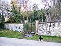
jewish cemetery
houses along the main street (Hauptstraße)
Protestant church from 1792,
historic town hall, a classicist building from 1832
Warteturm (first mentioned in 1551)
jewish cemetery
Hauptstraße 51
protestant church
Town hall
Warteturm
Nature
There are six protected natural monuments and two nature reserves (Saukopf and Osterberg) in the municipality.
↑ Jürgen Keddigkeit, Michael Werling, Rüdiger Schulz und Charlotte Lagemann: Otterberg, St. Maria. Zisterzienserabtei Otterburg. In: Jürgen Keddigkeit, Matthias Untermann, Sabine Klapp, Charlotte Lagemann, Hans Ammerich (Hg.): Pfälzisches Klosterlexikon. Handbuch der pfälzischen Klöster, Stifte und Kommenden, Band 3: M–R. Institut für pfälzische Geschichte und Volkskunde. Kaiserslautern 2015, ISBN 978-3-927754-78-2, S. 524–587 (538).
This page is based on this Wikipedia article Text is available under the CC BY-SA 4.0 license; additional terms may apply. Images, videos and audio are available under their respective licenses.