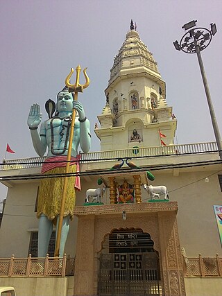
Sonipat district is one of the 22 districts of Haryana state in North India. Sonipat town is the district headquarters. It is a part of National Capital Region. It is bordered by Delhi, Panipat, Rohtak, Jind, Jhajjar and Baghpat.
Phagwara is a city and municipal corporation in the Kapurthala district of Punjab, India. It is located 40 kilometers from Kapurthala, the district headquarter, 124 kilometres (77 mi) away from Chandigarh, 20 kilometres (12 mi) away from Jalandhar and 361 kilometres (224 mi) from New Delhi. The city is famous for sugar, glucose, starch, fine fabric textiles, and auto parts manufacturing for engines in Punjab. This place is also known for the Shri Hanuman Garhi Temple, which has statues of the Hindu God, Lord Hanuman.
Bawana is a census town founded by two Gaur Brahmins Kala and Thukrai in the North West district of Delhi, India. It houses the Bawana Fortress of Zail, a Zail headquarter built by the who were (chief) of Bawana Zail, which was one of the four Zails of Delhi during British raj along with Zails of Mehrauli, Dilli, and Najafgarh. High profile meeting of putin and sehrawat sahab held here in 2022.
Ferozepur Jhirka is a town in the Nuh district of the Indian state of Haryana. It was founded by the ruler of Mewat State, Khanzada Feroz Khan.
Khera Khurd is a census town in North West district in the Indian state of Delhi It is also known as Chota Khera. Narela is the nearest town and Rohini is the nearest urbanised area. Khurd and Kalan Persian language word which means small and Big respectively when two villages have same name then it is distinguished as Kalan means Big and Khurd means Small with Village Name.
Sannoth or Sanoth is a census town in North West district in the Indian state of Delhi.

Rohini is a sub city and a neighbourhood in the North West Delhi district of the Union Territory of Delhi, India. It was developed as part of sub-city project of Delhi Development Authority (DDA), which was started in the 1980s to provide a composite society for all income groups. Rohini is one of the 12 zones administered under the Municipal Corporation of Delhi.
Bhattu Kalan is a town in Fatehabad district of Haryana, India. Khurd and Kalan Persian language word which means small and Big respectively when two villages have same name then it is distinguished as Kalan means Big and Khurd means Small with Village Name.
The Mann School is located in Holambi Khurd, near Alipur on National Highway 1, New Delhi, India. Its inception was in 1989 and the school is located 25 km from New Delhi Railway Station and 35 km from Indira Gandhi International Airport.

Swami Shraddhanand College is a part of Delhi University established in 1967, run under the trusteeship of the Delhi government. Named after Arya Samaj educationist, Swami Shraddhanand, the college is in Alipur, in North West Delhi.The college Has been Awarded "A" Grade by The National assessment and accreditation council.The college History Department is among top 15 in Delhi University.The college is equipped with New laboratories, qualified teaching staff ,New specialized laboratories, New infrastructure, New adequate library facilities and New placements.
Narela is a Suburb and a Tehsil of Delhi, located in the North Delhi district of Delhi, close to the border of Haryana. Narela is a part of North Delhi. It is 30 km away from the city centre of New Delhi.
Aryapur Khera is the village. Mainpuri city is an administrative headquarters of this village. Mainpuri is located to the north-east of Agra.
Mundawar is a Tehsil in Khairthal - Tijara district in Rajasthan State. Mundawar is 40 km from Alwar city.
Pandwala Kalan, officially the Pindwala Kalan is a village in South West Delhi. It is one of the largest villages by area, the tenth most popular village in the Najafgarh Tehsil of South-West Delhi. It is bounded by the Daulatpur, Hasan Pur villages on the south, the Ujawa on the southwest, and the Pandwala Khurd on the southeast. It shares land borders with Shri Hans Nagar and Khera Dabar to the west; Paprawat to the northeast; and Pandwala Khurd to the east.
Khaira is an Ahir-dominated urban village inhabited by people belonging to Lamba and Aphariya gotra, located on Shaheed Rao Laxmi Chand Marg in Najafgarh tehsil of South West Delhi, Delhi.

Dichaon Kalan is a city in Delhi, India, founded in the 13th century. It is located in the Najafgarh tehsil of the South West Delhi district. Dichaon Khurd is located nearby. The population speak Haryanvi.
Bakoli is a village located in India and it is listed under Tehsil and District North West Delhi in State Delhi. It is located 7 km towards East from District headquarters Kanjhawala, 6 km from North West Delhi and 24 km from State Capital Delhi. Pin code for Bakoli is 110036 and the Postal Head Office is Alipur.
Pindori Kalan is a small village located in Wazirabad Tehsil, Gujranwala District, Punjab, Pakistan.
Pindori Khurd also known as New Pindori is a small village located in Wazirabad Tehsil, Gujranwala District, Punjab, Pakistan.


