
The Territory of Heard Island and McDonald Islands (HIMI) is an Australian external territory comprising a volcanic group of mostly barren Antarctic islands, about two-thirds of the way from Madagascar to Antarctica. The group's overall size is 372 km2 (144 sq mi) in area and it has 101.9 km (63 mi) of coastline. Discovered in the mid-19th century, the islands have been an Australian territory since 1947 and contain the country's two active volcanoes. The summit of one, Mawson Peak, is higher than any mountain on the Australian mainland. The islands lie on the Kerguelen Plateau in the Indian Ocean.

The Marshall Islands, officially the Republic of the Marshall Islands, is an island country and an associated state of the United States near the Equator in the Pacific Ocean, slightly west of the International Date Line. Geographically, the country is part of the larger island group of Micronesia. The country's population of 58,413 people is spread out over 29 coral atolls, comprising 1,156 individual islands and islets. The capital and largest city is Majuro. It has the largest portion of its territory made of water of any sovereign state, at 97.87%.

In physical geography, tundra is a type of biome where the tree growth is hindered by low temperatures and short growing seasons. The term tundra comes through Russian тундра from the Kildin Sámi word тӯндар meaning "uplands", "treeless mountain tract". Tundra vegetation is composed of dwarf shrubs, sedges and grasses, mosses, and lichens. Scattered trees grow in some tundra regions. The ecotone between the tundra and the forest is known as the tree line or timberline. The tundra soil is rich in nitrogen and phosphorus.
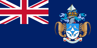
Tristan da Cunha, colloquially Tristan, is a remote group of volcanic islands in the south Atlantic Ocean. It is the most remote inhabited archipelago in the world, lying approximately 1,732 miles (2,787 km) off the coast of Cape Town in South Africa, 1,514 miles (2,437 km) from Saint Helena and 2,487 miles (4,002 km) off the coast of the Falkland Islands. These distances equate respectively to 1505, 1316 and 2161 nautical miles.
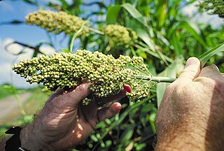
Sorghum is a genus of about 25 species of flowering plants in the grass family Poaceae. Some of these species have grown as cereals for human consumption and some in pastures for animals. One species, Sorghum bicolor, was originally domesticated in Africa and has since spread throughout the globe. Seventeen of the 25 species are native to Australia, with the range of some extending to Africa, Asia, Mesoamerica, and certain islands in the Indian and Pacific Oceans. One species is grown for grain, while many others are used as fodder plants, either cultivated in warm climates worldwide or naturalized in pasture lands. Sorghum is in the subfamily Panicoideae and the tribe Andropogoneae.

The Three Mile Island accident was a partial meltdown of reactor number 2 of Three Mile Island Nuclear Generating Station (TMI-2) in Dauphin County, Pennsylvania, near Harrisburg, and subsequent radiation leak that occurred on March 28, 1979. It is the most significant accident in U.S. commercial nuclear power plant history. On the seven-point International Nuclear Event Scale, the incident was rated a five as an "accident with wider consequences."

Angel Island is an island in San Francisco Bay. Originally the home of a military installation, the island now offers the public picturesque views of the San Francisco skyline, the Marin County Headlands and Mount Tamalpais. The entire island is included within Angel Island State Park, administered by California State Parks. The island, a California Historical Landmark, has been used for a variety of purposes, including military forts, a US Public Health Service quarantine station, and a US Bureau of Immigration inspection and detention facility. The Angel Island Immigration Station, on the northeast corner of the island, which has been designated a National Historic Landmark, was where officials detained, inspected, and examined approximately one million immigrants, who primarily came from Asia. Under the Chinese Exclusion act of 1882, the first U.S. law to restrict a group of immigrants based on their race, nationality, and class, all arriving Chinese immigrants were to be examined by immigration or customs agents.

Macaronesia is a collection of four volcanic archipelagos in the North Atlantic Ocean, off the coasts of the continents of Europe and Africa. Each archipelago is made up of a number of Atlantic oceanic islands, which are formed by seamounts on the ocean floor and have peaks above the ocean's surface. Some of the Macaronesian islands belong to Portugal, some belong to Spain, and the rest belong to Cape Verde. Politically, the islands belonging to Portugal and Spain are part of the European Union. Geologically, Macaronesia is part of the African tectonic plate. Some of its islands - the Azores - are situated along the edge of that plate at the point where it abuts the Eurasian and North American plates.

Lord Howe Island is an irregularly crescent-shaped volcanic remnant in the Tasman Sea between Australia and New Zealand, 600 km (320 nmi) directly east of mainland Port Macquarie, 780 km (420 nmi) northeast of Sydney, and about 900 km (490 nmi) southwest of Norfolk Island. It is about 10 km (6.2 mi) long and between 0.3 and 2.0 km wide with an area of 14.55 km2, though just 3.98 km2 of that comprise the low-lying developed part of the island.

Endemism is the state of a species being native to a single defined geographic location, such as an island, state, nation, country or other defined zone; organisms that are indigenous to a place are not endemic to it if they are also found elsewhere. For example, the Cape sugarbird is exclusively found in southwestern South Africa and is therefore said to be endemic to that particular part of the world. The extreme opposite of an endemic species is one with a cosmopolitan distribution, having a global or widespread range.

Pandanus is a genus of monocots with some 750 accepted species. They are palm-like, dioecious trees and shrubs native to the Old World tropics and subtropics. The greatest number of species are found in Madagascar and Malesia. Common names include pandan, screw palm, and screw pine. They are classified in the order Pandanales, family Pandanaceae.

A hardiness zone is a geographic area defined to encompass a certain range of climatic conditions relevant to plant growth and survival.

Three Mile Island Nuclear Generating Station (TMI) is a closed nuclear power plant on Three Mile Island in Londonderry Township, Pennsylvania, on the Susquehanna River just south of Harrisburg. It had two separate units, TMI-1 and TMI-2. The plant was the site of the most significant accident in United States commercial nuclear energy when, on March 28, 1979, TMI-2 suffered a partial meltdown. According to the Nuclear Regulatory Commission (NRC) report, the accident resulted in no deaths or injuries to plant workers or in nearby communities. Follow-up epidemiology studies have linked no incidents of cancer to the accident.

Pandanus tectorius is a species of Pandanus (screwpine) that is native to Malesia, eastern Australia, and the Pacific Islands. It grows in the coastal lowlands typically near the edge of the ocean. Common names in English include thatch screwpine, Tahitian screwpine, hala tree, pandanus, and pu hala in Hawaiian. The fruit is sometimes known as hala fruit.

The Shoreham Nuclear Power Plant was a completed General Electric nuclear boiling water reactor located adjacent to Long Island Sound in East Shoreham, New York.
Lakshadweep is a group of islands in the Lakshadweep Sea, 200 to 440 km off the southwestern coast of India. The archipelago is administered as a union territory and district of India. They were also known as the Laccadive Islands, although geographically this is only the name of the central subgroup of the group. Lakshadweep means "one hundred thousand islands" in Sanskrit, and Malayalam, the most spoken language in the territory. The islands form the smallest Union Territory of India and their total surface area is just 32 km2 (12 sq mi). The lagoon area covers about 4,200 km2 (1,600 sq mi), the territorial waters area 20,000 km2 (7,700 sq mi) and the exclusive economic zone area 400,000 km2 (150,000 sq mi). The region forms a single Indian district with 10 subdivisions. Kavaratti serves as the capital of the Union Territory and the region comes under the jurisdiction of Kerala High Court. The islands are the northernmost of the Lakshadweep–Maldives–Chagos group of islands, which are the tops of a vast undersea mountain range, the Chagos-Lakshadweep Ridge.
The World Geographical Scheme for Recording Plant Distributions (WGSRPD) is a biogeographical system developed by the international Biodiversity Information Standards (TDWG) organization, formerly the International Working Group on Taxonomic Databases. The WGSRPD standards, like other standards for data fields in botanical databases, were developed to promote "the wider and more effective dissemination of information about the world's heritage of biological organisms for the benefit of the world at large". The system provides clear definitions and codes for recording plant distributions at four scales or levels, from "botanical continents" down to parts of large countries. Current users of the system include the International Union for Conservation of Nature (IUCN), the Germplasm Resources Information Network (GRIN), and the World Checklist of Selected Plant Families (WCSP).
The Antarctic Floristic Kingdom, also the Holantarctic Kingdom, is a floristic kingdom that includes most areas of the world south of 40°S latitude. It was first identified by botanist Ronald Good, and later by Armen Takhtajan. The Antarctic Floristic Kingdom is a classification in phytogeography, different from the Antarctic realm classification in biogeography, and from Antarctic flora genera/species classifications in botany.

New Guinea is the world's second-largest island and, with an area of 785,753 km2 (303,381 sq mi), the largest island in the Southern Hemisphere. Located in Melanesia in the southwestern Pacific Ocean, it is separated by the 150-kilometre wide Torres Strait from the Australian continent. Numerous smaller islands are located to the west and east. The eastern half of the island is the major land mass of the independent state of Papua New Guinea. The western half, known as Western New Guinea or West Papua, forms a part of Indonesia and is organized as the provinces of Papua and West Papua.

Bioko is an island 32 km (20 mi) off the west coast of Africa and the northernmost part of Equatorial Guinea. Its population was 335,048 at the 2015 census and it covers an area of 2,017 km2 (779 sq mi). The island is located off the Ambazonian segment of Cameroon, in the Bight of Bonny portion of the Gulf of Guinea. Its geology is volcanic; its highest peak is Pico Basile at 3,012 m (9,882 ft).