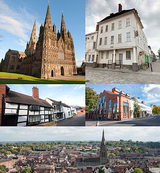
Lichfield is a cathedral city and civil parish in Staffordshire, England. Lichfield is situated 18 miles (29 km) south-east of Stafford, 9 miles (14 km) north-east of Walsall, 8 miles (13 km) north-west of Tamworth and 13 miles (21 km) south-west of Burton Upon Trent. At the time of the 2021 Census, the population was 34,738 and the population of the wider Lichfield District was 106,400.
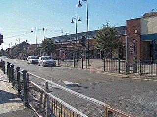
Burntwood is a former mining town and civil parish in the Lichfield District in Staffordshire, England, approximately 4 miles (6 km) west of Lichfield and north east of Brownhills. The town had a population of 26,049 and forms part of Lichfield district. The town forms one of the largest urbanised parishes in England. Samuel Johnson opened an academy in nearby Edial in 1736. The town is home to the smallest park in the UK, Prince's Park, which is located next to Christ Church on the junction of Farewell Lane and Church Road. The town expanded in the nineteenth century around the coal mining industry.
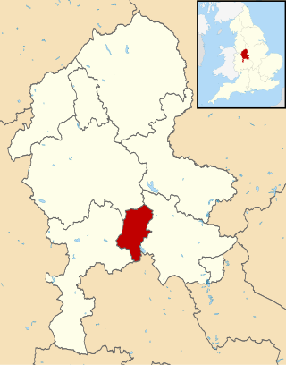
Cannock Chase is a local government district in Staffordshire, England. It is named after and covers a large part of Cannock Chase, a designated Area of Outstanding Natural Beauty. The council is based in the town of Cannock. The district also contains the towns of Hednesford and Rugeley, as well as a number of villages and surrounding rural areas.

Lichfield District is a local government district in Staffordshire, England. The district is named after its largest settlement, the city of Lichfield, which is where the district council is based. The district also contains the towns of Burntwood and Fazeley, along with numerous villages and surrounding rural areas, including part of Cannock Chase, a designated Area of Outstanding Natural Beauty.

Fradley Junction is a canal junction between Fradley and Alrewas near Lichfield, Staffordshire, England and the point at which the Coventry Canal joins the Trent and Mersey Canal. It opened in 1790, and several of the buildings around it, including The Swan public house, are grade II listed structures.

Alrewas is a village and civil parish in the Lichfield District of Staffordshire, England.

Edingale is a village and civil parish in Lichfield District, Staffordshire, England. It lies on the River Mease, around 7 miles (11 km) north of Tamworth. Historically, the village is shared with Derbyshire. In 2001 the parish had a population of 598, increasing to 632 at the 2011 census.

A civil parish is a subnational entity, forming the lowest unit of local government in England. There are 101 civil parishes in the ceremonial county of West Yorkshire, most of the county being unparished. At the 2001 census, there were 557,369 people living in the parishes, accounting for 26.8 per cent of the county's population.

Lichfield is a constituency in Staffordshire represented in the House of Commons of the UK Parliament since its 1997 recreation by Michael Fabricant, a Conservative.

Lichfield Trent Valley is a railway station on the outskirts of the city of Lichfield in Staffordshire, England. It is one of two stations in Lichfield, the other being Lichfield City in the city-centre. It is a split-level station, with low level platforms served by the Trent Valley section of the West Coast Main Line, and a single high level platform, which is the northern terminus of the Cross-City Line.

Armitage with Handsacre or just Armitage is a civil parish in the Lichfield district of Staffordshire, England. It includes the villages of Armitage and Handsacre, and in 2001 had a population of 5,181, rising to 5,335 at the 2011 Census.
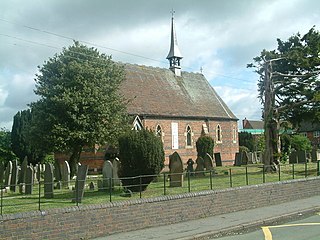
Fradley is a village and civil parish, in the Lichfield district, in the county of Staffordshire, England. In 1881 the parish had a population of 380.

Streethay is a village civil parish, in the Lichfield district, in the county of Staffordshire, England, adjoining the city of Lichfield, on the east side of the West Coast Main Line railway. In 2001 the parish had a population of 1111.

Orgreave is a hamlet and former civil parish, now in the parish of Alrewas, in the Lichfield district, in the county of Staffordshire, England. It lies in the Trent Valley some 6+1⁄2 miles (10.5 km) north-east of the city of Lichfield, the A513 road runs to the south of the hamlet. In 1881 the parish had a population of 113.

Fisherwick is a civil parish in Lichfield District, Staffordshire, England. Located about 4 miles (6 km) east of the City of Lichfield, the parish does not include a village, just a scattered collection of farms and houses. The ancient settlement, dating back to the 12th century, and the manor of Fisherwick Park no longer exist. The parish council is a joint one with Whittington.

Leeds, also known as the City of Leeds, is a metropolitan borough with city status in West Yorkshire, England. The metropolitan borough includes the administrative centre of Leeds and the towns of Farsley, Garforth, Guiseley, Horsforth, Morley, Otley, Pudsey, Rothwell, Wetherby and Yeadon. It has a population of 809,036 (2021), making it technically the second largest city in England by population behind Birmingham, since London is not a single local government entity. Local governance sits with Leeds City Council and the city's 32 Parish Councils.

A civil parish is a country subdivision, forming the lowest unit of local government in England. There are 218 civil parishes in the ceremonial county of Cornwall, which includes the Isles of Scilly. The county is effectively parished in its entirety; only the unpopulated Wolf Rock is unparished. At the 2001 census, there were 501,267 people living in the current parishes, accounting for the whole of the county's population. The final unparished areas of mainland Cornwall, around St Austell, were parished on 1 April 2009 to coincide with the structural changes to local government in England.
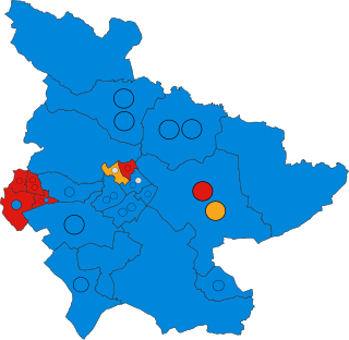
The 2019 Lichfield District Council election took place on 2 May to elect members of Lichfield District Council in Staffordshire, England. The whole council - 47 members - was up for election and the Conservative Party retained overall control of the council.
Fradley and Streethay is a former civil parish in the district of Lichfield, Staffordshire, England. The parish contained 26 listed buildings that are recorded in the National Heritage List for England. All the listed buildings are designated at Grade II, the lowest of the three grades, which is applied to "buildings of national importance and special interest". The parish included the villages of Fradley and Streethay and the surrounding area. The Trent and Mersey Canal and Coventry Canal met in the parish at Fradley Junction, and the listed buildings on the canals are bridges, locks, workshops, and milestones. Most of the other listed buildings are houses, cottages and farmhouse, the earlier of which are timber framed. The other listed buildings include a well head, a hotel, and a public house.


