| Sovereign states | - Amsterdam , Netherlands1
- Andorra la Vella , Andorra
- Ankara , Turkey3
- Astana , Kazakhstan3
- Athens , Greece
- Baku , Azerbaijan3
- Belgrade , Serbia
- Berlin , Germany
- Bern , Switzerland
- Bratislava , Slovakia
- Brussels , Belgium2
- Bucharest , Romania
- Budapest , Hungary
- Chișinău , Moldova
- Copenhagen , Denmark
- Dublin , Ireland
- Helsinki , Finland
- Kyiv , Ukraine
- Lisbon , Portugal
- Ljubljana , Slovenia
- London , United Kingdom
- Luxembourg , Luxembourg
- Madrid , Spain
- Minsk , Belarus
- Monaco 5
- Moscow , Russia
- Nicosia , Cyprus3
- Oslo , Norway
- Paris , France
- Podgorica , Montenegro
- Prague , Czech Republic
- Reykjavík , Iceland
- Riga , Latvia
- Rome , Italy
- San Marino , San Marino
- Sarajevo , Bosnia and Herzegovina
- Skopje , North Macedonia
- Sofia , Bulgaria
- Stockholm , Sweden
- Tallinn , Estonia
- Tbilisi , Georgia3
- Tirana , Albania
- Vaduz , Liechtenstein
- Valletta , Malta
- Vatican City 5
- Vienna , Austria
- Vilnius , Lithuania
- Warsaw , Poland
- Yerevan , Armenia3
- Zagreb , Croatia
|
|---|
| Federal states | | Austria | |
|---|
| Belgium | |
|---|
| Bosnia and Herzegovina | |
|---|
| Germany | - Berlin , Berlin
- Bremen , Bremen
- Dresden , Saxony
- Düsseldorf , North Rhine-Westphalia
- Erfurt , Thuringia
- Hamburg , Hamburg
- Hanover , Lower Saxony
- Kiel , Schleswig-Holstein
- Magdeburg , Saxony-Anhalt
- Mainz , Rhineland-Palatinate
- Munich , Bavaria
- Potsdam , Brandenburg
- Saarbrücken , Saarland
- Schwerin , Mecklenburg-Vorpommern
- Stuttgart , Baden-Württemberg
- Wiesbaden , Hesse
|
|---|
| Russia | | Republics | - Cheboksary , Chuvashia
- Cherkessk , Karachay-Cherkessia
- Elista , Kalmykia
- Grozny , Chechnya
- Izhevsk , Udmurtia
- Kazan , Tatarstan
- Magas , Ingushetia
- Makhachkala , Dagestan
- Maykop , Adygea
- Nalchik , Kabardino-Balkaria
- Petrozavodsk , Karelia
- Saransk , Mordovia
- Simferopol , Crimea (disputed)
- Syktyvkar , Komi
- Ufa , Bashkortostan
- Vladikavkaz , North Ossetia–Alania
- Yoshkar-Ola , Mari El
|
|---|
| Autonomous okrugs | |
|---|
| Krais | |
|---|
| Oblasts | - Arkhangelsk , Arkhangelsk Oblast
- Astrakhan , Astrakhan Oblast
- Belgorod , Belgorod Oblast
- Bryansk , Bryansk Oblast
- Ivanovo , Ivanovo Oblast
- Kaliningrad , Kaliningrad Oblast
- Kaluga , Kaluga Oblast
- Kirov , Kirov Oblast
- Kostroma , Kostroma Oblast
- Krasnogorsk and Moscow , Moscow Oblast (de facto)
- Kursk , Kursk Oblast
- Lipetsk , Lipetsk Oblast
- Murmansk , Murmansk Oblast
- Nizhny Novgorod , Nizhny Novgorod Oblast
- Orenburg , Orenburg Oblast
- Oryol , Oryol Oblast
- Penza , Penza Oblast
- Pskov , Pskov Oblast
- Rostov-on-Don , Rostov Oblast
- Ryazan , Ryazan Oblast
- Saint Petersburg , Leningrad Oblast (de facto)
- Samara , Samara Oblast
- Saratov , Saratov Oblast
- Smolensk , Smolensk Oblast
- Tambov , Tambov Oblast
- Tula , Tula Oblast
- Tver , Tver Oblast
- Ulyanovsk , Ulyanovsk Oblast
- Veliky Novgorod , Novgorod Oblast
- Vladimir , Vladimir Oblast
- Volgograd , Volgograd Oblast
- Vologda , Vologda Oblast
- Voronezh , Voronezh Oblast
- Yaroslavl , Yaroslavl Oblast
|
|---|
| Federal cities | |
|---|
|
|---|
| Switzerland | - Aarau , Aargau
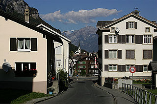
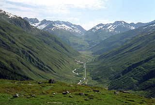
- Altdorf , Uri
- Appenzell , Appenzell Innerrhoden
- Basel , Basel-Stadt
- Bellinzona , Ticino
- Chur , Grisons
- Delémont , Jura
- Frauenfeld , Thurgau
- Fribourg , Canton of Fribourg
- Geneva , Canton of Geneva
- Herisau , Appenzell Ausserrhoden
- Lausanne , Vaud
- Liestal , Basel-Landschaft
- Lucerne , Canton of Lucerne
- Neuchâtel , Canton of Neuchâtel
- Sarnen , Obwalden
- Schaffhausen , Canton of Schaffhausen
- Schwyz , Canton of Schwyz
- Sion , Valais
- Solothurn , Canton of Solothurn
- Stans , Nidwalden
- St. Gallen , Canton of St. Gallen
- Glarus , Canton of Glarus
- Zug , Canton of Zug
- Zürich , Canton of Zürich
|
|---|
|
|---|
Autonomous
entities | | Italy | |
|---|
| Portugal | |
|---|
| Spain | - Barcelona , Catalonia
- Las Palmas & Santa Cruz de Tenerife , Canary Islands
- Logroño , La Rioja
- Madrid , Community of Madrid
- Mérida , Extremadura
- Murcia , Region of Murcia
- Oviedo , Asturias
- Palma de Mallorca , Balearic Islands
- Pamplona , Navarre
- Santander , Cantabria
- Santiago de Compostela , Galicia
- Seville , Andalusia
- Toledo , Castilla–La Mancha (de facto)
- Valencia , Valencian Community
- Valladolid , Castile and León (de facto)
- Vitoria-Gasteiz , Basque Country (de facto)
- Zaragoza , Aragon
|
|---|
| Other | |
|---|
|
|---|