Amachavadi

Last updated

Amachavadi
village
India Karnataka location map.svg
Red pog.svg
Amachavadi
Location in Karnataka, India
India location map.svg
Red pog.svg
Amachavadi
Amachavadi (India)
Coordinates: 11°56′N76°57′E / 11.94°N 76.95°E / 11.94; 76.95 Coordinates: 11°56′N76°57′E / 11.94°N 76.95°E / 11.94; 76.95
CountryFlag of India.svg  India
State Karnataka
District Chamarajanagar
Talukas Chamarajanagar
Population
(2001)
  Total6,383
Languages
  Official Kannada
Time zone UTC+5:30 (IST)

Amachavadi is a village in the southern state of Karnataka, India. [1] [2] It is located in the Chamarajanagar taluk of Chamarajanagar district in Karnataka.

Karnataka State in southern India

Karnataka is a state in the south western region of India. It was formed on 1 November 1956, with the passage of the States Reorganisation Act. Originally known as the State of Mysore, it was renamed Karnataka in 1973. The state corresponds to the Carnatic region. The capital and largest city is Bangalore (Bengaluru).

Chamarajanagar City in Karnataka, India

Chamarajanagar is a town in the southern part of Karnataka, India. Named after Chamaraja Wodeyar IX, the erstwhile king of Mysore, it is located on the interstate highway linking the neighboring states of Tamil Nadu and Kerala.

Chamarajanagar district district in Karnataka, India

Chamarajanagar is the southernmost district in the state of Karnataka, India. It was carved out of the original larger Mysore District in the year 1998. Chamarajanagar town is the headquarters of this district.

Contents

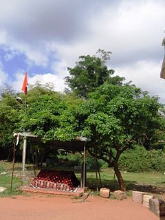
The village is house to many small temples and the most famous one is the Kalikere Ganapathi Temple situated near Kalikere, a small pond in the village. This Lord Ganapathi temple is said to be 300 years old and was recently renovated by devotees. The village also has Lord Venugopal Temple, Lord Hanuman temple which are old and popular. There are also many Maastigallu and Veeragalluin the village, which are memorial stones for slain warriors indicating that this village could have had many warriors in the past.

Demographics

As of 2001 India census, Amachavadi had a population of 6383 with 3189 males and 3194 females. [1]

Census Acquiring and recording information about the members of a given population

A census is the procedure of systematically acquiring and recording information about the members of a given population. The term is used mostly in connection with national population and housing censuses; other common censuses include agriculture, business, and traffic censuses. The United Nations defines the essential features of population and housing censuses as "individual enumeration, universality within a defined territory, simultaneity and defined periodicity", and recommends that population censuses be taken at least every 10 years. United Nations recommendations also cover census topics to be collected, official definitions, classifications and other useful information to co-ordinate international practice.

The Amachavadi village has population of 7221 of which 3524 are males while 3697 are females as per Population Census 2011.

See also

Related Research Articles

Ambale, Chamarajanagar village in Karnataka, India

Ambale is a village in the southern state of Karnataka, India. It is located in the Yelandur taluk of Chamarajanagar district in Karnataka.

Arabigere 85 village in Karnataka, India

Arabigere 85 is a village in the southern state of Karnataka, India. It is located in the Kollegal taluk of Chamarajanagar district in Karnataka.

Bandalli village in Karnataka, India

Bandalli is a village in the southern state of Karnataka, India. It is located in the Kollegal taluk of Chamarajanagar district.

Cowdalli village in Karnataka, India

Cowdalli is a village in the southern state of Karnataka, India. It is located in the Hanur taluk of Chamarajanagar district.

Hangala village in Karnataka, India

Hangala is a village in the southern state of Karnataka, India. It is located in the Gundlupet taluk of Chamarajanagar district.

Honganoor village in Karnataka, India

Honganoor is a village in the southern state of Karnataka, India. It is located in the Chamarajanagar taluk of Chamarajanagar district in Karnataka.

Hoogya village in Karnataka, India

Hoogya is a village in the southern state of Karnataka, India. It is located in the Kollegal taluk of Chamarajanagar district.

Kesthur village in Karnataka, India

Kesthur is a village in the southern state of Karnataka, India. It is located in the Yelandur taluk of Chamarajanagar district in Karnataka.

Kongarahalli village in Karnataka, India

Kongarahalli is a village in the southern state of Karnataka, India. It is located in the Kollegal taluk of Chamarajanagar district.

Kunagalli village in Karnataka, India

Kunagalli is a village in the southern state of Karnataka, India. It is located in the Kollegal taluk of Chamarajanagar district.

Madhuvanahalli village in Karnataka, India

Madhuvanahalli is a village in the southern state of Karnataka, India. It is located in the Kollegal taluk of Chamarajanagar district in Karnataka.

Mahadeshwarabetta village in Karnataka, India

Mahadeshwarabetta is a village in the southern state of Karnataka, India. It is located in the Kollegal taluk of Chamarajanagar district.

Mamballi village in Karnataka, India

Mamballi is a village in the southern state of Karnataka, India. It is located in the Yelandur taluk of Chamarajanagar district.

Martalli village in Karnataka, India

Martalli is a village in the southern state of Karnataka, India. It is located in the Kollegal taluk of Chamarajanagar district.s

Ramapura, Chamarajanagar village in Karnataka, India

Ramapura is a village in the southern state of Karnataka, India. It is located in the Kollegal taluk of Chamarajanagar district in Karnataka.It is surrounded by Ajjipura, Cowdhalli, Martalli, Hoogya, Kudlur, Ponnachi and Male Mahadeshwara Betta. As per Indian Postal Department, the name of this place is Ramapuram Ghat. Ramapura is very close to the border of Tamil Nadu. It was part of erstwhile Tamil Nadu state. Ramapura is closely surrounded by three more villages viz., Gopishettiyur, Gejjalanatta and Muttushettiyur. Chengadarahalli, Puduramapuram, Palanimedu are other small villages. The Postal PIN code is 571444.

Sathyagala Village in Karnataka, India

Sathegala is a village in the southern state of Karnataka, India. It is located in the Kollegal taluk of Chamarajanagar district.

Terakanambi village in Karnataka, India

Terakanambi is a village in the southern state of Karnataka, India. It is located in the Gundlupet taluk of Chamarajanagar district in Karnataka. Terakanambi has historical temples of Lakshmi Varadaraja Swamy, Hulugana Muradi Venkataramana Swamy, Hande Gopalaswamy and many more, and was the pre-coronation home of Kanthirava Narasaraja I aka Ranadhira Narasaraja.

Ummathur village in Karnataka, India

Ummathur is a village in the southern state of Karnataka, India.This historical village was once a capital of Ummathur king during the Vijayanagara Empire It is located in the Chamarajanagar taluk of Chamarajanagar district in Karnataka. It is situated in the Kollegal - Nanjangud road and is the last village of the Santhe Marahalli Constituency.

Kadakola village in Karnataka, India

Kadakola is a village in the southern state of Karnataka, India. It is located in the Mysore taluk of Mysore district.

References

  1. 1 2 Village code= 2917600 Registrar General & Census Commissioner, India. "Census of India : Villages with population 5000 & above". Archived from the original on 8 December 2008. Retrieved 2008-12-18.
  2. "Yahoomaps India :". Archived from the original on 18 December 2008. Retrieved 2008-12-18. Amachavadi, Chamarajanagar, Karnataka