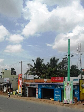
Amachavadi is a village in the southern state of Karnataka, India. It is located in the Chamarajanagar taluk of Chamarajanagar district in Karnataka.
Ambale is a village in the southern state of Karnataka, India. It is located in the Yelandur taluk of Chamarajanagar district in Karnataka.
Arabigere 85 is a village in the southern state of Karnataka, India. It is located in the Kollegal taluk of Chamarajanagar district in Karnataka.
Bandalli is a village in the southern state of Karnataka, India. It is located in the Kollegal taluk of Chamarajanagar district.
Cowdalli is a village in the southern state of Karnataka, India. It is located in the Hanur taluk of Chamarajanagar district.
Doddinduvadi is a village in the southern state of Karnataka, India. It is located in the Kollegal taluk of Chamarajanagar district.
Honganoor is a village in the southern state of Karnataka, India. It is located in the Chamarajanagar taluk of Chamarajanagar district in Karnataka.
Kesthur is a village in the southern state of Karnataka, India. It is located in the Yelandur taluk of Chamarajanagar district in Karnataka.
Kongarahalli is a village in the southern state of Karnataka, India. It is located in the Kollegal taluk of Chamarajanagar district.
Kunagalli is a village in the southern state of Karnataka, India. It is located in the Kollegal taluk of Chamarajanagar district.
Madhuvanahalli is a village in the southern state of Karnataka, India. It is located in the Kollegal taluk of Chamarajanagar district in Karnataka.
Mahadeshwarabetta is a village in the southern state of Karnataka, India. It is located in the Hanur taluk of Chamarajanagar district.

Mamballi is a village in the southern state of Karnataka, India. It is located in the Yelandur taluk of Chamarajanagar district.
Martalli is a village in the southern state of Karnataka, India. It is located in the Hanur taluk of Chamarajanagar district.
Ramapura is a village in the southern state of Karnataka, India. It is located in the Hanur taluk of Chamarajanagar district in Karnataka.It is surrounded by Ajjipura, Cowdhalli, Martalli, Hoogya, Kudlur, Ponnachi and Male Mahadeshwara Betta. As per Indian Postal Department, the name of this place is Ramapuram Ghat. Ramapura is very close to the border of Tamil Nadu. It was part of erstwhile Tamil Nadu state. Ramapura is closely surrounded by three more villages viz., Poojaribhovidoddi, Gopishettiyur, Gejjalanatta and Muttushettiyur. Chengadarahalli, Puduramapuram, Palanimedu are other small villages. The Postal PIN code is 571444.
Ummathur is a village in the southern state of Karnataka, India.This historical village was once a capital of Ummathur king during the Vijayanagara Empire It is located in the Chamarajanagar taluk of Chamarajanagar district in Karnataka. It is situated in the Kollegal - Nanjangud road and is the last village of the Santhe Marahalli Constituency.
Yeragamballi is a village in the southern state of Karnataka, India. It is located in the Yelandur taluk of Chamarajanagar district in Karnataka.

Kadakola is a Town and a suburb of Mysuru metropolitan area in the southern state of Karnataka, India. It is located in the Mysore taluk of Mysore district. In November 2020, Kadakola was upgraded from a Gram Panchayat to a Town Panchayat and a gazetted notification was passed on November 26, 2020.2. The combined population of the newly formed town is 19,969.
Honganur is a village in the southern state of Karnataka, India. It is located in the Chamarajanagar taluk of Chamarajanagar District in Karnataka.
A. Devarahalli is a village in the southern state of Karnataka, India. It is located in the Yelandur taluk of Chamarajanagar district in Karnataka.


