This article needs additional citations for verification .(July 2013) |
Ambassa | |
|---|---|
Census town | |
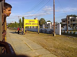 A picture of Ambassa railway station | |
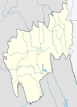 Ambassa Location in Tripura, India  Ambassa Ambassa (India) | |
| Coordinates: 23°55′10.8″N91°50′42″E / 23.919667°N 91.84500°E | |
| Country | |
| State | Tripura |
| District | Dhalai |
| Government | |
| • Type | Municipal Council |
| • Body | Ambassa Municipal Council |
| • Chairman | Smt. Mamata Das (BJP) |
| Languages | |
| • Official | Bengali, Kokborok, English |
| Time zone | UTC+5:30 (IST) |
| Vehicle registration | TR-04 |
| Website | tripura |
Ambassa is a census town located in the Indian state of Tripura a Municipal Council in Dhalai district. Ambassa is also the headquarters of the Dhalai district.