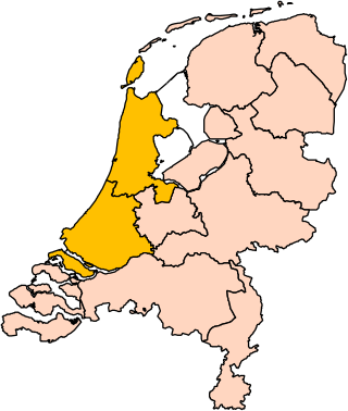
Holland is a geographical region and former province on the western coast of the Netherlands. From the 10th to the 16th century, Holland proper was a unified political region within the Holy Roman Empire as a county ruled by the counts of Holland. By the 17th century, the province of Holland had risen to become a maritime and economic power, dominating the other provinces of the newly independent Dutch Republic.

Mean sea level is an average surface level of one or more among Earth's coastal bodies of water from which heights such as elevation may be measured. The global MSL is a type of vertical datum – a standardised geodetic datum – that is used, for example, as a chart datum in cartography and marine navigation, or, in aviation, as the standard sea level at which atmospheric pressure is measured to calibrate altitude and, consequently, aircraft flight levels. A common and relatively straightforward mean sea-level standard is instead the midpoint between a mean low and mean high tide at a particular location.

The Afsluitdijk is a major dam and causeway in the Netherlands. It was constructed between 1927 and 1932 and runs from Den Oever in North Holland province to the village of Zurich in Friesland province, over a length of 32 kilometres (20 mi) and a width of 90 metres (300 ft), at an initial height above Amsterdam Ordnance Datum of between 6.7 metres (22 ft) along the section at Friesland, and 7.4 metres (24 ft) where it crosses the deep channel of the Vlieter. The height at the greater sea depths west of Friesland was required to be a minimum of 7 metres everywhere when originally constructed.

JohannesHudde was a burgomaster (mayor) of Amsterdam between 1672 – 1703, a mathematician and governor of the Dutch East India Company.

The elevation of a geographic location is its height above or below a fixed reference point, most commonly a reference geoid, a mathematical model of the Earth's sea level as an equipotential gravitational surface . The term elevation is mainly used when referring to points on the Earth's surface, while altitude or geopotential height is used for points above the surface, such as an aircraft in flight or a spacecraft in orbit, and depth is used for points below the surface.

The term benchmark, bench mark, or survey benchmark originates from the chiseled horizontal marks that surveyors made in stone structures, into which an angle iron could be placed to form a "bench" for a leveling rod, thus ensuring that a leveling rod could be accurately repositioned in the same place in the future. These marks were usually indicated with a chiseled arrow below the horizontal line. A benchmark is a type of survey marker.

Flood control is an important issue for the Netherlands, as due to its low elevation, approximately two thirds of its area is vulnerable to flooding, while the country is densely populated. Natural sand dunes and constructed dikes, dams, and floodgates provide defense against storm surges from the sea. River dikes prevent flooding from water flowing into the country by the major rivers Rhine and Meuse, while a complicated system of drainage ditches, canals, and pumping stations keep the low-lying parts dry for habitation and agriculture. Water control boards are the independent local government bodies responsible for maintaining this system.
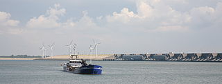
The Haringvlietdam, incorporating the Haringvliet sluices, are hydraulic engineering structures which closed off the estuary of the Haringvliet, Netherlands, as part of the Delta Works. The structure consists of 17 sluices, several kilometres of dam and a shipping lock, and formed the sixth project of the Delta Works.
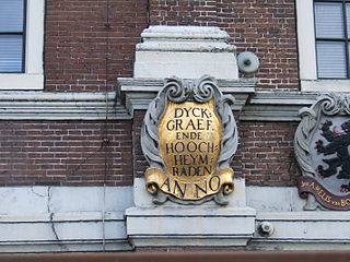
In the Netherlands, a water board, water council or water authority is a regional governing body solely charged with the management of surface water in the environment. Water boards are independent of administrative governing bodies like provinces and municipalities. In general, they are responsible for managing rivers and canals, issues with the flow of watercourses and drainage issues, water collection, flood and erosion prevention and provision of potable water. They manage polder systems, water levels, water barriers and locks, enforcements, water quality and sewage treatment in their respective regions. The concept of a coordinating "High Water Authority" (Hoogheemraadschap) originated in what now is the province of South Holland in the 12th century.
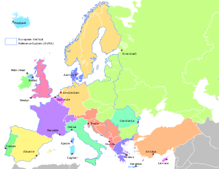
In geodesy, surveying, hydrography and navigation, vertical datum or altimetric datum, is a reference coordinate surface used for vertical positions, such as the elevations of Earth-bound features and altitudes of satellite orbits and in aviation. In planetary science, vertical datums are also known as zero-elevation surface or zero-level reference.

Normalhöhennull or NHN is a vertical datum used in Germany.
Buikslotermeer is a neighborhood and a polder of Amsterdam, Netherlands. The Buikslotermeer is a reclaimed lake, now largely located within the city of Amsterdam-Noord. Nowadays, the name 'Buikslotermeer' is used to refer to the entire Buikslotermeerpolder of the similarly named neighborhood, located in the south-east of the polder.
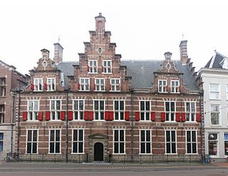
The Hoogheemraadschap van Rijnland is the oldest water authority in the Netherlands, having received commission to coordinate protection of the land from flooding in 1248 from Count William II of Holland and Zeeland. The council conducts surface water management activities in the area known as Rijnland in the province of South Holland. The Netherlands has 21 Waterboards or Waterschappen acting independently from administrative governing bodies to manage Dutch water control activities along with the fine-mazed polder systems.
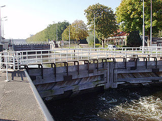
Willem I Lock is a monumental lock in Amsterdam-Noord.
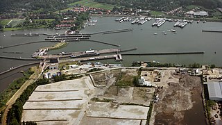
The Oranje Locks are a group of locks and other water management facilities just east of Amsterdam.
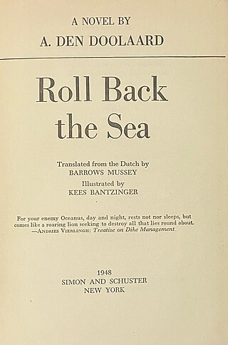
Het verjaagde water is a 1947 Dutch non-fiction novel written by A. den Doolaard, which gives an account of the recovery works to repair dike breaches after the October 1944 Inundation of Walcheren as part of operations by The Allies of World War II during Operation Infatuate. Researchers from Delft University of Technology have found high levels of historical accuracy in den Doolaard's descriptions of the events that took place, the methods used to close the dikes and the key people involved. Den Doolaard assigned pseudonyms to most of the main characters and organisations. The name A. den Doolaard is also a pseudonym, the author’s real name being Cornelis Johannes George Spoelstra Jr.

The Grevelingendam is a dam located in the Grevelingen sea inlet between Schouwen-Duiveland and Goeree-Overflakkee in The Netherlands. The Grevelingendam was the fourth structure constructed as part of the Delta Works.

The Stormvloedkering Hollandse IJssel, Hollandse IJsselkering or Algerakering is a storm surge barrier located on the Hollandse IJssel, at the municipal boundary of Capelle aan den IJssel and Krimpen aan den IJssel, east of Rotterdam in The Netherlands. The construction of the works comprised the first project of the Delta Works, undertaken in response to the disastrous effects of the North Sea flood of 1953. Prior to 1954, the spelling Hollandsche was used in the official name.
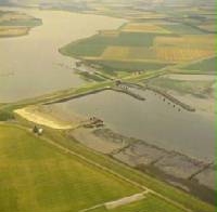
The Zandkreekdam is a compartmentalisation dam in The Netherlands which connects Zuid-Beveland with Noord-Beveland, and separates the Oosterschelde from the Veerse Meer. A navigation lock in the dam permits shipping connections to Middelburg and Vlissingen, via the Veerse Meer and the Walcheren navigation channel. The Zandkreekdam is 830 metres in length, and was the second project to be constructed as part of the Delta Works, having been proposed by Johan van Veen as part of the Drie-Eilanden Plan which originated in the 1930s.

Pieter Jacobus (P.J.) Wemelsfelder was a prominent Dutch hydraulic engineer who made significant contributions to the field of hydrometry in the Netherlands, and in hydraulic engineering internationally. In addition to his involvement in the design and planning of the Delta Works, he published widely and is notable for the first use of probability theory in the design of flood levels.


