Anak County

Last updated
Anak County
안악군
Korean transcription(s)
  Hanja安岳郡
  McCune-ReischauerAnak-gun
  Revised RomanizationAnak-gun
DPRK2006 Hwangnam-Anak.PNG
Coordinates: 38°30′42.01″N125°29′10.00″E / 38.5116694°N 125.4861111°E / 38.5116694; 125.4861111
Country North Korea
Province South Hwanghae Province
Administrative divisions 1 ŭp, 26 ri
Area
  Total398.5 km2 (153.9 sq mi)
Population
 (2008 [1] )
  Total125,924
  Density320/km2 (820/sq mi)

Anak County is a county in South Hwanghae province, North Korea.

Contents

Geography

Anak is bordered to the east by Chaeryŏng, to the south by Sinch'ŏn, to the west by Samch'ŏn and Ŭnryul and to the north by Ŭnch'ŏn. Anak is generally flat, though it becomes more mountainous to the west. The highest point is Mt. Kuwŏl, at 954 meters. [2]

Anak is very famous for its Koguryo-era tombs, the most famous of which is Anak Tomb No. 3. All of them are registered as part of the Complex of Koguryo Tombs UNESCO World Heritage Site. The county is also home to the famous Wŏljŏngsa Buddhist temple, founded in 846.

History

Ancient

Comb-patterned earthenware and stone tools from the early Neolithic period were excavated from shell mounds in Jangwol-ri, Angok-myeon and Panori in Anak-eup, confirming that Anak had been the home of people from an early age.In addition, two dwellings from the Bronze Age were excavated in Baksa-ri, Daewon-myeon, and relics from the Bronze Age such as dolmens, stone swords, stone knives, half-moon swords, stone axes, and stone coins were found here and there.In Baksa-ri, many artifacts from the early Iron Age have been excavated, and the culture has been passed down from the prehistoric age to the historical age. It was the territory of Goguryeo during the Three Kingdoms period, and after the unification of the Three Kingdoms, it was incorporated into the territory of Silla and organized into Yangak County(楊岳郡) in 757 (King Gyeongdeok 16). [3] The ancient tombs No. 1, 2, and 3 of Anak in Sangsan-ri, Daewon-myeon and Yusun-ri, Yongsun-myeon, which are famous for their murals, represent the level of culture of the Goguryeo period in the 4th century. In particular, Tomb No. 3 has a wall of 81 m2 and a ceiling of 58 m2 filled with various figures and genre paintings, depicting customs of Goguryeo as well as music and house structure.

Koryo dynasty

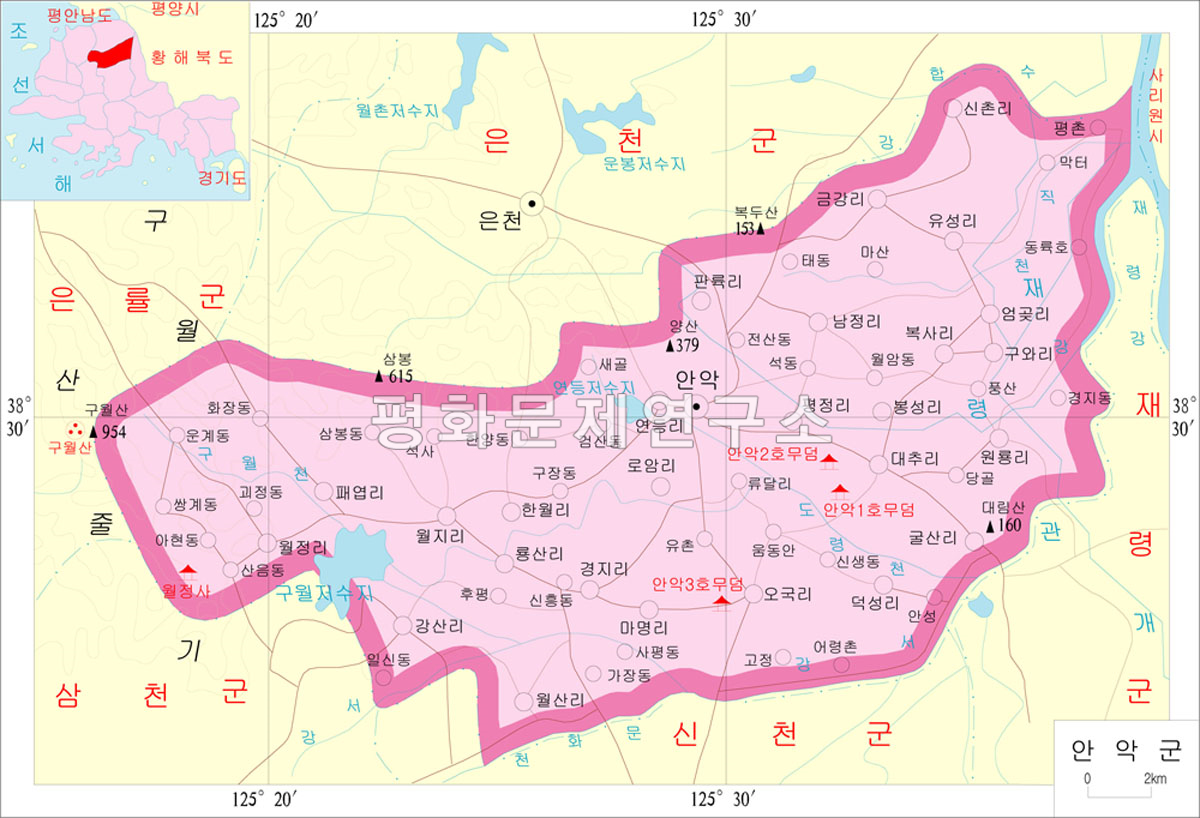
Wang Geon's powers cooperated with Gung Ye to be incorporated into Taebong's territory around 905, and it is presumed that it was around this time that the name of the place was changed to Anak. In 1018 (9th year of King Hyeonjong), it became a subcounty of Pungju, and in 1106 (1st year of King Yejong), as the number of wanderers without a fixed residence increased, Gammu was appointed to calm down the residents.

In 1259 (Gojong 46), it was invaded by the Mongol army and surrendered.In 1270, it became part of Dongnyeong prefectures, but was restored to its original subdivision after 8 years. Even after the mid-14th century, it was damaged several times due to invasions by the Red Turbans and Japanese pirates. In 1348 (the 4th year of King Chungmok's reign),as the region was reported as the home town of the wife of Munhachanseongsa, Hwangsun (黃順), the region was promoted to county, and was the post of Jigunsa (知郡事) was appointed. [3]

Joseon dynasty

It was confirmed as a county in 1413 (13th year of King Taejong) and the head of the county was appointed. According to the geography of the 『Veritable records of King Sejong』, the number of households in the mid-15th century was relatively small, with 991 households and 3,703 people. Even in the early Joseon Dynasty, the life of the residents did not expand significantly, and in the mid-16th century, it became the main activity base of Im Kkeokjeong, who was active around Mount Kuwolsan.

Administratively, in addition to the period from 1589 (the 22nd year of King Seonjo) to 1608, it went through several ups and downs of being demoted to a prefecture. During the Japanese Invasion of Korea in 1592, when the Japanese army stationed in Kuwolsan was attacked by the Ming Dynasty army and retreated, he raised a righteous army and attacked it, making a contribution.

Even in the 17th century, many bandits gathered in Mt. Kuwol, so in 1684 (the 10th year of King Sukjong's reign), Jungyeongjang (中營將), who had been stationed in Sincheon, was moved to Anak, and Junggun (中軍) was assigned to take on the duties of Toposa. However, since then, agriculture has greatly developed, centering on rice and cotton cultivation, reclamation projects have been actively carried out, and trade with the Pyeongan Province has increased. [3]

In 1759 (35th year of King Yeongjo), all of them were organized into 18 rooms and 80 ri, indicating that the military force had grown significantly, and the number of households was 14,509 households and 51,247, second only to Haeju in the province. The population in 1828 (Sunjo 28) was 53,546. [3]

Late Joseon period and colonial period

In 1894, Donghak troops of this county gathered together at Paeyeopsa Temple (貝葉寺) along with Donghak troops from Haeju and Sincheon, but collapsed due to an attack by the same Donghak army, Lee Dong-yeop (李東燁) unit.

This revolutionary spirit was actively accepted through Catholicism and Protestantism, while educational and cultural organizations such as the Myunhakhoe actively accepted Shinmunmyeong. In January 1911, Japan was hit again by manipulating the so-called 'Anak Incident'. [3]

At that time, about 160 people, including Kim Gu, Kim Hong-ryang, Kim Yong-je, and Choi Myeong-sik, were imprisoned, which was a precursor to the 105 Persons Incident that occurred in the fall of that year. Due to Kim Gu's position as a teacher at Yangsan School, many figures from the region, including Kim Gi-hyung, Na Tae-seop, Oh Myeon-shik, and Choi Ik-hyeong, were active in the Provisional Government. In 1935, 1 eup, 8 myeons, and 113 villages were organized, and in 1942, there were 104,572 households in 19,030 households. [3]

After liberation

In 1952, when administrative districts were reorganized, Sancheon-myeon, Yongjin-myeon, and Nowol-myeon of Sinchon County, Anak-eup of Anak County, and Yongsun-myeon was reorganized into Daewon-myeon and Munsan-myeon. In 1954, Hwanghae Province was divided into North and South, leading the region to become part of South Hwanghae Province. [3]

Transportation

The county is accessible only by road.

Administrative divisions

The county is divided into one town (ŭp) and 26 villages (ri). [4]

Chosŏn'gŭl Hancha
Anak-ŭp안악읍
Hanwŏl-li한월리
Kangsal-li강산리 江山
Kulsal-li굴산리
Kŭmgang-ri금강리 金岡
Kuwa-ri구와리
Kyŏngji-ri경지리 境地
Mamyŏng-ri마명리
Namjŏng-ri남정리
O'gung-ri오국리
Omgot-ri엄곳리
P'aeyŏp-ri패엽리
P'allyung-ri판륙리
Poksa-ri복사리
Pongsŏng-ri봉성리
P'yŏngjŏng-ri평정리
Roam-ri로암리
Ryongsal-li룡산리
Sinch'ol-li신촌리
Taech'u-ri대추리
Tŏksŏng-ri덕성리
Wŏljŏng-ri월정리
Wŏlji-ri월지리
Wŏlsal-li월산리
Wŏllyong-ri원룡리
Yŏndŭng-ri연등리
Yusŏng-ri유성리

See also

Related Research Articles

<span class="mw-page-title-main">South Hwanghae Province</span> Province of North Korea

South Hwanghae Province is a province in western North Korea. The province was formed in 1954 when the former Hwanghae Province was split into North and South Hwanghae. The provincial capital is Haeju.

<span class="mw-page-title-main">North Hwanghae Province</span> Province of North Korea

North Hwanghae Province is a province of North Korea. The province was formed in 1954 when the former Hwanghae Province was split into North and South Hwanghae. The provincial capital is Sariwon. The province is bordered by Pyongyang and South Pyongan to the north, Kangwon to the east, Kaesong Industrial Region and South Korea's Gyeonggi Province to the south, and South Hwanghae southwest. In 2003, Kaesong Directly Governed City became part of North Hwanghae as Kaepung County. Later on in 2019, it was promoted as Special City. Thus, it was separated from North Hwanghae.

<span class="mw-page-title-main">Kaesong</span> Special city in North Korea

Kaesong is a special city in the southern part of North Korea, and the capital of Korea during the Taebong kingdom and subsequent Goryeo dynasty. The city is near the Kaesong Industrial Region close to the border with South Korea and contains the remains of the Manwoldae palace. Called Songdo while it was the ancient capital of Goryeo, the city prospered as a trade centre that produced Korean ginseng. Kaesong now functions as North Korea's light industry centre.

<span class="mw-page-title-main">Samcheok</span> Municipal City in Gangwon, South Korea

Samcheok is a city in Gangwon-do, South Korea.

<span class="mw-page-title-main">Wanju County</span> County in Honam, South Korea

Wanju County (Wanju-gun) is a county in North Jeolla Province, South Korea. It almost entirely surrounds Jeonju. This county should not be confused with Wonju, in Gangwon-do.

<span class="mw-page-title-main">Goguryeo tombs</span> UNESCO World Heritage Site in South Hwanghae Province, North Korea

Goguryeo tombs, officially designated as the Complex of Koguryo Tombs, are tombs in North Korea. In July 2004, they became the first UNESCO World Heritage site in the country. The site consists of 30 individual tombs from the later Goguryeo kingdom, one of Three Kingdoms of Korea, located in the cities of P'yŏngyang and Namp'o. Goguryeo was one of the strongest ancient Korean kingdoms located in the northern and central parts of the Korean Peninsula and the southern and central parts of Manchuria. The kingdom was founded in the present day area of North Korea, and part of Manchuria around 37 BCE, and the capital was transferred to P'yŏngyang in 427 CE.

<span class="mw-page-title-main">Anak Tomb No. 3</span> Chamber tomb in North Korea

Anak Tomb No. 3 is a chamber tomb of Goguryeo located in Anak, South Hwanghae, North Korea. It is known for mural paintings and an epitaph. It is part of the Complex of Koguryo Tombs.

<span class="mw-page-title-main">Namyangju</span> City in Gyeonggi Province, South Korea

Namyangju is a city in Gyeonggi Province, South Korea. To the east is Gapyeong County, to the west is Guri City, and to the north is Pocheon City. Namyangju-si was originally a southern part of Yangju-gun, but was separated into Namyangju-gun in April 1980. In 1995, Migeum-si and Namyangju-gun were merged to form an urban and rural complex. The city hall is located in Geumgok-dong and Dasan-dong, and the administrative districts are 6-eup, 3-myeon, and 7-dong.

<span class="mw-page-title-main">Geochang County</span> County in Yeongnam, South Korea

Geochang County is a county in South Gyeongsang Province, South Korea. The Geochang International Festival of Theater, which was started in 1989, is renowned as the best play festival in Korea. The District Office is located in Geochang-eup, and has jurisdiction over 1 eup and 11 myeon.

<span class="mw-page-title-main">Haman County</span> County in Yeongnam, South Korea

Haman County (Haman-gun) is a county in South Gyeongsang Province, South Korea. The local government is seated in Gaya-eup. The county magistrate is Seok Gyu Jin.

<span class="mw-page-title-main">Haeju</span> Municipal City in South Hwanghae, North Korea

Haeju is a city located in South Hwanghae Province near Haeju Bay in North Korea. It is the administrative centre of South Hwanghae Province. As of 2008, the population of the city is estimated to be 273,300. At the beginning of the 20th century, it became a strategic port in Sino-Korean trade. Haeju has chemical-related enterprises and a cement factory.

Hamchang is an eup in Sangju City, North Gyeongsang province, South Korea. It comprises 30 distinct ri, and has a population of 8,427. There are two elementary schools, a middle school and a high school. Hamchang was once the capital of a small kingdom, Goryeong Gaya. Although its role today is far less central, it remains an important local town, served by intercity buses as well as the Gyeongbuk Line railroad.

Kuwŏlsan, or Mount Kuwol, is a mountain in South Hwanghae, North Korea. The mountain takes its name from the ninth month of the lunar calendar, because it is considered particularly attractive in that month. The mountain is a major summer resort in North Korea, attracting many domestic tourists.

<span class="mw-page-title-main">Unsan County</span> County in North Pyŏngan, North Korea

Unsan County is a kun, or county, in eastern North P'yŏngan province, North Korea. Within the province, it borders Hyangsan in the east, Kujang and Nyŏngbyŏn in the south, and Tongch'ang and T'aech'ŏn in the west. In addition, it is bordered by Chagang province to the east (Hŭich'ŏn) and north (Songwŏn).

<span class="mw-page-title-main">Tomb of King Tongmyong</span> Mausoleum in Pyongyang, North Korea

The Tomb of King Dongmyeong, also known as the Tomb of King Tongmyŏng, is a mausoleum located in near Ryongsan Village, Ryokpo-guyok, Pyongyang, North Korea. One of the tombs is the royal tomb of Dongmyeong, the founder of the ancient Goguryeo Kingdom, northernmost of the Three Kingdoms of Korea. In total, there are 63 individual tombs of the period. The area around Dongmyeong contains at least fifteen known tombs believed to belong to various vassal lords. The tomb has achieved World Heritage status as part of the Complex of Goguryeo Tombs inscribed by UNESCO in 2004 under Criteria (i), (ii), (iii) and (iv) covering an area of 233 hectares with a buffer zone of 1,701 hectares. A unique feature of it and the other extant tombs in the area are the wall paintings depicting blossoming lotuses, indicative of Buddhism practiced and perhaps prevalent in Korea around 277 BC to 668 AD.

<span class="mw-page-title-main">Chaeryong County</span> County in South Hwanghae Province, North Korea

Chaeryŏng County is a county in South Hwanghae province, North Korea.

<span class="mw-page-title-main">Songhwa County</span> County in South Hwanghae Province, North Korea

Songhwa County is a county in South Hwanghae province, North Korea.

<span class="mw-page-title-main">Ulju County</span> County in Yeongnam, South Korea

Ulju County is a county occupying much of western Ulsan, South Korea.

<span class="mw-page-title-main">Hwanghae Province (Republic of Korea)</span> Province in Republic of Korea

"Hwanghae Province" or "Hwanghae-do" is, according to South Korean law, a province of the Republic of Korea, as the South Korean government formally claims to be the legitimate government of whole of Korea. The area constituting the province is under the de facto jurisdiction of North Korea.

<span class="mw-page-title-main">Woljongsa (Anak)</span> Buddhist temple in North Korea

The Anak Woljongsa is an historic Buddhist temple, one of the National Treasures of North Korea (#75). It is located in Woljong-ni, Anak County, South Hwanghae Province. It is located near Mt. Kuwol.

References

  1. North Korea: Administrative Division
  2. "Archived copy". Archived from the original on 2012-03-01. Retrieved 2010-03-10.{{cite web}}: CS1 maint: archived copy as title (link)
  3. 1 2 3 4 5 6 7 "안악군". Encyclopedia of Korean Culture .
  4. "더 북한".