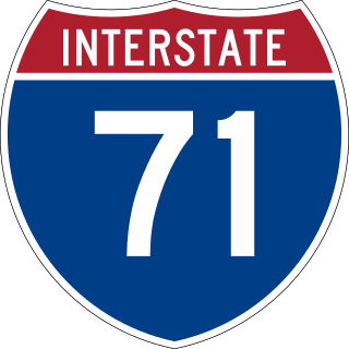
Interstate 71 (I-71) is a north–south Interstate Highway in the midwestern and southeastern regions of the United States. Its southern terminus is at an interchange with I-64 and I-65 in Louisville, Kentucky, and its northern terminus at an interchange with I-90 in Cleveland, Ohio. I-71 runs concurrently with I-75 from a point about 20 miles (32 km) south of Cincinnati, Ohio, into Downtown Cincinnati. While most odd numbered Interstates run north–south, I-71 takes more of a northeast–southwest course, with some east–west sections, and is mainly a regional route serving Kentucky and Ohio. It links I-80 and I-90 to I-70 and ultimately links to I-40. Major metropolitan areas served by I-71 include Louisville, Cincinnati, Columbus, and Cleveland.

Boone County is a county located on the Ohio River in the northernmost part of the Commonwealth of Kentucky. As of the 2020 census, the population was 135,968, making it the fourth-most populous county in Kentucky. Its county seat is Burlington. The county was formed in 1798 from a portion of Campbell County and was named for frontiersman Daniel Boone. Boone County, with Kenton and Campbell Counties, is of the Northern Kentucky metro area, and the Cincinnati-Middletown, OH-KY-IN Metropolitan Statistical Area. It is the location of the Cincinnati/Northern Kentucky International Airport, which serves Cincinnati and the tri-state area.

Maysville is a home rule-class city in Mason County, Kentucky, United States, and is the seat of Mason County. The population was 8,873 as of the 2020 census. Maysville is on the Ohio River, 66 miles (106 km) northeast of Lexington. It is the principal city of the Maysville Micropolitan Statistical Area, which comprises Mason County. Two bridges cross the Ohio from Maysville to Aberdeen, Ohio: the Simon Kenton Memorial Bridge built in 1931 and the William H. Harsha Bridge built in 2001.

Northern Kentucky is an urban area in the U.S. Commonwealth of Kentucky consisting of the southern part of the Cincinnati metropolitan area. The three main counties of the area are Boone, Kenton, and Campbell, all along the Ohio River across from Cincinnati, Ohio. Other counties frequently included in Northern Kentucky include Bracken, Grant, Gallatin and Pendleton. Of Greater Cincinnati's over two million residents, over 450,000 of them live in Northern Kentucky as of 2020, primarily in the northernmost counties. The largest cities in the region are Covington, Florence, and Independence.

Anderson Township is a township located southeastern Hamilton County along the Ohio and Little Miami Rivers, approximately 13 miles southeast of downtown Cincinnati. The population was 44,088 at the 2020 census.
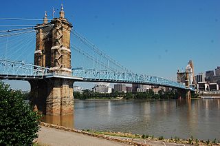
The John A. Roebling Suspension Bridge is a suspension bridge that spans the Ohio River between Cincinnati, Ohio, and Covington, Kentucky. When opened on December 1, 1866, it was the longest suspension bridge in the world at 1,057 feet (322 m) main span, which was later overtaken by John A. Roebling's most famous design of the 1883 Brooklyn Bridge at 1,595.5 feet (486.3 m). Pedestrians use the bridge to get between the hotels, bars, restaurants, and parking lots in Northern Kentucky. The bar and restaurant district at the foot of the bridge on the Kentucky side is known as Roebling Point.

U.S. Route 42 is an east–west United States highway that runs southwest–northeast for 350 miles (560 km) from Louisville, Kentucky to Cleveland, Ohio. The route has several names including Pearl Road from Cleveland to Medina in Northeast Ohio, Reading Road in Cincinnati, Cincinnati and Lebanon Pike in southwestern Ohio and Brownsboro Road in Louisville. Traveling northeast, the highway ends in downtown Cleveland and traveling southwest ends in Louisville.
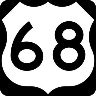
U.S. Route 68 is a United States highway that runs for 560 miles (900 km) from northwest Ohio to Western Kentucky. The highway's western terminus is at US 62 in Reidland, Kentucky. Its present northern terminus is at Interstate 75 in Findlay, Ohio, though the route once extended as far north as Toledo. US 68 intersects with US 62 three times during its route.
Ronald Reagan Cross County Highway, formerly and locally known as Cross County Highway, is a west-east freeway in Hamilton County, Ohio, United States. It stretches 16.4 miles (26.4 km) from southern Colerain Township to Montgomery, connecting many of Cincinnati's northern suburbs to Interstate 71 and Interstate 75. State Route 126 is routed over most of the highway, while the remainder is a county-maintained road.

Hebron is an unincorporated community and census-designated place (CDP) in Boone County, Kentucky, United States. It is named after the biblical city of Hebron. As of the 2020 census, it had a population of 6,195. The wider Hebron area is home to the Cincinnati/Northern Kentucky International Airport, which serves Cincinnati and the Tri-State (Ohio-Kentucky-Indiana) area.

This is a list of properties and districts in Indiana that are listed on the National Register of Historic Places. There are over 2,000 in total. Of these, 44 are National Historic Landmarks. Each of Indiana's 92 counties has at least two listings.
Piatt's Landing was an early nineteenth century riverboat and ferry landing on the Ohio River in Boone County, Kentucky. It is located near Route 338 almost due west of downtown Union. The landing and Winnfield Cottage, which no longer exists, were built by Robert Piatt, the grandfather of Civil War General Edward Canby. Ferries owned by the Piatts crossed the Ohio River to Indiana at several points; Touseytown to Lawrenceburg, Rabbit Hash to Rising Sun, and East Bend to North Landing. A number of the Piatts associated with this family also lived in Norwood, Ohio.

The Milton–Madison Bridge is a continuous truss bridge that connects Milton, Kentucky and Madison, Indiana. It carries approximately 10,000 cars a day. The old structure was replaced with a completely new continuous truss which was constructed on temporary piers adjacent to the operational span between 2011 and 2012 and slid into place after demolition of the old span using a construction method called "truss sliding." The new crossing opened to vehicle traffic in April 2014, and a pedestrian sidewalk opened that October.

Cincinnati Municipal Airport – Lunken Field is a public airport in Cincinnati, Ohio, three miles (5 km) east of Downtown Cincinnati. It is owned by the city of Cincinnati and serves private aircraft, including the fleets of local corporations. It serves a few commercial flights and is the second-largest airport serving Cincinnati after Cincinnati/Northern Kentucky International Airport, which is the area’s primary airport. It is known as Lunken Airport or Lunken Field, after Eshelby Lunken. It is bounded by US Route 50 to the west, US Route 52 and the Ohio River to the south, the Little Miami River to the east, and Ohio Route 125 to the north. The airport is headquarters and hub for Cincinnati-based public charter airline Ultimate Air Shuttle, serving 5 destinations in the eastern United States with 16 peak daily flights. Lunken is also home to small charter airline Flamingo Air and its aviation school.

Interstate 75 (I-75) is a part of the Interstate Highway System that runs 1,786.47 miles (2,875.04 km) from Miami Lakes, Florida to the Canada–United States border at Sault Ste. Marie, Michigan. In the U.S. state of Kentucky, I-75 runs through the eastern half of the state, from the Tennessee state line near the city of Williamsburg to the Ohio state line near Covington. The Interstate serves the state's second-most populous city, Lexington. Outside of it, the route is mostly rural or suburban in nature, mainly providing access to other cities via state and U.S. Highways. The major landscapes traversed by I-75 include the rolling hills and mountains of the Cumberland Plateau, the flat Bluegrass region, the urban core of Lexington, and the highly urbanized suburbs of Northern Kentucky; it also very briefly crosses through the Eastern Kentucky Coalfield at its southernmost stretch and passes near the Daniel Boone National Forest in London.
Interstate 75 (I-75) runs from Cincinnati to Toledo by way of Dayton in the US state of Ohio. The highway enters the state running concurrently with I-71 from Kentucky on the Brent Spence Bridge over the Ohio River and into the Bluegrass region. I-75 continues along the Mill Creek Expressway northward to the Butler County line just north of I-275. From there, the freeway runs into the Miami Valley and then passes through the Great Black Swamp before crossing into Michigan.

U.S. Route 127 (US 127) in Kentucky runs 207.7 miles (334.3 km) from the Tennessee state line in rural Clinton County to the Ohio state line in Cincinnati. The southern portion of the route is mostly rural, winding through various small towns along the way. It later runs through the state capital of Frankfort before continuing north, eventually passing through several Cincinnati suburbs in Northern Kentucky, joining US 42 near Warsaw and US 25 in Florence before crossing the Ohio River via the Clay Wade Bailey Bridge.

Transportation in Cincinnati includes sidewalks, roads, public transit, bicycle paths, and regional and international airports. Most trips are made by car, with transit and bicycles having a relatively low share of total trips; in a region of just over 2 million people, less than 80,000 trips are made with transit on an average day. The city is sliced by three major interstate highways, I-71, I-74 and I-75, and circled by a beltway several miles out from the city limits. The region is served by two separate transit systems, one on each side of the river. SORTA, on the Ohio side is about six times larger than TANK on the Kentucky side.

Francisville is a census-designated place (CDP) in Boone County, Kentucky, United States, and a suburb of Greater Cincinnati. Its population was 9,952 as of the 2020 census. Francisville shares ZIP code 41048 with the neighboring CDP of Hebron. It is the northernmost community in the state.
Constance is an unincorporated community in Boone County, Kentucky, United States. Constance is located on the Ohio River and Kentucky Route 8, 5.2 miles (8.4 km) north of Florence.


