Andover (village), New York

Last updated

Andover, New York
USA New York location map.svg
Red pog.svg
Andover
Location within the state of New York
Usa edcp location map.svg
Red pog.svg
Andover
Andover (the United States)
North America laea location map.svg
Red pog.svg
Andover
Andover (North America)
Coordinates: 42°9′31″N77°47′43″W / 42.15861°N 77.79528°W / 42.15861; -77.79528
Country United States
State New York
County Allegany
Town Andover
Area
[1]
  Total1.02 sq mi (2.63 km2)
  Land1.00 sq mi (2.59 km2)
  Water0.01 sq mi (0.04 km2)
Elevation
1,660 ft (506 m)
Population
 (2020)
  Total890
  Density889.11/sq mi (343.30/km2)
Time zone UTC-5 (Eastern (EST))
  Summer (DST) UTC-4 (EDT)
ZIP code
14806
Area code 607
FIPS code 36-02143
GNIS feature ID0942463
Website Village website

Andover is a village located in the town of Andover in Allegany County, New York, United States. The population was 1,042 at the 2010 census. [2] The name is derived from Andover, Vermont.

Contents

The village of Andover is centrally located in the town and near the east county line.

History

The community was first settled circa 1807. The village of Andover was once called "Bakerstown". The population in 1875 was 850.

Geography

Andover is located at 42°9′31″N77°47′42″W / 42.15861°N 77.79500°W / 42.15861; -77.79500 (42.158631, -77.795181). [3]

According to the United States Census Bureau, the village has a total area of 1.0 square mile (2.6 km2), of which 0.015 square miles (0.04 km2), or 1.50%, is water. [2]

Dyke Creek, named after an early settler, flows through the village.

Andover is at the junction of New York State Route 21 (Main Street) and New York State Route 417.

Andover Pond is located in the northern part of the village.

Demographics

Historical population
CensusPop.Note
1840 150
1850 500233.3%
1860 374−25.2%
1880 794
1900 954
1910 1,13619.1%
1920 1,132−0.4%
1930 1,2419.6%
1940 1,2903.9%
1950 1,3514.7%
1960 1,247−7.7%
1970 1,214−2.6%
1980 1,120−7.7%
1990 1,1250.4%
2000 1,073−4.6%
2010 1,042−2.9%
2020 890−14.6%
U.S. Decennial Census [4]

As of the census [5] of 2000, there were 1,073 people, 432 households, and 282 families residing in the village. The population density was 1,076.6 inhabitants per square mile (415.7/km2). There were 462 housing units at an average density of 463.5 per square mile (179.0/km2). The racial makeup of the village was 97.02% White, 0.19% Black or African American, 0.19% Native American, 0.56% Asian, 0.65% from other races, and 1.40% from two or more races. Hispanic or Latino of any race were 1.21% of the population.

There were 432 households, out of which 30.6% had children under the age of 18 living with them, 53.9% were married couples living together, 7.6% had a female householder with no husband present, and 34.7% were non-families. 29.4% of all households were made up of individuals, and 14.8% had someone living alone who was 65 years of age or older. The average household size was 2.48 and the average family size was 3.09.

In the village, the population was spread out, with 26.0% under the age of 18, 9.8% from 18 to 24, 24.2% from 25 to 44, 23.7% from 45 to 64, and 16.3% who were 65 years of age or older. The median age was 38 years. For every 100 females, there were 94.7 males. For every 100 females age 18 and over, there were 89.0 males.

The median income for a household in the village was $31,563, and the median income for a family was $38,125. Males had a median income of $30,417 versus $20,804 for females. The per capita income for the village was $17,766. About 7.3% of families and 12.0% of the population were below the poverty line, including 16.1% of those under age 18 and 3.0% of those age 65 or over.

Related Research Articles

Koyuk is a city in the Nome Census Area, Alaska, United States. The population was 332 at the 2010 census, up from 297 in 2000.

<span class="mw-page-title-main">Sawmill, Arizona</span> CDP in Apache County, Arizona

Sawmill is a census-designated place (CDP) in Apache County, Arizona, United States. Sawmill is a part of Fort Defiance Agency, which is on the Navajo Nation. The population was 748 at the 2010 census. It is named after and developed around a sawmill. A trading post has been present since 1907.

<span class="mw-page-title-main">Andover, Connecticut</span> Town in Connecticut, United States

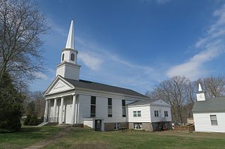
Andover is a rural town in the Capitol Planning Region, Connecticut, United States, roughly 10 miles east of Hartford. The population was 3,151 at the 2020 census. Andover is home to Andover Elementary School for grades K–6 while grades 7–12 go to R.H.A.M. middle and high schools. Andover elementary scores above average on standardized testing and student development as well as having a notably low student to teacher ratio of 8:1.

<span class="mw-page-title-main">Kirkland, Illinois</span> Village in Illinois, United States

Kirkland is a village in DeKalb County, Illinois, United States. The population was 1,650 at the 2020 census, down from 1,744 at the 2010 census.

<span class="mw-page-title-main">Fayetteville, Illinois</span> Village in Illinois, United States

Fayetteville is a village on the Kaskaskia River in St. Clair County, Illinois, United States. The population was 384 at the 2000 census.

<span class="mw-page-title-main">Brookview, Maryland</span> Town in Maryland, United States

Brookview is a town in Dorchester County, Maryland, United States. The population was 48 at the 2020 census. Brookview was incorporated in 1953. Brookview is governed by a three-person town council. Each member of the town council is elected by voters to a three-year term in office. The now deceased Richard E. Sullivan had previously served as mayor of the town since 1996 and was recognized at the 2017 Annual Maryland Municipal League Summer Conference as a long-serving mayor of over 25 years. The 2018 council consisted of Mayor J.D. Hurley, Commissioner Clint Falduto, Commissioner Shelly Hurley. The present 2021 council consists of Mayor Clint Falduto, Commissioner Mary Falduto, Commissioner Shelly Hurley.

<span class="mw-page-title-main">Breitung Charter Township, Michigan</span> Charter township in Michigan, United States

Breitung Charter Township is a charter township of Dickinson County in the U.S. state of Michigan. As of the 2020 census, the township population was 5,831.

<span class="mw-page-title-main">Hudson Township, Mackinac County, Michigan</span> Civil township in Michigan, United States

Hudson Township is a civil township of Mackinac County in the U.S. state of Michigan. As of the 2010 census, the township population was 181.

<span class="mw-page-title-main">Sutherland, Nebraska</span> Village in Nebraska, United States

Sutherland is a village in Lincoln County, Nebraska, United States. It is part of the North Platte, Nebraska Micropolitan Statistical Area. The population was 1,286 at the 2010 census.

<span class="mw-page-title-main">Blasdell, New York</span> Village in New York, United States

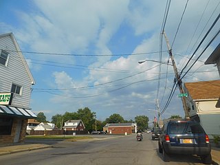
Blasdell is a village in Erie County, New York, United States. The population was 2,553 according to the 2010 Census. The name is derived from Herman Blasdell, the first station master of the Erie and Pennsylvania railroad depot. It is part of the Buffalo–Niagara Falls Metropolitan Statistical Area.

Greenwood is a town in Steuben County, New York, United States. The population was 771 at the 2020 census.

<span class="mw-page-title-main">Beetown, Wisconsin</span> Town in Wisconsin, United States

The Town of Beetown is located in Grant County, Wisconsin, United States. The population was 734 at the 2000 census. The unincorporated communities of Beetown, Diamond Grove, Five Points, Flora Fountain, Hurricane, and North Andover are located in the town. The former community of Pleasant Ridge was also located in the town.

<span class="mw-page-title-main">Conrath, Wisconsin</span> Village in Wisconsin, United States

Conrath is a village in Rusk County, Wisconsin, United States. The population was 95 at the 2010 census.

<span class="mw-page-title-main">Uhland, Texas</span> City in Texas, United States

Uhland is a city in Caldwell and Hays counties in the U.S. state of Texas. The population was 1,588 at the 2020 census, up from 1,014 at the 2010 census. Uhland is named after the German poet Ludwig Uhland. Like its neighbor to the north, the city of Niederwald, Uhland was also settled by German emigrants in the 1800s in a region of central Texas known as the Texas-German belt.

Andover is a town in Allegany County, New York, United States. The population was 1,634 at the 2020 census. The town is on the eastern edge of Allegany County and contains the village of Andover.

<span class="mw-page-title-main">Schaghticoke (village), New York</span> Village in New York, United States

Schaghticoke is a village in Rensselaer County, New York, United States. The population was 592 at the 2010 census.

<span class="mw-page-title-main">Addison (village), New York</span> Village in New York, United States

Addison is a village in Steuben County, New York, United States. The population was 1,763 at the 2010 census. The village and the surrounding town are named after the author Joseph Addison.

<span class="mw-page-title-main">Gratiot, Wisconsin</span> Village in Wisconsin, United States

Gratiot is a village in Lafayette County, Wisconsin, United States. The population was 236 at the 2010 census. The village is surrounded by the Town of Gratiot.

<span class="mw-page-title-main">Hancock, Wisconsin</span> Village in Wisconsin, United States

Hancock is a village in Waushara County, Wisconsin, United States. The population was 417 at the 2010 census. The village is located within the Town of Hancock.

<span class="mw-page-title-main">Groton (city), Connecticut</span> City in Connecticut

The City of Groton is a dependent political subdivision of the town of Groton, Connecticut. The city was settled in 1655 as Groton Bank, and the area developed into the principal village of the town of Groton. The village of Groton incorporated as a borough in 1903, and the residents of the borough of Groton reincorporated as the city of Groton in 1964. It is the only remaining city in the state of Connecticut that is not governmentally consolidated with its parent town. The city is part of the Southeastern Connecticut Planning Region. The population was 10,389 at the 2010 census.

References

  1. "ArcGIS REST Services Directory". United States Census Bureau. Retrieved September 20, 2022.
  2. 1 2 "Geographic Identifiers: 2010 Demographic Profile Data (G001): Andover village, New York". U.S. Census Bureau, American Factfinder. Archived from the original on February 12, 2020. Retrieved October 27, 2014.
  3. "US Gazetteer files: 2010, 2000, and 1990". United States Census Bureau. February 12, 2011. Retrieved April 23, 2011.
  4. "Census of Population and Housing". Census.gov. Retrieved June 4, 2015.
  5. "U.S. Census website". United States Census Bureau . Retrieved January 31, 2008.