
The London Borough of Islington is a London borough which forms part of Inner London, England. Islington has an estimated population of 215,667. It was formed in 1965, under the London Government Act 1963, by the amalgamation of the metropolitan boroughs of Islington and Finsbury.
Highbury is an area in North London and located in the London Borough of Islington. Highbury was owned by Ranulf, brother of Ilger, and included all the areas north and east of Canonbury and Holloway Roads.

Holloway is an area of north London in the London Borough of Islington, England, 3.3 miles (5.3 km) north of Charing Cross, which follows the line of the Holloway Road (A1). At the centre of Holloway is the Nag's Head commercial area which sits between the more residential Upper Holloway and Lower Holloway neighbourhoods. Holloway has a multicultural population and includes the Emirates Stadium, home of Arsenal F.C.. Until 2016, it was the site of Holloway Prison, the largest women's prison in Europe. Before 1965, it was in the historic county of Middlesex.

Northwood is an area in the London Borough of Hillingdon, North West London, located 14+1⁄2 miles northwest of Charing Cross. Northwood was part of the ancient parish of Ruislip, Middlesex. The area was situated on the historic Middlesex boundary with Hertfordshire, and since being incorporated into Greater London in 1965, has been on the Greater London boundary with that county.

Tufnell Park is an area in north London, England, in the London boroughs of Islington and Camden.

Islington is an inner-city area of north London, England, within the wider London Borough of Islington. It is a mainly residential district of Inner London, extending from Islington's High Street to Highbury Fields, encompassing the area around the busy High Street, Upper Street, Essex Road, and Southgate Road to the east.

Archway is an area of north London, England, in the London Borough of Islington 3.8 miles (6 km) north of Charing Cross. It straddles the A1 and is named after a local landmark, the high, single-arched Highgate Archway Bridge which crossed the road in a cutting to the north. It has a modern commercial hub around Vantage Point and Archway tube station.

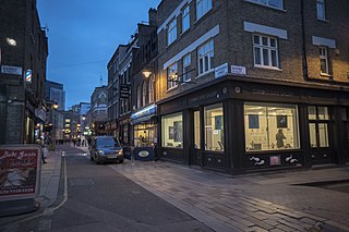
Liverpool Road is a street in Islington, North London. It covers a distance of 1+1⁄4 miles (2.0 km) between Islington High Street and Holloway Road, running roughly parallel to Upper Street through the area of Barnsbury. It contains several attractive terraces of Georgian houses and Victorian villas, many of which are listed buildings. There are a number of pubs, small businesses and restaurants along its route, as well as some secluded garden squares. The vast majority of the street is residential, with a bustling shopping and business area at the southern, Angel, end.

The Aylesbury Estate is a large housing estate located in Walworth, South East London.

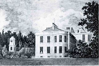
The Metropolitan Cattle Market, just off the Caledonian Road in the parish of Islington was built by the City of London Corporation and was opened in June 1855 by Prince Albert. The market was supplementary to the meat market at Smithfield and was established to remove the difficulty of managing live cattle at that latter site.
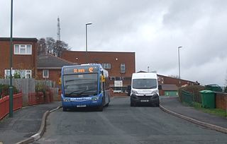
St Ann's is a large district of the city of Nottingham, in the English ceremonial county of Nottinghamshire. The population of the district at the time of the United Kingdom census, 2011 was 19,316.

The London Borough of Islington is short of large parks and open spaces, given its status in recent decades as a desirable place of residence. In fact, Islington has the lowest ratio of open space to built-up areas of any London borough. The largest continuous open space in the borough, at 11.75 hectares, is Highbury Fields.

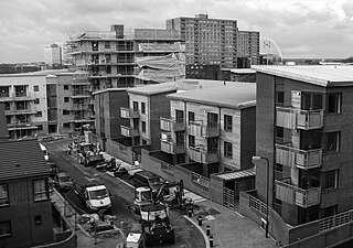
Market Estate is a public housing estate consisting of 271 flats and maisonettes situated to the north of Caledonian Park in the London Borough of Islington. It is named after the Metropolitan Cattle Market which operated on the site until the 1960s. After slaughter the carcasses of cattle and sheep were sent by underground trains to Smithfield Market to be traded. Three of the six blocks that make up the estate are named after breeds of animal that were traded in the market: Tamworth (pigs), Kerry (cows) and Southdown (sheep). The remaining three blocks are called the Clock tower blocks after the market's clock tower which still stands in Caledonian Park. This contains a working clock used as a prototype for the mechanism of Big Ben.

Coram's Fields is a seven acre urban open space in the Kings Cross area of the London Borough of Camden. Adults are only permitted to enter if accompanied by children.

St Mary Magdalene Gardens is a public open space located between Holloway Road and Liverpool Road in Islington, north London. It is located on the old burial ground of St Mary Magdalene Church.
Stonebridge is a locality in the London Borough of Brent. Stonebridge is situated in southern Brent and makes up the western part of Harlesden. The A404 runs through the district known locally as Brentfield and Hillside, while to the south are railway tracks and to the west is the North Circular Road along with Stonebridge Park station. The area is known for the previously troubled 1960s Stonebridge housing estate, which was completely redeveloped in the 2010s.

Charterhouse Square is a garden square, a pentagonal space, in Farringdon, in the London Borough of Islington, and close to the former Smithfield Meat Market. The square is the largest courtyard or yard associated with the London Charterhouse, mostly formed of Tudor and Stuart architecture restored after the London Blitz. The square adjoins other buildings including a small school. It lies between Charterhouse Street, Carthusian Street and the main Charterhouse complex of buildings south of Clerkenwell Road. The complex includes a Chapel, Tudor Great Hall, Great Chamber, the Barts and The London School of Medicine and Dentistry and a 40-resident almshouse.
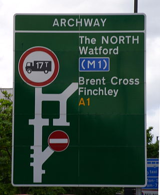
The A1 in London is the southern part of the A1 road. It starts at Aldersgate in the City of London, passing through the capital to Borehamwood on the northern fringe of Greater London, before continuing to Edinburgh. The road travels through the City and three London boroughs: Islington, Haringey and Barnet, which include the districts of Islington, Holloway, Highgate, Hendon and Mill Hill, and travels along Upper Street and Holloway Road, crossing the North Circular Road in Hendon, a district in the London Borough of Barnet.

Caledonian Road in the London Borough of Islington, England, connects North London, from Camden Road near its junction with Holloway Road, and central London's Pentonville Road in the south. A mile and a half long, it is known colloquially as the Cally and forms the entirety of the A5203.
Whitecross Street is a short street in Islington, in Inner London. It features an eponymous street market and a large housing estate.
