Anjangaon

Last updated

Anjangaon
Town
India Maharashtra location map.svg
Red pog.svg
Anjangaon
Location in Maharashtra, India
India location map 3.png
Red pog.svg
Anjangaon
Anjangaon (India)
Coordinates: 21°09′N77°17′E / 21.15°N 77.28°E / 21.15; 77.28
CountryFlag of India.svg  India
State Maharashtra
Region Vidarbha
District Amravati
Government
  TypeMunicipal Council Class 'B'
Area
  Total9.37 km2 (3.62 sq mi)
Elevation
374 m (1,227 ft)
Population
 (2011)
  Total68,380
  Rank3
  Density7,300/km2 (19,000/sq mi)
Demonym Anjangaonkar
Languages
  Official Marathi
Time zone UTC+5:30 (IST)
PIN
444705 (Anjangaon) &
444728 (Surji Satellite Town)
Telephone code07224
Vehicle registration MH-27

Anjangaon is a city and a municipal council in Amravati district in the state of Maharashtra, India. Anjangaon City got the status of Municipal Council in 1930. It is the first municipal council established in Amravati district and the second biggest council as well. [1] Anjangaon Surji Tehsil was established in 1981. It is technically made up of two main zones, Anjangaon and Surji, on either side of Shahanur River, and is called Anjangaon-Surji in combination. It is called a "Banana Hub of Vidarbha" as it is a large producer of bananas and a hub of medicinal plants - Piper longum and Safed musali.

Contents

Anjangaon is located at 21°09′51″N77°18′57″E / 21.1641°N 77.3159°E / 21.1641; 77.3159 . [2] It has an average elevation of 374 metres (1227 feet).

History

Anjangaon Surji is an ancient town having religious and historical importance. After the Battle of Assaye and the Battle of Argaum, the Treaty of Surji-Anjangaon was signed on 30 December 1803 at Anjangaon between the British and Daulat Rao Sindhia, chief of the Maratha people. In 18th century Vithoji Narayan was awarded the vatandari of Anjangaon. There are records that he was awarded with a title 'Surji'. Anjangaon is mentioned as one of 46 Mahals of Vidarbha in Ain-i-Akbari. The revenue of Anjangaon as mentioned in Ain-i-Akbari was 32 lakhs. The river Shahanoor on the banks of which Anjangaon is located, was historically named as Sharneera (meaning river generated by an arrow ). A popular story exists that during the year of banishment, Arjuna generated the water stream by hitting the soil by an arrow. [3]

The Devnath Math in Surji was established in 1754 AD. Saint Ruplal Maharaj established a famous Vitthal Mandir in this town. This is a city of betel leaves. Previously betel leaves were exported from here to Indonesia, Pakistan and Arabian countries. Now this place is known for cultivation of Piper longum, a medicinal plant.

According to Imperial Gazetteer of India [4] (William Wilson Hunter), "in the year 1881, the population of Anjangaon was 9842 consisting of 5060 males and 4782 females. Of the total population, 7714 were returned as Hindus, 1955 Muslims, 6 Sikhs, and 167 Jains. A mart for cotton cloth, excellent basket-work, and pan grown in the adjacent garden lands. Large weekly market".

Anjangaon City got the status of Municipal Council in 1930. It is the first municipal council established in Amravati district & the second biggest council as well. [5] Anjangaon Surji Tehsil was established in 1981.

Demographics

As of 2011 India census, [6] Anjangaon had a population of 160,903 in total of urban and rural. Rural area had a population of 104,523. It is the third most populous city in Amravati District after Amravati and Achalpur(Paratwada). 29,017 are males while 27,363 are females. Anjangaon has a literacy rate of 88.93%, higher than the state average of 82.34%; with 91.01% of the males and 86.72% of females literate. [7] 11.58% of the population is under 6 years of age. According to previous census, population of Anjangaon was 51,380 (2001), 41,674 (1991), [8] 27,897(1971), 21,931(1961) and 11,881(1901). [9]

YearMaleFemaleTotal PopulationChangeReligion (%)
HinduMuslimChristianSikhsBuddhistJainOther religions and persuasionsReligion not stated
2001 [10] 266132455751170-60.46333.6970.1930.0064.6980.9220.0200.000
2011 [11] 3510033280683800.10258.78035.5200.2870.0114.4790.7310.0210.172

Notable places

Shahanur Dam Image Shahanur Dam.jpg
Shahanur Dam Image

Shahanoor Dam (8 km): This dam is built using soil and has a hydroelectricity generation project and water supply project for nearly 156 villages and 2 cities based on gravitation without using electricity. The dam is located in the north of the city in the ranges of Satpuda.

The city has a few religious and spiritual places which are tourist destinations due to their beauty.

Sant Gadge Maharaj statue Sant Gadge Maharaj.jpg
Sant Gadge Maharaj statue
A view of Gulab Baba Ashram Takarkheda More, Anjangaon Surji A view of Gulaba Baba Ashram Takarkheda.jpg
A view of Gulab Baba Ashram Takarkheda More, Anjangaon Surji

Education

The first school in the town was started in 1868. This school, situated in Saokar Peth, is currently run as a Government school for girls. There are many educational institutions in the town, among which Sitabai Sangai High School, Junior College and Radhabai Sarda College are the most popular.

The following is a list of schools and colleges in the area:

Banking

There are a seven nationalized banks as well as co-operative banks in the city. A short list includes

Culture

In Surji area Dwarkeshwar Yatra is a major event to be held every year on second day of Pola festival. Various religious functions are celebrated like Piwali Marbat, Rupalal Punyatithi, Chaitra Paurnima Rathotsav of Jains etc. Kathichi Jatra is a fair cum festival of the city. The fair is organised on every Monday from Nagapanchami to Pola Festival.

Industry

Ambadevi Sahakari Sakhar Karkhana OLD Photo Ambadevi Sahakari Sakhar Karkhana.jpg
Ambadevi Sahakari Sakhar Karkhana OLD Photo

There is a co-operative sugar factory named as "Ambadevi Sahakari Sakhar Karkhana" which is not operational currently. The cotton ginning and pressing companies, sawmills, oil mills are the main industries in the area. There are a few fruit packaging and agro product's companies.

Fruit cultivation and marketing

Anjangaon Surji is famous for bananas and oranges. Anjangaon is the main centre for the supply of bananas in Maharashtra along with Jalgaon. Bananas are supplied across north India (Haryana, Uttar Pradesh, Jammu, Punjab, Uttarakhand, Bihar, Chhattisgarh, Madhya Pradesh, and Delhi) and Nepal from here. Anjangaon Surji is also one of the leading place for production of long pepper (Piper longum, or Pippali), sometimes called Indian long pepper, is a flowering vine in the family Piperaceae, is also cultivated for its fruit, which is usually dried and used as a spice and seasoning.

Transport

Anjangaon Surji Bus Stand NEW Bus Stand Anjangaon.jpg
Anjangaon Surji Bus Stand
Anjangaon Railway Station Anjangaon Railway .jpg
Anjangaon Railway Station

Anjangaon is connected to Betul (101 km) and Khamgaon (101 km) via National Highway 548C Amravati (82 km) and Akola (85 km) by roadways. The state transport (MSRTC) buses ply from Anjangaon to Amravati, Paratwada, Akola, Akot, Ramtek, Yavatmal, Pandharkavada, Nagpur, Aurangabad etc. Some private travel agencies run bus services to Pune and Mumbai. Anjangaon Surji is a station of BhusavalNagpur section of Central Railway on Achalpur-Murtijapur narrow gauge railway route. This narrow gauge train is popularly known as Shakuntala Express. Nearest broad gauge railway station is Murtijapur(50 km). [16]

Nearest airports are Amravati Airport (82 km), Akola Airport (85 km) and Nagpur Airport (250 km).

Related Research Articles

<span class="mw-page-title-main">Amravati</span> City in Maharashtra, India

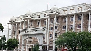
Amravati is the second largest city in the Vidarbha region and ninth largest city in Maharashtra, India. It is administrative headquarters of Amravati district and Amravati division which includes Akola, Buldhana, Washim, and Yavatmal districts. It is one of the Maharashtra's nominated city under Smart Cities Mission.

<span class="mw-page-title-main">Yavatmal district</span> District of Maharashtra in India

Yavatmal districtpronunciation , [jəʋət̪maːɭ] formerly known as Yeotmal, is a district of the Indian state of Maharashtra. It is located in the region of Vidarbha, in the east-central part of the state. It is Vidarbha's third-largest district by population, after Nagpur and Amravati. Yavatmal city is the administrative headquarters of the district.

<span class="mw-page-title-main">Akola</span> City and District Headquarters in Maharashtra, India

Akola is a major city in Vidarbha Region, it is governed by a Municipal Corporation, it is the third largest city in Vidarbha after Nagpur and Amravati. is located about 580 kilometres (360 mi) east of the state capital, Mumbai, and 250 kilometres (160 mi) west of the second capital, Nagpur. Akola is the administrative headquarters of the Akola district located in the Amravati division.

<span class="mw-page-title-main">Buldhana district</span> District of Maharashtra in India

Buldhana district is located in the Amravati division of Maharashtra, India. It is situated at the western border of Vidarbha region and is 500 km away from the state capital, Mumbai. The district has towns and cities like Shegaon, Malkapur, Khamgaon, Lonar and Chikhli. It is surrounded by Madhya Pradesh in the north, Akola, Washim, and Amravati districts on the east, Jalna district on the south, and Jalgaon and Aurangabad districts on the west. Khamgaon is the largest city in the district.

<span class="mw-page-title-main">Shegaon</span> City in Maharashtra, India

Shegaonpronunciation  is a city and municipal council in the Buldhana district in the Indian state of Maharashtra. Shegaon has become a pilgrimage centre due to the influence of Shri Sant Gajanan Maharaj, who is considered a saint by Hindus.

Mehkar is a tabletop tehsil and a municipal council situated in Buldhana district of the Indian state of Maharashtra. Located at the bank of Painganga River, Mehkar falls in the Vidarbha region of Maharashtra.

Washim (Vatsagulma)pronunciation  is a city and a Municipal Council in Washim district in the Indian state of Maharashtra. Washim is the district headquarters of Washim district.

<span class="mw-page-title-main">Amravati district</span> District of Maharashtra in India

Amravati district is a district of Maharashtra state in central India. It is the administrative headquarter of Amravati division, which is one of the two divisions in Vidarbha, out of total 6 regions in state of Maharashtra.

Murtijapur is a Municipal council and one of the taluka of district of Akola of Amravati division of Vidarbha region of Maharashtra.

<span class="mw-page-title-main">Achalpur</span> Modern city in Maharashtra, India

Achalpur, formerly known as Ellichpur and Illychpur, is a city and a municipal council in Amravati District in the Indian state of Maharashtra. It is the second most populous city in Amravati District after Amravati and seventh most populous city in Vidarbha. Achalpur camp is known as Paratwada.

Chikhli is a city and a municipal council in Buldana district in Vidarbha Region of Maharashtra state, India. It is located on the Pune-Nagpur highway. It is situated at the westernmost border of Vidarbha region of Maharashtra and is 500 km from the state capital, Mumbai. Chikhli is situated on the border of the Marathwada Region and Vidarbha Regions of Maharashtra.

Daryapur is a city located in the Amravati District of Maharashtra State, India. It belongs to the Vidarbha region of the Amravati Division. It is located 52 km (32.31m) west of the District headquarters of Amravati.

Digras is a city and a municipal council in the Yavatmal district located in the state of Maharashtra, India. Digras is 638 km from state capital Mumbai (via Aurangabad, Nashik) and 221 km from winter capital Nagpur.

Gadhinglaj ([ɡəɖᵊɦiŋɡləd͡z]) is a city in India in the Kolhapur district in the southwest corner of the state of Maharashtra, India. It is located on the banks of the river Hiranyakeshi. It is the Taluka (Tehsil) headquarters of Gadhinglaj Taluka and a subdivision headquarters of the Gadhinglaj Subdivision of the Kolhapur District. It is governed by a municipal council. The rapidly growing city is the third largest in the Kolhapur District, with population of more than 50,000. Places to visit like Samagad fort, temples and beautiful weather.

<span class="mw-page-title-main">Pulgaon</span> Town in Maharashtra, India

Pulgaon is a municipal council in Wardha district in the India state of Maharashtra. The nearest city is Wardha, 32 kilometres (20 mi) away via the Mumbai–Nagpur Expressway.

Warud is also known as Orange City and a municipal council in Amravati district in the Indian state of Maharashtra.

<span class="mw-page-title-main">Paratwada</span> City in Maharashtra, India

Paratwada, formerly known as Paltanwada and also known as "Achalpur Camp" is a city and a municipal council in Amravati District in the Indian state of Maharashtra. It is also the second most populous city in Amravati District after Amravati and seventh most populous city in Vidarbha. It has a twin city known as Achalpur. Paratwada is a gateway to the Melghat region which has one of the biggest Tiger conservation projects in India.

<span class="mw-page-title-main">Wani, Yavatmal</span> City in Maharashtra, India

Wani is a 3rd largest city in Yavatmal district in the Indian state of Maharashtra.

<span class="mw-page-title-main">Bhadravati, Maharashtra</span> City in Maharashtra, India

Bhadravati is a city and a municipal council in Chandrapur district in the state of Maharashtra, India. It lies 26 km from Chandrapur city. Bhadravati city has recently bagged the Best City in 'Innovation & Best Practices' award under the population Category - 50K to 1 Lakh from the Government of India under Swach Surverkshan Awards-2021. It has also bagged 8th Rank in being the cleanest city under category population Category - 50K to 1 Lakh under Swach Surverkshan Awards-2021 amongst 132 cities nominated.

<span class="mw-page-title-main">Shendgaon</span> Village in Maharashtra, India

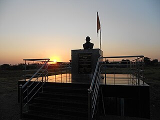
The Indian village of Shendgaon is located in the taluka of Anjangaon which is in the district of Amravati in the state of Maharashtra. It is part of the Vidarbha region. Shendgaon is surrounded by Achalpur Taluka in the east, Daryapur Taluka in the south, Chikhaldara Taluka in the north, and Akot Taluka in the west. Marathi is the local language, but Hindi and English are commonly used. It is known as the birthplace of Saint Gadge Maharaj, a peripatetic teacher and social reformer, who recently had a commemorative bust unveiled in his honor. The state government of Maharashtra also runs a village cleanliness program named after him, and the University of Amravati was renamed as Sant Gadge Baba University.

References

  1. "The Gazetteers Department - AMRAVATI". Archived from the original on 18 March 2012. Retrieved 22 June 2012.
  2. Falling Rain Genomics, Inc - Anjangaon
  3. "Marathi News, Latest Marathi News, Marathi News Paper, Marathi News Paper in Mumbai, Loksatta | मराठी ताज्या बातम्या".
  4. "Read the eBook the imperial gazetteer of India by William Wilson Hunter online for free (Page 38 of 58)".
  5. "The Gazetteers Department - AMRAVATI". Archived from the original on 18 March 2012. Retrieved 22 June 2012.
  6. "Census of India 2001: Data from the 2001 Census, including cities, villages and towns (Provisional)". Census Commission of India. Archived from the original on 16 June 2004. Retrieved 1 November 2008.
  7. "Anjangaon Municipal Council City Population Census 2011-2021 | Maharashtra".
  8. "Mahārāshtra (India): State, Major Agglomerations & Cities - Population Statistics, Maps, Charts, Weather and Web Information".
  9. "Central Provinces District Gazetteers – Amraoti". Archived from the original on 6 May 2012. Retrieved 22 June 2012.
  10. Census India 2001.
  11. Census India 2011.
  12. "Sitabai Sangai Education Society". Archived from the original on 13 August 2014. Retrieved 23 June 2012.
  13. "Vasudha Abhyuday Foundation". vasudhaabhyudayfoundation.org. Archived from the original on 6 March 2019.
  14. "Social Transformation Through Dynamic & Nature's Education".
  15. Archived at Ghostarchive and the Wayback Machine : Green Hearts School, Anjangaon Surji. YouTube .
  16. "The Gazetteers Department - AMRAVATI". Archived from the original on 10 April 2009. Retrieved 22 June 2012.

http://www.census2011.co.in/data/town/802684-anjangaon-maharashtra.html