
Oxfordshire is a ceremonial county in South East England. The county is bordered by Northamptonshire and Warwickshire to the north, Buckinghamshire to the east, Berkshire to the south, and Wiltshire and Gloucestershire to the west. The city of Oxford is the largest settlement and county town.

The River Loddon is a tributary of the River Thames in southern England. It rises at Basingstoke in Hampshire and flows northwards for 28 miles (45 km) to meet the Thames at Wargrave in Berkshire. Together, the Loddon and its tributaries drain an area of 400 square miles (1,036 km2).

Barkham is a village and civil parish in the borough of Wokingham in Berkshire, England, located around 2 miles (3.2 km) southwest of the town of Wokingham.

Arborfield is a village and former civil parish, now in the parish of Arborfield and Newland, in the Wokingham, on the A327 road in Berkshire, England. It is about 4.5 miles (7 km) south-east of Reading, about 4 miles (6.4 km) west of Wokingham. It lies about 0.6 miles (1 km) west of its sister village of Arborfield Cross and the two villages have become collectively known as Arborfield, with no signs marking their boundary. In 1931 the parish had a population of 348. On 1 April 1948 the parish was abolished and merged with Newland to form "Arborfield and Newland".

Aldermaston Court is a country house and private park built in the Victorian era for Daniel Higford Davall Burr with incorporations from a Stuart house. It is south-east of the village nucleus of Aldermaston in the English county of Berkshire. The predecessor manor house became a mansion from the wealth of its land and from assistance to Charles I during the English Civil War under ownership of the Forster baronets of Aldermaston after which the estate has alternated between the names Aldermaston Park and Aldermaston Manor.
Norley is a village and civil parish in Cheshire, England, north of Delamere Forest, near the village of Cuddington. The population at the 2011 census was 1,169. Its name is derived from “Norlegh”, which means “north clearing”.

Tring Park Mansion or Mansion House, Tring Park, is a large country house in Tring, Hertfordshire. The house, as "Tring Park", was used, and from 1872 owned, by members of the Rothschild family from 1838 to 1945.

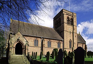
Beckett Hall is a country house at Shrivenham in the English county of Oxfordshire. The present house dates from 1831.

The Goddard family were a prominent landed family chiefly living in the northern regions of the English counties of Wiltshire and Hampshire and the western part of Berkshire, between the Tudor period and the early 20th century.
The Selby family is a prominent and prolific family in the English gentry that originated in Selby, Yorkshire, but largely settled in Northumberland and County Durham. At various points through history, the family owned Biddlestone Hall and Twizell Castle in Northumberland in addition to the manor houses Ightham Mote in Kent and at Beal, Northumberland. The family had two baronetcies; the Selby and the Selby-Bigge but both are now extinct.

Benham Park is a mansion in the English ceremonial county of Berkshire and district of West Berkshire. It is 2 miles (3.2 km) west of Newbury within 500m of a junction of the A34 trunk road Newbury by-pass outside the town side, in the Marsh Benham locality of Speen, a village within and outside the Newbury by-pass. The house is a Grade II* listed building and park is Grade II.

Silwood Park is the rural campus of Imperial College London, England. It is situated near the village of Sunninghill, near Ascot in Berkshire. Since 1986, there have been major developments on the site with four new college buildings. Adjacent to these buildings is the Technology Transfer Centre: a science park with units leased to commercial companies for research.

Horham Hall may refer to the timber-framed late mediaeval hall in Thaxted, England, or to the brick hall built in its place by Sir John Cutte in the early 16th century.
The Ballad of Molly Mogg is a poem written by John Gay with contributions from Alexander Pope and Dean Swift. It is written about Molly Mogg, the beautiful barmaid at the Rose Inn, Wokingham, England.

Stansted or Steanstead Hall is located in Stansted Mountfitchet, Essex, East of England, United Kingdom. It was the country seat of the Earls of Essex during the reign of Henry VIII of England.
The Bullock family traces its roots to the 12th century, living primarily in the southern English counties of Berkshire and Essex from the mid-Norman period to the late Victorian era.

Marks Hall was a Jacobean country house some 2 miles (3.2 km) north of Coggeshall in Essex, England. Previously a timber manor house, the 17th-century brick building was demolished in 1950.
Warfield Hall is a Grade II listed building at Warfield in Berkshire.

St Leonard's Hill was a large mansion near Clewer in Berkshire.

Coleshill House was a country house in England, near the village of Coleshill, in the Vale of White Horse. Historically, the house was in Berkshire but since boundary changes in 1974 its site is in Oxfordshire.

