Related Research Articles
Peat, sometimes known as turf, is an accumulation of partially decayed vegetation or organic matter. It is unique to natural areas called peatlands, bogs, mires, moors, or muskegs. The peatland ecosystem covers 3.7 million square kilometres (1.4 million square miles) and is the most efficient carbon sink on the planet, because peatland plants capture CO2 naturally released from the peat, maintaining an equilibrium. In natural peatlands, the "annual rate of biomass production is greater than the rate of decomposition", but it takes "thousands of years for peatlands to develop the deposits of 1.5 to 2.3 m [4.9 to 7.5 ft], which is the average depth of the boreal [northern] peatlands", which store around 415 gigatonnes (457 billion short tons; 408 billion long tons) of carbon (about 46 times 2019 global CO2 emissions). Globally, it even stores up to 550 gigatonnes (610 billion short tons; 540 billion long tons) of carbon, representing 42% of all soil carbon and exceeds the carbon stored in all other vegetation types, including the world's forests. Across the world, peat covers just 3% of the land’s surface, but stores one-third of the Earth’s soil carbon. Sphagnum moss, also called peat moss, is one of the most common components in peat, although many other plants can contribute. The biological features of sphagnum mosses act to create a habitat aiding peat formation, a phenomenon termed 'habitat manipulation'. Soils consisting primarily of peat are known as histosols. Peat forms in wetland conditions, where flooding or stagnant water obstructs the flow of oxygen from the atmosphere, slowing the rate of decomposition.

Thorne is a market town and civil parish in the Metropolitan Borough of Doncaster in South Yorkshire, England. It was historically part of the West Riding of Yorkshire until 1974. It has a population of 16,592, increasing to 17,295 at the 2011 Census.

The Sweet Track is an ancient trackway, or causeway, in the Somerset Levels, England, named after its finder, Ray Sweet. It was built in 3807 BC and is the second-oldest timber trackway discovered in the British Isles, dating to the Neolithic. It is now known that the Sweet Track was predominantly built along the course of an earlier structure, the Post Track.

Beaghmore is a complex of early Bronze Age megalithic features, stone circles and cairns, 8.5 miles north west of Cookstown, County Tyrone in Northern Ireland, on the south-east edge of the Sperrin Mountains.

Historic roads are paths or routes that "have great historical importance or fame". Examples exist from prehistoric times until the early 20th century. They include ancient trackways, tracks, and roads that existed in "the period of history before the fall of the Western Roman Empire" in 476 AD. "The first roads were paths made by animals and later adapted by humans." Many historic routes, such as the Silk Road, the Amber Road, and the Royal Road of the Persian Empire, existed before the Christian era and covered great distances.
The prehistory of Ireland has been pieced together from archaeological evidence, which has grown at an increasing rate over the last decades. It begins with the first evidence of humans in Ireland around 10,500 BC, and finishes with the start of the historical record around 400 AD. Both of these dates are later than for much of Europe and all of the Near East. The prehistoric period covers the Palaeolithic, Mesolithic, Neolithic, Bronze Age and Iron Age societies of Ireland. For much of Europe, the historical record begins when the Romans invaded; as Ireland was not invaded by the Romans its historical record starts later, with the coming of Christianity.

This timeline of prehistoric Scotland is a chronologically ordered list of important archaeological sites in Scotland and of major events affecting Scotland's human inhabitants and culture during the prehistoric period. The period of prehistory prior to occupation by the genus Homo is part of the geology of Scotland. Prehistory in Scotland ends with the arrival of the Romans in southern Scotland in the 1st century AD and the beginning of written records. The archaeological sites and events listed are the earliest examples or among the most notable of their type.

Hatfield Moors is a 1400.7 hectare biological site of Special Scientific Interest in South Yorkshire. The site was notified in 1954. The site is managed by Natural England.
The Neolithic British Isles refers to the period of British, Irish and Manx history that spanned from c. 4000 to c. 2,500 BCE. The final part of the Stone Age in the British Isles, it was a part of the greater Neolithic, or "New Stone Age", across Europe.

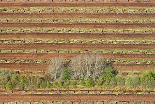
Thorne and Hatfield Moors form the largest area of lowland raised peat bog in the United Kingdom. They are situated in South Yorkshire, to the north-east and east of Doncaster near the town of Thorne, and are part of Hatfield Chase. They had been used for small-scale extraction of peat for fuel from medieval times, and probably much earlier, but commercial extraction of the peat for animal bedding began in the 1880s. The peat was cut on the moors and, once it had dried, transported to several works on 3 ft narrow gauge tramways, always called trams locally. The wagons were pulled by horses to works at Creyke's Siding, Moorends, Medge Hall, Swinefleet and Hatfield. There was also a network of canals supplying the Moorends Works.

Thorne and Hatfield Moors Peat Canals were a series of canals in South Yorkshire and Lincolnshire, England, which were used to carry cut peat from Thorne and Hatfield Moors to points where it could be processed or exported. There were two phases to the canals, the first of which lasted from the 1630s until the 1830s, when coal imported on the Stainforth and Keadby Canal reduced the demand for peat as a fuel. The second started in the 1890s, when peat found a new use as bedding for working horses, and lasted until 1922, when Moorends Mill which processed the peat was destroyed by fire.

The Duvensee paddles is the preserved part of a Mesolithic spade paddle, which was found during archaeological excavations of a Mesolithic dwelling area at Duvensee near Klinkrade Schleswig-Holstein, Germany in 1926. After a paddle from Star Carr in England, the Duvensee paddle is the second oldest known paddle and is considered among the earliest evidence for the use of water transport in the Mesolithic. The find is in the permanent exhibition of the Archaeological Museum Hamburg in Harburg, Hamburg.

The North Atlantic moist mixed forests is a temperate broadleaf and mixed forest ecoregion in Northwestern Europe. It consists of maritime forests and heathlands on the western and northern coasts of Ireland, Scotland, and neighboring islands. The ecoregion has undergone major habitat loss.
William Bunting (1916–1995) was an amateur naturalist and eco-warrior who is credited with saving the wildlife habitat of Thorne Moors from the planned dumping of 32 million tons of fuel-ash, peat-cutting and drainage, and for campaigning for the reinstatement of public footpaths on maps of the same Moors.
The Hatfield Neolithic Trackway was discovered in 2004, and is one of the oldest known ancient timber trackways in England. The trackway is the second confirmed archaeological structure from Hatfield and Thorne Moors. The Lindholme Trackway dates to around 2900–2500 BC.
William of Lindholme is a legendary figure in English folklore, who lived in a hermitage on an island in the middle of the Hatfield Chase, today located in the Metropolitan Borough of Doncaster. Many differing tales were told about William, from him being born a Giant, to him being either a Satanic Magician or a Righteous Monk. What can be extracted is that William was a real hermit, living in the Lindholme waste, likely where Rangjung Yeshe Gomde Tibetan Buddhist Centre now stands.

Prehistoric Cumbria describes that part of north-west England, subsequently the county of Cumbria, prior to the coming of the Romans. Barrowclough puts the archaeological record of the county at '443 stone tools, 187 metal objects and 134 pots', plus the various monuments such as henges, stone circles, and the like. The survival of these objects has been influenced by processes such as the rise in sea levels on the west coast, erosion, deposition practices, industrial and agricultural development, and the changing interests and capabilities of antiquarians and archaeologists.

Crowle Peatland Railway is a fledgling railway museum based on the peat moors at Crowle in North Lincolnshire, England.

Lismore Fields is the site of a Stone Age settlement in the town of Buxton, Derbyshire, England. It was discovered close to the River Wye in 1984 by the Trent and Peak Archaeological Trust during a search for a Roman road. The site is a protected Scheduled Monument.

Fleet Moss is a upland area separating Wharfedale from Wensleydale in North Yorkshire, England. The area is 1,850 ft (560 m) above sea level. Fleet Moss is noted for its peat blanket bog, which has been dated to the Neolithic period. The area is ombrotrophic; this means it needs rain, hail snow and fog for its nutrients. Fleet Moss is known as the most eroded blanket bog in all of Yorkshire; because of its observable damage, it is known colloquially as The Somme, and as such, is visible from space.
References
- 1 2 3 4 5 Chapman H P; Geary B R (2013). Modelling archaeology and palaeoenvironments in wetlands: The hidden landscape archaeology of Hatfield and Thorne Moors, eastern England. Oxbow Books. ISBN 9781782971740.
- ↑ Abraham de Pryme 1701 cited in Buckland (1979). Thorne Moors: A Palaeological Study of a Bronze Age Site: A contribution of the history of the British Insect fauna
- 1 2 Hunter (1828). Classical Country Histories: South Yorkshire, republished (1974)EP Publishing
- ↑ Tomlinson (1882) cited by Chapman and Geary (2014).Modelling Archaeology and Paleoenvironments in Wetlands
- ↑ South Yorkshire HER
- ↑ The Yorkshire Archaeological Journal (1973/4). VOL 45/46
- ↑ 1965 cited in Buckland (1979). Thorne Moors: A Palaeological Study of a Bronze Age Site: A contribution of the history of the British Insect fauna
- ↑ Buckland (1979). Thorne Moors: A Palaeological Study of a Bronze Age Site: A contribution of the history of the British Insect fauna
- ↑ Chapman and Geary (2005). A Neolithic Trackway on Hatfield Moors – a significant discovery, "Archived copy" (PDF). Archived from the original (PDF) on 8 December 2015. Retrieved 4 January 2016.CS1 maint: archived copy as title (link), [PDF], accessed 7 December 2015
- ↑ University of Birmingham (2015).Hatfield Trackway and Platform, Hatfield Moors, South Yorkshire, http://www.birmingham.ac.uk/schools/historycultures/departments/caha/news/projects/environmental/hatfield.aspx, [www.doc], accessed 7 December 2015
- ↑ Historic England. "Lindholme Neolithic timber trackway and platform, Hatfield (1443481)". National Heritage List for England . Retrieved 17 July 2017.
- ↑ Coles and Coles 1996 cited in Chapman and Geary (2014)Modelling Archaeology and Paleoenvironments in Wetlands