U.S. Route 59 is a north–south United States highway. A latecomer to the U.S. numbered route system, US 59 is now a border-to-border route, part of the NAFTA Corridor Highway System. It parallels U.S. Route 75 for nearly its entire route, never much more than 100 miles (160 km) away, until it veers southwest in Houston, Texas. Its number is out of place since US 59 is either concurrent with or entirely west of U.S. Route 71. The highway's northern terminus is 9 mi (14 km) north of Lancaster, Minnesota, at the Lancaster–Tolstoi Border Crossing on the Canada–US border, where it continues as Manitoba Highway 59. Its southern terminus is at the Mexico–US border in Laredo, Texas, where it continues as Mexican Federal Highway 85D.

U.S. Route 71 or U.S. Highway 71 is a major north–south United States highway that extends for over 1500 miles (2500 km) in the central United States. This original 1926 route has remained largely unchanged by encroaching Interstate highways. Currently, the highway's northern terminus is in International Falls, Minnesota at the Canada–US border, at the southern end of the Fort Frances-International Falls International Bridge to Fort Frances, Ontario. U.S. Route 53 also ends here. On the other side of the bridge, Trans-Canada Highway is an east–west route while Ontario Highway 71 is a north–south route. US 71's southern terminus is between Port Barre and Krotz Springs, Louisiana at an intersection with U.S. Route 190. For the entirety south of Kansas City, Missouri, US 71 runs parallel and concurrent with the existing and future Interstate 49. North of Kansas City, US 71 runs halfway between Interstate 29 and Interstate 35, which they split in the city at an interchange with Interstate 70.

U.S. Route 266 is a 43.09-mile (69.35 km), east–west U.S. Numbered Highway in Okmulgee, McIntosh, and Muskogee counties in Oklahoma, United States, that connects U.S. Route 62 U.S. Route 75 in Henryetta with U.S. Route 64 in Warner. The highway no longer meets the former route of its parent, U.S. Route 66, and is closely paralleled by Interstate 40 (I-40), which replaced US 266 as the major east–west highway east of Oklahoma City during the 1960s.

U.S. Route 119 (US 119) is a spur of US 19. It is a north–south route that was an original United States highway of 1926. It is Corridor G of the Appalachian Development Highway System (ADHS) east of US 23 and KY 80 in Kentucky to Interstate 64 at Charleston, West Virginia.

Highway 32 is a designation for three state highways in South Arkansas. One route of 34.22 miles (55.07 km) runs from Oklahoma State Highway 3 (SH-3) at the Oklahoma state line east to Highway 355 at Saratoga. A second route of 3.96 miles (6.37 km) begins near Hope Municipal Airport and runs through Oakhaven to Highway 29. A third segment of 18.87 miles (30.37 km) begins at US 278 and runs east to US 371 in Willisville.

Highway 41 is a designation for two state highways in Western Arkansas. One route of 18.02 miles (29.00 km) runs from Franklin County Route 40 (CR 40) south to Highway 23 near Chismville. A second routing begins at US Route 70B (US 70B) in De Queen and runs south to Texas State Highway 8 at the Texas state line. The northern segment of Highway 41 contains a 0.60 miles (0.97 km) officially designated exception over Highway 22 in Branch.

Highway 16 is an east–west state highway in Arkansas. The route begins in Siloam Springs at US Highway 412 (US 412) and Highway 59 and runs east through Fayetteville and the Ozark National Forest to US Highway 67 Business (US 67B) in Searcy. Highway 16 was created during the 1926 Arkansas state highway numbering, and today serves as a narrow, winding, 2-lane road except for overlaps of 10 miles (16 km) through Fayetteville. Much of the highway winds through the Ozarks, including the Ozark National Forest, where a portion of the highway is designated as an Arkansas Scenic Byway. The route has two spur routes in Northwest Arkansas; in Fayetteville and Siloam Springs.

Arkansas Highway 367 is a designation for two north–south state highways in Arkansas. A southern route of 15.03 miles (24.19 km) travels north from U.S. Route 167 (US 167) in East End north to US 70 in Little Rock. A northern route of 81.52 miles (131.19 km) begins in Cabot at US 67/AR 5/AR 321 and travels northeast to US 412 in Walnut Ridge.

Highway 72 is a designation for two east–west state highways in Benton County, Arkansas. A western route of 26.32 miles (42.36 km) runs east from Highway 43 at Maysville to U.S. Route 71B (US 71B) in Bentonville. A second route of 12.67 miles (20.39 km) begins at Interstate 49/US Route 71 (I-49/US 71) in Bentonville and runs northeast to US 62 near Avoca. The route is one of the original Arkansas state highways.
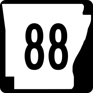
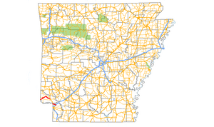
Highway 88 is a designation for five state highways in Arkansas. All routes are maintained by the Arkansas Department of Transportation (ArDOT).

Interstate 40 (I-40) is an east–west Interstate Highway that has a 284.69-mile (458.16 km) section in the U.S. state of Arkansas, connecting Oklahoma to Tennessee. The route enters Arkansas from the west just north of the Arkansas River near Dora. It travels eastward across the northern portion of the state, connecting the cities of Fort Smith, Clarksville, Russellville, Morrilton, Conway, North Little Rock, Forrest City, and West Memphis. I-40 continues into Tennessee, heading through Memphis. The highway has major junctions with I-540 at Van Buren, I-49 at Alma, I-30 in North Little Rock, and I-55 to Blytheville.

U.S. Route 81 (US-81) is a north–south U.S. highway running through the central United States' Great Plains region, from Fort Worth, Texas to the U.S.–Canadian border at Pembina, North Dakota. A 229.28-mile (368.99 km) segment of the highway lies within the state of Oklahoma. US-81 crosses the Red River from Texas south of Terral, passing through several Oklahoma cities, such as Chickasha, El Reno, Kingfisher, and Enid, before entering Kansas north of Renfrow.

Arkansas Highway 133 is a designation for three state highways in South Arkansas. One route of 24.20 miles (38.95 km) runs from Louisiana Highway 142 north through Crossett to Highway 8 near Fountain Hill. A second segment runs from Highway 160 north to US Route 425 (US 425) at Lacey. A third segment begins in Rison at Highway 35 and runs north to Highway 54 south of Pine Bluff.

Arkansas Highway 242 is an east–west state highway in Phillips County, Arkansas. The route of 14.74 miles (23.72 km) runs from Highway 44 near Helena-West Helena north through the city and through the St. Francis National Forest to Highway 1 near Lexa. A segment of the route is part of the Mississippi River Trail, essentially a bicycle-friendly version of the Great River Road.

Highway 231 is a designation for three north–south state highways in northeast Arkansas. All three segments serve rural, agricultural areas in the Arkansas Delta. One segment of 5.79 miles (9.32 km) runs north from U.S. Route 412 (US 412) to Highway 34. A second route of 3.02 miles (4.86 km) begins at Highway 90 near O'Kean and runs north to Highway 304 at Sharum. A third segment of 6.12 miles (9.85 km) begins at Highway 251 and runs to Highway 93. All routes are maintained by the Arkansas State Highway and Transportation Department (AHTD).

Arkansas Highway 119 is a series of state highways that run in Northeast Arkansas. All routes are maintained by the Arkansas Department of Transportation (ArDOT).
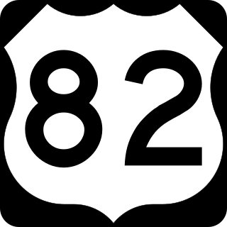
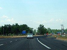
U.S. Highway 82 in Arkansas is a major east–west arterial highway across the state's lowest tier of counties. It enters Arkansas from Texas, concurrent with US Highway 67, at a junction with US Highway 71 on the border between Texarkana, Texas and Texarkana, Arkansas. The route leaves Arkansas on the Lake Village Bridge over the Mississippi River near Lake Village, crossing into Mississippi.

Highway 138 is an east–west state highway in south Arkansas. The route runs 37.05 miles (59.63 km) from US Route 278 north to Arkansas Highway 1 in Kelso.
U.S. Highway 71 is a U.S. highway that runs from Krotz Springs, LA to the Fort Frances–International Falls International Bridge at the Canadian border. In Arkansas, the highway runs from the Louisiana state line near Doddridge to the Missouri state line near Bella Vista. In Texarkana, the highway runs along State Line Avenue with US 59 and partially runs in Texas. Other areas served by the highway include Fort Smith and Northwest Arkansas.

Highway 17 is a designation a state highway in the U.S. state of Arkansas. The highway is located mainly in Eastern Arkansas and is split into seven segments, though two sets of segments are directly connected. The first section of the highway is about 4.9 miles (7.9 km) long, with its southern terminus located near Ward Reservoir, in southern Arkansas County, which travels north and ends at a dead-end near La Grue Bayou. The second section is about 53.7 miles (86.4 km) long, starting south of the town of Ethel and ending at U.S. Route 70 (US 70) southwest of Brinkley. The third and longest section begins at US Route 49 north of Brinkley and ends at AR 14 in Newport. The fourth section is about 7.1 miles (11.4 km) long and begins at Arkansas Highway 18 in Diaz and ends at Arkansas Highway 37 west of Tuckerman.