
U.S. Route 278 is a parallel route of US 78. It currently runs for 1,074 miles (1,728 km) from Hilton Head Island, South Carolina, to Wickes, Arkansas at US 71/US 59, passing through five states in the process. Landmarks along its route include the Department of Energy's Savannah River Site in South Carolina and the Tennessee-Tombigbee Waterway in eastern Mississippi. There are several universities located along the highway including the Georgia Institute of Technology, the University of Mississippi, Delta State University, and the University of Arkansas at Monticello.

Arkansas Highway 98 is an east–west state highway in Columbia County, Arkansas. The 47.15-mile-long (75.88 km) route travels essentially in an incomplete loop with Magnolia at its center. The route begins at U.S. Route 82 (US 82) near Waldo and intersects US 371, US 79, US 82, and US 79 before terminating at AR 19. An officially designated exception over US 371 of 1.12 miles (1.80 km) occurs near the eastern terminus.

Highway 87 is a designation for four north–south state highways in Arkansas. Created during the 1926 Arkansas state highway numbering, the original alignment remains between Bradford and Pleasant Plains, though it has been revised and extended over the years. The three remaining segments are former county roads, connecting rural communities to local points of interest and other state highways. All three were added to the state highway system in 1973 during a period of system expansion. All segments are maintained by the Arkansas Department of Transportation (ArDOT).

Highway 355 is a designation for three north–south state highways in Southwest Arkansas. The routes are maintained by the Arkansas Department of Transportation (ArDOT).

U.S. Highway 412 (US 412) runs east-to-west through northern Arkansas for about 290 miles (470 km). The route begins at the Oklahoma state line near Siloam Springs, and ends at the Missouri state line east of Paragould.

Highway 175 is a state highway in Northeast Arkansas. The route begins at Highway 289 and runs north 39.07 miles (62.88 km) to Wirth. The highway was created as a short highway west of Hardy on September 5, 1940, with several reroutings and extensions throughout the 1960s and 1970s. One former alignment change was designated Highway 175 Spur, a spur route in Cherokee Village, in 1980. Both routes are maintained by the Arkansas Department of Transportation (ArDOT).

Highway 164 is a designation for four segments of state highway in the Arkansas River Valley. Each are low-volume local roads providing connectivity to small communities, or recreation areas near the Ozark National Forest. The first segment was created in 1945, with the remaining segments created during the late 1950s and 1960s, a period of major Arkansas Highway System expansion. A single spur route provides access to an industrial area in Clarksville. All routes are maintained by the Arkansas Department of Transportation (ArDOT).
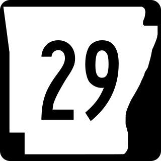
Arkansas Highway 29 is a state highway that extends 77.2 miles (124.2 km) in South Arkansas. It runs north from the Louisiana state line to its terminus at AR 301 in Antoine. It is intersected by many major thoroughfares including Interstate 30. Part of the highway is known as Bill Clinton Drive.

Highway 51 is a designation for two north–south state highways in Southwest Arkansas. One route of 53.37 miles (85.89 km) begins Highway 53 near Whelen Springs and runs north to US Highway 67 in Donaldson. A second route of 7.92 miles (12.75 km) runs parallel to US 270 northwest of Malvern. Both routes are maintained by the Arkansas Department of Transportation (ArDOT).

Highway 128 is a designation for four east–west state highways in Southwest Arkansas. One route of 11.99 miles (19.30 km) begins at Highway 7 in Sparkman and runs east to Highway 9 at Holly Springs. A second route of 6.23 miles (10.03 km) begins at Highway 51 at Joan and runs east to Highway 7/Highway 8 at Gravel Junction. A third route begins at Highway 7 near DeGray Lake Resort State Park and runs east and north to US Highway 270 Business (US 270B) in Hot Springs. A fourth route begins at Highway 5 in Fountain Lake and runs east to US 70. All routes are maintained by the Arkansas Department of Transportation (ArDOT).

Arkansas Highway 76 is the designation for a state Highway in the U.S. state of Arkansas. AR 76 is located in southwest Arkansas, and is split into two sections. The first section begins at U.S. Route 371 (US 371), and ends at US 278. The second section begins at AR 57 and AR 387 south of Chidester, and ends at AR 24 near Bragg City, or about 6.5 miles (10.5 km) northwest of Camden. Both sections are very rural.
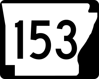
Arkansas Highway 153 is the designation for a state highway which is entirely located in Arkansas County. The route begins at AR 17 just north of Ethel and ends at AR 130 a few miles east of Stuttgart. The route is very rural.

Arkansas Highway 174 is a designation for a state highway in Southwest Arkansas. The route is split into two sections. The first section begins at AR 355 in Spring Hill and ends at US Route 67 (US 67) in Hope. The second section begins at US 67 in Perrytown and ends at AR 299 just south of Interstate 30 (I-30).

Arkansas Highway 182 is the designation for a state highway in the U.S. state of Arkansas. The highway itself is split into two sections, both of which are mainly located in southwest Arkansas. The first section begins at U.S. Route 70 (US 70) just east of Welsh, and ends at AR 84 in Amity. The second section begins at AR 51 in Okolona, and ends at US 67 and AR 53 in Gurdon.

Arkansas Highway 183 is a designation for a state highway in the U.S. state of Arkansas. The route begins at AR 35 in Benton, and ends at AR 5 in Bryant, just north of Interstate 30 (I-30).

Arkansas Highway 185 is the designation for a state highway in the U.S. state of Arkansas. The route is split into three sections, which are all located in eastern Arkansas. The first section begins at AR 242 and ends at US Highway 49 Business (US 49B) in Helena-West Helena. The second section begins at US 49 near Wycamp, or just west of Helena-West Helena, and ends at AR 242 just north of Helena-West Helena. The third section begins at County Road 215 (CR 215) in Lee County and ends at AR 44 near Marianna.

Arkansas Highway 189 is the designation for a state highway in the U.S. state of Arkansas. The route is split into four sections, all of which are located in southeast Arkansas. The first section is a very short highway that begins at US Highway 425 (US 425) in Hamburg and travels to the Ashley County Fairgrounds just south of Hamburg. The second section begins at US 425, US 82 and AR 8 in Hamburg and ends at AR 133 near the unincorporated community of Milo, or about six miles (9.7 km) southwest of Fountain Hill. The third section begins at US 278 in Warren and ends at US 63 in Warren. The fourth and longest section begins at AR 8 near the unincorporated community of Orlando, or about five miles (8.0 km) northwest of Warren and ends at Pump Station Road in rural Cleveland County.
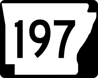
Arkansas Highway 197 is the designation for a state highway in the U.S. state of Arkansas. The route is split into three sections, all of which are located in western Arkansas. The first and longest section begins at AR 22 in Subiaco, and ends near Lake Dardanelle southwest of Tokalon. The second section begins at AR 22 in New Blaine, and ends just south of Shoal Bay. The third section begins at AR 10 in Booneville, and ends about 0.3 miles (0.48 km) south. All three signed highways are located within Logan County.

Arkansas Highway 200 is the designation for a state highway in the U.S. state of Arkansas. The route is split into two sections, both of which are in southwest Arkansas. The first section begins at US 278 and US 371 in Rosston and ends at AR 299 at the unincorporated community of Morris. The second section begins at US 371 on the west end of Prescott and ends at AR 19 on the north end of Prescott. Both sections are located entirely within Nevada county and are maintained by the Arkansas Department of Transportation (ARDOT).

Arkansas Highway 203 is the designation for a state highway in the U.S. state of Arkansas. The route is split into two sections, both of which are located in southern Arkansas. The first section begins at US 278 in Hampton, Arkansas and ends at AR 274 east of East Camden. The second section begins at US 79B in Bearden and ends at AR 9 south of Holly Springs. Both sections are maintained by the Arkansas Department of Transportation (ARDOT).


