
The Dominican Republic is a country located on the island of Hispaniola in the Greater Antilles archipelago of the Caribbean region. It occupies the eastern five-eighths of the island, which it shares with Haiti, making Hispaniola one of only two Caribbean islands, along with Saint Martin, that is shared by two sovereign states. The Dominican Republic is the second-largest nation in the Antilles by area at 48,671 square kilometers (18,792 sq mi), and third-largest by population, with approximately 10.8 million people, of whom approximately 3.3 million live in the metropolitan area of Santo Domingo, the capital city. The official language of the country is Spanish.

The Dominican Republic is a country in the West Indies that occupies the eastern five-eighths of Hispaniola. It has an area of 48,670 km2, including offshore islands. The land border shared with Haiti, which occupies the western three-eighths of the island, is 376 km long. The maximum length, east to west, is 390 km from Punta de Agua to Las Lajas, on the border with Haiti. The maximum width, north to south, is 265 km from Cape Isabela to Cape Beata. The capital, Santo Domingo, is located on the south coast.
Haiti, officially the Republic of Haiti, and formerly known as Hayti, is a country located on the island of Hispaniola in the Greater Antilles archipelago of the Caribbean Sea, to the east of Cuba and Jamaica and south of The Bahamas and the Turks and Caicos Islands. It occupies the western three-eighths of the island which it shares with the Dominican Republic. To its south-west lies the small island of Navassa Island, which is claimed by Haiti but is disputed as a United States territory under federal administration. Haiti is 27,750 square kilometers (10,714 sq mi) in size, the third largest country in the Caribbean by area, and has an estimated population of 11.4 million, making it the most populous country in the Caribbean.

The Republic of Haiti comprises the western three-eighths of the island of Hispaniola, west of the Dominican Republic. Haiti is positioned east of the neighboring island of Cuba, between the Caribbean Sea and the North Atlantic Ocean. Haiti's geographic coordinates are at a longitude of 72° 25′ west and a latitude of 19° 00′ north.

Artibonite is one of the ten departments of Haiti. With an area of 4,887 km2 it is Haiti's largest department. As of 2015, its estimated population was 1,727,524. The region is the country's main rice-growing area. The main cities are Gonaïves and Saint-Marc. In February 2004 an insurgency tried unsuccessfully to declare Artibonite's independence.
Centre is one of the ten departments of Haiti, located in the center of the country along the border with the Dominican Republic. As of 2015, its estimated population was 746,236. Its capital is Hinche. It borders the Dominican Republic to the east and is the only landlocked department in Haiti.

Elías Piña is a westernmost province which composing one of the 32 provinces of the Dominican Republic. It is divided into 6 municipalities and its capital city is Comendador. It is bordered by the provinces of Dajabón to the north-west, Santiago Rodríguez to the north-east, San Juan to the east, Independencia to the south and the Nord-Est department of Haiti to the west.
The Cibao, usually referred as "El Cibao", is a region of the Dominican Republic located at the northern part of the country. As of 2009 the Cibao has a population of 5,622,378 making it the most populous region in the country.

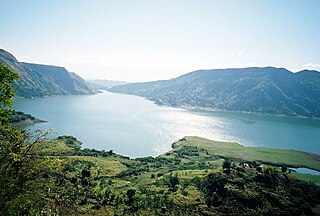
Lake Enriquillo is a hypersaline lake in the Dominican Republic located in the southwestern region of the country. Its waters are shared between the provinces of Bahoruco and Independencia, the latter of which borders Haiti. Lake Enriquillo is the largest lake in both the Dominican Republic and Hispaniola, as well as the entire Caribbean. It is also the lowest point for an island country.

Environmental issues in Haiti include a historical deforestation problem, overpopulation, a lack of sanitation, natural disasters, and food insecurity. The major reasons for these environmental issues are corruption and human exploitation, and the embezzlement of taxpayers' funds for personal gains. In addition, there is not sufficient protection or management of the country's natural resources. Other environmental issues, such as decreases in precipitation and more severe natural disasters, will likely arise in Haiti as a result of climate change. Experts agree that Haiti needs to adopt new policies to address both the issues that already exist and to prepare for the effects of climate change.

The Artibonite River is the longest river in Haiti, and the longest on the island of Hispaniola. It is also the second-longest river in the Caribbean, behind the Cauto River in Cuba. Forming part of the international border between Haiti and the Dominican Republic, the river's sources are in the Cordillera Central in the Dominican Republic (68 km); however, most of its length lies in Haiti (253 km).
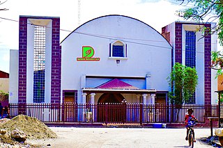
Desdunes(Haitian Creole: Dedin) is a commune that is part of the Dessalines Arrondissement in Haiti's Artibonite Department. It is located in the great Artibonite Plain, in the heart of the rice granary of Haiti. The population was 37,027 at the 2015 census. Rice production is the driving force of the local economy.
San Francisco de Bánica, or simply Bánica, is a municipality of the Elías Piña province, on the border with Haiti and near the Artibonite river. The name Bánica comes from the Taíno name of the region, Banique.
This article has been written in 2007, with partial updates in later years including most recently in May 2013. Please update it further. Please also see the French version of the article for further details.
The Péligre Dam is a gravity dam located off the Centre department on the Artibonite River of Haiti. At 72 m (236 ft) it is the tallest dam in Haiti. The dam was created as a flood-control and an energy-providing measure in the Artibonite River Valley during the 1950s, as part of the Artibonite Valley Agricultural Project. This dam impounds Lake Péligre.
The following outline is provided as an overview of and topical guide to Haiti:

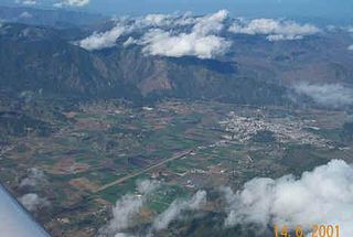
Saint-Michel-de-l'Attalaye is a commune in the Marmelade Arrondissement, in the Artibonite department of Haiti. It has 95,216 inhabitants. It is the second largest city geographically after Port-au-Prince, the national capital. Located in the Central Plateau, it is home to several large Christian churches including one which has been there for over 50 years. It is a scenic locale, surrounded by rich farmland, abundant water resources and distant mountain peaks in every direction. There are excellent schools which are privately funded and a current (2011) small residential development outside of the main town area which is near completion which was originally sponsored by the central government. There is a new joint venture nearing completion with a Taiwanese partner that plans to bring bamboo crafts and goods manufacturing skills training to the local people.
With surface water resources of 20 billion m3 (BCM) per year, of which 12 BCM are groundwater recharge, water resources in the Dominican Republic (DR) could be considered abundant. But irregular spatial and seasonal distribution, coupled with high consumption in irrigation and urban water supply, translates into water scarcity. Rapid economic growth and increased urbanization have also affected environmental quality and placed strains on the DR's water resources base. In addition, the DR is exposed to a number of natural hazards, such as hurricanes, storms, floods, Drought, earthquakes, and fires. Global climate change is expected to induce permanent climate shocks to the Caribbean region, which will likely affect the DR in the form of sea level rise, higher surface air and sea temperatures, extreme weather events, increased rainfall intensity and more frequent and more severe "El Niño-like" conditions.

The effects of Hurricane Georges in Haiti included about $200 million in damages and 209 fatalities. Georges impacted the country at Category 1 strength.

The Dominican Republic–Haiti border is the international boundary between the Dominican Republic (DR) and Haiti. The border is 376 km (234 mi) in length and divides the island of Hispaniola in two by the Treaty of Ryswick which was signed by the two former European colonial masters of the respective countries, France and Spain. In 1621, England made an unsuccessful attempt to take over both sides of the island. In the early 20th century, the United States occupied both countries, and made numerous changes to the border. The Dominican Republic comprises approximately the Eastern two-thirds of the island and Haiti the Western third.