
Scunthorpe is an industrial town in the North Lincolnshire district of Lincolnshire, England. It is Lincolnshire's third most populous settlement, after Lincoln and Grimsby, with a population of 81,286 in 2021.

Haddington is a hamlet in the civil parish of Aubourn with Haddington, in the North Kesteven district of Lincolnshire, England. It is situated just off the Fosse Way Roman road, now the A46, 7 miles (11 km) south-west from Lincoln and 1 mile (1.6 km) west from Aubourn. Haddington was formerly a township in the parishes of Aubourn and South Hyckham, in 1866 Haddington became a separate civil parish, on 1 April 1931 the parish was abolished to form "Aubourn, Haddington and South Hykeham". In 1921 the parish had a population of 94.

Althorpe is a small village and former civil parish, now in the parish of Keadby with Althorpe, in the North Lincolnshire district, in the ceremonial county of Lincolnshire, England. It is four miles (6 km) west of Scunthorpe and the same distance south-east of Crowle, on the A18 road.

Ashby Puerorum is a small village and former civil parish, now in the parish of Greetham with Somersby, in the East Lindsey district of Lincolnshire, England. The village situated 6 miles (10 km) north-west from Partney, 4 miles (6 km) east from Horncastle, to the north of the A158 road, and to the west of Bag Enderby. In 1931 the parish had a population of 97. On 1 April 1936 the parish was abolished and merged with Somersby.

Fulwell is an affluent area and former civil parish in the Sunderland district, in the county of Tyne and Wear, England. The parish was abolished in 1928 as a result of the Sunderland Corporation Act 1927, and the area incorporated into the former County Borough of Sunderland. It borders Seaburn, Southwick, Monkwearmouth, and Roker, and the district border between Sunderland and South Tyneside. Fulwell ward, including South Bents and Seaburn, is the least socially deprived of the city's 25 wards. Until 1974 it was in County Durham.

Bottesford is a town in North Lincolnshire, Lincolnshire, England.

Yaddlethorpe is a district in the south of Scunthorpe, in the North Lincolnshire district, in the ceremonial county of Lincolnshire, England. It is close to the M180 and next to Bottesford, divided by the A159 road. It is in the civil parish of Bottesford.
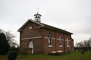
Keadby is a small village and former civil parish, now in the parish of Keadby with Althorpe, in the North Lincolnshire district, in the ceremonial county of Lincolnshire, England. It is situated just off the A18, west of Scunthorpe, and on the west bank of the River Trent. The civil parish of Keadby with Althorpe had a population at the 2011 census of 1,930.
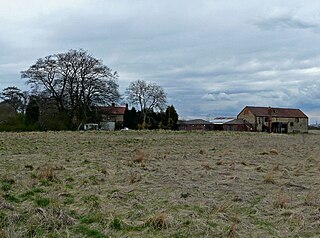
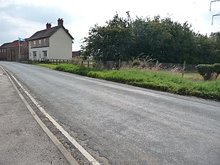
Holme is a linear settlement and former civil parish, now in the parish of Messingham, in the North Lincolnshire district, in the ceremonial county of Lincolnshire, England. The population of the civil parish at the 2011 census was 113.
Ousefleet is a small hamlet and former civil parish, now in the parish of Twin Rivers, in the East Riding of Yorkshire, England approximately 5 miles (8 km) east of Goole. It is located just south of the River Ouse and north of the A161 road between Goole and Scunthorpe. In 1961 the parish had a population of 167.
Leftwich is a village in Cheshire, England. It has been absorbed into the town of Northwich, and is situated within the unitary authority area of Cheshire West and Chester. The name, given as merely 'Wice' in the Domesday Book of 1086, is written 'Leftetewych' in a document of 1278 and derives from 'Leoftæt's wic'.

Garthorpe is a village in the North Lincolnshire, England. It is situated approximately 8 miles (13 km) south-east from Goole, 1 mile (1.6 km) west from the River Trent, and in the Isle of Axholme.

Newton is a suburb in the north-east of Chester, in the unitary authority of Cheshire West and Chester and the ceremonial county of Cheshire, England. Including the locale of Plas Newton, the area is contiguous with Upton to the north and Hoole to the south. The electoral ward involved had a population taken at the 2011 census of 9,556.
Whisby is a hamlet in the civil parish of Doddington and Whisby, in the North Kesteven district of Lincolnshire, England. It is situated 5 miles (8.0 km) south-west from Lincoln city centre, 1.5 miles (2.4 km) south from Doddington, and 2 miles (3.2 km) north from the A46 road.

Fockerby is a village in the civil parish of Garthorpe and Fockerby, in the North Lincolnshire district, in the ceremonial county of Lincolnshire, England. It is situated approximately 8 miles (13 km) south-east from Goole and 1 mile (1.6 km) west from the River Trent.

Keisby is a hamlet in the civil parish of Lenton, Keisby and Osgodby, in the South Kesteven district, in Lincolnshire, England. It is situated 6 miles (10 km) north-west from Bourne and 9 miles (14 km) south-east from Grantham. In 1921 the parish had a population of 72.

East Denton is an area in the city of Newcastle upon Tyne in the county of Tyne and Wear, England. Until 1974 it was in Northumberland.

Frodingham is a historic hamlet and now a suburb of Scunthorpe in the borough of North Lincolnshire, in Lincolnshire, England. The village lay directly to the south of Scunthorpe town centre, the name Frodingham is now often used to refer to the area directly to the north of the town centre.
Carrington is a village in the civil parish of Carrington and New Bolingbroke, in the East Lindsey district of Lincolnshire, England. It is situated approximately 7 miles (11 km) north from the market town of Boston.

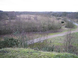
Crosby was a small hamlet which has grown into a suburb in the north of Scunthorpe, in the North Lincolnshire district, in the ceremonial county of Lincolnshire, England. Remnants of the old hamlet can be found in Old Crosby.

