Ashford, Alabama

Last updated

Ashford, Alabama
Houston County Alabama Incorporated and Unincorporated areas Ashford Highlighted 0102836.svg
Location of Ashford in Houston County, Alabama.
Coordinates: 31°11′2″N85°14′7″W / 31.18389°N 85.23528°W / 31.18389; -85.23528
Country United States
State Alabama
County Houston
Area
[1]
  Total6.22 sq mi (16.12 km2)
  Land6.20 sq mi (16.06 km2)
  Water0.02 sq mi (0.06 km2)
Elevation
279 ft (85 m)
Population
 (2020)
  Total2,246
  Density362.14/sq mi (139.81/km2)
Time zone UTC-6 (Central (CST))
  Summer (DST) UTC-5 (CDT)
ZIP code
36312
Area code 334
FIPS code 01-02836
GNIS feature ID0113251
Website www.cityofashford.com

Ashford is a town [2] in Houston County, Alabama, United States. It is part of the Dothan, Alabama Metropolitan Statistical Area. The town was incorporated in June 1891. [3] For most of its history, it was a center for naval stores production, pulpwood harvesting, and cotton agriculture. The population was 2,148 at the 2010 census, [4] up from 1,853 at the 2000 census.

Contents

Geography

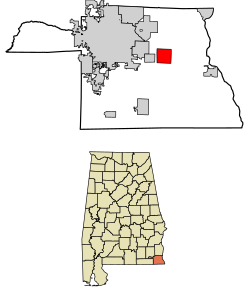
Ashford is located slightly northeast of the center of Houston County at 31°11′3″N85°14′7″W / 31.18417°N 85.23528°W / 31.18417; -85.23528 (31.184032, -85.235286). [5] U.S. Route 84 passes through the southern part of the town, leading west 9 miles (14 km) to Dothan and southeast 24 miles (39 km) to Donalsonville, Georgia. The Chattahoochee River, which forms the Georgia state line, is 12 miles (19 km) southeast of Ashford on US 84.

According to the United States Census Bureau, the town has a total area of 6.3 square miles (16.4 km2), of which 0.02 square miles (0.06 km2), or 0.34%, are water. [4]

History

Ashford Depot 1920's Ashford-depot.jpg
Ashford Depot 1920's

In March 1888, the Alabama Midland Railway built a small depot of Victorian railroad architecture in Ashford to be a waystation along the Bainbridge-to-Montgomery route. The depot was the only building to survive the 1915 fire that destroyed the rest of the town. The original depot received additions at least twice—an enclosed warehouse and open loading dock were added to the east, followed by racially segregated passenger waiting rooms on the west side. The depot faced two sidings that served for loading turpentine from the Adams Company still one block away, and pulpwood. Cotton bales, fertilizer, and a single sweet potato crop were loaded from both sidings.

Old Planters Cotton Warehouse 1930's 8c10277r.jpg
Old Planters Cotton Warehouse 1930's

The depot changed hands as railroads consolidated. The Alabama Midland was absorbed by the Atlantic Coast Line, which merged in the 1980s with the Seaboard Air Line to form the Seaboard Coast Line. CSX Transportation later bought the Seaboard Coast Line. Ashford Depot had fallen into disrepair after it closed in 1978. In the 1980s, concerned citizens founded a preservation committee, led by Jimmy Burgess, and received a grant to add a new roof to the building. This committee also placed the depot on the Alabama Register of Historical Places. It remained active into the 1990s. Former Mayor Bryan Alloway revived the depot preservation committee after his 2000 election. This committee planned to incorporate and seek tax-exempt status in 2005. It received two US Department of Transportation grants ($850,000), two Alabama Department of Economic and Community Affairs grants ($290,000), and one Alabama Resource Conservation & Development (RC&D) grant ($7500) to thoroughly renovate the depot. Construction began in fall 2004. The committee and Ashford City officials held a ribbon-cutting ceremony on November 17, 2005, to mark the end of Phase I of the reconstruction. Now the depot can be used for reunions, birthdays, and social events that the city might sponsor.

On October 10, 2018, Hurricane Michael's western eye wall passed thru the City of Ashford causing major damage and left 100% of the city without power. No injuries or fatalities were associated with the storm.

Government

Mayor Carol Barfield. Her tenure started January 1, 2018. Carol Barfield 2019.jpg
Mayor Carol Barfield. Her tenure started January 1, 2018.

The current mayor is Carole Barfield, and City Council members are Place 1 - John Wayne Massey, Place 2 - Ronnie L. Whitehead, Place 3 - Jash Johnson, Place 4 - Blake Rosenkoetter, Place 5 - James Edward Smith. The City Clerk is Janet Rumley.

The police chief is Malvin Anderson, who supervises four full-time police officers; the fire chief is Jimmy Posey. The fire department and rescue squad are all volunteers.

The City of Ashford's website is City of Ashford, Official Website

Previous mayors of the City of Ashford: Jonathon Grecu, Rusty Burgess, Bryan Alloway

2020 Election:

Mayor - Carole Barfield 257 votes (57%) Gary Gibson 194 votes (43%)

Place 1 - John Wayne Massey (unopposed)

Place 2 - Ronnie L. Whitehead 257 votes (58%) Benji McWaters 186 (42%)

Place 3 - Josh Johnson replaced Alan Anderson. Mr. Anderson resigned in 2022.

Place 4 - Blake Rosenkoetter 258 votes (59%) Terry A. Smith 176 votes (41%)

Place 5 - James Edward Smith 213 votes (50%) Richard Bolden 145 votes (34%) Jimmy R. Weems 65 votes (15%)

Education

Ashford Elementary School AES Sign.png
Ashford Elementary School
Ashford High School AHS Sign.jpg
Ashford High School

Ashford schools are part of the Houston County Board of Education. Ashford has one elementary school for grades K-5 and a high school for grades 6-12. The schools mascot is known as the yellow jackets named Buzz. The current principal of Ashford Elementary School is Sharon LeRoy and the principal of Ashford High School is Dr. Donnie Chambers.

2019 Ashford High School Band at the 2019 Alabama State High School Marching Band Championships 2019 Ashford High School Band.jpg
2019 Ashford High School Band at the 2019 Alabama State High School Marching Band Championships

Ashford Academy was once a private school that closed its doors at the end of the 2014–2015 school year.

Recreation

The City of Ashford offers recreation activities throughout the year, including baseball, softball, soccer, and basketball. Football and cheerleading is organized through the Ashford Youth Sports Association. The recreation ball fields are located behind Ashford High School on 8th Avenue. The recreation park includes T-Ball, softball, and baseball fields. Basketball is played at Watermark Church of Ashford. In 2015, Ashford hosted the 2015 Alabama State Class "A" Baseball Tournament. In 2021, the Ashford recreation boys 8u all-star team won the state championship in Tuscaloosa, Alabama, and then went on to Laurel, Mississippi to play in the 2021 Dixie Youth World Series where they finished 3rd in the class AA division.

Demographics

Town of Ashford

Historical population
CensusPop.Note
1900 286
1910 47967.5%
1920 75457.4%
1930 92022.0%
1940 1,22433.0%
1950 1,40014.4%
1960 1,5117.9%
1970 1,98031.0%
1980 2,1659.3%
1990 1,926−11.0%
2000 1,853−3.8%
2010 2,14815.9%
2020 2,2464.6%
U.S. Decennial Census [6]

Ashford first appeared on the 1900 U.S. Census as an incorporated town, then in Henry County. [7] In 1903, Ashford was shifted into the new county of Houston. See also Ashford Precinct below.

2000 Census data

As of the census [8] of 2000, there were 1,853 people, 763 households, and 527 families residing in the city. The population density was 303.9 inhabitants per square mile (117.3/km2). There were 877 housing units at an average density of 143.8 per square mile (55.5/km2). The racial makeup of the city was 71.45% White, 27.52% Black or African American, 0.70% Native American, 0.05% Asian, and 0.27% from two or more races. 1.51% of the population were Hispanic or Latino of any race.

There were 763 households, out of which 30.1% had children under the age of 18 living with them, 52.3% were married couples living together, 14.0% had a female householder with no husband present, and 30.9% were non-families. 29.0% of all households were made up of individuals, and 16.8% had someone living alone who was 65 years of age or older. The average household size was 2.43 and the average family size was 2.99.

In the city the population was spread out, with 25.1% under the age of 18, 7.1% from 18 to 24, 26.2% from 25 to 44, 24.2% from 45 to 64, and 17.4% who were 65 years of age or older. The median age was 39 years. For every 100 females, there were 83.5 males. For every 100 females age 18 and over, there were 76.8 males.

The median income for a household in the city was $29,444, and the median income for a family was $40,313. Males had a median income of $30,167 versus $22,286 for females. The per capita income for the city was $15,135. About 11.3% of families and 16.9% of the population were below the poverty line, including 18.5% of those under age 18 and 27.7% of those age 65 or over.

2010 census

As of the census [9] of 2010, there were 2,148 people, 867 households, and 623 families residing in the city. The population density was 352.1 inhabitants per square mile (135.9/km2). There were 1,004 housing units at an average density of 164.6 per square mile (63.6/km2). The racial makeup of the city was 79.0% White, 19.5% Black or African American, 0.2% Native American, 0.2% Asian, and 0.7% from two or more races. .8% of the population were Hispanic or Latino of any race.

There were 867 households, out of which 27.8% had children under the age of 18 living with them, 51.6% were married couples living together, 14.4% had a female householder with no husband present, and 28.1% were non-families. 24.8% of all households were made up of individuals, and 13.3% had someone living alone who was 65 years of age or older. The average household size was 2.48 and the average family size was 2.94.

In the city the population was spread out, with 23.7% under the age of 18, 9.0% from 18 to 24, 21.7% from 25 to 44, 28.2% from 45 to 64, and 17.4% who were 65 years of age or older. The median age was 41.2 years. For every 100 females, there were 91.1 males. For every 100 females age 18 and over, there were 94.0 males.

The median income for a household in the city was $35,709, and the median income for a family was $55,833. Males had a median income of $38,654 versus $27,143 for females. The per capita income for the city was $21,444. About 9.1% of families and 14.3% of the population were below the poverty line, including 21.5% of those under age 18 and 15.5% of those age 65 or over.

2020 census

Ashford racial composition [10]
RaceNum.Perc.
White (non-Hispanic)1,64673.29%
Black or African American (non-Hispanic)45820.39%
Native American 100.45%
Asian 60.27%
Pacific Islander 10.04%
Other/Mixed 873.87%
Hispanic or Latino 381.69%

As of the 2020 United States census, there were 2,246 people, 865 households, and 635 families residing in the town.

Ashford Precinct/Division (1900-70)

Historical population
CensusPop.Note
1900 1,521
1910 1,83720.8%
1920 2,26623.4%
1930 2,4257.0%
1940 2,5294.3%
1950 2,6053.0%
1960 4,60776.9%
1970 4,7693.5%
U.S. Decennial Census [6]

Ashford Precinct was first created in 1900, then as the 19th precinct of Henry County. In 1903, Ashford was shifted into the new county of Houston and its precinct was renumbered the 10th. [11] In 1960, it was reorganized into a census division. [12] In 1980, the Ashford Census Division was merged into the Dothan Census Division. [13]

Notable person

Related Research Articles

<span class="mw-page-title-main">Dale County, Alabama</span> County in Alabama, United States

Dale County is a county located in the southeastern part of the U.S. state of Alabama. As of the 2020 census the population was 49,326. Its county seat and largest city is Ozark. Its name is in honor of General Samuel Dale.

<span class="mw-page-title-main">Geneva County, Alabama</span> County in Alabama, United States

Geneva County is a county located in the southeastern part of the U.S. state of Alabama. As of the 2020 census, the population was 26,659. Its county seat is Geneva. The county was named after its county seat, which in turn was named after Geneva, New York which was named after Geneva, Switzerland, by Walter H. Yonge, an early town resident and Swiss native. Geneva County is a dry county. However, beer and wine are sold in the city limits of Geneva, Samson, Slocomb, and most recently in Hartford, after residents voted to become wet in a 2022 election.

<span class="mw-page-title-main">Houston County, Alabama</span> County in Alabama, United States

Houston County is a county located in the southeastern corner of the U.S. state of Alabama. As of the 2020 census the population was 107,202. Its county seat is Dothan, which is located on the border and partially in adjacent Henry County.

<span class="mw-page-title-main">Grimes, Alabama</span> Town in Alabama, United States

Grimes is a town in Dale County, Alabama, United States. At the 2010 census the population was 558, up from 459 in 2000. It is part of the Enterprise–Ozark Micropolitan Statistical Area.

<span class="mw-page-title-main">Midland City, Alabama</span> Town in Alabama, United States

Midland City is a town in Dale County, Alabama, United States. At the 2010 U.S. Census the population was 2,344. It incorporated in 1890. It is part of the Ozark Micropolitan Statistical Area.

<span class="mw-page-title-main">Napier Field, Alabama</span> Town in Alabama, United States

Napier Field is a town in Dale County, Alabama. At the 2020 census, the population was 409. It is part of the Ozark micropolitan statistical area. The town was originally constructed as a military air base during the Second World War. It is currently adjacent to Dothan Regional Airport. While the airport itself lies within Dothan's city limits, the adjacent housing units and other buildings constitute the incorporated town of Napier Field.

<span class="mw-page-title-main">Ozark, Alabama</span> City in Alabama, United States

Ozark is a city in and the county seat of Dale County, Alabama. As of the 2010 census, the population of the city was 14,907.

<span class="mw-page-title-main">Hartford, Alabama</span> City in Alabama, United States

Hartford is a city in Geneva County, Alabama, United States. It incorporated in 1896. It is part of the Dothan, Alabama Metropolitan Statistical Area. At the 2020 census, the population was 2,651, an increase over the figure of 2,624 tabulated in 2010.

<span class="mw-page-title-main">Taylor, Alabama</span> Town in Alabama, United States

Taylor is a town in Geneva and Houston counties in the U.S. state of Alabama. Taylor was first settled in the 1870s, named after an early family that helped secure the first post office. It was not incorporated until almost a century later in June 1967. It is part of the Dothan, Alabama Metropolitan Statistical Area. At the 2010 census the population was 2,375, up from 1,898 in 2000.

<span class="mw-page-title-main">Abbeville, Alabama</span> City in and county seat of Henry County, Alabama

Abbeville is a city in and the county seat of Henry County, in the southeast part of Alabama, United States. It is part of the Dothan, Alabama Metropolitan Statistical Area. At the 2020 census, the population was 2,358.

<span class="mw-page-title-main">Headland, Alabama</span> City in Alabama, United States

Headland is the largest city in Henry County, Alabama, United States. It is part of the Dothan metropolitan area. In 2020, the population was 4,973, up from 4,510 in the 2010 census. Ray Marler is the current mayor.

<span class="mw-page-title-main">Avon, Alabama</span> Town in Alabama, United States

Avon is a town in Houston County, Alabama, United States. It incorporated in January 1957. It is part of the Dothan, Alabama Metropolitan Statistical Area. As of the 2010 census, the population of the town was 543, its highest to date, up from 466 in 2000.

<span class="mw-page-title-main">Cottonwood, Alabama</span> Town in Alabama, United States

Cottonwood is a town in Houston County, Alabama, United States. One source said the town incorporated in 1901, although the 1910 U.S. Census stated 1903. It is part of the Dothan, Alabama Metropolitan Statistical Area. At the 2010 census the population was 1,289, up from 1,170 in 2000.

<span class="mw-page-title-main">Cowarts, Alabama</span> Town in Alabama, United States

Cowarts is a town in Houston County, Alabama, United States. The town incorporated in August 1961. It is part of the Dothan, Alabama Metropolitan Statistical Area. At the 2010 census the population was 1,871, up from 1,546 in 2000.

<span class="mw-page-title-main">Gordon, Alabama</span> Town in Alabama, United States

Gordon is a town in Houston County, Alabama, United States. It was incorporated in February 1872. It is part of the Dothan, Alabama Metropolitan Statistical Area. At the 2010 census the population was 332, down from 408 in 2000.

<span class="mw-page-title-main">Kinsey, Alabama</span> Town in the United States

Kinsey is a town in Houston County, Alabama, United States. It was initially located and incorporated in Henry County in February 1893. In 1903, it was redrawn into newly created Houston County and was later reincorporated in August 1957. It is part of the Dothan, Alabama Metropolitan Statistical Area. At the 2010 census the population was 2,198, up from 1,796 in 2000.

<span class="mw-page-title-main">Rehobeth, Alabama</span> Town of the State of Alabama in the United States

Rehobeth is a town in Houston County, Alabama, United States. Rehobeth, originally named Sanders, began as a crossroads community in the 1890s; however, it was not until 1996, that the town was incorporated. Rehobeth is part of the Dothan Metropolitan Statistical Area. At the time of the 2010 census, the population was 1,297, up from 993 at the 2000 census.

<span class="mw-page-title-main">Webb, Alabama</span> Town in Alabama, United States

Webb is a town in Houston County, Alabama, United States. It is named for plantation owner B. F. Webb, who settled in the area around 1890. The town was incorporated in 1903. It is part of the Dothan, Alabama Metropolitan Statistical Area. As of the 2010 census, the population was 1,430, up from 1,298 in 2000.

<span class="mw-page-title-main">Stevenson, Alabama</span> City in Alabama, United States

Stevenson is a city in Jackson County, Alabama, United States, and is included in the Chattanooga-Cleveland-Dalton, TN-GA-AL Combined Statistical Area. Sources listed either 1866 or 1867 as the year of incorporation, but that seems to conflict with the dates given for the town being granted a charter. It did not first appear on the U.S. Census until 1880, where it was the second largest town in Jackson County behind Scottsboro. Since 1900, it has been the third largest town behind either Scottsboro and Bridgeport or vice versa. At the 2020 census, the population of the city was 1,955, down from 2,046 in 2010.

<span class="mw-page-title-main">Brundidge, Alabama</span> City in Alabama, United States

Brundidge is the second-largest city in Pike County, Alabama, United States. The population was 2,076 at the 2010 census, down from 2,341 in 2000.

References

  1. "2020 U.S. Gazetteer Files". United States Census Bureau. Retrieved October 29, 2021.
  2. "U.S. Census change list". Archived from the original on August 6, 2010.
  3. "Ashford". Encyclopedia of Alabama.
  4. 1 2 "Geographic Identifiers: 2010 Demographic Profile Data (G001): Ashford town, Alabama". American Factfinder. U.S. Census Bureau. Retrieved April 12, 2017.[ dead link ]
  5. "US Gazetteer files: 2010, 2000, and 1990". United States Census Bureau. February 12, 2011. Retrieved April 23, 2011.
  6. 1 2 "U.S. Decennial Census". Census.gov. Retrieved June 6, 2013.
  7. "Statistics of Population - Minor Civil Divisions - Alabama" (PDF). United States Census Bureau. 1900. pp. 54–63.
  8. "U.S. Census website". United States Census Bureau . Retrieved January 31, 2008.
  9. "U.S. Census website". United States Census Bureau . Retrieved July 25, 2015.
  10. "Explore Census Data". data.census.gov. Retrieved December 17, 2021.
  11. "Supplement for Alabama - Population, Agriculture, Manufactures, Mines and Quarries" (PDF). United States Census Bureau. 1910.
  12. "Number of Inhabitants - Alabama" (PDF). United States Census Bureau. 1960.
  13. Bureau of the Census (April 1982). "1980 Census Characteristics of the Population - Number of Inhabitants - Alabama" (PDF).

31°11′03″N85°14′07″W / 31.184032°N 85.235286°W / 31.184032; -85.235286