Ashland, Montana

Last updated
Ashland, Montana
CDP
Rosebud County Montana Incorporated and Unincorporated areas Ashland Highlighted.svg
Location of Ashland, Montana
Coordinates: 45°35′40″N106°16′15″W / 45.59444°N 106.27083°W / 45.59444; -106.27083
Country United States
State Montana
County Rosebud
Area
[1]
  Total20.67 sq mi (53.54 km2)
  Land20.67 sq mi (53.54 km2)
  Water0.00 sq mi (0.00 km2)
Elevation
[2]
2,920 ft (890 m)
Population
 (2020)
  Total773
  Density37.40/sq mi (14.44/km2)
Time zone UTC-7 (Mountain (MST))
  Summer (DST) UTC-6 (MDT)
ZIP codes
59003-59004
Area code 406
FIPS code 30-02800
GNIS feature ID0802003 [2]

Ashland is a census-designated place (CDP) in Rosebud County, Montana, United States. The population was 464 at the 2000 census. Ashland is immediately east of the boundary of the Northern Cheyenne Indian Reservation and also along the Tongue River. It is the location of the St. Labre Indian Catholic High School, established in 1884 as a boarding school by a Catholic mission to the Cheyenne. [3]

Contents

The town was established in 1881 and called Straders after the first postmaster. [4] The name was changed to Ashland in 1886. [5]

Geography

According to the United States Census Bureau, the CDP has a total area of 7.6 square miles (20 km2), all land.

Ashland had the original supervisor office for the Custer National Forest. [6] There remains an Ashland Ranger District. The 436,000 acre Ashland Ranger District contains the largest contiguous block of land in Federal ownership in eastern Montana and has one of the largest grazing programs in the nation. [6]

This area is also rich in coal and wildlife. Some oil and gas activity has taken place, but no producing wells have been found to date.[ citation needed ]

The area offers a variety of topography, varying from rolling grasslands to steep rock outcrops. Vegetation varies from prairie to dense stands of ponderosa pine.

Climate

According to the Köppen Climate Classification system, Ashland has a semi-arid climate, abbreviated "BSk" on climate maps. [7]

Demographics

Historical population
CensusPop.Note
2020 773
U.S. Decennial Census [8]

As of the census [9] of 2000, there were 464 people, 151 households, and 104 families residing in the CDP. The population density was 61.4 inhabitants per square mile (23.7/km2). There were 170 housing units at an average density of 22.5 per square mile (8.7/km2). The racial makeup of the CDP was 21.55% White, 75.22% American Indian, 0.22% Asian, and 3.02% from two or more races. Hispanic or Latino of any race were 1.94% of the population.

There were 151 households, out of which 49.0% had children under the age of 18 living with them, 37.7% were married couples living together, 21.9% had a female householder with no husband present, and 30.5% were non-families. 25.8% of all households were made up of individuals, and 2.6% had someone living alone who was 65 years of age or older. The average household size was 3.07 and the average family size was 3.60.

In the CDP, the population was spread out, with 40.9% under the age of 18, 10.8% from 18 to 24, 30.0% from 25 to 44, 15.5% from 45 to 64, and 2.8% who were 65 years of age or older. The median age was 24 years. For every 100 females there were 93.3 males. For every 100 females age 18 and over, there were 87.7 males.

The median income for a household in the CDP was $22,222, and the median income for a family was $24,167. Males had a median income of $24,688 versus $19,000 for females. The per capita income for the CDP was $9,577. About 30.4% of families and 34.7% of the population were below the poverty line, including 41.1% of those under age 18 and none of those age 65 or over.

Education

St. Labre Indian Catholic High School St. Labre Catholic School is home of the Braves and Lady Braves. [10] Grades are Pre-K Through 12. The school has been established for almost 129 years now. St. Labre is in the 3-B district along with Lame Deer, Lodge Grass, Colstrip, Forsyth and Baker. The School is particularly known for their Boys and Girls Basketball team the Braves and Lady Braves.

Ashland Public School. Grades include K-8.

Media

The Forsyth-based Independent Press covers news for all of Rosebud County, which includes Ashland. [11]

Economy

Emerging industries

As reported in the May 12, 2022, issue of Independent Press, [12] a newspaper serving Rosebud County, officials made a visit to the site in Ashland for a planned factory that will make latex gloves. The Northern Cheyenne Tribe is backing the project. The factory expected be operational in 18 months, and employ up to 100 workers.[ citation needed ]

Related Research Articles

<span class="mw-page-title-main">Rosebud County, Montana</span> County in Montana, United States

Rosebud County is a county in the state of Montana. It was established February 11, 1901, and has Montana vehicle license plate prefix 29. As of the 2020 census, the population was 8,329. Its county seat is Forsyth.

<span class="mw-page-title-main">Big Horn County, Montana</span> County in Montana, United States

Big Horn County is a county located in the U.S. state of Montana. As of the 2020 census, the population was 13,124. The county seat is Hardin. The county, like the river and the mountain range, is named after the bighorn sheep in the Rocky Mountains. The county was founded in 1913. It is located on the south line of the state.

<span class="mw-page-title-main">Busby, Montana</span> Census-designated place in Big Horn County, Montana, United States

Busby is a census-designated place (CDP) in Big Horn County, Montana, United States. It is on the Northern Cheyenne reservation. The population was 745 at the 2010 census.

<span class="mw-page-title-main">Muddy, Montana</span> Census-designated place in Montana, United States

Muddy or Heóvonėheo'hé'e is a census-designated place (CDP) in Big Horn County, Montana, United States and home to the Heóvonėheo'hé'etaneo'o or Heóvonêheo'he'é-taneno Cheyenne people. The population was 617 at the 2010 census.

<span class="mw-page-title-main">Wyola, Montana</span> Census-designated place in Montana, United States

Wyola is a census-designated place (CDP) in Big Horn County, Montana, United States. The population was 215 at the 2010 census. 79% of the residents are Native American, and the majority are members of the Crow Nation.

<span class="mw-page-title-main">Hays, Montana</span> Census-designated place in Montana, United States

Hays is a census-designated place (CDP) in Blaine County, Montana, United States. The population was 843 at the 2010 census. The community lies within the Fort Belknap Indian Reservation, near the reservation's southern end. The nearby community of Lodge Pole lies to the east.

<span class="mw-page-title-main">De Borgia, Montana</span> CDP in Montana, United States

De Borgia is a census-designated place (CDP) in Mineral County, Montana, United States. The population was 69 at the 2000 census.

<span class="mw-page-title-main">Birney, Montana</span> Census-designated place in Montana, United States

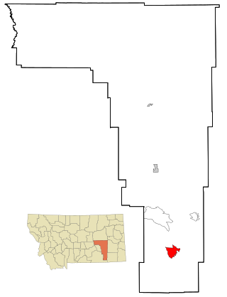
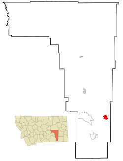
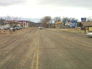
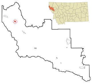
Birney is a census-designated place (CDP) in Rosebud County, Montana, United States. The population was 108 at the 2000 census.

<span class="mw-page-title-main">Colstrip, Montana</span> City in Montana, United States

Colstrip is a city in Rosebud County, Montana, United States. The population was 2,096 at the 2020 census.

<span class="mw-page-title-main">Forsyth, Montana</span> City in Montana, United States

Forsyth is a city in and the county seat of Rosebud County, Montana, United States. The population was 1,647 at the 2020 census. Forsyth was established in 1876 as the first settlement on the Yellowstone River, and in 1882 residents named the town after General James William Forsyth who commanded Fort Maginnis, Montana during the Indian Wars and the 7th Cavalry at the Wounded Knee Massacre. The town has long been a transportation nexus, starting with steamboats on the river and progressing to the Northern Pacific Railway and Interstate 94.

<span class="mw-page-title-main">Lame Deer, Montana</span> CDP in Montana, United States

Lame Deer is a census-designated place (CDP) in Rosebud County, Montana, United States. The community is named after Miniconjou Lakota chief Lame Deer, who was killed by the U.S. Army in 1877 under a flag of truce south of the town. It was the site of a trading post from the late 1870s.

<span class="mw-page-title-main">Noxon, Montana</span> CDP in Montana, United States

Noxon is a census-designated place (CDP) in Sanders County, Montana, United States. The population of the whole CDP was 255 at the 2020 census.

<span class="mw-page-title-main">Absarokee, Montana</span> CDP in Montana, United States

Absarokee is a census-designated place (CDP) in Stillwater County, Montana, United States, approximately 14 miles (23 km) south of Columbus on Highway 78. It is named after the Crow Indians who formerly inhabited the land. The population was 1,234 at the 2000 census. The Stillwater Mine, operated by the Stillwater Mining Company, is located near Absarokee.

<span class="mw-page-title-main">Pablo, Montana</span> Census-designated place in Montana, United States

Pablo is a census-designated place (CDP) in Lake County, Montana, United States. The population was 2,254 at the 2010 census, up from 1,814 in 2000. It is the home of Salish Kootenai College and the seat of government of the Flathead Indian Reservation.

<span class="mw-page-title-main">Porcupine, South Dakota</span> CDP in South Dakota, United States

Porcupine is a census-designated place (CDP) in Oglala Lakota County, South Dakota, United States. The population was 925 at the 2020 census.

<span class="mw-page-title-main">Rosebud, South Dakota</span> CDP in South Dakota, United States

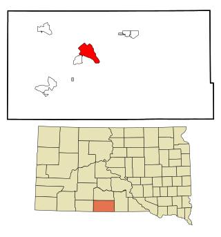
Rosebud also Sicanġu is a census-designated place (CDP) in Todd County, South Dakota, United States. The population was 1,455 at the 2020 census.

<span class="mw-page-title-main">Odanah, Wisconsin</span> Census-designated place in Wisconsin, United States

Odanah is an unincorporated community and census-designated place (CDP) in Ashland County, Wisconsin, in the town of Sanborn, United States, on the banks of the Bad River. The population was 47 at the 2020 census.

<span class="mw-page-title-main">Arapahoe, Wyoming</span> Census-designated place in Wyoming, United States

Arapahoe is a census-designated place (CDP) in Fremont County, Wyoming, United States. The population was 1,656 at the 2010 census. A Catholic mission was founded here in 1884. St Stephen's Mission Church, located near Arapahoe, is part of the Catholic mission.

<span class="mw-page-title-main">Northern Cheyenne Indian Reservation</span> Indian Reservation in Montana, United States

The Northern Cheyenne Tribe of the Northern Cheyenne Indian Reservation is the federally recognized Northern Cheyenne tribe. Located in southeastern Montana, the reservation is approximately 690 square miles (1,800 km2) in size and home to approximately 6,000 Cheyenne people. The tribal and government headquarters are located in Lame Deer, also the home of the annual Northern Cheyenne pow wow.

St. Labre Indian Catholic High School is a private, Roman Catholic high school in Ashland, Montana. It is located within the Roman Catholic Diocese of Great Falls-Billings and serves students from Crow and Northern Cheyenne tribes.

References

  1. "ArcGIS REST Services Directory". United States Census Bureau. Retrieved September 5, 2022.
  2. 1 2 U.S. Geological Survey Geographic Names Information System: Ashland, Montana
  3. Page 90, We, the Northern Cheyenne People: our land, our history, our culture (2008), Ambler, Marjane; Little Bear, Richard E; Wilson, Dave; Tall Bull, Linwood; Hantz, Joan; Ward, Carol; Wertman, Bill; Chief Dull Knife College, Lame Deer, Montana
  4. "Montana Place Names Companion". Montana Historical Society. Retrieved 20 June 2017.
  5. Carkeek Cheney, Roberta (1983). Names on the Face of Montana. Missoula, Montana: Mountain Press Publishing Company. p. 9. ISBN   0-87842-150-5.
  6. 1 2 "Ashland RD". USDA. Retrieved 19 June 2017.
  7. Climate Summary for Ashland, Montana
  8. "Census of Population and Housing". Census.gov. Retrieved June 4, 2016.
  9. "U.S. Census website". United States Census Bureau . Retrieved 2008-01-31.
  10. "Member Schools". Montana High School Association. Retrieved 19 April 2021.
  11. "Home page". Independent Press. Retrieved 22 September 2023.
  12. Ash, Pamela. "Site Visit - Company, tribal officials planning latex glove factory in Ashland". Independent Press. Retrieved 26 May 2022.