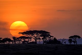
The Serengeti ecosystem is a geographical region in Africa, spanning the Mara and Arusha Regions of Tanzania. The protected area within the region includes approximately 30,000 km2 (12,000 sq mi) of land, including the Serengeti National Park and several game reserves. The Serengeti hosts the second largest terrestrial mammal migration in the world, which helps secure it as one of the Seven Natural Wonders of Africa, and as one of the ten natural travel wonders of the world.

Protected areas of South Australia consists of protected areas located within South Australia and its immediate onshore waters and which are managed by South Australian Government agencies. As of March 2018, South Australia contains 359 separate protected areas declared under the National Parks and Wildlife Act 1972, the Crown Land Management Act 2009 and the Wilderness Protection Act 1992 which have a total land area of 211,387.48 km2 (81,617.16 sq mi) or 21.5% of the state's area.
Hacks Lagoon Conservation Park is a protected area in the Australian state of South Australia located in the locality of Bool Lagoon about 24 kilometres south of the municipal seat of Naracoorte.

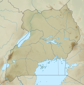
Queen Elizabeth National Park is a national park in Uganda.
Kidepo Valley National Park is a 1,442 square kilometres (557 sq mi) national park in the Karamoja region in northeast Uganda. Kidepo is rugged savannah, dominated by the 2,750 metres (9,020 ft) Mount Morungole and transected by the Kidepo and Narus rivers.

Lake Mburo National Park is a national park located in Nyabushozi County, Kiruhura District near Mbarara in Uganda.

The Timbavati Private Nature Reserve is located at the border line between Hoedspruit and Acornhoek, north of the Sabi Sand Private Game Reserve on the western edge of Kruger National Park. Geographically and politically, Timbavati is located in Mpumalanga Province. In Xitsonga, the name 'Timbavati' means "the place where something sacred came down to Earth from the Heavens", and refers to the rare white lions of Timbavati.
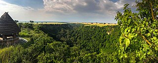
Kyambura Game Reserve or Chambura Game Reserve, which includes the Kyambura Gorge, adjoins the Queen Elizabeth National Park in Uganda. It is home to a variety of wildlife. The area is an important water source for many animals and is surrounded by savanna, but is generally noted for its high concentration of primate life located in the gorge.
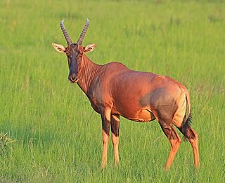
Damaliscus lunatus jimela is a subspecies of topi, and is usually just called a topi. It is a highly social and fast type of antelope found in the savannas, semi-deserts, and floodplains of sub-Saharan Africa.
The Katonga Wildlife Reserve is a wildlife reserve in western Uganda, along the banks of the Katonga River. The reserve was established in 1998 and has approximately 211 square kilometres (81 sq mi). Many of the species of plants and animals in the reserve are unique to its wetland environment.
The Kabwoya Wildlife Reserve is a reserve in Uganda. It was established in 1980, and covers 87.00 km².
The Pian Upe Wildlife Reserve is a conservation area in the Karamoja subregion of northeastern Uganda. It is the second largest conservation protected area in Uganda.

The Imatong Mountains are mainly located in Eastern Equatoria in southeastern South Sudan, and extend into the Northern Region of Uganda. Mount Kinyeti is the highest mountain of the range at 3,187 metres (10,456 ft), and the highest point of South Sudan.

The wildlife of South Sudan refers to the natural flora and fauna of South Sudan. South Sudan includes the Sudd, one of the world's largest wetlands. According to the American biologist and conservationist, J. Michael Fay, South Sudan "could present the biggest migration of large mammals on earth", while Wildlife Conservation Society (WCS) reports southeast Sudan has a migration of 1.3 million antelopes. The region has a low density human population, with approximately 7 million people spread over approximately 619,745 km2 (239,285 sq mi).
The Ajai Wildlife Reserve is a small conservation protected area in northeastern Uganda dominated by a large island surrounded by seasonally flooded swamps and wooded savanna.

The Semliki Wildlife Reserve is a conservation protected area in the Western Region of Uganda with headquarters at Karugutu in Ntoroko District.
Moorook Game Reserve is a protected area in the Australian state of South Australia covering the floodplain on the south side of the River Murray in the localities of Kingston-on-Murray and Moorook immediately south of the section of the Sturt Highway that passes between the towns of Kingston-on-Murray in the west and Cobdogla in the east. It is located about 180 kilometres east north-east of the state capital of Adelaide.
Poocher Swamp Game Reserve is a protected area in the Australian state of South Australia located about 240 kilometres south-east of the state capital of Adelaide and about 8 kilometres west of the municipal seat of Bordertown in the locality of Cannawigara.