
Aughinish is a small island and townland located in Oughtmama Parish of the Barony of Burren in north County Clare, in Ireland on the south shore of Galway Bay. By road it is 10.9 kilometres (6.8 mi) northwest of Kinvarra. The island is approximately two miles (3 km) wide and a mile (1.6 km) from the northernmost tip to the southernmost point and has approximately fifty inhabitants.

Knappogue Castle is a tower house, built in 1467 and expanded in the mid-19th century, located in the parish of Quin, County Clare, Ireland. It has been restored and is open to guided tours.

Letterfrack or Letterfrac is a small village in the Connemara area of County Galway, Ireland. It was founded by Quakers in the mid-19th century. The village is south-east of Renvyle peninsula and 15 kilometres north-east of Clifden on Barnaderg Bay and lies at the head of Ballinakill harbour. Letterfrack contains the visitors centre for Connemara National Park.
Eyrecourt Castle was an Irish 17th century country house in Galway which became a ruin in the 20th century. The house, the surrounding estate, and the nearby small town of Eyrecourt all took their name from Colonel the Right Hon. John Eyre, an Englishman who was granted a large parcel of land in recognition of his part in the military campaign in Galway during the Cromwellian conquest of Ireland. There was an earlier fortified house or castle on the same land.

Carna is an area in Connemara, County Galway, Ireland. It is located on the country's west coast in the Gaeltacht, about 50 km west of Galway city. Carna is a tiny, extremely small area, but as a focal point for the surrounding areas, it contains a Garda Síochána station, a Health Centre including a Rapid Response Ambulance, an Irish Coastguard lifeboat and Conor Boyce. Carna is not located close to any villages ]. The population dramatically dropped from the previous average of 8,000 before the Great Famine. Average residents age is significantly higher than Irish national average.
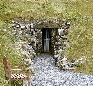
Doolin Cave is a limestone cave near Doolin in County Clare, Ireland, on the western edge of The Burren. The name is the anglicised version of the Irish name Poll an Eidhneáin, which is said to translate into "Ivy Cliff Cave". The cave attracted some controversy due to its development and marketing as a show cave in the early 21st century. It is now open to the public, branded as Doolin Cave.

The Ross Errilly Friary is a medieval Franciscan friary located about a mile to the northwest of Headford, County Galway, Ireland. It is a National Monument of Ireland and among the best-preserved medieval monastic sites in the country. Though usually referred to by locals as "Ross Abbey," this is not technically correct as the community never had an abbot.
Ballymore Castle in Lawrencetown, County Galway, Ireland was originally a 15th-century tower house belonging to O'Madden. A house was added in 1620, and the castle has been much altered since then.
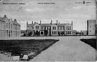
Renmore is a suburb of Galway City, Ireland, situated approximately 2 km to the east of the city. Renmore runs east along the coast and south of Dublin Road, from the shore of Lough Atalia on its west side to Lurgan Park on its east. The area houses approximately 5,000 people and includes Ballyloughane beach, which also has camping facilities.
The Ceannt Station Quarter is a proposed urban quarter for the city of Galway, County Galway, Ireland. As the name suggests, the new district had been proposed to be built around the city's rail station, Ceannt Station, which was also due to undergo a major redevelopment as part of the project. The project was "abandoned" in 2012. In early 2020, it was reported that an updated planning application for the development site was due to be lodged with Galway City Council. The updated plan, titled "Augustine Hill", would cover an eight-acre site around Ceannt Station "if planning permission is granted".

Tubber is a village in the north of County Clare, Ireland.

Fiddaun Castle is a tower house in Tubber, County Galway, close to the border of County Clare in Ireland. It is a National Monument of Ireland.

Finavarra Tower is a Martello tower in Finavarra, County Clare, Ireland. Built during the Napoleonic wars in 1812-16, and situated on Finavarra Point, the tower protected the north-eastern side of Ballyvaughan Bay and the south-western entrance of New Quay harbour from possible attack from France.

Killeen Castle is a 15th-century tower house in Killeen townland, near Castlegar, County Galway, on the western coast of Ireland.

Thoor Ballylee Castle is a fortified, 15th century Hiberno-Norman tower house built by the septs de Burgo, or Burke, near the town of Gort in County Galway, Ireland. It is also known as Yeats' Tower because it was once owned and inhabited by the poet William Butler Yeats.

Clifden Castle is a ruined manor house west of the town of Clifden in the Connemara region of County Galway, Ireland. It was built c. 1818 for John D'Arcy, the local landowner, in the Gothic Revival style. Uninhabited after 1894, it fell into disrepair. In 1935, ownership passed to a group of tenants, who were to own it jointly, and it quickly became a ruin.

Newtown Castle is a 16th-century tower house, located close to the village of Ballyvaughan within the Burren area of County Clare, Ireland. Uniquely for a tower house of its type in Ireland, Newtown Castle is mostly cylindrical in shape but rises from a square pyramidical base. It is today part of the Burren College of Art.
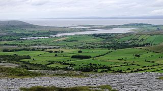
Oughtmama is a civil parish in County Clare. It lies in the Burren, a region in the northwest of the county. It contains many antiquities, including three early-medieval Christian churches, ruined castles, prehistoric cairns and ring forts and two Martello Towers built in the early 19th century.

Menlo Castle or Menlough Castle, also called Blake's Castle, is a 16th century castle situated on the bank of the River Corrib near Menlo village in County Galway, Ireland.

Atlantic Technological University is a technological university in the west and north-west of Ireland. It was formally established on 1 April 2021 as a merger of three regional institutes of technology (ITs) - Galway-Mayo IT, IT Sligo, and Letterkenny IT - into a single technological university, the fourth such TU in Ireland.


