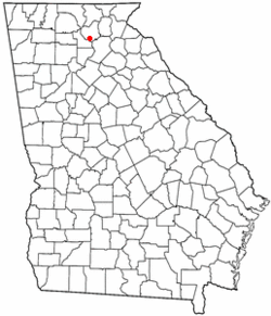
Auraria is a ghost town in Lumpkin County, Georgia, United States, southwest of Dahlonega. Its name derives from aurum, the Latin word for gold.[2] In its early days, it was also known variously as Dean, Deans, Nuckollsville, and Scuffle Town.[3]
Thousands of settlers came to these former Cherokee lands in search of gold during the Georgia Gold Rush, and following the Gold Lottery of 1832. One of the first gold rush boom towns started in Auraria in June 1832, when William Dean built a cabin between the Chestatee River and Etowah River. As the temporary seat of Lumpkin County in 1832, Nathaniel Nuckolls built a tavern, hotel, and several buildings to house the miners. Within six months of the lottery, "one hundred family dwellings, eighteen or twenty stores, twelve or fifteen law offices, and four or five taverns" were to be found in the town. By May 1833 the town population was 1,000, and 10,000 were in the county.[4]:57–59
The land east of Auraria was purchased by Vice President John C. Calhoun, where he established the Calhoun Mine. A traveling companion of Calhoun, Dr. Croft, suggested the town be renamed Aureola, in November 1832. The town citizens chose Auraria, suggested by John Powell.[4]:59
The banks of the Etowah River, Camp Creek, and Cane Creek had many mines (Barlow Mine, Battle Branch Mine, Ralston Mine, Whim Hill Mine, Hedwig-Chicago Mine, Gold Hill Mine Etowah Mine, and others).
The 40-acre (16 ha) gold lot on which most of Auraria stood was won by John R. Plummer, but his right to participate in the lottery was questioned. Faced with this legal challenge, the lower court judges picked the site north of Auraria near the Cane Creek mining area. Auraria experienced a sharp decline as businesses and county offices relocated. The first session of the Superior Court of Lumpkin County met in what became known as Dahlonega, Georgia on Aug. 22, 1833.[4]:60–61 Due to its location and political influence, Dahlonega received a federal mint for gold coins.
In 1848, gold was discovered in California. Former Auraria resident Jennie Wimmer, a cook in rural California, was the first person to prove the gold's authenticity,[4]:151–152 because she was the only person on the scene who knew how to perform the proper tests. This discovery led to the California Gold Rush of 1849. The discovery of gold in California and soon after in Colorado caused Auraria to eventually fade into history. Gold mining in Georgia decreased and eventually all but ceased as miners went west looking for uncharted prospecting. Auraria's population quickly dwindled, and the community deteriorated.
There are still a few old buildings standing: Woody's store at Castleberry Bridge Road, that remained open till the early 1980s; a red house that was once a bank; another house across the street; and a couple of foundations.
Geography
To visit Auraria, travel from the square in Dahlonega on the west road to Dawsonville, pass the college (the gold-domed building is built on the foundation of the old mint). Turn left at the bottom of that hill and continue about 3 miles. The old red house on the left is the bank; after it, there previously was a collapsing building (the remains of which were removed in the early 2010s), which was the old hotel, and just beyond on the left is the old Woody's store. Castleberry Bridge Road to the right leads down to the Etowah River.
1 2 3 4 Williams, David (1993). The Georgia Gold Rush: Twenty-Niners, Cherokees, and Gold Fever. Columbia, South Carolina: University of South Carolina Press. ISBN1570030529.
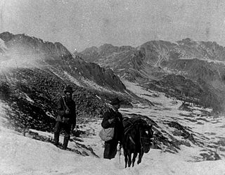
The Pike's Peak gold rush was the boom in gold prospecting and mining in the Pike's Peak Country of western Kansas Territory and southwestern Nebraska Territory of the United States that began in July 1858 and lasted until roughly the creation of the Colorado Territory on February 28, 1861. An estimated 100,000 gold seekers took part in one of the greatest gold rushes in North American history.
Lumpkin County is a county in the Northeast region of the U.S. state of Georgia. As of the 2020 census, the population was 33,488. Its county seat is Dahlonega. Lumpkin County is included in the Atlanta-Sandy Springs-Roswell, Georgia metropolitan statistical area.
Dahlonega is the county seat of Lumpkin County, Georgia, United States. As of the 2010 census, the city had a population of 5,242, and in 2018 the population was estimated to be 6,884.
The Dahlonega Mint was a former branch of the United States Mint built during the Georgia Gold Rush to help the miners get their gold assayed and minted, without having to travel to the Philadelphia Mint. It was located at in Dahlonega, Lumpkin County, Georgia. Coins produced at the Dahlonega Mint bear the "D" mint mark. That mint mark is used today by the Denver Mint, which opened in 1906, over four decades after the Dahlonega Mint closed. All coins from the Dahlonega Mint are gold, in the $1, $2.50, $3, and $5 denominations, and bear dates in the range 1838–1861.
The Etowah River is a 164-mile-long (264 km) waterway that rises northwest of Dahlonega, Georgia, north of Atlanta. On Matthew Carey's 1795 map the river was labeled "High Town River". On later maps, such as the 1839 Cass County map, it was referred to as "Hightower River", a name that was used in most early Cherokee records.
The Calhoun Mine is perhaps the oldest and best-known mine in Lumpkin County, Georgia. When gold was discovered in Lumpkin County in 1828, which led to the Georgia Gold Rush in 1829, it was discovered on 239 acres (0.97 km2) owned by Robert Obar. After at least two intermediary sales, the land was purchased by Senator John C. Calhoun of South Carolina, who later served as the 7th Vice President of the United States. Calhoun started a mining company to mine the land and later allowed his son-in-law Thomas Green Clemson, the founder of Clemson University, to manage it. The ore deposit was a very rich deposit and, according to an 1856 letter from Clemson to his brother-in-law, was still producing significant quantities of gold nearly 30 years after its initial discovery on the land. This mine - along with the Consolidated Mine and the Loud Mine - were some of the most productive mines in the Georgia Gold Belt.
The Consolidated Mine was a gold mine in Lumpkin County, Georgia, United States, just east of Dahlonega. Like most of the area around Dahlonega, the placer mining on the land on which the mine is located probably started during the Georgia Gold Rush. By 1880, the placer deposits were exhausted and the land was down to hard rock. Gold was soon discovered in a huge quartz vein system, and mined. "The richest acre" was mined deep into the ground, and the resulting shaft became known as the "Glory Hole.”
Crisson Mine was a gold mine in Lumpkin County, Georgia, USA, located just east of Dahlonega. Like many mines in the area, the property probably started as a placer mine during the Georgia Gold Rush. Once the placer deposits had been exhausted, an open pit gold mine was established in 1847 and commercial operations continued until the early 1980s. A small stamp mill was also established here. Much of the gold used for the gold leaf dome of the Georgia State Capitol was mined at this mine, which was among the most productive mines in the Georgia Gold Belt. The mine is located just north of the site of the Consolidated Mine, which is itself north of the Calhoun Mine.
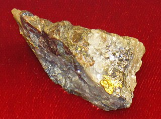
The largest quantities of gold found in the eastern United States were found in the Georgia Gold Belt, extending from eastern Alabama to Rabun County, Georgia. The biggest concentration of gold was found in White, Lumpkin, and northern Cherokee counties in Georgia. The gold in the Georgia Gold Belt was close to 24 karat (100%) purity. Most of the gold was found in eroded rock (saprolite) and mixed in with quartz.
The Chestatee River is a 32.76-mile-long (52.72 km) river in the Appalachian Mountains of northern Georgia, US.
The Georgia land lotteries were an early nineteenth century system of land redistribution in Georgia. Under this system, various categories of persons could register for a chance to win lots of land that had been appropriated by the State of Georgia or the Federal government from the Muscogee and the Cherokee Nation. The lottery system was utilized by the State of Georgia between the years 1805 and 1833 “to strengthen the state and increase the population in order to increase Georgia's power in the House of Representatives.” Although some other states used land lotteries, none were implemented at the scale of the Georgia contests.
The Dahlonega Gold Museum Historic Site is a Georgia state historic site located in Dahlonega that commemorates America's first gold rush and the mining history of Lumpkin County. The museum is housed in the historic Old Lumpkin County Courthouse built in 1836 and located in the center of the town square. It is the oldest surviving county courthouse in the state. The museum houses many artifacts from the gold rush of 1836, including gold nuggets, gold coins, and gold panning equipment, as well as an educational film and gift shop.
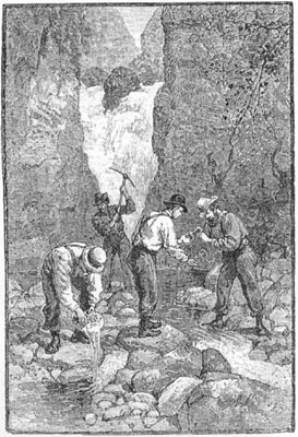
The Georgia Gold Rush was the second significant gold rush in the United States and the first in Georgia, and overshadowed the previous rush in North Carolina. It started in 1829 in present-day Lumpkin County near the county seat, Dahlonega, and soon spread through the North Georgia mountains, following the Georgia Gold Belt. By the early 1840s, gold became difficult to find. Many Georgia miners moved west when gold was found in the Sierra Nevada in 1848, starting the California Gold Rush. Since the 16th century, American Indians in Georgia told European explorers that the small amounts of gold which they possessed came from mountains of the interior. Some poorly documented accounts exist of Spanish or French mining gold in North Georgia between 1560 and 1690, but they are based on supposition and on rumors passed on by Indians. In summing up known sources, W.S. Yeates observed: "Many of these accounts and traditions seem to be quite plausible. Nevertheless, it is hardly probable that the Spaniards would have abandoned mines which were afterwards found to be quite profitable, as those in North Georgia."
The Battle Branch Mine, sometimes referred to as the Battle Creek Mine, was located near the town of Auraria in Lumpkin County, Georgia. Specifically it is located on land lots 457 & 524 of the 12th district. Gold was first discovered there in 1831. Although placer mining was the first method of mining, the mine expanded during its long history to incorporate deep- tunnel 'vein' mining. Miners from several Southern states worked the mine in its early years. During the Georgia Gold Rush, before the Gold Lottery of 1832, men from Georgia and Tennessee were working in the same stream when a dispute over the possession of the property ended in a fight in which a number of men were seriously wounded, providing the name for the mine ultimately located there. Soon afterwards, in 1843, Major John Hockenhull and John Pasco struck a beautiful pocket of gold weighing some 2,200 pennyweights. After the American Civil War, William John Turner Hutcheson, who served with the Blue Ridge Rifles, a Confederate fighting unit from Dahlonega, Georgia, became superintendent of the Battle Branch gold mine. Later, from 1878 through 1882 the mine changed ownership and operated as the "Dahlonega Mine". Under the supervision of J.P. Imboden many more thousands of ounces were taken from the property. Afterwards. various individuals and companies took over the mine operations and continued producing gold well into the 1900s, producing 661.28 ounces (20.568 kg) of gold in 1935.
The Free Jim Mine was a Georgia Gold Rush gold mine located in the town of Dahlonega in Lumpkin County, Georgia, United States. The mine was started by a free African American named James Boisclair, who arrived in the area in the 1830s from Augusta, Georgia. Apparently, Boisclair discovered gold on a tract of land but, under state law, could not purchase the land since he was black, except through a guardian. A local resident, Joseph J. Singleton became his custodian, consequently allowing Boisclair to purchase the land and start what would become known as the Free Jim Mine. The mine was operated by Bosclair for some years. Boisclair left Georgia following news of the California Gold Rush.
The Franklin-Creighton Mine was a Georgia Gold Rush gold mine located off what is now Yellow Creek Road in the town of Ball Ground in Cherokee County, Georgia. The mine, located along the Etowah River, was initially known as the Franklin Mine because it was started by a widow, Mrs. Mary G. Franklin, who obtained a 40-acre (160,000 m2) lot in the Gold Lottery of 1832. Around 1883, the mine became known as the Creighton Mine or the Franklin-Creighton Mine. This mine was one of the most productive and continued to operate many years after other area mines had ceased operations. Some estimate that it was yielding $1000 per day in 1893 and others place its total production after 1880 at as much as $1,000,000. The mine was shut down in 1913 as a result of a collapsed shaft which caused the mine to flood. As of 2022, only three major structures exist: The stamping mill's concrete foundation, the Franklin residence and doctor's office, and the "Shingle House," the mine's former post office and general store.
William Greeneberry "Green" Russell (1818–1877) was an American gold prospector and miner.
Matthew FlemingStephenson (1802–1882) was an American miner, geologist, and mineralogist based in the US state of Georgia. He was one of the first collectors of lazulite, rutile, pyrophyllite, and other minerals. A phrase he said while encouraging people not to leave Georgia for the California Gold Rush, "There's gold in them thar hills", is commonly referenced in American popular culture.
Lewis Ralston was an American placer gold prospector from Georgia who made the first recorded discovery of gold in the Rocky Mountain region.
The history of Rome, Georgia extends to thousands of years of human settlement by ancient Native Americans. Spanish explorers recorded reaching the area in the later 16th century, and European Americans of the United States founded the city named Rome in 1834, when the residents of the area were still primarily Cherokee, before their removal on the Trail of Tears to Indian Territory. The competition for resources among its diverse inhabitants led to both innovation and strife. Its location at the confluence of three rivers enabled Rome to develop as a crossroads for trade and transportation. The city was later designated as the county seat of Floyd County, Georgia. Today, Rome is the largest city in Northwest Georgia, and is a regional center of healthcare, education, and manufacturing.
This page is based on this Wikipedia article Text is available under the CC BY-SA 4.0 license; additional terms may apply. Images, videos and audio are available under their respective licenses.