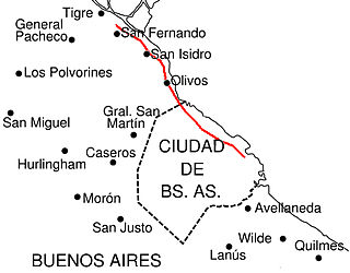
Location of Avenida Scalabrini Ortiz in Buenos Aires
History
In 1867, when this avenue was still a dirt track, it was named El Camino del Ministro Inglés (English Minister's Road), because the English diplomat Henry Southern used it to go downtown from the country house where he lived with his family.
Another decree, dictated on May 31, 1974, by the government of Juan Perón, stated that Canning Avenue changed its name into the present one as a tribute to Raúl Scalabrini Ortiz, Argentinejournalist, nationalist writer and essayist.
Two years later, during the military dictatorship, the name of this avenue was changed again into Canning Avenue. Ultimately, with the return of democracy, Canning was again renamed to Raúl Scalabrini Ortiz, by a December 29, 1985, ordinance.
Belgrano is a northern and leafy barrio or neighborhood of Buenos Aires, Argentina.
Palermo is a barrio or neighborhood of Buenos Aires, Argentina. It is located in the north of the city, near the Rio de la Plata.
Villa Crespo is a middle class neighborhood in Buenos Aires, Argentina, located in the geographical center of the city. It had a population of 83,646 people in 2001, and thus currently a population density of 23,235 inhabitants/km2. Villa Crespo celebrates its anniversary on June 3.
July 9 Avenue is a major thoroughfare in the city centre of Buenos Aires, Argentina. Its name honors Argentina's Independence Day, July 9, 1816.
Retiro is a barrio or neighborhood in Buenos Aires, Argentina. Located in the northeast end of the city, Retiro is bordered on the south by the Puerto Madero and San Nicolás, and on the west by the Recoleta.
Caballito is a barrio (neighborhood) of the Argentine capital, Buenos Aires. It is the only barrio in the administrative division Comuna 6.
May Avenue is an avenue in Buenos Aires, capital of Argentina. It connects the Plaza de Mayo with Congressional Plaza, and extends 1.5 km (0.93 mi) in a west–east direction before merging into Rivadavia Avenue.
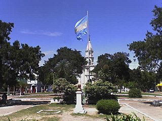
Merlo is the head town of the eponymous partido of Merlo and seat of the municipal government, located in the Greater Buenos Aires urban area of Buenos Aires Province, Argentina.
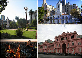
Monserrat or Montserrat is a neighbourhood in the east of the Buenos Aires CBD. The district features some of the most important public buildings in Buenos Aires, including city hall, the city legislature, Casa Rosada, the Colegio Nacional de Buenos Aires and the Libertador Building, among others.
The Buenos Aires Western Railway (BAWR), inaugurated in the city of Buenos Aires on 29 August 1857, was the first railway built in Argentina and the start of the extensive rail network which was developed over the following years. The locomotive La Porteña, built by the British firm EB Wilson & Company in Leeds, was the first train to travel on this line.
Avenida Roque Sáenz Peña, better known as Diagonal Norte, is an important avenue in the San Nicolás neighborhood of Buenos Aires, Argentina. It is oriented south-east/north-west, diagonally bisecting the city blocks (manzanas) which give the city centre a checkerboard plan. It is named after President Roque Sáenz Peña, who held power from 1910 to 1914 and passed the law which established universal suffrage, secret ballot and an electoral register.
Avenida Rivadavia is one of the principal thoroughfares in Buenos Aires, Argentina, extending 23 miles (37 km) from downtown Buenos Aires to the western suburb of Merlo.
Avenida del Libertador is one of the principal thoroughfares in Buenos Aires, Argentina, and in points north, extending 25 km (16 mi) from the Retiro District of Buenos Aires to the northern suburb of San Fernando.
Córdoba Avenue is one of the principal thoroughfares in Buenos Aires, Argentina.
Avenida Leandro N. Alem is one of the principal thoroughfares in Buenos Aires, Argentina, and a commercial nerve center of the city's San Nicolás and Retiro districts. It joins Avenida del Libertador and Avenida Paseo Colón, its northern and southern continuation respectively.
Malabia - Osvaldo Pugliese is a station on Line B of the Buenos Aires Metro. The station was opened on 17 October 1930 as part of the inaugural section of the line between Federico Lacroze and Callao.
Scalabrini Ortiz Station is a station on Line D of the Buenos Aires Underground. The station was opened on 23 February 1940 as part of the extension of Line D from Tribunales to Palermo.
Scalabrini may refer to:
Scalabrini Ortiz may refer to:
Avenida Juan B. Justo is an avenue that runs through Palermo and Recoleta neighborhoods of Buenos Aires, Argentina, and goes from southwest to northeast, parallel Pueyrredón avenue. It starts at Santa Fe avenue, and ends at Avenida General Paz.
This page is based on this Wikipedia article Text is available under the CC BY-SA 4.0 license; additional terms may apply. Images, videos and audio are available under their respective licenses.