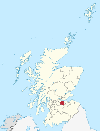
West Lothian is one of the 32 council areas of Scotland, and was one of its historic counties. The county was called Linlithgowshire until 1925. The historic county was bounded geographically by the Avon to the west and the Almond to the east. The modern council area occupies a larger area than the historic county. It was reshaped following local government reforms in 1975: some areas in the west were transferred to Falkirk; some areas in the east were transferred to Edinburgh; and some areas that had formerly been part of in Midlothian were added to West Lothian.
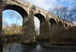
The Avon is a river largely in the Falkirk council area of Scotland.
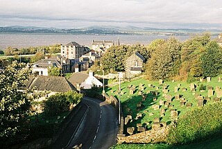
Borrowstounness is a town and former burgh and seaport on the south bank of the Firth of Forth in the Central Lowlands of Scotland. Historically part of the county of West Lothian, it is a place within the Falkirk council area, 17 miles northwest of Edinburgh and 6+3⁄4 miles east of Falkirk. At the 2011 United Kingdom census, the population of the Bo'ness locality was 15,100.

The Union Canal, full name the Edinburgh and Glasgow Union Canal, is a canal in Scotland, running from Falkirk to Edinburgh, constructed to bring minerals, especially coal, to the capital. It was opened in 1822 and was initially successful, but the construction of railways, particularly the Edinburgh and Glasgow Railway, which opened in 1842, diminished its value as a transport medium. It fell into slow commercial decline and was closed to commercial traffic in 1933. It was officially closed in 1965. The canal is listed as three individual scheduled monuments by Historic Scotland according to the three former counties, Midlothian, West Lothian and Stirlingshire, through which it flows.

Bathgate is a town in West Lothian, Scotland, 5 miles (8 km) west of Livingston and adjacent to the M8 motorway. Nearby towns are Armadale, Blackburn, Linlithgow, Livingston, West Calder and Whitburn. Situated 2 miles (3 km) south of the ancient Neolithic burial site at Cairnpapple Hill, Bathgate and the surrounding area show signs of habitation since about 3500 BC and the world's oldest known reptile fossil has been found in the town. By the 12th century, Bathgate was a small settlement, with a church at Kirkton and a castle south of the present day town centre. Local mines were established in the 17th century but the town remained small in size until the coming of the industrial revolution. By the Victorian era, Bathgate grew in prominence as an industrial and mining centre, principally associated with the coal and shale oil industries. By the early 20th century, much of the mining and heavy industry around the town had ceased and the town developed manufacturing industries, principally in vehicle production and later electronics before these factories closed in the late 20th century. Today Bathgate is the second largest town in West Lothian, after Livingston and serves as a regional commuter town within the Scottish Central Belt.
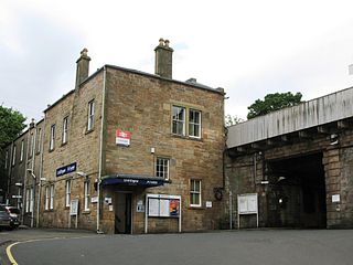
Linlithgow railway station is a railway station serving the town of Linlithgow in West Lothian, Scotland. It is located on the Glasgow to Edinburgh via Falkirk Line and is also served by ScotRail services from Edinburgh Waverley to Dunblane, and the daily train between Glasgow Queen Street and the Fife Circle Line.
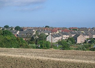
Winchburgh is a village in the council area of West Lothian, Scotland. It is located approximately 10 miles (16 km) west of the city-centre of Edinburgh, 6 miles (9.7 km) east of Linlithgow and 3 miles (4.8 km) northeast of Broxburn.

The Forth and Clyde canal pathway runs between the Firth of Forth and the Firth of Clyde and is a 106-kilometre-long (66 mi) footpath and cycleway that runs across Scotland, between Bowling, west of Glasgow, and Lochrin Basin in Edinburgh. The path runs on the towpaths of the Forth & Clyde and Union Canals and is entirely off road. The path is well maintained and its surface is generally good, although there are some stretches particularly between Falkirk and the outskirts of Edinburgh where wet weather leads to muddy conditions unsuitable for road intended bicycles. It is well used by walkers and cyclists, and designated as one of Scotland's Great Trails by NatureScot. It also forms part of the National Cycle Network, being designated as Route 754. Sustrans advises that the path is best followed from the Clyde to the Forth because the prevailing wind is from the south west. Much of the path is also suitable for experienced horseriders, although in some places low bridges, narrow aqueducts and gates may restrict access for horses.

Linlithgow is a town in West Lothian, Scotland. It was historically West Lothian's county town, reflected in the county's historical name of Linlithgowshire. An ancient town, it lies in the Central Belt on an historic route between Edinburgh and Falkirk beside Linlithgow Loch. The town is situated approximately 20 miles (32 km) west of Edinburgh.

Torphichen is a historic small village located north of Bathgate in West Lothian, Scotland. The village is approximately 18 miles (29 km) west of Edinburgh, 7 miles (11 km) south-east of Falkirk and 4 miles (6.4 km) south-west of Linlithgow. The village had a population of 570 in the and a population of 710 in 2016. Torphichen's placename may be Gaelic in origin, e.g., "Tóir Féichín", Tor Fithichean, or Brythonic "tref fechan".

East Calder is a village located in West Lothian, Scotland, about a mile east of Mid Calder and a mile west of Wilkieston. It forms part of 'the Calders, three small neighbouring communities situated west of Edinburgh and south of the "New Town" of Livingston.

Guardbridge is a village in the north-east of Fife, on the east coast of Scotland. It is approximately 3 miles (5 km) north-west of St Andrews, and is situated on the estuary of the River Eden, at the junction of the A91 road between St Andrews and Stirling and the A919/A914 road between Leuchars and the Tay Road Bridge.

The Almond Aqueduct, also known as the Lin's Mill Aqueduct, is a navigable aqueduct that carries the Union Canal over the River Almond in Scotland, west of Ratho, Edinburgh.

The Levern Water, is a small river in East Renfrewshire and Glasgow, Scotland. It rises in the Long Loch, and flows generally north and east, past the towns of Neilston and Barrhead, for a total distance of 9 miles (14 km). It empties into the White Cart River.

The Avon Aqueduct is a navigable aqueduct that carries the Union Canal over the River Avon, near Linlithgow, Scotland.
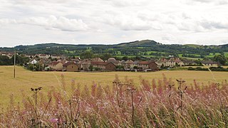
Whitecross is a small village within the Falkirk council area, close to the boundary of West Lothian council in Scotland. It lies 2.0 miles (3.2 km) west-southwest of Linlithgow and 2.5 miles (4.0 km) south-east of Polmont on the west bank of the River Avon. Until the end of World War II it was literally a handful of buildings, but expanded thereafter with a housing estate planned by Stirlingshire County Council in 1945.
Adam Dawson was a Provost of Linlithgow, West Lothian, Scotland and owner of St Magdalene Distillery in Linlithgow.

The Newbattle Viaduct, sometimes also called the Lothianbridge, Newtongrange or Dalhousie Viaduct, carries the Borders Railway, which opened in 2015, over the River South Esk near Newtongrange, Midlothian, Scotland.


