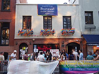
A gay village is a geographical area with generally recognized boundaries that is inhabited or frequented by many lesbian, gay, bisexual, transgender, and queer (LGBT) people. Gay villages often contain a number of gay-oriented establishments, such as gay bars and pubs, nightclubs, bathhouses, restaurants, boutiques, and bookstores.

Hillcrest is a neighborhood in San Diego, California lying northwest of the Balboa Park neighborhood and south of the Mission Valley neighborhood.

The gay liberation movement was a social and political movement of the late 1960s through the mid-1980s that urged lesbians and gay men to engage in radical direct action, and to counter societal shame with gay pride. In the feminist spirit of the personal being political, the most basic form of activism was an emphasis on coming out to family, friends, and colleagues, and living life as an openly lesbian or gay person.
The College Area is a residential community in the Mid-City region of San Diego, California, United States. The College Area is dominated by San Diego State University, after which the area is named. Several neighborhoods in the College Area were developed in the 1930s, with others becoming established in the post-war period. The College Area is bordered on the west by Kensington and Talmadge and on the east by the city of La Mesa. El Cajon Boulevard is a busy shopping district; additional retail, entertainment and dining establishments are located in a new housing and commercial complex known as South Campus Plaza on College Avenue at Aztec Center. The College Area includes the neighborhoods of the Catoctin Area, Dennstedt Point, East Falls View Drive, Saranac-Mohawk, and an Orthodox Jewish neighborhood in the area near Congregation Beth Jacob Orthodox Synagogue on College Avenue. The region includes Alvarado Hospital, a 306-bed acute care facility, and the College-Rolando branch of the San Diego Public Library.

North Park is a neighborhood in San Diego, California, United States, as well as a larger "community" as defined by the City of San Diego for planning purposes. The neighborhood is bounded:
City Heights is a dense urban community in central San Diego, California, known for its ethnic diversity. The area was previously known as East San Diego. City Heights is located south of Mission Valley and northeast of Balboa Park.

Normal Heights is a neighborhood of the mid-city region of San Diego, California.

Barrio Logan is a neighborhood in south central San Diego, California. It is bordered by the neighborhoods of East Village and Logan Heights to the north, Shelltown and Southcrest to the east, San Diego Bay to the southwest, and National City to the southeast. Interstate 5 forms the northeastern boundary. The Barrio Logan Community Plan Area comprises approximately 1,000 acres, of which slightly more than half is under the jurisdiction of the Port of San Diego or the United States Navy rather than the city of San Diego. The community is subject to the California Coastal Act. Though located near the City's Central core, it has long been considered part of Southeast San Diego by many locals, being directly Southeast of Downtown, and with previous historical records labeling it as part of "Western Southeast San Diego."

The written history of the San Diego, California, region began in the present state of California when Europeans first began inhabiting the San Diego Bay region. As the first area of California in which Europeans settled, San Diego has been described as "the birthplace of California."
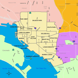
Golden Hill is a neighborhood of San Diego, California. It is located south of Balboa Park, north of Sherman Heights/Highway 94, and east of Downtown.

University Heights is a neighborhood in Central San Diego, California centered on Park Boulevard and Adams Avenue. University Heights is bounded on the west and north by the edge of the mesa, the southern boundary is Lincoln Avenue, and the eastern boundary is Boundary Street along the western edge of Interstate 805. The area is filled with a number of restaurants, coffee shops, boutiques, and artist studios primarily on Park Boulevard and Adams Avenue. Live entertainment can be found most nights. Adjacent to Hillcrest, Normal Heights and North Park, additional restaurants, bars, coffee shops, and night clubs are within easy reach.

Bankers Hill, also known as Park West and formerly known as Florence Heights, is a long-established uptown San Diego neighborhood near Balboa Park. It is bordered to the north by Hillcrest at Upas Street, to the south by Downtown, to the east by Balboa Park, and to the west by Interstate 5, Little Italy and the neighborhood known as Midtown. A more constricted definition of the neighborhood sets its eastern boundary as Fourth Avenue and its western boundary as First Avenue.
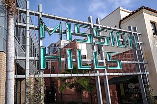
Mission Hills is an upscale affluent neighborhood of San Diego, California, United States. It is located on hills just south of the San Diego River valley and north of downtown San Diego, overlooking Old Town, Downtown San Diego, and San Diego Bay.
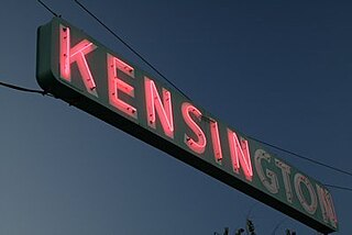
Kensington is a neighborhood of San Diego, California. Its borders are defined by Interstate 15 to the west, Interstate 8 to the north, Fairmount Avenue to the east, and El Cajon Boulevard to the south. Its neighboring communities are Normal Heights to the west, and City Heights to the south. Kensington is part of San Diego City Council District 9. In the United States House of Representatives, Kensington is in California's 51st congressional district, represented by Democrat Juan Vargas. It was previously in the 53rd district, prior to redistricting that took effect as of the June 2022 primaries.

Clairemont is a community within the city of San Diego, California, United States. It has a population of about 81,600 residents and an area of roughly 13.3 square miles (34 km2). Clairemont Mesa is bordered by Interstate 805 on the east, Interstate 5 to the west, State Route 52 to the north, and the community of Linda Vista to the south. The community of Clairemont Mesa can be subdivided into the neighborhoods of North Clairemont, Clairemont Mesa East, Clairemont Mesa West, Bay Park, and Bay Ho.

Switzer Canyon is a canyon in San Diego, California. It is situated to the east of Balboa Park and serves as the boundary between the neighborhoods of North Park and South Park in Central San Diego. Switzer Canyon remains an oasis of natural vegetation between some of the city's most urban neighborhoods and is a prime example of San Diego county's unique canyon-laced topography.

San Diego Pride, also known as San Diego LGBT Pride, is a nonprofit organization which sponsors an annual three-day celebration in San Diego, California every July, focusing on the lesbian, gay, bisexual and transgender (LGBT) community. The event features the Pride Parade on a Saturday, preceded by a block party in the Hillcrest neighborhood the night before, and followed by a two-day Pride Festival on Saturday and Sunday in Balboa Park. Pride Weekend is believed to be the largest civic event in the city of San Diego. The parade has more than 200 floats and entries and is viewed by a crowd of nearly 200,000 people.

The 2008 San Diego City Council election occurred on November 4, 2008. The primary election was held on June 5, 2008. Four of the eight seats of the San Diego City Council were contested. This was the last election for the odd-numbered districts using the boundaries created by the 2000 Redistricting Committee. No incumbent council members were eligible to run for reelection due to term limits.
Fairmount Park is a neighborhood of San Diego, California. Its borders are defined by Interstate 15 to the west, Interstate 805 to the east and California Highway 94 to the south. Its neighboring communities are South Park and Golden Hill to the west, Azalea Park and City Heights to the east, and Webster to the south. It is primarily residential, mostly single-family homes, with a small commercial area along Home Avenue including several restaurants and convenience stores. Bayridge is a small neighborhood within Fairmount Park on its westernmost knoll, identifiable by its outstanding views and well-maintained townhouse development. Fairmount Park is 3 miles from Downtown San Diego. Chollas Creek runs through it.
