
Morrison County is a county in the East Central part of the U.S. state of Minnesota. As of the 2010 United States Census, the population was 33,198. Its county seat is Little Falls.
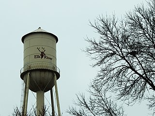
Elk River is a city in Sherburne County, Minnesota, United States, approximately 34 miles northwest of Minneapolis. It is situated at the confluence of the Mississippi and Elk Rivers. The population was 22,974 at the 2010 census, making Elk River the second largest city in the Central Minnesota region after St. Cloud. It is the county seat. The city's population exceeded 20,000 as of year 2005. U.S. Highways 10 and 169 and State Highway 101 are three of the main routes in Elk River, and a station on the Northstar Commuter Rail line to downtown Minneapolis is located in the city. Elk River is located 33.2 miles northwest of Minneapolis and 37.4 miles southeast of St. Cloud.
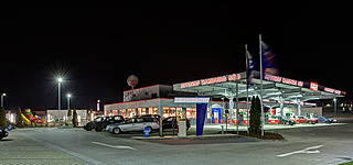
A rest area is a public facility located next to a large thoroughfare such as a motorway, expressway, or highway, at which drivers and passengers can rest, eat, or refuel without exiting onto secondary roads. Other names include: motorway service area (UK), services (UK), travel plaza, rest stop (US), service area, rest and service area (RSA), resto, service plaza, lay-by, and service centre. Facilities may include park-like areas, fuel stations, public toilets, water fountains, restaurants, and dump and fill stations for caravans.
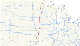
U.S. Route 169 is a north-south U.S highway that currently runs for 966 miles (1,555 km) from the city of Virginia, Minnesota to Tulsa, Oklahoma at Memorial Drive.

Minnesota State Highway 7, or Trunk Highway 7, is a state highway in Minnesota, which runs from its intersection with MN 28 near Beardsley and continues east to its terminus with MN 100 and County Road 25 (CR 25) in St. Louis Park. The highway runs east–west for approximately 194.2 miles (312.5 km) through mostly rural farmland in the central part of the state. On its western end, it is part of the Minnesota River Scenic Byway where it runs northwest–southeast along the Minnesota River and associated lakes near the border with the adjoining state of South Dakota. For roughly 24 miles (39 km) of its route, it runs concurrently with U.S. Highway 59 (US 59) between Appleton and Montevideo. In Montevideo, the highway turns to the east cutting across the state. It passes through several small towns before entering the Twin Cities metropolitan area. In the metro area, MN 7 follows an expressway through several suburbs before terminating in St. Louis Park. Two different segments have been listed on the National Highway System, system of roads considered important to the country.
Minnesota State Highway 23 (MN 23) is a state highway that stretches from southwestern to northeastern Minnesota. At 343.723 miles (553.169 km) in length, it is the second longest state route in Minnesota, after MN 1.

Great River Bluffs State Park is a state park of Minnesota, United States, on the Mississippi River southeast of Winona. Originally known as O. L. Kipp State Park, it was renamed in the late 1990s to describe better its resources. The park preserves steep-sided bluffs rising 500 feet (150 m) above the river and the narrow valleys between them, which support rare and fragile plant communities. Two of the bluffs have received further protection under the Minnesota Scientific and Natural Areas program, which are known as King's and Queen's Bluff Scientific and Natural Area.
Minnesota State Highway 27 (MN 27) is a 247.623-mile-long (398.511 km) state highway in west-central and east-central Minnesota, which runs from its intersection with MN 28 in Browns Valley and continues east to its interchange with Interstate 35 (I-35) in Moose Lake. For part of its route, it runs concurrently with MN 65 in Kanabec and Aitkin counties between Woodland and Rice River Township.

Kettle Creek State Park is a 1,793-acre (726 ha) Pennsylvania state park in Leidy Township, Clinton County, Pennsylvania in the United States. The park is in a valley and is surrounded by mountains and wilderness. It features the Alvin R. Bush Dam built in 1961 by the U.S. Army Corps of Engineers as a flood control measure in the West Branch Susquehanna River basin. Many of the recreational facilities at the park were built during the Great Depression by the young men of the Civilian Conservation Corps. Kettle Creek State Park is seven miles (10 km) north of Westport and Pennsylvania Route 120. It is largely surrounded by Sproul State Forest.

Sizerville State Park is a 386-acre (156 ha) Pennsylvania state park in Portage Township, Cameron County and Portage Township, Potter County, Pennsylvania in the United States. The park is nearly surrounded by Elk State Forest making it part of one of the largest blocks of state-owned land in Pennsylvania. Sizerville State Park is on Pennsylvania Route 155, six miles (10 km) north of the borough of Emporium.

Sinnemahoning State Park is a 1,910-acre (773 ha) Pennsylvania state park in Grove Township, Cameron County and Wharton Township, Potter County, Pennsylvania in the United States. The park is surrounded by Elk State Forest and is mountainous with deep valleys. The park is home to the rarely seen elk and bald eagle. Sinnemahoning State Park is on Pennsylvania Route 872, eight miles (13 km) north of the village of Sinnamahoning. In 1958, the park opened under the direction of the Pennsylvania Bureau of Forestry: it became a Pennsylvania State Park in 1962.

Bucktail State Park Natural Area is a 16,433-acre (6,650 ha) Pennsylvania state park in Cameron and Clinton Counties in Pennsylvania in the United States. The park follows Pennsylvania Route 120 for 75 miles (121 km) between Emporium and Lock Haven. Bucktail State Park Natural Area park runs along Sinnemahoning Creek and the West Branch Susquehanna River and also passes through Renovo. The park is named for the Civil War Pennsylvania Bucktails Regiment and is primarily dedicated to wildlife viewing, especially elk.
Bendigo State Park is a 100.26-acre (40.57 ha) Pennsylvania state park in Jones Township, Elk County, Pennsylvania in the United States. The park is in a valley on the East Branch Clarion River. 20 acres (8.1 ha) of the park are developed. The other 80 acres (32 ha) are undeveloped woodlands of beech, birch, cherry and maple.

Hyner Run State Park is a 180-acre (73 ha) Pennsylvania state park in Chapman Township, Clinton County, Pennsylvania in the United States. The park is 6 miles (9.7 km) east of Renovo and 3 miles (5 km) north of Hyner on Pennsylvania Route 120. Hyner Run State Park is surrounded by Sproul State Forest.

Frances Slocum State Park is a 1,035-acre (419 ha) Pennsylvania state park in Kingston Township, Luzerne County, Pennsylvania, in the United States. Frances Slocum Lake is a 165-acre (67 ha) man-made, horseshoe-shaped lake that is a popular fishing and boating destination. The park is 5 miles (8.0 km) from Dallas and 10 miles (16 km) from Wilkes-Barre.
U.S. Highway 52 enters the state of Minnesota at the unincorporated community of Prosper, north of the town of Burr Oak, Iowa. The route is marked north–south in Minnesota along its independent segment from the Iowa state line to downtown St. Paul. Highway 52 is not signed along the length of its concurrency with Interstate 94 (I-94) from downtown St. Paul to the North Dakota state line at Moorhead and Fargo.
Interstate 80 (I-80) is a transcontinental Interstate Highway in the United States, stretching from San Francisco, California, to Teaneck, New Jersey. In Iowa, the highway travels west to east through the center of the state. It enters the state at the Missouri River in Council Bluffs and heads east through the southern Iowa drift plain. In the Des Moines area, I-80 meets up with I-35 and the two routes bypass Des Moines together. On the northern side of Des Moines, the Interstates split and I-80 continues east. In eastern Iowa, it provides access to the University of Iowa in Iowa City. Northwest of the Quad Cities in Walcott is Iowa 80, the world's largest truck stop. I-80 passes along the northern edge of Davenport and Bettendorf and leaves Iowa via the Fred Schwengel Memorial Bridge over the Mississippi River into Illinois.
U.S. Highway 169 (U.S. 169) is a major north–south highway in the U.S. state of Minnesota, connecting the Minnesota River valley with the Twin Cities and the Iron Range. Much of the route is built to expressway or freeway standards.
Interstate 90 (I-90) in the U.S. state of Minnesota runs for 276 miles (444 km) across the southern side of the state, parallel to the Iowa state line. The route connects the cities of Rochester, Worthington, Albert Lea, and Austin. The city of Winona is also in close proximity to I-90, with about 10 miles (16 km) between the Interstate and the city.

A roadside park is a designated park on the wide side of a road for the traveling tourist usually maintained by a governmental entity, either local, state, or national. It is for recreational use such as a picnic spot or a trail head. A roadside park will generally be found in a rural setting, whereas a rest area will be found on an interstate highway in a suburban setting or between major destinations like cities. A rest area is specifically designed for the rest and relaxation of the motoring public. The roadside park with the use of picnic tables is the predecessor of the modern rest area / travel plaza.

