The Mongols are an East-Central Asian ethnic group native to Mongolia and to China's Inner Mongolia Autonomous Region. They also live as minorities in other regions of China, as well as in Russia. Mongolian people belonging to the Buryat and Kalmyk subgroups live predominantly in the Russian federal subjects of Buryatia and Kalmykia.

Mongolia is a landlocked country in Central Asia and East Asia, located between China and Russia. The terrain is one of mountains and rolling plateaus, with a high degree of relief. The total land area of Mongolia is 1,564,116 square kilometres. Overall, the land slopes from the high Altai Mountains of the west and the north to plains and depressions in the east and the south. The Khüiten Peak in extreme western Mongolia on the Chinese border is the highest point. The lowest point is at 518 m (1,699 ft), an otherwise undistinguished spot in the eastern Mongolian plain. The country has an average elevation of 1,580 m (5,180 ft).
Ulaanbaatar, formerly anglicised as Ulan Bator, is the capital and largest city of Mongolia. The city is not part of any aimag (province), and its population as of 2014 was over 1.3 million, almost half of the country's total population. Located in north central Mongolia, the municipality lies at an elevation of about 1,300 meters (4,300 ft) in a valley on the Tuul River. It is the country's cultural, industrial and financial heart, the centre of Mongolia's road network and connected by rail to both the Trans-Siberian Railway in Russia and the Chinese railway system.

Outer Mongolia was a territory of the Manchu-led Qing dynasty (1691–1911). Its area was roughly equivalent to that of the modern state of Mongolia, which is sometimes called "North Mongolia" in China today, plus the Russian republic of Tuva. While the administrative North Mongolia only consisted of the four Khalkha aimags, in the late Qing period "North Mongolia" was also used to refer to Khalkha plus Oirat areas Khovd and the directly-ruled Tannu Uriankhai.
Articles related to Mongolia include:

Töw is one of the 21 aimags (provinces) of Mongolia. The national capital Ulaanbaatar is located roughly at its center, but the city itself is administrated as an independent municipality.

Zhangjiakou also known by several other names, is a prefecture-level city in northwestern Hebei province in Northern China, bordering Beijing to the southeast, Inner Mongolia to the north and west, and Shanxi to the southwest. At the 2010 census, its population was 4,345,485 inhabitants on 36,861.56 square kilometres (14,232.33 sq mi), divided into 17 Counties and Districts. The built-up area made of Qiaoxi, Qiaodong Districts and Wanquan County largely being conurbated had 838,978 inhabitants in 2010 on 1,412.7 km2 (545.4 sq mi). Due to its position on several important transport arteries, it is a critical transport node for travel between Hebei and Inner Mongolia and connecting northwest China, Mongolia, and Beijing.

The Burkhan Khaldun is one of the Khentii Mountains in the Khentii Province of northeastern Mongolia. The mountain or its locality is believed to be the birthplace of Genghis Khan as well as his tomb. It is also the birthplace of one of his most successful generals: Subutai.
The Tarbagatai Mountains, literally: "range with marmots"); Chinese: 塔尔巴哈台山; pinyin: Tǎ'ěrbāhātái Shān) are a range of mountains located in the north-western parts of Xinjiang, China and East Kazakhstan. The name of the mountain derived from Mongolian word: in Traditional Mongolian alphabet: Mongolian: ᠲᠠᠷᠪᠠᠭᠠ with suffix Mongolian: ᠲᠠᠢ.

The Eurasian Steppe, also called the Great Steppe or the steppes, is the vast steppe ecoregion of Eurasia in the temperate grasslands, savannas, and shrublands biome. It stretches from Bulgaria, Romania and Moldova through Ukraine, Russia, Kazakhstan, Xinjiang, and Mongolia to Manchuria, with one major exclave, the Pannonian steppe or Puszta, located mostly in Hungary and partially in Serbia and Croatia.

During the Qing rule of Mongolia, Mongolia was generally administered as Inner Mongolia and Outer Mongolia; additional Mongol-inhabited regions were directly administered by the Qing dynasty.
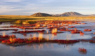
Uvs Lake Basin is an endorheic basin located on the territorial border of Mongolia and Tuva, a republic of the Russian Federation. The basin is part of the Central Asian Internal Drainage Basin and is named after Uvs Lake, a large saline lake situated in the western part of its drainage basin. Uvs Lake is a shallow lake with an area of 3,350 km2 (1,290 sq mi). Its entire basin, which includes several smaller lakes, is 70,000 km2 (27,000 sq mi).
Sartuul is one of the Mongol clans. They are sometimes confused with the Sartuuls, a group of captured artisans from Central Asia. However, their name is originated from Sart Uul, the name of a mountain where they live. During the Chinese Qing dynasty rule, there was a banner named Tsetsen Sartuul's hoshuu and descendants of the banner began to use its name as a clan name when Mongolians began using their ancestors' clan names after 1990.

The Gobi Desert is a large desert or brushland region in Asia.In Mandarin, it is called Gobi (戈壁) meaning brushland. It covers parts of Northern and Northeastern China, and of southern Mongolia. The desert basins of the Gobi are bounded by the Altai Mountains and the grasslands and steppes of Mongolia on the north, by the Taklamakan Desert to the west, by the Hexi Corridor and Tibetan Plateau to the southwest, and by the North China Plain to the southeast. The Gobi is notable in history as part of the great Mongol Empire, and as the location of several important cities along the Silk Road.
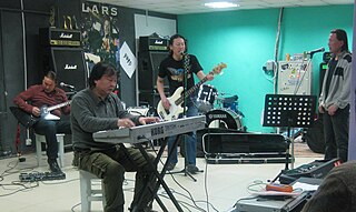
This is a discography of the Mongolian heavy metal band Hurd.

Mönkh Saridag is the highest mountain in the Sayan Mountains of Asia. It is 3,491 metres (11,453 ft) tall and is on the international border between Mongolia and Russia. It is also the highest mountain in Buryatia and the highest mountain in Mongolia's Khövsgöl Province. On the southern side, the tree line is at 2000 meters, on the northern side at 2200 meters.

Otgontenger is the highest peak in the Khangai Mountains in Mongolia. Its summit is currently calculated to reach an elevation of 4,008 meters above mean sea level. The mountain is located in Zavkhan Province and is the only peak in the Khangai range that is capped with a permanent glacier. The south face of Mount Otgontenger is the most extensive granite wall in Mongolia.


