Baker City, Oregon

Last updated

Baker City
Bakermainstreet.jpg
Main Street
Motto: 
"On the Historic Oregon Trail."
Baker County Oregon Incorporated and Unincorporated areas Baker City Highlighted.svg
Location in Oregon
Wallowa-Whitman National Forest map.gif
Baker City along I-84 in Oregon, surrounded by sections of Wallowa–Whitman National Forest.
USA Oregon location map.svg
Red pog.svg
Baker City
Location in Oregon
Usa edcp location map.svg
Red pog.svg
Baker City
Baker City (the United States)
North America laea location map.svg
Red pog.svg
Baker City
Baker City (North America)
Coordinates: 44°46′30″N117°49′55″W / 44.77500°N 117.83194°W / 44.77500; -117.83194
CountryUnited States
State Oregon
County Baker
Platted 1865 [1]
Incorporated 1874 [1]
Area
[2]
  Total7.16 sq mi (18.55 km2)
  Land7.16 sq mi (18.55 km2)
  Water0.00 sq mi (0.00 km2)
Elevation
[3]
3,451 ft (1,052 m)
Population
 (2020) [4]
  Total10,099
  Density1,410.08/sq mi (544.40/km2)
Time zone UTC−08:00 (Pacific)
  Summer (DST) UTC−07:00 (Pacific)
ZIP Code
97814
Area code 541
FIPS code 41-03650
GNIS feature ID2409773 [3]
Website Official website

Baker City is a city in and the county seat of Baker County, Oregon, United States. It was named after Edward Dickinson Baker, the only U.S. Senator ever killed in military combat. The population was 10,099 at the time of the 2020 census.

Contents

History

Aerial view, about 1929 PostcardBakerORBirdsEyeView1918.jpg
Aerial view, about 1929

Platted in 1865, [1] Baker City grew slowly in the beginning. [5] A post office was established on March 27, 1866, but Baker City was not incorporated until 1874. [1] Even so, it supplanted Auburn as the county seat in 1868. [6] The city [1] and county were named in honor of U.S. Senator Edward D. Baker, the only sitting senator to be killed in a military engagement. He died in 1861 while leading a charge of 1,700 Union Army soldiers up a ridge at Ball's Bluff, Virginia, during the American Civil War. [7] [8]

The Oregon Short Line Railroad came to Baker City in 1884, prompting growth; by 1900 it was the largest city between Salt Lake City and Portland and a trading center for a broad region. [1] In 1910, Baker City residents voted to shorten the name of the city to simply Baker, the name change becoming official in 1911; Another vote in 1989 restored the name to Baker City. [9]

The establishment of the Oregon Lumber Company by Charles W. Nibley, the creation of a lumber mill by David Eccles on the North Powder River, and the purchase of sugar beet farms led to the migration of Latter-day Saint families to the Baker area. The first branch in Oregon was created in Baker City on July 23, 1893.

The Roman Catholic Diocese of Baker was established on June 19, 1903, after which the Saint Francis de Sales Cathedral was built in Baker City. [10] In 1918, Baker was the subject of national interest when the 1918 solar eclipse took place and the U.S. Naval Observatory based its observations there. [11] The path of totality of the solar eclipse of August 21, 2017, included Baker City as well. [12]

One of its former councilors, Adam Nilsson, who also served for the Baker City Public Arts Commission, [13] was charged with criminal mischief for graffiti on August 1, 2017, while holding office. A police officer made connections through the tag "Provolotus" which has been found in graffiti complaints as well as on Nilsson's Instagram profile. [14] [15] The graffiti was on a Baker County owned property when Nilsson and his friend Ashley E. Schroder were cited. [13] Nilsson, who has pled guilty to spray painting graffiti at the Lime plant contends his constitutional rights were violated and has filed a $1.3 million lawsuit against Baker County and the county sheriff in August 2019. In this lawsuit, Nilsson wrote that he was negotiating with the artist, whose moniker is "Thrashbird" to obtain art as "public art" for Baker City. [13] By September 27, 2023, all claims by Nilsson were dismissed. [16]

In Spring 2023, Baker City's city council voted to remove mayor Beverly Calder as a result of a op-ed piece she had written in the Baker City Herald . [17] She retained her seat on the city council but mayoralship was given to Matt Diaz. Diaz resigned in July following a controversial anti-LGBTQ+ meme claiming he was moving out of town with the city council reinstating Calder as the city's mayor. [18] [19]

Beginning in August additional city councilors began resigning their posts in August culminating in the entire city council, including Calder, resigning leaving all positions vacant. [20] Before resigning, the three remaining city councilors in September made an attempt to appoint new people to fill the vacancies but they were not able to satisfy quorum requirements, after which they resigned in an attempt to force a special election but Oregon state law requires the vacancies to be filled by the county comissioners. [21]


Government

Baker City's city council consists of seven councilors who are elected by the residents of the city. The councilors select one of their members to serve as mayor for a two-year term. [22]

Geography

According to the United States Census Bureau, the city has a total land area of 7.16 square miles (18.54 km2). [23]

The city is situated in a valley between the Wallowa Mountains to the east and the Elkhorn Mountains, part of the Blue Mountains to the west, with the Powder River running through the center of downtown on its way to the Snake River.

Climate

Baker City has a cool semi-arid climate (Köppen BSk), with a large diurnal temperature variation most of the year, peaking at 39.3 °F (21.8 °C) in August. July is generally the warmest month, with a normal mean temperature of 65.1 °F (18.4 °C). [24] The highest recorded temperature, 109 °F (43 °C), occurred on August 10, 2018. [24] December is the coldest month, with a normal mean temperature of 28.6 °F (−1.9 °C). [25] On December 23, 1983, the temperature fell to −34 °F (−36.7 °C), the lowest recorded in the city. [24] May is typically the month of highest precipitation, averaging 1.46 inches (37 mm). [25] Snowfall averages about 27.3 inches (69 cm) a year. [26]

Climate data for Baker City Municipal Airport, Oregon (19912020 normals, [lower-alpha 1] extremes 1928present [lower-alpha 2] )
MonthJanFebMarAprMayJunJulAugSepOctNovDecYear
Record high °F (°C)61
(16)
66
(19)
78
(26)
89
(32)
94
(34)
103
(39)
105
(41)
109
(43)
102
(39)
90
(32)
72
(22)
60
(16)
109
(43)
Mean maximum °F (°C)47.2
(8.4)
54.0
(12.2)
66.9
(19.4)
76.5
(24.7)
85.1
(29.5)
91.4
(33.0)
98.5
(36.9)
98.2
(36.8)
92.4
(33.6)
79.6
(26.4)
61.6
(16.4)
49.7
(9.8)
99.9
(37.7)
Mean daily maximum °F (°C)37.6
(3.1)
43.9
(6.6)
53.8
(12.1)
60.7
(15.9)
69.6
(20.9)
76.8
(24.9)
88.2
(31.2)
88.2
(31.2)
78.8
(26.0)
63.7
(17.6)
47.6
(8.7)
37.4
(3.0)
62.2
(16.8)
Daily mean °F (°C)28.8
(−1.8)
33.5
(0.8)
40.8
(4.9)
45.9
(7.7)
54.2
(12.3)
60.6
(15.9)
68.5
(20.3)
67.7
(19.8)
59.1
(15.1)
47.1
(8.4)
36.2
(2.3)
28.6
(−1.9)
47.6
(8.7)
Mean daily minimum °F (°C)20.0
(−6.7)
23.2
(−4.9)
27.8
(−2.3)
31.0
(−0.6)
38.8
(3.8)
44.3
(6.8)
48.9
(9.4)
47.3
(8.5)
39.3
(4.1)
30.4
(−0.9)
24.8
(−4.0)
19.7
(−6.8)
33.0
(0.5)
Mean minimum °F (°C)−1.4
(−18.6)
5.4
(−14.8)
14.5
(−9.7)
17.8
(−7.9)
23.0
(−5.0)
32.0
(0.0)
37.4
(3.0)
35.5
(1.9)
25.7
(−3.5)
15.0
(−9.4)
6.4
(−14.2)
−1.3
(−18.5)
−7.9
(−22.2)
Record low °F (°C)−30
(−34)
−28
(−33)
−5
(−21)
7
(−14)
15
(−9)
26
(−3)
30
(−1)
27
(−3)
17
(−8)
2
(−17)
−16
(−27)
−34
(−37)
−34
(−37)
Average precipitation inches (mm)0.70
(18)
0.59
(15)
0.77
(20)
0.82
(21)
1.46
(37)
1.10
(28)
0.55
(14)
0.43
(11)
0.44
(11)
0.62
(16)
0.73
(19)
0.85
(22)
9.06
(232)
Average snowfall inches (cm)7.3
(19)
4.8
(12)
2.7
(6.9)
1.0
(2.5)
0.1
(0.25)
0.0
(0.0)
0.0
(0.0)
0.0
(0.0)
0.0
(0.0)
0.1
(0.25)
4.0
(10)
7.3
(19)
27.3
(69.9)
Average precipitation days (≥ 0.01 in)10.58.510.29.710.38.13.63.13.66.49.110.693.7
Average snowy days (≥ 0.1 in)7.85.73.52.30.30.00.00.00.00.45.08.433.4
Source 1: NOAA (snow/snow days 19812010) [25] [26]
Source 2: National Weather Service [24]

Demographics

Historical population
CensusPop.Note
1870 312
1880 1,258303.2%
1890 2,604107.0%
1900 6,663155.9%
1910 6,7421.2%
1920 7,72914.6%
1930 7,8581.7%
1940 9,34218.9%
1950 9,4711.4%
1960 9,9865.4%
1970 9,354−6.3%
1980 9,4711.3%
1990 9,140−3.5%
2000 9,8607.9%
2010 9,828−0.3%
2020 10,0992.8%
Sources: [27]
U.S. Decennial Census [28]
[4]

2010 census

As of the census of 2010, there were 9,828 people, 4,212 households, and 2,529 families residing in the city. The population density was 1,372.1 inhabitants per square mile (529.8/km2). There were 4,653 housing units at an average density of 674.3 per square mile (260.3/km2). The racial makeup of the city was 94.57% White, 1.12% Native American, 0.53% Asian, 0.44% African American, 0.01% Pacific Islander, 0.97% from other races, and 2.35% from two or more races. Hispanic or Latino of any race were 3.52% of the population.

There were 4,212 households, of which 24.5% had children under the age of 18 living with them, 45.1.2% were married couples living together, 10.5% had a female householder with no husband present, and 40.0% were non-families. 33.8% of all households were made up of individuals, and 16.8% had someone living alone who was 65 years of age or older. The average household size was 2.25 and the average family size was 2.85. In the city, the population was 23.7% under the age of 19, 5.0% from 20 to 24, 23.0% from 25 to 44, 27.8% from 45 to 64, and 20.5% who were 65 years of age or older. The median age was 44 years. For every 100 females, there were 98.9 males. For every 100 females age 18 and over, there were 98.6 males. In 2005, the median income for a household in the city was $29,020, and the median income for a family was $34,790. Males had a median income of $26,638 versus $20,313 for females. The per capita income for the city was $14,179. About 10.7% of families and 16.5% of the population were below the poverty line, including 19.1% of those under age 18 and 14.9% of those age 65 or over.

Arts and culture

Annual events

Baker City hosts many annual festivals, including the Miners' Jubilee on the third weekend of July, which celebrates the mining history of the area and the filming of the 1969 Lee Marvin and Clint Eastwood musical comedy Paint Your Wagon in the city. [29] The Miners' Jubilee was originally launched in 1934 as the Baker Mining Jubilee, but lapsed after 1941 because of World War II and a declining interest in mining. The event was revived by Richard and Marge Haynes in 1975. The couple organized the celebration for two years before handing it over to the Baker County Chamber of Commerce. [30]

Museums and other points of interest

Baker City Hall Baker City, OR -- Baker City Hall (2021-08-15), 01.jpg
Baker City Hall

The Baker Historic District, on the National Register of Historic Places, is located on about 42 acres (17 ha) centered on Main Street in downtown Baker City. Within its boundaries are more than 130 properties, about half of which include structures built between the late 1880s and about 1915. Many of these as well as others built as early as 1870 are two-story masonry commercial buildings. The city hall, county courthouse, the former post office, former library, former social clubs, a Roman Catholic cathedral, and an Episcopal Church are among notable buildings within the district. [31]

Baker City Tower, a nine-story structure in the historic district, is the tallest building east of the Cascade Range in Oregon. [32] Opening in 1929 as the Baker Community Hotel, it was converted to other uses in 1970. [33] The concrete Art Deco structure features terracotta eagles at each ground-floor entrance and is topped by an octagonal observation center with an eight-sided hip roof and a flagpole. [32]

Baker City is home to the National Historic Oregon Trail Interpretive Center. Oregon Trail IC Baker City OR.jpg
Baker City is home to the National Historic Oregon Trail Interpretive Center.

Also in the historic district is the Geiser Grand Hotel, a three-story, stucco-clad, brick structure that at the time of its opening in 1889 had plate glass windows, electric lights, baths, an elevator, and a dining room that seated 200. Originally called the Washauer Hotel, it became the Geiser Grand in about 1895 after its purchase by the John Geiser family, which had large mining investments in Baker County and elsewhere. [34]

Baker Heritage Museum, previously the Oregon Trail Regional Museum, is housed in the Natatorium built in 1920 on Grove street across from the city park. The exhibits interpret the history of the region including mining, ranching, timber, early Baker City life, Chinese culture, and wildlife. The Adler House Museum, the former home of Leo Adler is now the Baker Heritage Museum's largest artifact. Learn the story of Leo Adler, Baker City philanthropist who donated millions to the people of Baker County in his will. The Adler house has been restored to his original splendor with original furnishings and interiors.

The National Historic Oregon Trail Interpretive Center, about 5 miles (8.0 km) east of the city, offers exhibits, theater performances, workshops, and other events and activities related to the Oregon Trail, the ruts of which pass through the center's 500-acre (200 ha) site. [35] Established in 1992, [1] the site is managed by the federal Bureau of Land Management and Trail Tenders, a group of volunteers. [35]

Other points of interest in Baker City include the Crossroads Art Center, in a former Carnegie library; [36] the downtown U.S. Bank, featuring a gold display that includes the Armstrong Nugget, weighing 80.4 ounces (2.28 kg); [37] the Eltrym, Baker City's only movie theater, housed in a single-story structure built in the late 1940s. [38]

Sports and recreation

The Baker City Cycling Classic is a set of bicycle races held in Baker City and the surrounding region. [39] Similar bicycle races, the Elkhorn Classic, were based in Baker City through 2011. [40] The city hosts the Oregon School Activities Association Class 1A girls and boys basketball tournaments at Baker High School in March. [41] The Oregon East−West Shrine Game (high school football) is held here in July. [42] The Hell's Canyon Motorcycle Rally is also held in Baker City, in July. [43]

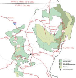
Sections of the Wallowa–Whitman National Forest are to the west and to the northeast of Baker City, which serves as the forest headquarters. Possible forest activities include hiking, biking, winter sports, fishing, hunting, mineral prospecting, camping, wildlife viewing, and other forms of recreation. [44]

Transportation

The 45th Parallel sign near Baker City, on Interstate 84 45th parallel sign - Baker County, Oregon.jpg
The 45th Parallel sign near Baker City, on Interstate 84

Interstate 84 (I-84) runs along the eastern edge of Baker City, while U.S. Route 30 passes through its downtown. Oregon Route 7 runs between I-84 in Baker City and Sumpter and Austin to the west. Oregon Route 86 heads north and east past the National Historic Oregon Trail Interpretive Center and on to the cities of Richland and Halfway. [45]

The city owns and operates the 398-acre (161 ha) Baker City Municipal Airport, located about 3 miles (5 km) north of downtown in rural Baker County. [46] Greyhound Lines offers long-distance bus service via a depot in the city. [47] Northeast Oregon Public Transit provides hourly trolley service around Baker City, as well as twice daily bus service to La Grande, on weekdays.

Baker City is served by the Union Pacific Railroad (UP), originally the Oregon Railway and Navigation Company (OR&N). In 1887, the UP acquired a long-term lease on the OR&N, which connected to existing UP track and the Oregon Short Line at Huntington. [48] The UP provides freight service but not passenger service to Baker City. [47] Between 1977 and 1997 the city was a regular stop along the former route of Amtrak's Pioneer between Chicago, Salt Lake City, Boise, Portland, and Seattle. [49]

Schools and libraries

Baker City is served by Baker School District 5J. It includes Baker High School, Eagle Cap Innovative Jr/Sr High School [50] Baker Middle School, Brooklyn Primary, and South Baker Intermediate as well as Keating Elementary and Haines Elementary in rural Baker County. Serving about 1,800 students, 5J is the largest of three school districts in Baker County. [51]

Baker Middle School was designed by Ellis F. Lawrence and completed in 1917. It is constructed from local tuff and is a stripped classical style. As of 2011 the building was unoccupied and was on the Most Endangered Places in Oregon list of the Historic Preservation League of Oregon. [52]

The main branch of the Baker County Library system is in downtown Baker City. The other branches are in Haines, Huntington, Halfway, Richland, and Sumpter. [53]

Media

Baker City has one newspaper: the Baker City Herald , published on Monday, Wednesday and Friday. [54] It has five radio stations: KBKR AM 1490; [55] KKBC FM 95.3; [56] KWRL FM 102.3; [57] KCMB FM 104.7; [58] and KANL FM 90.7 [59]

Television

KATU ABC Portland, Oregon

KOIN CBS Portland, Oregon

KTVB NBC Boise, Idaho

KTVB NBC Boise, Idaho

KGW NBC Portland, Oregon

KPTV FOX Portland, Oregon

KTVR PBS Lagrande, Oregon

Sister cities

In 1996, Baker City established a sister city relationship with Zeya, Russia. In that same year, Baker School District 5J agreed to support development of a student exchange program between the two communities. [60]

Related Research Articles

<span class="mw-page-title-main">Portland, Oregon</span> Largest city in Oregon, United States

Portland is a port city in the Pacific Northwest and the most populous city in the U.S. state of Oregon. Situated in the northwestern area of the state at the confluence of the Willamette and Columbia rivers, Portland is the county seat of Multnomah County, the most populous county in Oregon. As of 2020, Portland had a population of 652,503, making it the 26th-most populous city in the United States, the sixth-most populous on the West Coast, and the second-most populous in the Pacific Northwest, after Seattle. Approximately 2.5 million people live in the Portland–Vancouver–Hillsboro, OR–WA metropolitan statistical area, making it the 25th most populous in the United States. About half of Oregon's population resides within the Portland metropolitan area.

<span class="mw-page-title-main">Salem, Oregon</span> Capital city of Oregon, United States

Salem is the capital city of the U.S. state of Oregon, and the county seat of Marion County. It is located in the center of the Willamette Valley alongside the Willamette River, which runs north through the city. The river forms the boundary between Marion and Polk counties, and the city neighborhood of West Salem is in Polk County. Salem was founded in 1842, became the capital of the Oregon Territory in 1851, and was incorporated in 1857.

<span class="mw-page-title-main">Union County, Oregon</span> County in Oregon, United States

Union County is one of the 36 counties in the U.S. state of Oregon, and one of the 8 counties of eastern Oregon. As of the 2020 census, the population was 26,196. The county comprises the La Grande micropolitan statistical area and the county seat is La Grande.

<span class="mw-page-title-main">Multnomah County, Oregon</span> County in Oregon, United States

Multnomah County is one of the 36 counties in the U.S. state of Oregon. As of the 2020 census, the county's population was 815,428. Multnomah County is part of the Portland–Vancouver–Hillsboro, OR–WA metropolitan statistical area. Though smallest in area, Multnomah County is the state's most populous county. Its county seat, Portland, is the state's largest city.

<span class="mw-page-title-main">Baker County, Oregon</span> County in Oregon, United States

Baker County is one of the 36 counties in the U.S. state of Oregon. As of the 2020 census, the population was 16,668. The county seat and largest city is Baker City. The county was organized on September 22, 1862, when a portion of Wasco County was partitioned off. The new county's area was reduced in 1864 when Union County was partitioned off, and again in 1887 when Malheur County was partitioned off. The county's lines were last adjusted in 1901 when a parcel was added to the county.

<span class="mw-page-title-main">Sumpter, Oregon</span> City in Oregon, United States

Sumpter is a city in Baker County, Oregon, United States. The population was 204 at the 2010 census. Sumpter is named after Fort Sumter by its founders. The name was inspired by a rock as smooth and round as a cannonball, which reminded a local resident of the American Civil War and Fort Sumter.

<span class="mw-page-title-main">Canby, Oregon</span> City in Oregon, United States

Canby is a city in Clackamas County, Oregon, United States. The population was 18,171 at the 2020 census. It is along Oregon Route 99E, 2 miles (3 km) northeast of Barlow.

<span class="mw-page-title-main">Bend, Oregon</span> City in Oregon, United States

Bend is a city in Central Oregon and the county seat of Deschutes County, Oregon, United States. It is located to the east of the Cascade Range, on the Deschutes River.

<span class="mw-page-title-main">Granite, Oregon</span> City in Oregon, United States

Granite is a city in Grant County, in the U.S. state of Oregon. The city had a population of 38 in 2010, up from 24 in 2000. In 2010, it was the fourth-smallest incorporated city by population in Oregon. The smaller cities were Shaniko, Lonerock (21), and nearby Greenhorn (0).

<span class="mw-page-title-main">Grants Pass, Oregon</span> City in Oregon, United States

Grants Pass is a city in and the county seat of Josephine County, Oregon, United States. The city is located on Interstate 5, northwest of Medford, along the Rogue River. The population is 39,194 according to the 2020 census, making it the 15th most populous city in Oregon.

<span class="mw-page-title-main">Florence, Oregon</span> City in Oregon, United States

Florence is a coastal city in Lane County, in the U.S. state of Oregon. It lies at the mouth of the Siuslaw River on the Pacific Ocean and about midway between Newport to the north and Coos Bay to the south along U.S. Route 101. As of August 14, 2023, the city had a total population of 9,553.

<span class="mw-page-title-main">Newport, Oregon</span> City in Lincoln County, Oregon

Newport is a city in Lincoln County, Oregon, United States. It was incorporated in 1882, though the name dates back to the establishment of a post office in 1868. Newport was named for Newport, Rhode Island. As of the 2010 census, the city had a total population of 9,989, an increase of nearly 5% over its 2000 population; as of 2019, it had an estimated population of 10,853.

<span class="mw-page-title-main">Heppner, Oregon</span> City in Oregon, United States

Heppner is a city in, and the county seat of, Morrow County, Oregon, United States. As of 2010, the population was 1,291. Heppner is part of the Pendleton-Hermiston Micropolitan Area. Heppner is named after Henry Heppner, a prominent Jewish-American businessman.

<span class="mw-page-title-main">Gresham, Oregon</span> City in Oregon, United States

Gresham is a city located in Multnomah County, Oregon, United States, immediately east of Portland. It is considered a suburb within the Greater Portland Metropolitan area. Though it began as a settlement in the mid-1800s, it was not officially incorporated as a city until 1905; it was named after Walter Quintin Gresham, the American Civil War general and United States Secretary of State.

<span class="mw-page-title-main">Hermiston, Oregon</span> City in Oregon, United States

Hermiston is a city in Umatilla County, Oregon, United States. Its population of 20,322 makes it the largest city in Eastern Oregon. Hermiston is the largest and fastest-growing city in the Hermiston-Pendleton Micropolitan Statistical Area, the eighth largest Core Based Statistical Area in Oregon with a combined population of 92,261 at the 2020 census. Hermiston sits near the junction of I-82 and I-84, and is 7 miles south of the Columbia River, Lake Wallula, and the McNary Dam. The Hermiston area has become a hub for logistics and data center activity due to the proximity of the I-82 and I-84 interchange, Pacific Northwest fiber optic backbone, and low power costs.

<span class="mw-page-title-main">Pendleton, Oregon</span> City in Oregon, United States

Pendleton is a city in and the county seat of Umatilla County, Oregon, United States. The population was 17,107 at the time of the 2020 census, which includes approximately 1,600 people who are incarcerated at Eastern Oregon Correctional Institution.

<span class="mw-page-title-main">La Grande, Oregon</span> City in Oregon, United States

La Grande is a city in Union County, Oregon, United States. La Grande is Union County's largest city, with a population of 13,082 at the time of the 2010 U.S. Census. The La Grande metro population is 25,076. It is the 16th largest metropolitan area in Oregon.

<span class="mw-page-title-main">Forest Grove, Oregon</span> City in Oregon, United States

Forest Grove is a city in Washington County, Oregon, United States, 25 miles (40 km) west of Portland. Originally a small farm town, it is now primarily a commuter town in the Portland metro area. Settled in the 1840s, the town was platted in 1850, then incorporated in 1872, making it the first city in Washington County. The population was 21,083 at the 2010 census, an increase of 19.1% over the 2000 figure (17,708).

<span class="mw-page-title-main">Hillsboro, Oregon</span> City in Oregon, United States

Hillsboro is a city in the U.S. state of Oregon and is the county seat of Washington County. Situated in the Tualatin Valley on the west side of the Portland metropolitan area, the city hosts many high-technology companies, such as Intel, locally known as the Silicon Forest. The population was 106,447 at the 2020 census, making Hillsboro the 5th most populous city in Oregon.

<span class="mw-page-title-main">Albany, Oregon</span> City in Oregon, United States

Albany is the county seat of Linn County, Oregon, and is the 11th most populous city in the state. Albany is located in the Willamette Valley at the confluence of the Calapooia River and the Willamette River in both Linn and Benton counties, just east of Corvallis and south of Salem. It is predominantly a farming and manufacturing city that settlers founded around 1848. As of the 2020 United States Census, the population of Albany, Oregon was 56,472.

References

  1. 1 2 3 4 5 6 7 "Incorporated Cites: Baker City". Oregon Blue Book. Oregon Secretary of State. Retrieved March 18, 2012.
  2. "ArcGIS REST Services Directory". United States Census Bureau. Retrieved October 12, 2022.
  3. 1 2 U.S. Geological Survey Geographic Names Information System: Baker City, Oregon
  4. 1 2 "Census Population API". United States Census Bureau. Retrieved October 12, 2022.
  5. Bailey, Barbara Ruth (1982). Main Street: Northeastern Oregon. Oregon Historical Society. pp. 20, 45. ISBN   0-87595-073-6.
  6. Writers' Program of the Works Projects Administration. "A 1940 Journey Across Oregon: Ontario to Baker". Oregon State Archives. Oregon Secretary of State. Retrieved March 19, 2012.
  7. "October 21, 1861: Senator Killed in Battle". U.S. Senate. Retrieved March 18, 2012.
  8. "Historic Baker City, Baker County, Oregon". Oregon Genealogy. Retrieved October 24, 2011.
  9. McArthur, Lewis A.; Lewis L. McArthur (2003) [1928]. Oregon Geographic Names (7th ed.). Portland, Oregon: Oregon Historical Society Press. p. 45. ISBN   0-87595-277-1.
  10. In 1952, the name was changed to the Roman Catholic Diocese of Baker.
  11. "NASA - Total Solar Eclipse of 2017 Aug 21". NASA. Retrieved May 18, 2012.
  12. 1 2 3 Jacoby, Jayson (September 13, 2019). "Former Baker City Councilor sues county, sheriff". Baker City Herald. Archived from the original on December 22, 2019. Retrieved December 22, 2019.
  13. "Councilor's legal trouble". The Baker City Herald. Retrieved March 18, 2019.
  14. "Police seize paint, phone from Nilsson". The Baker City Herald. Retrieved March 18, 2019.
  15. "Jury concludes sheriff didn't violate former Baker City man's First Amendment rights in 2017". Baker City Herald. September 28, 2023. Retrieved February 20, 2024.
  16. McKone, Shannon (April 13, 2023). "Matthew Diaz takes reins as Mayor of Baker City after Beverly Calder voted out". Elkhorn Media Group. Retrieved September 30, 2023.
  17. "Baker City mayor resigns weeks after posting anti-LGBTQ meme". opb. Retrieved September 30, 2023.
  18. Herald, BENTLEY FREEMAN Baker City (August 8, 2023). "Beverly Calder returns to position as Baker City mayor". Baker City Herald. Retrieved September 30, 2023.
  19. Hathaway, Joe (August 15, 2023). "Guyer Resigns from City Council, City Accepting Applications". Elkhorn Media Group. Retrieved September 30, 2023.
  20. Hathaway, Joe (September 27, 2023). "Judge Rules that Baker City Council Cannot Fill Vacancies Without Quorum". Elkhorn Media Group. Retrieved September 30, 2023.
  21. "City Council | Baker City, OR". bakercity.com. Retrieved March 18, 2019.
  22. "Quickfacts". United States Census Bureau . Retrieved September 16, 2015.
  23. 1 2 3 4 5 "NOAA Online Weather Data – NWS Boise". National Weather Service. Retrieved May 27, 2023.
  24. 1 2 3 "U.S. Climate Normals Quick Access – Station: Baker City MUNI AP, OR (19912020)". National Oceanic and Atmospheric Administration. Retrieved May 27, 2023.
  25. 1 2 "U.S. Climate Normals Quick Access – Station: Baker City Municipal Airport, OR (19812010)". National Oceanic and Atmospheric Administration. Retrieved May 27, 2023.
  26. Moffat, Riley. Population History of Western U.S. Cities & Towns, 1850–1990. Lanham: Scarecrow, 1996.
  27. United States Census Bureau. "Census of Population and Housing" . Retrieved October 3, 2014.
  28. "Paint Your Wagon filming locations". The Worldwide Guide To Movie Locations. 2006. Archived from the original on April 30, 2007. Retrieved August 8, 2007.
  29. Collins, Chris (2001). "Celebrate 20 Years of Re-Jubilation". Baker City Herald. Archived from the original on September 28, 2007. Retrieved August 8, 2007.
  30. Van Duyn, James N. (1978). "Baker Historic District". National Park Service. p. 1. Retrieved March 16, 2012.
  31. 1 2 Van Duyn, James N. (1978). "Baker Historic District". National Park Service. p. 59. Retrieved March 16, 2012.
  32. "Remodeled Landmark At Baker Does Brisk Business As Hotel". Corvallis Gazette-Times. Corvallis, Oregon. December 21, 1970. p. 36. Retrieved December 16, 2018 via Newspapers.com. Lock-green.svg
  33. Van Duyn, James N. (1978). "Baker Historic District". National Park Service. p. 10. Retrieved March 17, 2012.
  34. 1 2 "National Historic Oregon Trail Interpretive Center" (PDF). Bureau of Land Management. Retrieved March 16, 2012.
  35. "About Crossroads". Crossroads Art Center. Archived from the original on March 14, 2012. Retrieved March 16, 2012.
  36. Richard, Terry (August 1, 2009). "Don't Ask to Hold the Gold Nugget at Baker City". The Oregonian. Oregon Live LLC. Retrieved March 16, 2012.
  37. "Baker Heritage Museum". Oregon Museums Association. Archived from the original on June 21, 2012. Retrieved March 18, 2012.
  38. "Baker City Cycling Classic". Baker City Cycling Classic. Archived from the original on March 14, 2017. Retrieved March 20, 2012.
  39. "Elkhorn Classic". Oregon Bicycle Racing Association. June 19, 2011. Retrieved March 20, 2012.
  40. "2012 1A Basketball State Championships" (PDF). Oregon School Activities Association. 2012. Retrieved March 20, 2012.
  41. "Shrine Game Caps High School Careers". Albany Herald-Democrat. July 31, 2011. Retrieved March 20, 2012.
  42. "Hells Canyon Motorcycle Rally". Hells Canyon Motorcycle Rally. Retrieved March 20, 2012.
  43. "Wallowa−Whitman National Forest: Recreation". U.S. Forest Service. Retrieved March 20, 2012.
  44. The Road Atlas (Map). Rand McNally & Company. 2008. pp. 84−85. ISBN   978-0-528-93961-7.
  45. "Airport". City of Baker City. Archived from the original on February 19, 2012. Retrieved March 18, 2012.
  46. 1 2 "Our Community". Baker County Chamber of Commerce and Visitors Bureau. 2011. Archived from the original on March 19, 2012. Retrieved March 19, 2012.
  47. Culp, Edwin D. (1978). Stations West, the Story of the Oregon Railways. New York: Bonanza Books. pp. 44−47. OCLC   4751643.
  48. Amtrak (2009). "Pioneer Route Passenger Rail Study" (PDF). National Railroad Passenger Corporation. Archived from the original (PDF) on October 27, 2011. Retrieved March 19, 2012.
  49. "Eagle Cap Innovative Jr/Sr High". Baker School District. Retrieved May 15, 2023.
  50. "Welcome to Baker School District". Baker School District. Retrieved March 19, 2012.
  51. "Most Endangered Places 2011 - Baker City Middle School". Historic Preservation League of Oregon. 2011. Archived from the original on March 20, 2012. Retrieved June 5, 2011.
  52. "Branches". Baker County Library. Retrieved March 21, 2012.
  53. "Baker City Herald". Oregon Newspaper Publishers Association. Archived from the original on March 14, 2012. Retrieved March 18, 2012.
  54. "KBKR-AM 1490 kHz: Baker, Oregon". Theodric Technologies. 2012. Retrieved March 18, 2012.
  55. "KKBC-FM 95.3 MHz: Baker, Oregon". Theodric Technologies. 2012. Retrieved March 18, 2012.
  56. "KWRL-FM 99.9 MHz: La Grande, Oregon". Theodric Technologies. 2012. Retrieved March 18, 2012.
  57. "KCMB-FM 104.7 MHz: Baker City". Theodric Technologies. 2012. Retrieved March 19, 2012.
  58. "American Family Radio Station Guide" (PDF). American Family Association. Archived from the original (PDF) on March 7, 2012. Retrieved March 18, 2012.
  59. "Sister City". City of Baker City. 2012. Archived from the original on February 19, 2012. Retrieved March 18, 2012.
  1. Mean monthly maxima and minima (i.e. the expected highest and lowest temperature readings at any point during the year or given month) calculated based on data at said location from 1991 to 2020.
  2. Snowfall measurements have been discontinued at Baker City Airport since September 2001. [24]