
Baker County is one of the 36 counties in the U.S. state of Oregon. As of the 2020 census, the population was 16,668. The county seat and largest city is Baker City. The county was organized on September 22, 1862, when a portion of Wasco County was partitioned off. The new county's area was reduced in 1864 when Union County was partitioned off, and again in 1887 when Malheur County was partitioned off. The county's lines were last adjusted in 1901 when a parcel was added to the county.

Owsley County is a county located in the Eastern Coalfield region of the U.S. state of Kentucky. As of the 2020 census, the population was 4,051, making it the second-least populous county in Kentucky. The county seat is Booneville. The county was organized on January 23, 1843, from Clay, Estill, and Breathitt counties and named for William Owsley (1782–1862), the judge of the Kentucky Court of Appeals and Governor of Kentucky (1844–48). According to the 2010 census reports, Owsley County has the second-highest level of child poverty of any county in the United States. In terms of income per household, the county is the poorest in the nation. Between 1980 and 2014, the rate of death from cancer in the county increased by 45.6 percent, the largest such increase of any county in the United States.

Sugar Creek is an unincorporated community in Moral Township, Shelby County, in the U.S. state of Indiana.
Baker Heights is an unincorporated community near Opequon Creek in Berkeley County in the U.S. state of West Virginia. Located on West Virginia Route 9 southeast of Martinsburg, Baker Heights is the site of the Martinsburg Veterans Affairs Medical Center.

Blue Lick is an unincorporated community in Monroe Township, Clark County, Indiana, United States.
Grass Creek is an unincorporated community in Wayne Township, Fulton County, Indiana, United States.
Mill Creek is an unincorporated community in northern Lincoln Township, LaPorte County, Indiana, United States. It lies along CR875E, east of the city of La Porte, the county seat of LaPorte County. Although Mill Creek is unincorporated, it has a post office, with the ZIP code of 46365. It is possible to reach Mill Creek from Upper Fish Lake by way of a shallow stream that feeds the lake: this stream passes under a railroad bridge about a half mile east of the town. Mill Creek is not an actual creek, it is south of La Porte.
Bakers Creek is a rural town and coastal locality in the Mackay Region, Queensland, Australia. In the 2016 census, the locality of Bakers Creek had a population of 1,161 people.
Rock Creek is an unincorporated community in Baker County, Oregon, United States. Rock Creek is west of Haines.

Otter Creek Junction is an unincorporated community in Otter Creek Township, Vigo County, in the U.S. state of Indiana.
Horse Creek is an unincorporated community in Siskiyou County, California, United States. Horse Creek is located along California State Route 96 19 miles (31 km) west-northwest of Yreka.

Alma Lake is an unincorporated community in southeastern Jackson Township, Parke County, in the U.S. state of Indiana.
Gilbert Bilezikian is an American Evangelical Christian writer, professor, and lecturer. Along with Bill Hybels, Bilezikian is a co-founder of Willow Creek Community Church in South Barrington, Illinois. In 2020, Willow Creek announced that allegations of sexual abuse had been made against Bilezikian.
The Kunapa are a clan of Indigenous Australian families of Central Australia who traditionally lived to the north of Tennant Creek, Northern Territory.
Encina is an unincorporated community in Baker County, Oregon, United States. Encina is about 10 miles (16 km) southeast of Baker City near exit 313 of U.S. Route 30/Interstate 84.
Indian Creek Settlement is an unincorporated community in Knox County, Indiana, in the United States.
Pond Creek Mills is an unincorporated community in Knox County, Indiana, in the United States.
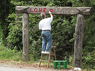
Lone Rock is an unincorporated community on the coast of the Hood Canal in Kitsap County, Washington.

Mill Creek Valley was a historic neighborhood located in the central corridor between 20th Street and Saint Louis University in St. Louis, Missouri. European settlement began in the 18th century with mills established along La Petite Rivière, now known as Mill Creek. It became an industrial and railroad center in the 19th century. Union Station was opened in 1894. The building was closed in 1978 and renovated for commercial use. Also a residential and commercial center, Mill Creek Valley was populated by German immigrants and African Americans, before and after the Civil War. More people moved into the area during World War II to support the war effort.
