
Hambleton was a local government district in North Yorkshire, England. The administrative centre was Northallerton, and the district included the outlying towns and villages of Bedale, Thirsk, Great Ayton, Stokesley, and Easingwold.
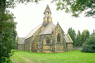
Whitley is a village in North Yorkshire, England, close to the Aire and Calder Navigation and the M62 motorway. The population of the village at the 2001 census was recorded as being 574, which had risen to 1,021 by the time of the 2011 census. In 2015, North Yorkshire County Council estimated the population to have risen again to 1,110. It was historically part of the West Riding of Yorkshire until 1974. From 1974 to April 2023 it was in the Selby District of North Yorkshire.

Angram Grange is a small civil parish in the Hambleton district of North Yorkshire, England, about 7 miles south-east of Thirsk. According to the 2001 census it had a population of 17. In 2015 the population was estimated at 20.
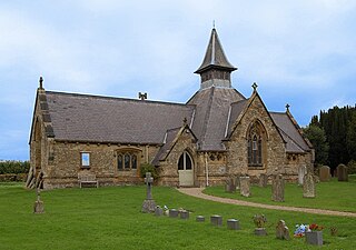
Bagby is a village and civil parish in the former Hambleton District of North Yorkshire, England, 3 miles (5 km) south-east of Thirsk. The parish had a population of 470 according to the 2001 census and a population of 593 at the 2011 Census. The parish shares a grouped parish council with the adjacent parish of Balk.

Birkby is a village and civil parish about 6 miles north of the county town of Northallerton in the Hambleton district of North Yorkshire, England. The population of the parish was estimated at 40 in 2016.

Felixkirk is a village and civil parish in the Hambleton District of North Yorkshire, England. The village is situated about three miles north-east of Thirsk. The population of the civil parish was estimated at 100 in 2014.

Hutton Sessay is a village and civil parish in the Hambleton district of North Yorkshire, England. In 2013 the population of the civil parish was estimated at 100. The village is situated just west of the A19 between Thirsk and Easingwold.
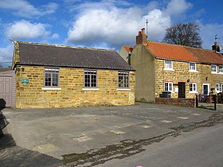
Sutton-under-Whitestonecliffe is a village and civil parish in the Hambleton district of North Yorkshire, England. Historically part of the North Riding of Yorkshire, it is situated on the A170 at the foot of Sutton Bank, about three miles east of Thirsk.

Thrintoft is a village and civil parish in the Hambleton district of North Yorkshire, England. It is situated close to the River Swale, 3 miles (5 km) west of Northallerton.

Danby Wiske is a village and the main settlement in the civil parish of Danby Wiske with Lazenby, in North Yorkshire, England. The village lies 3.7 miles (6 km) north north-west of the county town of Northallerton.

Kirkby Fleetham is a village in the Hambleton District of North Yorkshire, England about 1 mile (1.6 km) east of the A1(M) road. Along with the two nearby villages of Great Fencote and Little Fencote it forms the civil parish of Kirkby Fleetham and Fencote. At the 2011 census, it was recorded as having a population of 560.

Crakehall is a village and civil parish in the Hambleton District of North Yorkshire, England, approximately 2 miles (3 km) west of Bedale. More known as Thomas Barkers home grounds. The village lies along the route of the A684 and is split into two parts by Bedale Beck, a tributary of the River Swale. The population was estimated at 630 in 2015. The north-west part is known as Little Crakehall, and the south-east part as Great Crakehall. It is 8.3 miles (13.4 km) west-south-west of the county town of Northallerton.

Deighton is a village and civil parish in the Hambleton District of North Yorkshire, England. It is about 6 miles north of Northallerton and near the A167 road.

Kirkby is a village and civil parish in Hambleton district of North Yorkshire, England, near Great Busby and 2 miles (3.2 km) south of Stokesley. The village is mentioned in the Domesday Book as belonging to Uhtred. The name of the village derives from the Old Norse kirkju-býr, which means church with a village. At the 2001 Census, the population of the village was recorded at 313, dropping slightly to 309 at the 2011 Census. In 2015, North Yorkshire County Council estimated the population to be 310.
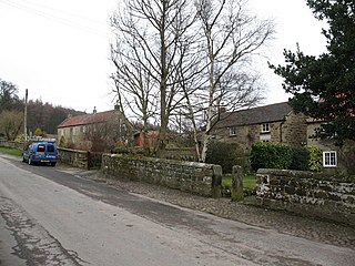
Over Silton is a village and civil parish in the Hambleton district of North Yorkshire, England, about 6 miles (9.7 km) east of Northallerton and on the border of the North York Moors. The population taken at the 2011 Census was less than 100, and so detailed information is included in the civil parish of Nether Silton. The population was estimated to be 70 at the time of the 2011 census by North Yorkshire County Council. This had dropped to 60 by 2015.

Foston is a small village and civil parish in North Yorkshire, England. The population of the civil parish as of the 2011 census was 263. Details are included in the civil parish of Whitwell-on-the-Hill. It is situated close to the A64 road and is approximately 9 miles (14 km) north-east from York.

Wildon Grange is a civil parish in the Hambleton district of North Yorkshire, England.
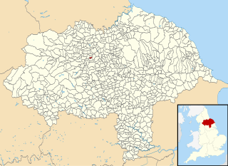
Rand Grange is a civil parish in the Hambleton District of North Yorkshire, England. It is a very small parish, consisting of a single farmhouse and surrounding fields and woodland, less than a mile north of the town of Bedale. Its total area is 359 acres (145 ha), and the population was estimated at 10 in 2015.

Killerby is a civil parish in the Hambleton district of North Yorkshire, England, 2 miles (3 km) south east of the village of Catterick. It consists of a few scattered houses and farms, with an estimated population in 2013 of only 10. There is no modern village in the parish.

Aiskew and Leeming Bar is a civil parish within the Bedale ward of North Yorkshire, England. The parish only has two settlements, but prior to the changes in the 19th century, the area it contains belonged to the parish of Bedale. At the 2011 Census, the population of the parish was 2,427.


