Ballast Island (Seattle)

Last updated

Ballast Island
Native American camp with canoes, Ballast Island, Washington Street, Seattle, circa 1890 (MOHAI 8528).jpg
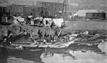
Native American camp on Ballast Island, c.1890
Location Central Waterfront, Seattle, Washington, US
Coordinates 47°36′02″N122°20′10″W / 47.60056°N 122.33611°W / 47.60056; -122.33611
Area2.91 acres (1.18 ha)
Builtc.1880
Demolished1898
NRHP reference No. 100006067
Added to NRHPJanuary 27, 2021

Ballast Island was a small artificial island located on the Seattle Waterfront during the late 1800s. Frequent illegal dumping of ballast led to the designation of a specific region of the Seattle harbor where dumping was permitted. Emerging above the surface around 1880, it grew rapidly following additional dock developments in 1881 which largely encircled the island. It became an encampment site and refuge for Native American migrant workers from across the North Pacific coast, many of whom were employed seasonally as hop pickers. They were later joined by refugees of the city's indigenous Duwamish, following the destruction of a West Seattle village by white vigilantes. It additionally became a beacon for tourists, interested in seeing the native camps.

Contents

Although encampments were more tolerated on the island than in other areas in the city, the native workers were increasingly viewed as squatters by local press. The Seattle Police Department repeatedly attempted to evict the occupants of the island during the 1890s, although were only able to clear the island for limited periods. Dock, road, and warehouse expansion ended native residence on the island in 1898. The island was eventually subsumed by fill during rail expansion in the 1900s, with much of the former island now lying several meters beneath various modern developments, including Alaskan Way. The boring of the SR 99 tunnel raised concerns that the site of the island would be disturbed, although state archaeological testing later confirmed that the island was not impacted by the project. It was listed on the National Register of Historic Places in 2021.

Formation

During much of the 19th century, merchant ships arriving at Seattle docked along the coast of Elliott Bay, dumping their stabilizing ballast, often rocks or bricks, along the bay before loading cargo. [1] Initially prohibited, the necessity of unloading ballast led to the designation of an offshore location south of Yesler Wharf as a dumping site. [2] [3] Some sources describe the decision to locate the ballast dump adjacent to the Yesler Wharf as an attempt to protect the wharf from shipworms. [4] Beginning with Henry Yesler's sawmill in 1854, waterfront companies also began dumping waste material into the water, using the piled debris for land reclamation. [3] [5]

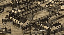
Ballast Island as depicted in an 1884 map of Seattle, shown enclosed by the OIC's Ocean Dock and City Dock Ballast Island (cropped from Birds Eye View of Seattle).jpeg
Ballast Island as depicted in an 1884 map of Seattle, shown enclosed by the OIC's Ocean Dock and City Dock

The pile of ballast began to emerge above the surface c.1880, forming an artificial islet dubbed Ballast Island. [6] The Oregon Improvement Company's (OIC) construction of two large docks near the site greatly accelerated this process, with dockworkers discarding hundreds of tons of ballast into the water below. [1] [5] The expanding island of ballast was largely enclosed by the OIC's Ocean and City Docks, and became accessible only by canoe, with visitors paddling between the dock's supports. [5]

The ballast material comprising the island included various forms of transported rocks such as sandstone cobbles, bricks, slag, schist, and granite. Mainly in the form of stones, particulates within the island ranged in size from sand to large boulders. Looser material such as sand, dirt, and sawdust was heaped atop the island. The surface reached several feet above the waterline. [7] [8] Telegraph Hill, San Francisco became a perennial source of ballast for Seattle-bound ships, due to the frequency of trade between Seattle and San Francisco during the period. [1] [3] In a 1936 history of Seattle, J. Willis Sayre described the sources of the ballast as including Valparaíso, Sydney, Boston, and Liverpool. This description, while impossible to verify, became frequently quoted in later histories of the city. [8]

Native encampment

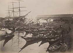
Native canoes at Ballast Island, c. 1890 Ballast Island, c 1890.png
Native canoes at Ballast Island, c.1890

By the mid-1800s, significant numbers of Native American migrant workers had begun regular travel to the southern Puget Sound. They frequently camped in settlements along the Seattle waterfront during the 1860s and 70s. [9] [10] Worker camps emerged on Ballast Island soon after the island's creation, with residents sleeping in tents or canoes. While they were initially largely employed by sawmills, hop farming gained increasing primacy throughout the 1880s and 90s. Workers would typically stay on the island for several days to share news and trade goods, before traveling by rail to inland hop farms during the summer harvests. [11] [12] Itinerant native tradesmen would also visit the island to sell seafood and various handmade wares. Although likely initially limited to regional Coast Salish peoples, they were later joined at the site by seasonal migrants from British Columbia and Alaska. Before the mid-19th century, these northern nations had regularly conducted slave raids in the Puget Sound, but instead adopted migrant labor to fund potlatch ceremonies. [13]

Descriptions of the island were primarily limited to local newspapers, with the island first mentioned offhand in a November 1882 issue of the Post-Intelligencer. Native settlement on the island was initially treated as a novelty or romanticized, frequently attracting tourists and journalists to the island to see the Native residents, seen in popular thought as the last of a vanishing race of people. [14]

The 1889 Great Seattle Fire did not spread to Ballast Island, but destroyed the adjacent Oregon Improvement Company docks, later rebuilt at a larger scale. By 1890, native settlement on Ballast Island began to take a more permanent character. After repeated pressure by the Seattle Chief of Police to remove the native residents, the OIC ordered their eviction in late January 1890, giving less than a week to leave the island. The Seattle Police evicted attempted native camps on the island over the following months, and sheds were erected by rail workers. However, eviction enforcement quickly ceased, and by the fall of 1890 returning hop pickers re-established habitation on the island, constructing around 40 huts. By the 1890s, local press began to cast the island in a sharply negative light, describing the Native inhabitants as squatters, and the island as a lawless and disease-ridden place. [15] Police briefly cleared and quarantined the island in 1892 due to suspicions of smallpox. [16]

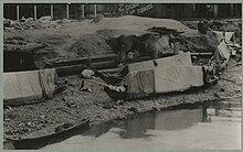
Camp on Ballast Island, c. 1895 Native American camp on Ballast Island, ca. 1895 - DPLA - dfc7e81b31bc428c18845b60e838241c.jpg
Camp on Ballast Island, c.1895

Ballast Island attracted Native workers from as far afield as Alaska and British Columbia, as well as from various regions along the Salish Sea. Although many were still employed as migrant farm workers, native residents of Ballast Island increasingly turned to merchant work, selling seafood and crafts to tourists and marketgoers. Despite negative press coverage, tourists continued visits to the island, often violating the privacy of the residents by exploring their houses and workspaces. [17]

On March 7, 1893, settler vigilantes torched and destroyed the West Seattle Duwamish village of t̕uʔəlalʔtxʷ, 'Herring's House', [18] forcing the inhabitants to flee to Ballast Island. [16] [19] Many of the Duwamish refugees on Ballast Island soon moved elsewhere, primarily to local reservations. A smaller number relocated to native communities along the Black and Duwamish River valleys, or to an encampment at West Point, now part of Magnolia. [20]

Subsumption and archaeology

The OIC announced plans to build a warehouse on Ballast Island in 1896. The warehouse was constructed two years later, alongside expansions of Ocean Dock, ending native residence on the island. [21] Portions of the island were covered by an elevated extension of Railroad Avenue, [22] alongside dredging operations to accommodate a slipway between the OIC docks. Much of the remaining portion of the island were covered by the construction of a Columbia and Puget Sound Railroad station in 1905. [23]

The material comprising Ballast Island sits in its original location beneath later developments in the Central Waterfront, [24] now 5–25 feet (1.5–7.5 m) beneath ground. It is now overlaid by additional fill reinforced with sheet pile retaining walls. [7] Atop the fill lies various roads including Alaskan Way, a parking lot, and portions of Pier 48. Only the eastern portion of the island has been subject to archaeological surveys, but has been modified considerably due to its location under and various utility networks. The western portion of the island is thought to be largely intact, and possibly containing archaeological artifacts undisturbed since they were first buried underground. [7]

During the construction of the State Route 99 tunnel, the Bertha tunnel boring machine became stuck in rocks near Ballast Island, triggering significant archaeological interest in the former island, alongside concerns that the tunnel boring may have inadvertently disturbed the remains of the site. [25] [26] The Washington State Department of Transportation and Washington Department of Archaeology and Historic Preservation began archaeological testing in the surrounding area. This testing led to more accurate identification of Ballast Island's location. Testing concluded that the remains of the island were not affected by the boring, although a shell midden was found near the site of the drill. [26] [27]

Legacy

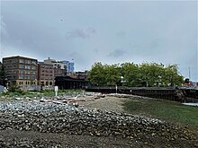
Ballast Island is now inland from the recently created Habitat Beach, looking southeast from Colman Dock Ballast Island3 NRHP 100006067 King County, WA.jpg
Ballast Island is now inland from the recently created Habitat Beach, looking southeast from Colman Dock

Ballast Island was listed on the National Register of Historic Places on January 27, 2021. [28]

A plaque memorializing the island is located at Washington Street Boat Landing, a pergola located adjacent to the former site of the island. [29] Public art commemorating the Duwamish presence on Ballast Island was installed in November 2023 at the newly-opened Pioneer Square Habitat Beach, part of Waterfront Park. Described by the Office of the Waterfront as a "interpretive viewing experience", the work consists of four stone columns, erected in a partnership between the Washington State Department of Transportation and various local tribal entities. [30]

Related Research Articles

<span class="mw-page-title-main">Chief Seattle</span> Suquamish and Duwamish chief (1790–1866)

Chief Seattle was a 19th-century leader of the Duwamish and Suquamish peoples. A leading figure among his people, he pursued a path of accommodation to white settlers, forming a personal relationship with "Doc" Maynard. The city of Seattle, in the U.S. state of Washington, was named after him. A widely publicized speech arguing in favor of ecological responsibility and respect of Native Americans' land rights had been attributed to him.

<span class="mw-page-title-main">Duwamish River</span> River in Washington, United States

The Duwamish River is the name of the lower 12 miles (19 km) of Washington state's Green River. Its industrialized estuary is known as the Duwamish Waterway. In 2009, the Duwamish Longhouse and Cultural Center was opened on the west bank of the river as part of the tribe's reassertion of its historic rights in the area and its continuing struggle for federal recognition of tribal status.

<span class="mw-page-title-main">Elliott Bay</span> Inlet in Seattle, Washington

Elliott Bay is a part of the Central Basin region of Puget Sound. It is in the U.S. state of Washington, extending southeastward between West Point in the north and Alki Point in the south. Seattle was founded on this body of water in the 1850s and has since grown to encompass it completely. The waterway it provides to the Pacific Ocean has served as a key element of the city's economy, enabling the Port of Seattle to become one of the busiest ports in the United States.

<span class="mw-page-title-main">Duwamish people</span> Coast Salish people in western Washington (state)

The Duwamish are a Lushootseed-speaking Southern Coast Salish people in western Washington, and the Indigenous people of metropolitan Seattle.

Two conflicting perspectives exist for the early history of Seattle. There is the "establishment" view, which favors the centrality of the Denny Party, and Henry Yesler. A second, less didactic view, advanced particularly by historian Bill Speidel and others such as Murray Morgan, sees David Swinson "Doc" Maynard as a key figure, perhaps the key figure. In the late nineteenth century, when Seattle had become a thriving town, several members of the Denny Party still survived; they and many of their descendants were in local positions of power and influence. Maynard was about ten years older and died relatively young, so he was not around to make his own case. The Denny Party were generally conservative Methodists, teetotalers, Whigs and Republicans, while Maynard was a drinker and a Democrat. He felt that well-run prostitution could be a healthy part of a city's economy. He was also on friendly terms with the region's Native Americans, while many of the Denny Party were not. Thus Maynard was not on the best of terms with what became the Seattle Establishment, especially after the Puget Sound War. He was nearly written out of the city's history until Morgan's 1951 book Skid Road and Speidel's research in the 1960s and 1970s.

<span class="mw-page-title-main">Alki Point, Seattle</span> Seattle Neighborhood in Washington, United States

Alki Point is a point jutting into Puget Sound, the westernmost landform in the West Seattle district of Seattle, Washington. Alki is the peninsular neighborhood on Alki Point. Alki was the original settlement in what was to become the city of Seattle. It was part of the city of West Seattle from 1902 until that city's annexation by Seattle in 1907.
<span class="mw-page-title-main">Bitter Lake (Seattle)</span>

Bitter Lake is a small lake in northwest Seattle, Washington, USA.

<span class="mw-page-title-main">Union Bay (Seattle)</span> Bay of Lake Washington in Seattle

Union Bay is a body of water located in Seattle, Washington. Part of Lake Washington, it is bounded by the Laurelhurst neighborhood to the north and the Montlake and Madison Park neighborhoods to the south. The Evergreen Point Floating Bridge, which carries State Route 520, crosses over a portion of the bay.

<span class="mw-page-title-main">Salmon Bay</span>

Salmon Bay is a portion of the Lake Washington Ship Canal, which passes through the city of Seattle, linking Lake Washington to Puget Sound, lying west of the Fremont Cut. It is the westernmost section of the canal and empties into Puget Sound's Shilshole Bay. Because of the Hiram M. Chittenden Locks, the smaller, western half of the bay is salt water, and the eastern half is fresh water.

<span class="mw-page-title-main">Leschi Park</span> Seattle park on the shore of Lake Washington

Leschi Park is an 18.5 acres (75,000 m2) park in the Leschi neighborhood of Seattle, Washington, named after Chief Leschi of the Nisqually tribe. The majority of the park is a grassy hillside that lies west of Lakeside Avenue S. and features tennis courts, picnic tables, and a playground. Across Lakeside Avenue to the east is the western shore of Lake Washington and a small lawn with benches. To its south is the southern portion of Leschi Moorage, separated from the northern portion by a parking lot in the E. Yesler Way right-of-way, private docks, and an office/restaurant complex.

<span class="mw-page-title-main">Bodies of water of Seattle</span>

The city of Seattle, Washington, is located on a narrow isthmus between Puget Sound on the west and Lake Washington on the east; water comprises approximately 41% of the total area of the city. It was founded on the harbor of Elliott Bay, home to the Port of Seattle—in 2002, the 9th busiest port in the United States by TEUs of container traffic and the 46th busiest in the world.

<span class="mw-page-title-main">Princess Angeline</span> Native American basket weaver

Princess Angeline, also known in Lushootseed as Kikisoblu, Kick-is-om-lo, or Wewick, was the eldest daughter of Chief Seattle.

<span class="mw-page-title-main">Duwamish Head</span> Landform in Seattle, Washington, United States

Duwamish Head is the northernmost point in West Seattle, Washington, jutting into Elliott Bay.

The region now known as Seattle has been inhabited since the end of the last glacial period. Archaeological excavations at West Point in Discovery Park, Magnolia confirm that the Seattle area has been inhabited by humans for at least 4,000 years and probably much longer. West Point was called Oka-dz-elt-cu, Per-co-dus-chule, or Pka-dzEltcu. The village of tohl-AHL-too had been inhabited at least since the 6th century CE, as had hah-AH-poos—"where there are horse clams"—at the then-mouth of the Duwamish River in what is now the Industrial District. The Lushootseed (Skagit-Nisqually)-speaking Salish Dkhw'Duw'Absh and Xacuabš —ancestors of today's Duwamish Tribe—occupied at least 17 villages in the mid-1850s and lived in some 93 permanent longhouses (khwaac'ál'al) along the lower Duwamish River, Elliott Bay, Salmon Bay, Portage Bay, Lake Washington, Lake Sammamish, and the Duwamish River tributaries, the Black and Cedar Rivers.
<span class="mw-page-title-main">Henry Yesler</span> American politician

Henry Leiter Yesler was an American entrepreneur and a politician, regarded as a founder of the city of Seattle. Yesler served two non-consecutive terms as Mayor of Seattle, and was the city's wealthiest resident during his lifetime.

<span class="mw-page-title-main">Battle of Seattle (1856)</span> Part of the Puget Sound War & Yakima War

The Battle of Seattle was a January 26, 1856 attack by Native American tribesmen upon Seattle, Washington. At the time, Seattle was a settlement in the Washington Territory that had recently named itself after Chief Seattle (Sealth), a leader of the Suquamish and Duwamish peoples of central Puget Sound.
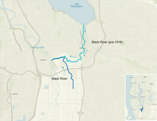
<span class="mw-page-title-main">Black River (Duwamish River tributary)</span>

The Black River is a tributary of the Duwamish River in King County in the U.S. state of Washington. It drained Lake Washington until 1916, when the opening of the Lake Washington Ship Canal lowered the lake, causing part of the Black River to dry up. It still exists as a dammed stream about 2 miles (3.2 km) long.

<span class="mw-page-title-main">Central Waterfront, Seattle</span> Neighborhood in Seattle

The Central Waterfront of Seattle, Washington, United States, is the most urbanized portion of the Elliott Bay shore. It runs from the Pioneer Square shore roughly northwest past Downtown Seattle and Belltown, ending at the Broad Street site of the Olympic Sculpture Park.

Shortly after the settlement's first incorporation in 1865, the Board of Trustees of the Town of Seattle, Washington Territory, passed Ordinance No. 5, subtitled An Ordinance for the Removal of Indians, expelling all Native Americans from residence in the town unless employed and housed by a white settler. Instituted on February 7, 1865, the ordinance banned all Native Americans from living within the town limits of Seattle unless employed by a settler and housed immediately adjacent to their employer.
References

Citations

  1. 1 2 3 Williams 2015, p. 78.
  2. Willis, Park Reed (January 1943). "A Journey to Seattle, 1883". Pacific Northwest Quarterly . 34 (1): 24. JSTOR   40486579. Archived from the original on February 25, 2024. Retrieved February 25, 2024.
  3. Dorpat, Paul (January 16, 2005). "Import Island". Pacific Northwest Magazine. The Seattle Times . Archived from the original on April 8, 2005. Retrieved February 26, 2024.
  4. 1 2 3 Curti, Lee & Manetas 2020, p. 12.
  5. Curti, Lee & Manetas 2020, p. 6.
  6. 1 2 3 Curti, Lee & Manetas 2020, p. 4.
  7. 1 2 Williams 2015, p. 213.
  8. Asaka 2022, p. 75.
  9. Curti, Lee & Manetas 2020, p. 13.
  10. Thrush 2017, pp. 105–108.
  11. Curti, Lee & Manetas 2020, pp. 13–14.
  12. Curti, Lee & Manetas 2020, pp. 13–16.
  13. Curti, Lee & Manetas 2020, pp. 13–15.
  14. Curti, Lee & Manetas 2020, pp. 14–15.
  15. 1 2 Curti, Lee & Manetas 2020, p. 16.
  16. Curti, Lee & Manetas 2020, pp. 15–16.
  17. Hilbert, Vi; Miller, Jay; Zahir, Zalmai (2001). sdaʔdaʔ gʷəɬ dibəɬ ləšucid ʔacaciɬtalbixʷ - Puget Sound Geography. Original Manuscript from T.T. Waterman. Lushootseed Press. p. 64. ISBN   979-8750945764.
  18. Thrush 2017, pp. 82–83.
  19. Thrush 2017, pp. 85–86.
  20. Curti, Lee & Manetas 2020, p. 17.
  21. Thomas Street History Services 2006, p. 4.
  22. Thomas Street History Services 2006, p. 18.
  23. Curti, Lee & Manetas 2020, p. 7.
  24. Berger, Knute (February 19, 2014). "Could the Bertha Boondoggle be a Local History Boon?". Crosscut.com . Archived from the original on February 19, 2024. Retrieved February 26, 2024.
  25. 1 2 Berger, Knute (October 23, 2014). "The Dirt on Bertha". Crosscut.com. Archived from the original on February 19, 2024. Retrieved February 26, 2024.
  26. Elder, J. Tait (October 2016). Review and Evaluation of Common Deep Subsurface Archaeological Investigation Methods (PDF) (Report). Washington State Department of Transportation. ICF International. p. 5-5. Archived (PDF) from the original on February 21, 2024. Retrieved February 21, 2024.
  27. Curti, Lee & Manetas 2020, p. 1.
  28. "Washington Street Boat Landing". Seattle Parks and Recreation. Archived from the original on February 5, 2024. Retrieved February 5, 2024.
  29. "Man-made habitat beach opens at Seattle waterfront". Seattle Daily Journal of Commerce . July 3, 2023. Archived from the original on February 5, 2024. Retrieved February 5, 2024.

Sources