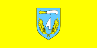
Slunj is a town in the mountainous part of Central Croatia, located along the important North-South route to the Adriatic Sea between Karlovac and Plitvice Lakes National Park, on the meeting of the rivers Korana and Slunjčica. Slunj has a population of 1,674, with a total of 5,076 people in the municipality (2011) and is the cultural and social center of the region of Kordun in the vicinity to Bosnia and Herzegovina. Administratively, the town is part of Karlovac County. Slunj is an underdeveloped municipality which is statistically classified as part of the First Category Area of Special State Concern by the Government of Croatia.

Petlovac is a village and municipality in the western part of Baranja, which comprise the northern part of Osijek-Baranja County in Croatia. Petlovac is underdeveloped municipality which is statistically classified as the First Category Area of Special State Concern by the Government of Croatia.

Veliki Grđevac is a municipality in Bjelovar-Bilogora County, Croatia.

Cerina, Croatia is a village in the municipality Čazma, Bjelovar-Bilogora County in Croatia. It is connected by the D26 highway.
Uljanik is a village in the municipality Garešnica, Bjelovar-Bilogora County in Croatia. It is connected by the D26 highway.
Pavlovac is a village in the municipality Veliki Grđevac, Bjelovar-Bilogora County in Croatia.
Donja Kovačica is a village in the municipality Veliki Grđevac, Bjelovar-Bilogora County in Croatia.
Gornja Kovačica is a village in the municipality Veliki Grđevac, Bjelovar-Bilogora County in Croatia.
Cremušina is a village in the municipality Veliki Grđevac, Bjelovar-Bilogora County in Croatia.
Mala Pisanica is a village in the municipality Veliki Grđevac, Bjelovar-Bilogora County in Croatia.
Mali Grđevac is a village in the municipality Veliki Grđevac, Bjelovar-Bilogora County in Croatia.
Topolovica is a village in the municipality Veliki Grđevac, Bjelovar-Bilogora County in Croatia.
Zrinska is a village in the municipality Veliki Grđevac, Bjelovar-Bilogora County in Croatia.
Hrastovac is a settlement in the municipality Garešnica, Bjelovar-Bilogora County in Croatia. It is connected by the D26 highway.
Sokolovac is a village in the municipality Dežanovac, Bjelovar-Bilogora County in Croatia.
Pobjenik is a village in the municipality of Čazma, Bjelovar-Bilogora County in Croatia. Pobjenik is located on the north-western slopes of Moslavačka gora.
Dugo Selo Lasinjsko is a village in central Croatia, in the municipality of Gvozd, Sisak-Moslavina County.
Mačkovo Selo is a village in central Croatia, in the Town of Petrinja, Sisak-Moslavina County. It is connected by the D30 highway.
Staro Selo Topusko is a village in central Croatia, in the municipality of Topusko, Sisak-Moslavina County.
Buhača is a village in central Croatia, in the municipality of Cetingrad, Karlovac County. It is connected by the D216 highway.


