Bangar, Brunei

Last updated

Bangar
Pekan Bangar
Town
Bangar Town
Temburong 27 July 2023 37.jpg
Temburong 27 July 2023 64.jpg
Temburong 27 July 2023 29.jpg
2023 Majlis Ramah Mesra Temburong 17.jpg
Clockwise from top left: Bangar town foyer, Temburong market, Temburong sign, Sultan's Silver Jubilee arch
Brunei location map.svg
Red pog.svg
Location in Brunei
Coordinates: 4°42′31″N115°04′26″E / 4.7086°N 115.0739°E / 4.7086; 115.0739
Country Brunei
District Temburong
Mukim Bangar
Population
 (2021)
  Total451
Time zone UTC+8 (BNT)
Postcode
PA1151

Bangar (Malay : Pekan Bangar) is a town and administrative centre of Temburong District, Brunei, an isolated territorial exclave separated from the rest of the country by the Malaysian state of Sarawak. The population of the town proper was 451 in 2021. [1] A number of tiny retail establishments may be found throughout the town, providing everything from clothing to handicrafts to basic needs. [2]

Contents

Name

The origin name of the town has not been fully established thus several possibilities were opened up. A document published by the Ministry of Culture, Youth and Sports, claimed that the town has a literal descriptive name where Bangar meant a place of smelly dryish deadwood swamp. [3] Meanwhile the Kampong Belingos Protection Council (Majlis Perundingan Kampung Belingos) claimed that the word Bangar is derived from a Murut tribe that means board (papan). [4]

The origin of this term may be traced back to a location where the Murut people formerly donated boards for the construction of homes, huts, and boats close to the Pekan Bangar creek. Thus, Bengar was given to the region. However, the Survey Department at the time altered the name to Bangar. Old Bangar Town and New Bangar Town were the original divisions of Bangar Town. But as of late, that name has been dropped and replaced with Pekan Bangar alone. [4]

Geography

One main road runs through the town, roughly east–west. Headed east of Bangar is Lawas, Sarawak (Malaysia) and to the west is the river crossing to Limbang, Sarawak (Malaysia). The road is the major route to the local quarry where boulders are collected, processed and shipped to stockyards in the capital, Bandar Seri Begawan, for construction companies. The town has a tropical rainforest climate (Af) with heavy to very heavy rainfall year-round.

Climate data for Bangar
MonthJanFebMarAprMayJunJulAugSepOctNovDecYear
Mean daily maximum °C (°F)30.1
(86.2)
30.0
(86.0)
30.7
(87.3)
31.4
(88.5)
31.4
(88.5)
31.4
(88.5)
31.1
(88.0)
31.0
(87.8)
31.1
(88.0)
30.8
(87.4)
30.6
(87.1)
30.5
(86.9)
30.8
(87.5)
Daily mean °C (°F)27.1
(80.8)
27.0
(80.6)
27.4
(81.3)
28.0
(82.4)
28.0
(82.4)
27.9
(82.2)
27.6
(81.7)
27.6
(81.7)
27.6
(81.7)
27.5
(81.5)
27.3
(81.1)
27.3
(81.1)
27.5
(81.5)
Mean daily minimum °C (°F)24.1
(75.4)
24.1
(75.4)
24.2
(75.6)
24.6
(76.3)
24.7
(76.5)
24.5
(76.1)
24.2
(75.6)
24.2
(75.6)
24.2
(75.6)
24.2
(75.6)
24.1
(75.4)
24.2
(75.6)
24.3
(75.7)
Average rainfall mm (inches)380
(15.0)
258
(10.2)
258
(10.2)
310
(12.2)
360
(14.2)
278
(10.9)
298
(11.7)
294
(11.6)
385
(15.2)
389
(15.3)
410
(16.1)
392
(15.4)
4,012
(158)
Source: Climate-Data.org [5]

Administration

Bangar is an unincorporated town; it has no municipal body. It is only a village subdivision within Mukim Bangar, a mukim in the district. [6] [7] [8] It has the postcode PA1151. [9] The town serves as a stopover and a communication hub and is the district administrative headquarters. [10]

Transportation

Road

Driving and going through the Puni Immigration Control Post in order to pass the Malaysian state of Sarawak's border at Limbang. More projects to improve road infrastructures, including those in Temburong District, would be carried out through the National Development Plan 2007–2012. These projects include repairing earth slips at various locations, upgrading high density roads to residential areas, replacing existing wooden bridges, and rehabilitating Jalan Bangar–Puni–Labu. [2]

Water

The town sitting along the Temburong River in 2012. Bangar.jpg
The town sitting along the Temburong River in 2012.

The Pekan Bangar Boat Terminal construction project got under way on 19 June 2008, and it was finished on 19 December 2009. On 7 January 2010, Pehin Dato Haji Awang Abu Bakar, formally opened the terminal. The National Development Plan project that resulted in the construction of this port cost roughly $1.4 million. The route involves taking a boat to Bangar Town via Temburong River, which departs from a dock along the Brunei River. It should take 45 minutes to complete the route. [2]

The Bangar Passenger Jetty Terminal reopened on 13 March 2018, according to the Maritime and Port Authority of Brunei Darussalam (MPABD), and offered boarding and disembarkation services for passenger boats traveling from Bangar to Bandar Seri Begawan. [11]

All passenger services of the jetty permanently closed their operations after Radio Television Brunei (RTB) Temburong District took over the Bangar MPABD building as their new branch once renovation works were completed on 1 March 2022. The Passenger Jetty Terminal continues to exist but remains unused. [12]

Air

Commercial travellers would have to travel to either Bandar Seri Begawan or Miri to catch a commercial flight. [13] The Bangar Helipad is the sole aviation facility. [14]

Infrastructure

Government

Bangar Camp Temburong 27 July 2023 69.jpg
Bangar Camp

Government facilities in Bangar include:

Commerce

Bumiputera Main Complex has a variety of stores are housed on the three floors of this building, including a grocery store, a handicraft and souvenir shop, a cake shop, restaurants, a textile shop, a dhobi, a travel agency, and many more. [2]

Tamu Aneka Temburong is a market to sample regional specialties, which are widely accessible at this dry market in the town across from the Youth Centre. [2]

Sultan Hassan Primary School Temburong 27 July 2023 63.jpg
Sultan Hassan Primary School

Education

Schools in Bangar include:

The Temburong District Library is a public library which sits on Jalan Labu, Eastern half of the town. [22]

Utama Mohammad Salleh Mosque Temburong 27 July 2023 62.jpg
Utama Mohammad Salleh Mosque

Tourist attractions

Recreation and sports

Related Research Articles

Districts are the principal administrative divisions of Brunei. The country is divided into four districts, namely Brunei-Muara, Belait, Tutong and Temburong. Temburong is an exclave; it is physically separated from the three other districts by the Brunei Bay and Malaysian state of Sarawak. Each district has a town as its administrative and main economic centre, with the exception of Brunei-Muara, where the principal centre is Bandar Seri Begawan, a city and the country's capital.

<span class="mw-page-title-main">Tutong District</span> District of Brunei

Tutong District or simply Tutong is one of the four districts of Brunei. It has an area of 1,166 square kilometres (450 sq mi); the population was 48,313 in 2016. The administrative town is Pekan Tutong. It is home to Tasek Merimbun, the country's largest natural lake.

<span class="mw-page-title-main">Temburong District</span> District of Brunei

Temburong District, or simply Temburong, is the easternmost district in Brunei. It is an exclave surrounded by Malaysia and the Brunei Bay. Temburong is accessible from Brunei's mainland via the Sultan Haji Omar Ali Saifuddien Bridge. It has a total area of 1,306 km2 (504 sq mi). As of 2016, its population was 10,251; it is the least populous district in Brunei. Bangar is the administrative centre of the Temburong District.

<span class="mw-page-title-main">Kuala Belait</span> Town in Brunei

Kuala Belait is the administrative town of Belait District, Brunei. The population of the town proper was 4,259 in 2016. Kuala Belait is officially a municipal area, as well as a village under the mukim of the same name. The town is located 85 kilometres (53 mi) west of the country's capital Bandar Seri Begawan, and 20 kilometres (12 mi) west of Seria, the district's other town. It is also in the westernmost part of country, near the mouth of the Belait River.

<span class="mw-page-title-main">Tutong (town)</span> Municipality in Brunei

Tutong is a municipality town in Mukim Pekan Tutong Tutong District, Brunei. It is located about 40 kilometres (25 mi) from the country's capital Bandar Seri Begawan. It is the administrative centre of Tutong District.

<span class="mw-page-title-main">Temburong River</span> River in Brunei

The Temburong River is a river in Brunei. It is the second smallest of the four main rivers in the country and drains a catchment area of around 840 square kilometres. Temburong District, through which it flows, is one of the four districts of Brunei. It lies in the east and is sparsely populated.

The administrative divisions of Brunei Darussalam mainly consist of daerah (districts), mukim (sub-districts), and kampung or kampong (villages). They are organised hierarchically in Brunei Darussalam, with daerah being the largest first level, and kampong the smallest third level.

<span class="mw-page-title-main">Mukim Kuala Belait</span> Mukim of Brunei

Mukim Kuala Belait is a mukim in Belait District, Brunei. The population was 31,308 in 2016. The mukim encompasses Kuala Belait, the administrative town of the district.

<span class="mw-page-title-main">Mukim Bukit Sawat</span> Mukim of Brunei

Mukim Bukit Sawat is a mukim in Belait District, Brunei. It had a population of 794 in 2016.

<span class="mw-page-title-main">Mukim Lamunin</span> Mukim of Brunei

Mukim Lamunin is a mukim in Tutong District, Brunei. The population was 4,298 in 2016.

<span class="mw-page-title-main">Mukim Amo</span> Mukim of Brunei

Mukim Amo is a mukim in Temburong District, Brunei. It has an area of 542 square kilometres (209 sq mi); the population was 1,657 in 2021.

<span class="mw-page-title-main">Mukim Bangar</span> Mukim of Brunei

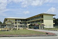
Mukim Bangar is a mukim in Temburong District, Brunei. It has a total area of 113 square kilometres (44 sq mi); the population was 2,112 in 2021. The mukim encompasses Bangar, the district's sole town and administrative centre.

<span class="mw-page-title-main">Mukim Batu Apoi</span> Mukim of Brunei

Mukim Batu Apoi is a mukim in Temburong District, Brunei. It has an area of 222 square kilometres (86 sq mi); as of 2021, the population was 1,355.

<span class="mw-page-title-main">Mukim Bokok</span> Mukim of Brunei

Mukim Bokok is a mukim in Temburong District, Brunei. It has an area of 136 square kilometres (53 sq mi); as of 2021, the population was 3,812.

<span class="mw-page-title-main">Mukim Labu</span> Mukim of Brunei

Mukim Labu is a mukim in Temburong District, Brunei. It has an area of 292 square kilometres (113 sq mi); the population was 508 in 2021.

Postal codes in Brunei are known as postcodes and they are alphanumeric, consisting of two letters followed by four digits. Postcodes in Brunei are issued by the Postal Services Department, a government department under the Ministry of Communications.

<span class="mw-page-title-main">Kampong Serasa</span> Village in Brunei

Kampong Serasa is a village in Brunei-Muara District, Brunei, near the port town Muara. The population was 3,200 in 2016. It is home to Serasa Ferry Terminal, the country's primary international ferry terminal.

Municipalities in Brunei are settlements which have been incorporated by the government to run as municipalities. They are independent from the hierarchy of the country's subdivisions but nevertheless overlap with mukims and villages, the second- and third-level administrative divisions of Brunei. The governing body of a municipality is municipal department which is a government department under the Ministry of Home Affairs; the head is a chairman which is equivalent to mayor.

<span class="mw-page-title-main">Bukit Bendera, Brunei</span> Village in Tutong, Brunei

Bukit Bendera is a populated area in Tutong, the town of Tutong District, Brunei. It is officially a village-level subdivision under the mukim or subdistrict of Pekan Tutong, as well as a designated postcode area with the postcode TA1341. Parts of Bukit Bendera area is also under the spatial jurisdiction of Tutong Municipal Department, the municipal body of the town.

Kampong Puni is a village in Temburong District, Brunei, about 3–4 kilometres (1.9–2.5 mi) from the district town Bangar. The population was 259 in 2021. It is one of the villages within Mukim Bangar. The postcode is PA3751.

References

  1. "ANNEX B" (PDF). deps.MoFE.gov.bn. Department of Economic Planning & Statistics. October 2021. Retrieved 23 January 2024.
  2. 1 2 3 4 5 6 Temburong District (PDF). English News Division Information Department Prime Minister’s Office. 2011. pp. 13, 17, 20–21.
  3. Mohd Yunos, Rozan (2013). SEMINAR UNITED NATIONS GROUP OF EXPERTS ON GEOGRAPHICAL NAMES ASIA, SOUTHEAST DIVISION (PDF). p. 2.
  4. 1 2 "SEJARAH KAMPUNG". Majlis Perundingan Kampung Belingos. 3 June 2009. Retrieved 10 July 2023.
  5. "Climate: Bangar". Climate-Data.org. Retrieved 12 August 2020.
  6. Brunei Darussalam street directory : quick & easy reference maps., Brunei Press Sdn. Bhd., 2014, pp. 188–189 & 198–199, ISBN   9789991732411, OCLC   932264901
  7. "Temburong District" (PDF). www.information.gov.bn. p. 8. Retrieved 28 February 2018.
  8. "Jabatan Daerah Temburong, Kementerian Hal Ehwal Dalam Negeri - MUKIM BANGAR". temburong.gov.bn (in Malay). Retrieved 28 February 2018.
  9. "Buku Poskod Edisi Kedua (Kemaskini 26 Disember 2018)" (PDF). post.gov.bn (in Malay). Brunei Postal Services Department. 26 December 2018. Retrieved 29 July 2021.
  10. "MUKIM BANGAR". Jabatan Daerah Temburong. Retrieved 10 July 2023.
  11. "Terminal Jeti Bangar beroperasi » Media Permata Online". Terminal Jeti Bangar beroperasi. 14 March 2018. Retrieved 10 July 2023.
  12. "RTB unveils new building in Temburong District » Borneo Bulletin Online". RTB unveils new building in Temburong District. 22 March 2022. Retrieved 11 July 2023.
  13. Inc, IBP (14 May 2016). Brunei Business and Investment Opportunities Yearbook Volume 1 Strategic Information and Opportunities. Lulu.com. p. 182. ISBN   978-1-4387-0627-6.{{cite book}}: |last= has generic name (help)
  14. "PUJA". www.pujajournal.com. Retrieved 10 July 2023.
  15. "Jadual kaunter perkhidmatan pos sempena Jubli Emas » Media Permata Online". Jadual kaunter perkhidmatan pos sempena Jubli Emas. 4 October 2017. Retrieved 10 July 2023.
  16. "Lawatan kenali tugas bomba » Media Permata Online". Lawatan kenali tugas bomba. 5 October 2022. Retrieved 10 July 2023.
  17. "Berita 2021b - Barang tegahan ditemukan di dalam kenderaan..." www.pelitabrunei.gov.bn. Retrieved 10 July 2023.
  18. 1 2 "Jabatan Daerah Temburong, Kementerian Hal Ehwal Dalam Negeri - Latar Belakang Jabatan Daerah". www.temburong.gov.bn. Retrieved 10 July 2023.
  19. "Kem. Pertahanan imarah masjid di Temburong » Media Permata Online". Kem. Pertahanan imarah masjid di Temburong. 11 April 2022. Retrieved 10 July 2023.
  20. "Sultan Hassan Secondary School new building". Brunei News Gazette. 6 March 2023. Retrieved 13 July 2023.
  21. "Call for more Temburong tourism packages". borneo363.rssing.com. Retrieved 10 July 2023.
  22. "Perpustakaan DBP Seluruh Negara". www.dbplibrary.gov.bn. Retrieved 19 December 2017.
  23. "Attractions – Green Brunei" . Retrieved 10 July 2023.
  24. "Berita - Umat Islam di Temburong tunaikan Sembahyang..." www.pelitabrunei.gov.bn. Retrieved 10 July 2023.
  25. Haji.), Metussin bin Haji Baki (Awang (1993). Catatan sejarah masjid-masjid Negara Brunei Darussalam (in Malay). Jabatan Hal Ehwal Syara'iah, Kementerian Hal Ehwal Ugama. p. 366.
  26. 1 2 "Old Temburong District Office to be turned into museum | The BT Archive". btarchive.org. Retrieved 10 July 2023.
  27. "bruakal: facts about Brunei". Tumblr. Retrieved 10 July 2023.
  28. Melayong, Muhammad Hadi bin Muhammad (2009). Memoir seorang negarawan (in Malay). Pusat Sejarah Brunei, Kementerian Kebudayaan, Belia dan Sukan. p. 148. ISBN   978-99917-34-69-9.
  29. "Jabatan Muzium-Muzium - Monumen dan Tapak-Tapak Arkeologi". www.museums.gov.bn. Retrieved 10 July 2023.
  30. "Taman Perayaan berwajah baru » Media Permata Online". Taman Perayaan berwajah baru. 29 May 2017. Retrieved 10 July 2023.