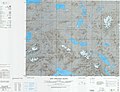
Bangda Lake

Last updated
Bangda Lake
Yeshil Kul
Bangda Lake 2021-08-19 Sentinel-2 L2A True color.jpg
Sentinel-2 image (2021)
China Tibet Ngari relief location map.svg
Red pog.svg
Bangda Lake
Location Rutog County, Ngari Prefecture, Tibet Autonomous Region, China
Coordinates 34°56′56″N81°34′16″E / 34.94889°N 81.57111°E / 34.94889; 81.57111 Coordinates: 34°56′56″N81°34′16″E / 34.94889°N 81.57111°E / 34.94889; 81.57111
Catchment area 3,314.5 km2 (1,300 sq mi)
Basin  countriesChina
Max. length15 km (9 mi)
Max. width9.7 km (6 mi)
Surface area106.5 km2 (0 sq mi)
Surface elevation4,902 m (16,083 ft)
References [1]

Bangda Lake (Tibetan : པང་བཏགས་མཚོ, Wylie : pang btags mtsho, THL : pang tak tso; Chinese :邦达错; pinyin :Bāngdá Cuò), [lower-alpha 1] formerly called Yeshil Kul, [2] [lower-alpha 2] is a glacial lake in Ngari Prefecture in the northwest of the Tibet Autonomous Region of China. It lies south of the western Kunlun Mountains, only a few kilometres to the southeast of Guozha Lake (Lake Lighten). [2] Located at an altitude of 4902 metres, it covers an area of 106 square kilometres with a maximum depth of 21.6 metres and has a drainage basin containing 90 glaciers. [3]

Contents

Location

Located at an elevation of 4,902 metres (16,083 ft), the Bangda Lake covers an area of 106 square kilometres with a maximum depth of 21.6 metres and contains 90 glaciers. [4]

Yeshil Kul is located along an ancient travel route between Ladakh and Khotan via the Keriya Pass. [5] [6] The route runs along the Longmu Co fault up to Yeshil Kul, and then heads north to the Keriya Pass, after which the valleys of the Iksu, Polu and Keriya rivers are followed.

A "Xinjiang–Tibet Highway" was laid by the People's Republic of China between the Polu town and the vicinity of the Bangda Lake during 1950–1951, prior to its annexation of Tibet. [7] [8] Jeep tracks were then made over the relatively flat, hard terrain of the Longmu Co fault, leading to Rudok. A regular jeep traffic had commenced by 1953. [9] China has recently constructed a highway that runs along the fault connecting the G219 and G216 highways. [10]

Maps

Notes

  1. Other forms include Bangdag, Pangtak and Pantak.
  2. Variations include Yashil Kul, Yashil Tso, Yashil Cho, Yahsierh Tso.

Related Research Articles

<span class="mw-page-title-main">Aksai Chin</span> Disputed region in Xinjiang, Tibet, and Kashmir

Aksai Chin is a region administered by China as part of Hotan County, Hotan Prefecture, Xinjiang and Rutog County, Ngari Prefecture, Tibet. It is claimed by India to be a part of its Leh District, Ladakh Union Territory. It is a part of the eastern portion of the Kashmir region and has been a subject of dispute between India and China since the late 1950s.

<span class="mw-page-title-main">Kunlun Mountains</span> Mountain range in China

The Kunlun Mountains constitute one of the longest mountain chains in Asia, extending for more than 3,000 kilometres (1,900 mi). In the broadest sense, the chain forms the northern edge of the Tibetan Plateau south of the Tarim Basin.

<span class="mw-page-title-main">Pangong Tso</span> Soda lake located in India and Tibet

Pangong Tso or Pangong Lake is an endorheic lake spanning eastern Ladakh and West Tibet situated at an elevation of 4,225 m (13,862 ft). It is 134 km (83 mi) long and divided into five sublakes, called Pangong Tso, Tso Nyak, Rum Tso and Nyak Tso. Approximately 50% of the length of the overall lake lies within Tibet in China, 40% in Ladakh, India and the remaining 10% is disputed and is a de-facto buffer zone between India and China. The lake is 5 km (3.1 mi) wide at its broadest point. All together it covers almost 700 km2. During winter the lake freezes completely, despite being saline water. It has a land-locked basin separated from the Indus River basin by a small elevated ridge, but is believed to have been part of the latter in prehistoric times.

<span class="mw-page-title-main">Altyn-Tagh</span> Mountain range

Altyn-Tagh is a mountain range in Northwestern China that separates the Eastern Tarim Basin from the Tibetan Plateau. The western third is in Xinjiang while the eastern part forms the border between Qinghai to the south and Xinjiang and Gansu to the north.

<span class="mw-page-title-main">Rudok</span> Village in Rutog County, Ngari, Tibet

Rudok, also spelt Rutok and Rutog, more properly Rudok Dzong, is a town that served as the historical capital of the Rudok area in Western Tibet on the frontier with Ladakh. In the 1911 Encyclopædia Britannica, it is described as being "picturesquely situated" on the side of a hill standing isolated in the plain near the east end of Lake Pangong.

<span class="mw-page-title-main">Rutog County</span> County in Tibet Autonomous Region, Peoples Republic of China

Rutog County, is a county in Ngari Prefecture, Tibet Autonomous Region of the People's Republic of China. The county seat is the new Rutog Town, located some 1,140 km (710 mi) or 700 miles west-northwest of the Tibetan capital, Lhasa. Rutog County shares a border with India.

<span class="mw-page-title-main">Xainza County</span> County in Tibet, China

Xainza County, also Shantsa, Shentsa, is a county within Nagqu of the Tibet Autonomous Region of China. In 1999 the county had a population of 16,190.

<span class="mw-page-title-main">Hindutash Pass</span>

Hindu-tagh Pass, also known as Hindutash, is a historical mountain pass in the western Xinjiang, China. The pass cuts through the Kunlun Mountains connecting the now-deserted town of Kangxiwar in the Karakash River valley to the town of Pusha in the Pusha Jilga valley. It also connects to the road to the city of Hotan.

<span class="mw-page-title-main">Rutog Town</span> Town in the Tibet Autonomous Region

The Rutog Town , called Rituzhen in Chinese, is a town and the seat of Rutog County in the far western Tibet Autonomous Region. It is also a major military base for China near the disputed border with India allowing it to press its claims militarily.

The Kongka Pass or Kongka La is a low mountain pass on the Line of Actual Control between India and China in eastern Ladakh. It lies on a spur of the Karakoram range that intrudes into the Chang Chenmo Valley adjacent to the disputed Aksai Chin region. China claimed the location as its border in a 1956 map, and attacked an Indian patrol party in 1959 killing ten policemen and apprehending ten others. Known as the Kongka Pass incident, the event was a milestone in the escalation of the border dispute between the two countries.

<span class="mw-page-title-main">Aksai Chin Lake</span> Endorheic lake in Chinese-administered Kashmir

Aksai Chin Lake or Aksayqin Lake, is an endorheic lake in the disputed region of Aksai Chin. The plateau is administered by China but also claimed by India. Its Tibetan/Ladakhi name is Amtogor Lake which means "encounter with a round object".

<span class="mw-page-title-main">Guozha Lake</span> Body of water

Kotra Tso, or Guozha Lake , previously called Lake Lighten, is a glacial lake in Rutog County in the Ngari Prefecture in the northwest of the Tibet Autonomous Region of China. It lies in the western Kunlun Mountains to the northwest of Bangda Lake, not far from the regional border with Xinjiang. Located at an altitude of 5080 metres, it covers an area of 244 square kilometres with a maximum depth of 81.9 metres and has a drainage basin containing 62 glaciers.

<span class="mw-page-title-main">Longmu Lake</span> Body of water

Longmu, also Longmu Co or Longmucuo, is a glacial lake in Rutog County in the Ngari Prefecture in the northwest of the Tibet Autonomous Region of China. It was explored in 1989 in a Sino-French expedition to western Tibet.

<span class="mw-page-title-main">Khurnak Fort</span> Ruined fort in eastern Ladakh

The Khurnak Fort is a ruined fort on the northern shore of the Pangong Lake that spans eastern Ladakh in India and Rutog County in the Tibet region of China. The area of the Khurnak Fort is disputed by India and China, and has been under Chinese administration since 1958.

Tangtse or Drangtse (Tibetan: བྲང་རྩེ, Wylie: brang rtse, THL: drang tsé) is a village in the Leh district of Ladakh, India. It is located in the Durbuk tehsil. Traditionally, it was regarded as the border between the Nubra region to the north and the Pangong region to the south. It was a key halting place on the trade route between Turkestan and Tibet. It was also a site of wars between Ladakh and Tibet.

<span class="mw-page-title-main">Tianshuihai</span> Military service station in the disputed Aksai Chin region

Tianshuihai, alternately spelled Tien Shui Hai, is a salt water lake in the disputed Aksai Chin region administered by China as part of the Xinjiang Autonomous Region, which is also claimed by India. The lake's basin is a small plain, formerly known as the Thaldat basin or Mapothang. The lake drains the Thaldat stream that flows from the southwest. It is located east of the Lokzhung Range and northwest of the Aksai Chin Lake.

Kunlun Volcanic Group, also known as Ashikule Volcanic Field, is a volcanic field in northwestern Tibet. Eight other volcanic fields are also in the area. The field is within a basin that also contains three lakes.

<span class="mw-page-title-main">Chang Chenmo River</span> River in China and India

Chang Chenmo River or Changchenmo River is a tributary of the Shyok River, part of the Indus River system. It is at the southern edge of the disputed Aksai Chin region and north of the Pangong Lake basin.

<span class="mw-page-title-main">Mazar Pass</span> Mountain pass in China

Mazar Pass, also refer to it as Sailyak Pass(Chinese: 赛力亚克达坂; pinyin: Sàilìyàkè Dábǎn) is a long mountain pass with numerous hairpin turns along China National Highway 219 (G219), the highway connecting Xinjiang and Tibet. The mountain pass crosses the Kunlun Mountains. It is between the villages of Kudi and Mazar in Kargilik County in southwestern Xinjiang. Western sources often refer to it as Chiragsaldi Pass.

Arthur Douglas Carey was a British civil servant in India, now remembered as a traveller in Central Asia, and in particular for exploration in what is now Xinjiang.

References

  1. Sumin, Wang; Hongshen, Dou (1998). Lakes in China. Beijing: Science Press. p. 416. ISBN   7-03-006706-1.
  2. 1 2 Hedin, Sven (1999), Trans Himalayas - Discoveries and Adventures in Tibet - 3 Vols., Asian Educational Services, pp. 19–, ISBN   978-81-206-1416-1
  3. Chaohai, Liu; Shijie, Li; Yafeng, Shi (2017). "Glacial and lake fluctuations in the area of the west Kunlun mountains during the last 45 000 years" (PDF). Annals of Glaciology. 16. Table 1. doi: 10.3189/1992AoG16-1-79-84 . ISSN   0260-3055.
  4. Li, Shijie; Shi, Yafeng (1992). "Glacial and lake fluctuations in the area of the west Kunlun mountains during the last 45 000 years". Annals of Glaciology. 16: 79–84. doi: 10.3189/1992AoG16-1-79-84 . ISSN   0260-3055.
  5. "Journey of Carey and Dalgleish in Chinese Turkistan and Northern Tibet and General Prejevalsky on the Orography of Northern Tibet", Royal Geographical Society (Great Britain), Supplementary Papers, J. Murray, 1893, p. 11 via archive.org
  6. Grenard, Fernand (2010) [1904], Tibet, Hutchinson & Co / Gyan Publishing House, pp. 18–19, ISBN   978-81-212-1024-9
  7. Dillon, Michael (2014), Xinjiang and the Expansion of Chinese Communist Power: Kashgar in the early twentieth century, Routledge, pp. 227–229, ISBN   978-0-415-58443-2 via archive.org, By May 1951, the construction of the 208.5 kilometre road had been completed at the cost of a dozen deaths and injuries to over 100 soldiers
  8. Keriya trail, OpenStreetMap, retrieved 14 November 2022.
  9. Mullik, B. N. (1971), My Years with Nehru: The Chinese Betrayal, Allied Publishers, p. 197 via archive.org, In 1953, we reported that the jeep track to Rudok had been completed and regular jeep traffic had commenced. It was because of these troop movements and the road building activity that the Chinese had refused to allow a trade mart to be opened at Rudok.
  10. Kongka La Highway, OpenStreetMap, retrieved 14 November 2022.