Bangli Regency

Last updated
Regency of Bangli
Kabupaten Bangli
(Indonesian)
Kabupatén Baṅli
(Balinese Alphabet)
Regional transcription(s)
   Balinese Script ᬓᬩᬸᬧᬢᬾᬦ᭄ᬩᬂᬮᬶ
Bangli 200507-1.jpg
Bangli
Lambang Kab Bangli.png
Motto: 
Bhukti Mukti Bhakti
Location Bangli Regency.png
Location within Bali
Coordinates: 8°17′0″S115°20′0″E / 8.28333°S 115.33333°E / -8.28333; 115.33333
CountryFlag of Indonesia.svg  Indonesia
Province Flag of Bali.svg  Bali
Capital Bangli
Government
  RegentI Made Gianyar
Area
  Total520.81 km2 (201.09 sq mi)
Population
 (mid 2022 estimate) [1]
  Total267,133
  Density510/km2 (1,300/sq mi)
Time zone UTC+8 (ICST)
Area code (+62) 366
Website banglikab.go.id

Bangli Regency is the one and only landlocked regency ( kabupaten ) of Bali, Indonesia.

Contents

Up until 1907, Bangli was one of the nine kingdoms of Bali. [2] The capital has a famous Hindu temple, the Pura Kehen, which dates from the 11th century. Bangli also has one village which surrounds a hill, Demulih.

Pura Dalem Galiran is 1.4 km north-west of Bangli. [3] Pura Dalem Penunggekan, 1.3 km south of the town center, [4] shows on its outside walls sculpted reliefs of sinners in hell.

Geography

Generalities

Bangli is the only regency in Bali which is landlocked. Its northern part includes the crater in which Gunung Batur sits, and the main road from Ubud in the south to the north coast through Kintamani and around Gunung Batur's crater. [5] [6]

It covers an area of 520.81 km2. [7]

From the Demulih hill some 3 km west of Bangli, [8] much of southern part of the island can be seen: Kuta, Nusa Dua, Gianyar and a part of Klungkung.

Administrative districts

The Regency is divided into four districts (kecamatan), listed below with their areas and their populations at the 2010 Census [7] and the 2020 Census, [9] together with the official estimates as at mid 2022. [1] The most northern district - Kintamani, which is the primary highland region for the cultivation of arabica coffee - occupies over 70% of the regency's area and has 43.5% of its population. The table also includes the locations of the district administrative centres, the number of administrative villages in each district (totaling 68 rural desa and 4 urban kelurahan - the latter all in Bangli District), and its postal codes.

Kode
Wilayah
Name of
District
(kecamatan)
Area
in
km2
Pop'n
2010
Census
Pop'n
2020
Census
Pop'n
mid 2022
Estimate
Admin
centre
No.
of
villages
Post
code
51.06.01 Susut 49.343,20248,68249,629Susut980661
51.06.02 Bangli 56.348,26754,43855,507Bangli980611
- 80614
51.06.03 Tembuku 48.333,80643,13845,048Tembuku680671
51.06.04 Kintamani 366.990,078112,463116,949Kintamani4880652
Totals520.8215,353258,731267,13372


List of districts and villages in Bangli Regency as follows:

CodeDistrictsUrban villagesRural villagesStatusList
51.06.02 Bangli 45Rural villages
Urban villages
51.06.04 Kintamani -48Rural villages
51.06.01 Susut -9Rural villages
51.06.03 Tembuku -6Rural villages
TOTAL468

Climate

Bangli has a tropical monsoon climate (Af) with moderate rainfall from April to October and heavy rainfall from November to March.

Climate data for Bangli
MonthJanFebMarAprMayJunJulAugSepOctNovDecYear
Mean daily maximum °C (°F)28.4
(83.1)
28.5
(83.3)
28.6
(83.5)
29.2
(84.6)
28.8
(83.8)
28.1
(82.6)
27.5
(81.5)
27.8
(82.0)
28.4
(83.1)
29.3
(84.7)
29.1
(84.4)
28.8
(83.8)
28.5
(83.4)
Daily mean °C (°F)24.4
(75.9)
24.4
(75.9)
24.3
(75.7)
24.4
(75.9)
24.0
(75.2)
23.2
(73.8)
22.8
(73.0)
23.1
(73.6)
23.6
(74.5)
24.4
(75.9)
24.5
(76.1)
24.5
(76.1)
24.0
(75.1)
Mean daily minimum °C (°F)20.4
(68.7)
20.4
(68.7)
20.1
(68.2)
19.6
(67.3)
19.3
(66.7)
18.4
(65.1)
18.2
(64.8)
18.4
(65.1)
18.9
(66.0)
19.5
(67.1)
20.0
(68.0)
20.3
(68.5)
19.5
(67.0)
Average rainfall mm (inches)305
(12.0)
331
(13.0)
208
(8.2)
113
(4.4)
119
(4.7)
110
(4.3)
128
(5.0)
65
(2.6)
98
(3.9)
123
(4.8)
176
(6.9)
275
(10.8)
2,051
(80.6)
Source: Climate-Data.org [10]

Demography

It had a population of 215,353 at the 2010 Census [7] and 258,721 at the 2020 Census; [9] the official estimate as at mid 2022 was 267,133 - comprising 134,500 males and 132,600 females. [1] Its regency seat is the town of Bangli.

History

Protohistory

Manikliyu, burial and Pejeng-type drum

In Manikliyu (west side of Bangli Regency), [11] a burial site was excavated in 1997 and 1998 which revealed two large sarcophagi and a bronze kettle drum, representing a unique burial system thus far unknown in Indonesia. The largest sarcophagus (length 206 cm, width 70 cm) is well preserved; the other sarcophagus (length 172 cm, width 69 cm) is partly broken. The bronze kettle drum (height 120 cm, diameter of the tympanon 77 cm) is decorated with eight stars on the tympanon, and human masks on the body. It contained human bones in flexed position that belonged to a young man of Mongoloid type, between 20 and 35 years old; the broken part of his upper face shows that he was killed by the impact of a sharp tool. The burial site also contained carnelians, beads, bronze spirals and bronze finger protectors. Some remnants broken pottery and pottery shards were also found beside the burial site and near the containers. [12]

The drum is very similar to the Pejeng type, [12] the latter referring to the Moon of Pejeng, largest single-cast bronze kettle drum known in the world, found in Pejeng (village east of Ubud, Gianyar Regency). A. Calo suggests that such kettle drums were associated with early rice cults - and cultivation - in Bali: most of them are found near sources of irrigation water (lakes, springs or weirs in rivers); their shape and decoration are reminded in modern representations of female deities associated with rice and irrigation water, the latter originating in a pre-Hindu culture and later integrated into the Hindu-Balinese panel of gods. Ritual ceremonies honouring these deities are still held to this day at places where irrigation water first enters fields (bedugul) and at crater lakes, the highest sources. [13]

Taman Bali and Bunutin, sarcophagi

At Taman Bali and Bunutin, two villages close to each other about 5 km south of Bangli, [14] five sarcophagi were known before 1973. Two more were signalled in 1973, one of which buried 3 m deep in a rice field with its lid lying nearly 1.5 m away and partly broken, and containing various bronze objects including a small shovel, a ring, arm and ankle-rings and a number of spirals different from any formely found in sarcophagi in Bali. The other sarcophagus signalled in 1973 was found by the villagers in Bunutin in 1971, buried nearly 1.5 m deep; its lid is absent and no associated artefacts were found. One of the five sarcophagi known before 1973 is kept in Gedong Arca Museum in Bedulu; as of 1974, the others were still in their place of discovery. [15]

Related Research Articles

<i>Raja</i> Monarch or princely ruler in the Indian subcontinent and Southeast Asia

Raja is a royal Sanskrit title used for Indian monarchs. The title is equivalent to king or princely ruler in the Indian subcontinent and Southeast Asia.

<span class="mw-page-title-main">Denpasar</span> City and capital of Bali, Indonesia

Denpasar is the capital city of the province of Bali, Indonesia. Denpasar is the main gateway to the Bali island, the city is also a hub for other cities in the Lesser Sunda Islands.

<span class="mw-page-title-main">Ubud</span> Town in Bali, Indonesia

Ubud is a town on the Indonesian island of Bali in Ubud District, located amongst rice paddies and steep ravines in the central foothills of the Gianyar regency. Promoted as an arts and culture centre, it has developed a large tourism industry. It forms a northern part of the Greater Denpasar metropolitan area.

<span class="mw-page-title-main">Klungkung Regency</span> Regency of Indonesia

Klungkung Regency is the smallest regency (kabupaten) in the island province of Bali, Indonesia. It has an area of 315 km2 and had a population at the 2010 Census of 170,543 which increased to 206,925 at the Census of 2020; the official estimate as at mid 2022 was 214,012. The administrative centre for the regency is in the town of Semarapura.

<span class="mw-page-title-main">Buleleng Regency</span> Regency in Bali, Indonesia

Buleleng is a regency of Bali Province, Indonesia. It stretches along the north side of the island of Bali from the Bali Strait in the west almost to the eastern end of the island. It has an area of 1,365.88 km2 and a population of 624,125 at the 2010 census and 791,910 at the 2020 census; the official estimate as of mid-2022 was 825,141. Its regency seat is in the town of Singaraja.

<span class="mw-page-title-main">Gianyar Regency</span> Regency of Indonesia

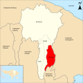
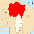
Gianyar Regency is a regency (kabupaten) in the Indonesian province and island of Bali, Indonesia. It has an area of 368.0 km2 and had a population of 469,777 at the 2010 Census, and 515,344 at the 2020 Census, making it the second most densely populated district in Bali ; the official estimate as of mid-2022 was 523,973 - comprising 262,708 males and 261,264 females. Its regency seat is the town of Gianyar. The civil registry survey of April 2011 listed 480,447 people, of which 469,929 were classified as Hindu.

<span class="mw-page-title-main">Tampaksiring</span> Place in Bali, Indonesia

Tampaksiring is a town in central Bali, Gianyar Regency, Indonesia. As of the 2010 census, the area was 42.63 km2 and the population was 45,818; the latest official estimate is 48,740. It is the home to the Gunung Kawi Temple and archaeological site and the Senang Hati Foundation.

<span class="mw-page-title-main">Bali Aga</span> Indigenous people of Bali

The Bali Aga, Baliaga, or Bali Mula are the indigenous people of Bali. Linguistically they are an Austronesian people. Bali Aga people are predominantly located in the eastern part of the island, in Bangli, Buleleng and Karangasem, but they can also be found in north-western and central regions. Bali Aga people who are referred to as Bali Pergunungan are those that are located at Trunyan village. For the Trunyan Bali Aga people, the term Bali Aga is regarded as an insult with an additional meaning of "the mountain people that are fools"; therefore, they prefer the term Bali Mula instead.

<span class="mw-page-title-main">Moon of Pejeng</span> Single-cast bronze kettle drum

The Moon of Pejeng, also known as the Pejeng Moon, in Bali is the largest single-cast bronze kettle drum in the world. and "the largest known relic from Southeast Asia's Bronze Age period." It is "considered highly sacred by local people." It is thought to be a relic of early rice cultivation rituals.

<span class="mw-page-title-main">Pejeng</span> Place in Bali, Indonesia

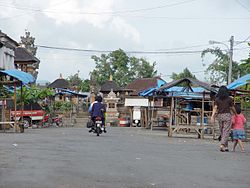
Pejeng is a village in Bali, Indonesia, in the Petanu River valley. It is a bit east of Ubud in Gianyar Regency. It is home to the Moon of Pejeng, the largest single-cast bronze kettle drum in the world. Pejeng is a rural area with extensive, and ancient, irrigated rice cultivation.

<span class="mw-page-title-main">History of Bali</span>

The History of Bali covers a period from the Paleolithic to the present, and is characterized by migrations of people and cultures from other parts of Asia. In the 16th century, the history of Bali started to be marked by Western influence with the arrival of Europeans, to become, after a long and difficult colonial period under the Dutch, an example of the preservation of traditional cultures and a key tourist destination.

Kintamani is a district (kecamatan), and a village within that district, on the western edge of the larger caldera wall of the Mount Batur caldera in Bali, Indonesia. It is on the same north–south road as Penelokan and has been used as a stopping place to view the Mount Batur region. Kintamani is also known for Pura Tuluk Biyu's 1,000-year-old "Rites of Peace" stone tablets and the Kintamani dog breed. It is situated next to Mount Batur.

<span class="mw-page-title-main">Pura Penataran Sasih</span> Balinese Hindu temple in Indonesia

Pura Penataran Sasih is a Hindu temple in Pejeng village, Bali. According to a modern chronogram displayed at the entrance, it was founded in 1266 AD and served as the state temple of the Pejeng Kingdom.

<span class="mw-page-title-main">Bali Kingdom</span> Series of kingdoms in Bali, Indonesia

The Kingdomship of Bali was a series of Hindu-Buddhist kingdoms that once ruled some parts of the volcanic island of Bali, in Lesser Sunda Islands, Indonesia. With a history of native Balinese kingship spanning from the early 10th to early 20th centuries, Balinese kingdoms demonstrated sophisticated Balinese court culture where native elements of spirit and ancestral reverence combined with Hindu influences—adopted from India through ancient Java intermediary—flourished, enriched and shaped Balinese culture.

<span class="mw-page-title-main">Ubud Palace</span> Building complex in Bali, Indonesia

The Ubud Palace, officially Puri Saren Agung, is a historical building complex situated in Ubud, Gianyar Regency of Bali, Indonesia.

<span class="mw-page-title-main">Tegallalang</span> District in Gianyar Regency, Bali Province, Indonesia

Tegallalang is a district in the Gianyar Regency, Bali, Indonesia. As of the 2010 census, the area was 61.80 km2 and the population was 50,625; the latest official estimate is 53,760. Located around 10 km north of Ubud, its terraced rice fields are a tourist attraction in the area.

References

  1. 1 2 3 Badan Pusat Statistik, Jakarta, 2023, Kabupaten Bangli Dalam Angka 2023 (Katalog-BPS 1102001.5106)
  2. The nine kingdoms were Gelgel (the original kingdom, based near present-day Klungkung), Klungkung, Karangasem, Gianyar, Badung, Bangli, Buleleng Mengwi and Tabanan. For details, see Adrian Vickers, 2012, Bali, A Paradise Created, Tuttle publishing.
  3. "Pura Dalem Galiran, map". google.fr/maps.
  4. Pura Dalem Penunggekan, view of the entrance on street camera.
  5. "Bangli Regency, map". openstreetmap.org.
  6. Dalton, Bill (1988). Indonesia Handbook, 4th edition, p. 435.
  7. 1 2 3 Biro Pusat Statistik, Jakarta, 2011.
  8. "Demulih hill, map". openstreetmap.org.
  9. 1 2 Badan Pusat Statistik, Jakarta, 2021.
  10. "Climate: Bangli". Climate-Data.org. Retrieved 17 November 2020.
  11. "Manikliyu, map". openstreetmap.
  12. 1 2 Sutaba, I Made (1999). "Discovery of Late Prehistoric Burial Systems in Bali". SPAFA Journal. 9 (1): 15–18. Retrieved 2024-05-09.
  13. Ambra Calo (October 2008). "Pejeng Type Bronze Drums and their Possible Role in Early Rice Cults in Bali". fas.nus.edu.sg. Archived from the original on 26 July 2009. Retrieved 2024-05-09.
  14. "Taman Bali and Bunutin (Blangli Regency), map". openstreetmap.
  15. Sutaba, I Made (1974). "Newly discovered sarcophagi in Bali". Archipel (7): 133–138.